Nevada City is the county seat of Nevada County, California, United States, located 60 miles (97 km) northeast of Sacramento and 28 miles north of Auburn. The population was 3,068 as of the 2010 Census.

Cedar City is the largest city in Iron County, Utah, United States. It is located 250 miles (400 km) south of Salt Lake City, and 170 miles (270 km) north of Las Vegas on Interstate 15. It is the home of Southern Utah University, the Utah Shakespeare Festival, the Utah Summer Games, the Neil Simon Theatre Festival, and other events. As of the 2010 census the city had a population of 28,857, up from 20,257 in 2000. As of 2016 the estimated population was 31,223.
The Shoshone or Shoshoni are a Native American tribe with four large cultural/linguistic divisions:

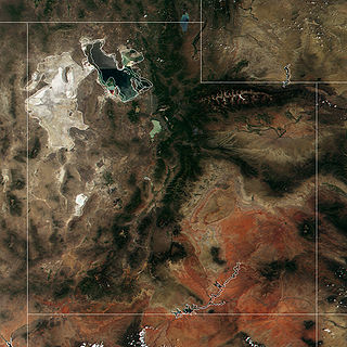
The Great Salt Lake Desert is a large dry lake in northern Utah, United States, between the Great Salt Lake and the Nevada border which is noted for white evaporite Lake Bonneville salt deposits.
Roop County is a defunct county of Nevada. It was created as Lake County in 1861 as one of the original nine counties of Nevada. The name Lake County was chosen due to the many lakes in the area, including Honey Lake, Pyramid Lake, and Winnemucca Lake.

Tahoe National Forest is a United States National Forest located in California, northwest of Lake Tahoe. It includes the 8,587-foot (2,617 m) peak of Sierra Buttes, near Sierra City, which has views of Mount Lassen and Mount Shasta. It is located in parts of six counties: Sierra, Placer, Nevada, Yuba, Plumas and El Dorado. The forest has a total area of 871,495 acres. Its headquarters is in Nevada City, California. There are local ranger district offices in Camptonville, Foresthill, Sierraville and Truckee.

Eldorado National Forest is a U.S. National Forest located in the central Sierra Nevada mountain range, in eastern California.

Plumas National Forest is a 1,146,000-acre (4,638 km2) United States National Forest located at the northern terminus of the Sierra Nevada, in northern California. The Forest was named after its primary watershed, the Rio de las Plumas, which was later anglicized to "Feather River".

Cedar Ridge is an unincorporated community in Nevada County, California, United States, along State Route 174 2.5 miles (4.0 km) east/southeast of Grass Valley, California. and approximately 1 mile (1.6 km) east/southeast of the Empire Mine in Gold Country. The first Post Office was established in 1948 and the zip code is 95924.

Peardale is an unincorporated community in Nevada County, California, United States, along State Route 174, southeast of Cedar Ridge, California and northwest of Chicago Park, California. Its elevation is 2,710 feet (830 m) above sea level.

The Cedar Mountains, also known as the Hardscrabble Mountains, are located in western Nevada in the United States. The mountain range lay north of the Monte Cristo Range about 30 miles (48 km) north of Tonopah in Mineral County and its highest point is Little Pilot Peak. This mountain range is situated in the Walker Lane region, which is part of the boundary between the Pacific Plate and the North American Plate, similar to the San Andreas Fault in to the west in California. Cedar Mountains was named for the cedar timber in the area. It was the site of a magnitude 7.2 earthquake on December 20, 1932 that was felt throughout much of the west.

Cedar Grove is an unincorporated community and the location of the visitor center in Kings Canyon National Park. Situated near the South Fork of the Kings River, in Fresno County, California, Cedar Grove and Grant Grove Village are the only commercially developed areas in the park. Facilities include the Cedar Grove Visitor Center, the Cedar Grove Lodge, a market and four campgrounds. The road into the canyon closes mid-November to mid-April.

Birchville is a former settlement in Nevada County, California. Birchville is located 2 miles (3.2 km) north-northeast of French Corral. It was situated at an elevation of 1,765 ft (538 m) above sea level.

Glenbrook is a former settlement in Nevada County, California, located near Grass Valley. It was listed on an official map as of 1949.

Providence is a former settlement in Nevada County, California. Providence is located on Deer Creek, 1.25 miles (2.0 km) west-southwest of Nevada City. It lay at an elevation of 2320 feet.
Cedar Ridge, California may refer to:


