Ward Creek is a 6.1-mile (9.8 km) eastward-flowing stream in Placer County, California, USA. The creek flows into Lake Tahoe 2.7 miles (4.3 km) south of Tahoe City, California, and has undergone extensive restoration to reduce sediment and surface run-off to maintain the purity of Lake Tahoe.

The Smoke Creek Desert is an arid region of northwestern Nevada, USA that lies about 60 miles (97 km) to the north of Pyramid Lake, west of the Fox Range and east of the Smoke Creek Mountains. The southern end of the desert lies on the Pyramid Lake Indian Reservation, and a rail line lies at the eastern edge. The Smoke Creek Desert is southwest of the Black Rock Desert's South Playa and is between the Granite Range and the Fox Range.

Deer Creek is a 60-mile-long (97 km) southwestward-flowing stream in Northern California that flows through Tehama County, California. It is an eastside tributary of the Sacramento River. As one of only three remaining Sacramento River tributaries supporting native runs of the genetically distinct Central Valley spring-run Chinook salmon, it is a stronghold for this state and federally endangered fish as well as other salmonids.

The Jackson Mountains are a north-northeast trending mountain range in southwestern Humboldt County, Nevada. The range is flanked on the west by the Black Rock Desert and the Black Rock Range beyond. To the north across the Quinn River and Nevada State Route 140 lie the Bilk Creek Mountains. To the northeast across Kings River Valley is the Double Mountains and to the east are the Sleeping Hills. To the southeast and south lie the Eugene and Kamma Mountains. The ghost town of Sulphur lies just southwest of the pass between the Jackson and Kamma ranges. Nevada State Route 49 and the Union Pacific railroad Feather River Route traverse this pass.
Goshute Canyon Wilderness is a 42,544-acre (17,217 ha) wilderness area in northern White Pine County in the U.S. state of Nevada. Located in the Cherry Creek Range north of the town of Mcgill, the Wilderness was created by the "White Pine County Conservation, Recreation and Development Act of 2006" and is administered by the U.S. Bureau of Land Management.

Scotts Flat Reservoir is an artificial lake in the Tahoe National Forest of Nevada County, California, 6.5 miles (10.5 km) east of Nevada City. The lake is at an elevation of 3,100 ft (940 m) and has a surface area of 850 acres (340 ha), with 7.5 miles (12.1 km) of shoreline lined with pine trees. Amenities consist of two launch ramps, a marina, campsites, a picnic area, sandy beaches, and a general store.

The Bucks Lake Wilderness is a 23,958-acre (97.0 km2) wilderness area located in the Plumas National Forest section of the Sierra Nevada, in northeastern California, United States.
Rose's Corral is a former settlement in Nevada County, California, United States. It was located on the lower San Juan Ridge, between Deer Creek and the South Yuba River, about 10 mi (16 km) southwest of Nevada City and Grass Valley. Established during the summer of 1848, it is notable for being the county's first settlement. It is named for a cattle corral built by John Rose, a trader.

Little York is a former settlement in Nevada County, California, located near Chicago Park, between Bear River and Greenhorn Creek.

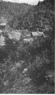
Red Dog was a California gold rush mining town located in the Gold Country in south-central Nevada County, California, United States, 6 mi (9.7 km) northeast of Chicago Park. Red Dog Hill, a mine and campsite, was founded by three men all under the age of 22, and was named by their youngest, a 15-year-old prospector. As mining operations grew, the campsite became a settlement, and then a town with a population of 2,000 residents, before it was eventually abandoned. Still considered important today, Red Dog Townsite is listed on the National Register of Historic Places. Red Dog has been noted for its unusual place name.
Carpenter Valley is an unincorporated community in Nevada County, California, United States. Situated at the north fork of Prosser Creek, it is said to be named for John S. Carpenter, who in the 1860s was engaged in hauling logs to "Old Hobart Mills".
Prosser Creek is a former settlement in Nevada County, California. Prosser Creek is located on the former Central Pacific Railroad, 1 mile (1.6 km) southwest of Boca. The first appearance is on the von Leicht-Hoffmann Tahoe map of 1874. According to Henry T Williams (1876) a man by that name operated a hotel there in the early days.
Beckmans Flat is a former settlement in Nevada County, California, USA, located on Deer Creek, 1 mile (1.6 km) southeast of Newtown. It appeared on maps as late as 1873.
Pleasant Flat is a former settlement in Nevada County, California. Pleasant Flat is located on Deer Creek, 1 mile (1.6 km) east-southeast of Newtown. It still appeared on maps as of 1873.
Stockings Flat is a former settlement in Nevada County, California. Stockings Flat is located on Deer Creek, 2.5 miles (4.0 km) east of Newtown. It still appeared on maps as of 1873.
Diamond Creek is a former settlement in Nevada County, California. Diamond Creek is located 1.5 miles (2.4 km) east of Omega. It still appeared on maps as of 1873.
Providence is a former settlement in Nevada County, California. Providence is located on Deer Creek, 1.25 miles (2.0 km) west-southwest of Nevada City. It lay at an elevation of 2320 feet.
Deer Creek, formerly More's Creek, is a creek in Tulare County, California. Its source is in the on the west slope of the Greenhorn Mountains, in the Sierra Nevada Mountain range. From there Deer Creek runs west to terminate at the Lakeland and Homeland Canals in the San Joaquin Valley just east of the Tulare - Kings County border. Originally it ran into Tulare Lake before it was diverted for agriculture.
Banner Mountain is in Nevada County in the U.S. state of California. Located on a ridge, its summit is at 3,902 feet (1,189 m). The unincorporated community of North Columbia is nearby. The headwaters of Wolf Creek originate on Banner Mountain; the creek's watershed has been heavily mined.