
In Abrahamic religions, Noah was the tenth and last of the pre-Flood Patriarchs. The story of Noah's Ark is told in the Bible's Genesis flood narrative. The biblical account is followed by the story of the Curse of Ham.

La Niña is a coupled ocean-atmosphere phenomenon that is the counterpart of El Niño as part of the broader El Niño–Southern Oscillation climate pattern. The name La Niña originates from Spanish, meaning "the little girl", analogous to El Niño meaning "the little boy". It has also in the past been called anti-El Niño, and El Viejo. During a period of La Niña, the sea surface temperature across the equatorial Eastern Central Pacific Ocean will be lower than normal by 3 to 5°C. An appearance of La Niña persists for at least five months. It has extensive effects on the weather across the globe, particularly in North America, even affecting the Atlantic and Pacific hurricane seasons.

Noah's Ark is the vessel in the Genesis flood narrative through which God spares Noah, his family, and examples of all the world's animals from a world-engulfing flood. The story in Genesis is repeated, with variations, in the Quran, where the ark appears as Safina Nūḥ.
Colusa is the county seat of Colusa County, California. The population was 5,971 at the 2010 census, up from 5,402 at the 2000 census. Colusi originates from the local Coru Native American tribe, who in the 1840s lived on the opposite side of the Sacramento River.

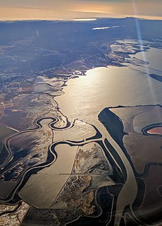
A marsh is a wetland that is dominated by herbaceous rather than woody plant species. Marshes can often be found at the edges of lakes and streams, where they form a transition between the aquatic and terrestrial ecosystems. They are often dominated by grasses, rushes or reeds. If woody plants are present they tend to be low-growing shrubs. This form of vegetation is what differentiates marshes from other types of wetland such as swamps, which are dominated by trees, and mires, which are wetlands that have accumulated deposits of acidic peat.
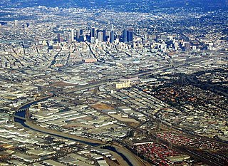
The Los Angeles River starts in the Simi Hills and Santa Susana Mountains and flows through Los Angeles County, California, from Canoga Park in the western end of the San Fernando Valley, nearly 51 miles (82 km) southeast to its mouth in Long Beach. Several tributaries join the once free-flowing and frequently flooding river, forming alluvial flood plains along its banks. It now flows through a concrete channel on a fixed course, which was built after a series of devastating floods in the early 20th century.

The Salton Sea is a shallow, saline, endorheic rift lake located directly on the San Andreas Fault, predominantly in the U.S. state of California's Imperial and Coachella valleys.
Coyote Creek is a river that flows through the Santa Clara Valley in California, United States.

The 1939 California tropical storm, also known as the 1939 Long Beach tropical storm, El Cordonazo, and The Lash of St. Francis, was a tropical cyclone that affected Southern California in September 1939. Formerly a hurricane, it was the only tropical storm to make landfall in California in the twentieth century. The only other known tropical cyclone to directly affect California at tropical storm intensity or higher is the 1858 San Diego hurricane, and only three other eastern Pacific tropical cyclones have produced gale-force winds in the continental United States. The tropical storm caused heavy flooding, leaving many dead, mostly at sea.

Rumsey is an unincorporated community in Yolo County, California. It is located 18 miles (29 km) northwest of Esparto, in the Capay Valley, in the northwestern part of the county. Rumsey's ZIP Code is 95679 and its area code 530. It lies at an elevation of 420 feet.

Myers Flat is a census-designated place in Humboldt County, California. It is located 4.5 miles (7.2 km) south-southeast of Weott, at an elevation of 203 feet. The ZIP Code is 95554. The population was 146 at the 2010 census.
Salmon Falls is a former settlement in El Dorado County, California. It was located on the South Fork of the American River 5.5 miles (9 km) south-southwest of Pilot Hill, at an elevation of 469 feet. It was flooded by Folsom Lake. Nearby were waterfalls from which the place got its name. The site is now registered as California Historical Landmark #571.
Merced Falls is an unincorporated community in Merced County, California. It is located on the north bank of the Merced River 6 miles (9.7 km) east of Snelling, at an elevation of 348 feet . Merced Falls was named for a set of rapids on the Merced River.
Las Plumas is a former settlement in Butte County, California.
Fresno City is a former settlement in Fresno County, California. It was located at the head of navigation on Fresno Slough 2 miles (3.2 km) northwest of Tranquillity, at an elevation of 164 feet. The city was named after the Spanish word for the Oregon Ash trees that commonly grew along the river banks.

Port Kenyon is an unincorporated community in Humboldt County, California. It is located 1.5 miles (2.4 km) northwest of Ferndale, at an elevation of 13 feet.
Stafford is an unincorporated community in Humboldt County, California. It is located on the south bank of the Eel River 3 miles (4.8 km) southeast of Scotia, at an elevation of 138 feet.
Barrett is an unincorporated community in Mariposa County, California. It is located on the western shore of Lake McClure on the Yosemite Valley Railroad 6.5 miles (10 km) south-southwest of Penon Blanco Peak, at an elevation of 876 feet.
Pleyto is an unincorporated community in Monterey County, California. It is located on the San Antonio River 12.5 miles (20 km) southeast of Jolon, at an elevation of 781 feet.
Jaeger City or Jaegerville, was a former settlement in what is now Imperial County, California, at Jaeger's Ferry on the Colorado River a mile downstream from Fort Yuma. It was named for L. J. F. Jaeger who ran the ferry there from 1851.


