Cathedral Square, locally known simply as the Square, is the geographical centre and heart of Christchurch, New Zealand, where the city's Anglican cathedral, ChristChurch Cathedral is located. The square stands at the theoretical crossing of the city's two main orthogonal streets, Colombo Street and Worcester Street, though in practice both have been either blocked off or detoured around the square itself. The square was badly damaged in the February 2011 Christchurch earthquake.

The Christchurch Town Hall, since 2007 formally known as the Christchurch Town Hall of the Performing Arts, opened in 1972, is Christchurch, New Zealand's premier performing arts centre. It is located in the central city on the banks of the Avon River overlooking Victoria Square, opposite the former location of the demolished Christchurch Convention Centre. Due to significant damage sustained during the February 2011 Christchurch earthquake, it was closed until 2019. Council staff initially recommended demolition of all but the main auditorium, but at a meeting in November 2012, councillors voted to rebuild the entire hall. In 2020, the town hall was registered as a Category I heritage building.

Christchurch City Libraries is a network of 21 libraries and a mobile book bus. operated by the Christchurch City Council and Following the 2011 Christchurch earthquake the previous Christchurch Central Library building was demolished, and was replaced by a new central library building in Cathedral Square, Tūranga, which opened in 2018. A number of community libraries were also rebuilt post earthquake.

Christchurch Central City or Christchurch City Centre is the geographical centre and the heart of Christchurch, New Zealand. It is defined as the area within the Four Avenues and thus includes the densely built up central city, some less dense surrounding areas of residential, educational and industrial usage, and green space including Hagley Park, the Christchurch Botanic Gardens and the Barbadoes Street Cemetery.

Colombo Street is a main road of the city of Christchurch, New Zealand. It runs south-north through the centre of Christchurch with a break at Cathedral Square. As with many other central Christchurch streets, it is named for a colonial Anglican bishopric, Colombo, Sri Lanka in what at the time was known as Ceylon. Parts of the street which run through Sydenham were known as Addison Street during the 1880s, and some parts were known as Colombo Road.

Oxford Terrace Baptist Church is a Baptist church located in the Christchurch Central City on a prominent corner property fronting the Avon River. It is affiliated with the Baptist Churches of New Zealand.

The Civic was a building in Manchester Street, central Christchurch, that was erected in 1900 and demolished in 2011. It was first used as an exhibition hall, then as a cinema, and then a theatre, before being gutted by fire in 1917. The northern part of the building was purchased by Christchurch City Council (CCC) and opened as the civic office in 1924, and served this purpose until 1980. After that it had several uses, including a restaurant, bar and live music venue. The building was heavily damaged in the February 2011 Christchurch earthquake, and was demolished.

City Mall is the main pedestrian mall in the central city of Christchurch, New Zealand, comprising two sections of Cashel Street plus the Bridge of Remembrance and one section of High Street. It is also known colloquially as Cashel Mall. The Bridge of Remembrance was pedestrianised in 1976. The main mall was closed to traffic on 11 January 1982 and formally reopened as a pedestrian mall on 7 August, but it was not until 1992 that the entire mall was paved. The mall was redeveloped between 2006 and 2009, and track was installed for an expansion of the heritage tram network.

TheTrinity Church or Trinity Congregational Church designed by Benjamin Mountfort, later called the State Trinity Centre, is a Category I heritage building listed with Heritage New Zealand. Damaged in the 2010 Canterbury earthquake and red-stickered after the February 2011 Christchurch earthquake, the building was threatened with demolition like most other central city heritage buildings. In June 2012, it was announced that the building would be saved, repaired and earthquake strengthened. The building, post its church status, has housed some commercial operations, including the State Trinity Centre; 'The Octagon' (2006–2010); and later, following earthquake repairs, a business called 'The Church Brew Pub' (2023–present).

Victoria Square is a public park located in central Christchurch, New Zealand. Originally known by European settlers as Market Place or Market Square, it was renamed to Victoria Square in 1903 in honour of Queen Victoria. It was one of the four squares included in the original plan of Christchurch when the city was laid out in 1850.

The Christchurch Central Police Station was the former headquarters of the Canterbury Police District. Once the tallest building in Christchurch, New Zealand, it was damaged in the 2011 Christchurch earthquake and demolished by implosion on 31 May 2015.

Container Mall was a temporary mall built from shipping containers in Christchurch Central City, New Zealand. It was a response to the 22 February 2011 Christchurch earthquake, which destroyed most buildings in City Mall, and resulted in the central city being cordoned off from public access while buildings were being demolished. Initially considered a short-term response to the lack of permanent buildings, Re:START was popular with locals and tourists alike and remained open for business until January 2018.

New Regent Street is a pedestrian mall in Christchurch. Built as a private development in the early 1930s with 40 shops in Spanish Mission architectural style, it is one of the city's major tourist attractions. Providing a number of small shops as a comprehensive development was an advanced idea at the time, and New Regent Street is regarded as a forerunner to modern shopping malls. Due to its coherent architectural character, the buildings in the streets are listed as Category I heritage items by Heritage New Zealand, and in addition, the entire street has a historic area listing. The street was pedestrianised in 1994 in preparation for the introduction of the Christchurch heritage tram, which began operation in February 1995. Damaged in the February 2011 Christchurch earthquake, the street and buildings reopened in April 2013, and the tram returned from November of that year. Following the 2016 Valentine's Day earthquake, five of the buildings that had not been repaired after the previous earthquakes had been cordoned off, which stopped the tram from operating on its original heritage loop until May.

Tūranga is the largest public library located in Central Christchurch, New Zealand. It opened on 12 October 2018 and replaced the nearby Christchurch Central Library that was closed on the day of the 2011 Christchurch earthquake.

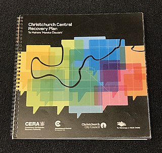
The Christchurch Central Recovery Plan, often referred to as the Blueprint, is the plan developed by the Fifth National Government of New Zealand for the recovery of the Christchurch Central City from a series of earthquakes, in particular the February 2011 Christchurch earthquake. The Canterbury Earthquake Response and Recovery Act 2010 required the Christchurch City Council to develop a recovery plan for the central city. The plan, known as Share an Idea, was presented to the Minister for Canterbury Earthquake Recovery, Gerry Brownlee, in December 2011. Brownlee rejected the city council's plan, established the Canterbury Earthquake Recovery Authority (CERA), and tasked that organisation with developing a plan based on the city council's draft. The Christchurch Central Recovery Plan was published in July 2012 and defined 17 anchor projects. All projects where a timeline was specified were to have been finished by 2017; none of the 17 projects have been delivered on time and some have not even been started yet.

The Christchurch Bus Interchange is the bus station in the Christchurch Central City in New Zealand. Built as one of the 17 anchor projects identified in the Christchurch Central Recovery Plan, it opened in May 2015 after the previous Bus Exchange had been damaged in the 2011 Christchurch earthquake.

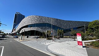
Te Pae Christchurch Convention Centre is a convention centre located in Christchurch Central City, New Zealand. The centre is a replacement for the previous Christchurch Convention Centre that was demolished after the 2011 Christchurch earthquake. Originally known as the Convention Centre Precinct, construction was funded by the New Zealand Government as part of the Christchurch Central Recovery Plan. The centre is owned by the Crown through Rau Paenga Crown Infrastructure Delivery Ltd state-owned enterprise, and managed by ASM Global. The polysemous name Te Pae is "inspired" by the Māori language, and can roughly be interpreted to mean "gathering place".

Gloucester Street is a major urban street in central Christchurch in the South Island of New Zealand. It runs for approximately 4.9 kilometres (3.0 mi) from a junction with Rolleston Avenue at its western end, directly opposite Christ's College, to the suburbs of Linwood and Avonside in the east. For the majority of its length it runs due west-east, with the section from the central city's eastern edge to Linwood veering to the northeast.


