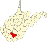
Newcastle is an Eastside city in King County, Washington, United States. The population was 11,681 in a 2017 census estimate.
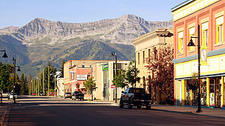
Fernie is a city in the Elk Valley area of the East Kootenay region of southeastern British Columbia, Canada, located on BC Highway 3 on the eastern approaches to the Crowsnest Pass through the Rocky Mountains. Founded in 1898 and incorporated as the City of Fernie in July 1904, the municipality has a population of over 5,000 with an additional 2,000 outside city limits in communities under the jurisdiction of the Regional District of East Kootenay. A substantial seasonal population swells the city during the winter months.
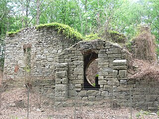
Midlothian, Virginia is an unincorporated area in Chesterfield County, Virginia, U.S. Founded over 300 years ago as a coal town, it is now a suburban community located west of Richmond, Virginia and south of the James River in the Greater Richmond Region.

Briceville is an unincorporated community in Anderson County, Tennessee. It is included in the Knoxville, Tennessee Metropolitan Statistical Area. The community is named for railroad tycoon and one-term Democratic U.S. Senator Calvin S. Brice of Ohio, who was instrumental in bringing railroad service to the town.

Luxor is an unincorporated community and coal town in Hempfield Township, Westmoreland County, Pennsylvania, United States.

Sharon is an unincorporated community and coal town in southeastern Kanawha County, West Virginia, United States, located along the West Virginia Turnpike.

Monaville is a census-designated place (CDP) in Logan County, West Virginia, United States. As of the 2010 census, its population was 309. It lies in the valley of Island Creek, a tributary of the Guyandotte River near the city of Logan. Monaville is situated between the unincorporated communities of Wilkinson and Rossmore.

Sarah Ann is a census-designated place (CDP) in Logan County, West Virginia, United States. Sarah Ann is located along West Virginia Route 44 and Island Creek, 6.5 miles (10.5 km) west-southwest of Man. Sarah Ann has a post office with ZIP code 25644. As of the 2010 census, its population was 345. It was named for Sarah O'Toole, wife of coal company official Edward O'Toole, and Ann Shanklin, wife of the coal company's coal town doctor, Doctor Shanklin.
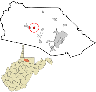
Rachel is a census-designated place (CDP) in Marion County, West Virginia, United States. It is located along Buffalo Creek, 2 miles (3.2 km) east-southeast of Mannington. Rachel has a post office with ZIP code 26587. As of the 2010 census, its population was 248.

Norton is an unincorporated community in Randolph County, West Virginia, United States. Norton is 6.5 miles (10.5 km) west of Elkins, at the junction of County Route 151 and Corridor H. Norton had a post office, which closed on November 12, 2011. It is a former coal town operated by the West Virginia Coal and Coke Company from the early 1900s until the late 1950s. Besides the mine, the town was once home to a company store, a company bank, and the Norton Grade School. The denominationally unaffiliated Norton Community Church still serves the town.

Seth is an unincorporated community and coal town in Boone County, West Virginia, United States. Seth is located on West Virginia Route 3 11 miles (18 km) east-northeast of Madison. Seth has a post office with ZIP code 25181.

Cannelton is an unincorporated community in Fayette County, West Virginia, United States. Cannelton is 1 mile (1.6 km) northeast of Smithers, along Smithers Creek. Cannelton has a post office with ZIP code 25036. The community was named for the deposits of cannel coal in the area.

Eskdale is an unincorporated community and coal town in Kanawha County, West Virginia, United States. Eskdale is 9 miles (14 km) south of East Bank along Cabin Creek. Eskdale has a post office with ZIP code 25075.

Hernshaw is an unincorporated community in Kanawha County, West Virginia, United States. Hernshaw is located on West Virginia Route 94, 2.5 miles (4.0 km) southwest of Marmet, along Lens Creek. Hernshaw has a post office with ZIP code 25107.

Artie is an unincorporated community in Raleigh County, West Virginia, United States. Artie is 5.5 miles (8.9 km) west-northwest of Pax. Artie had a post office, which opened on October 5, 1903, and closed on February 1, 1997.

Clothier is an unincorporated community in Logan County, West Virginia, United States. Clothier is located along West Virginia Route 17 8 miles (13 km) south of Madison. Clothier has a post office with ZIP code 25047.

Lorado is an unincorporated community in Logan County, West Virginia, United States. Lorado is 10 miles (16 km) east-northeast of Man, along Buffalo Creek. Lorado has a post office with ZIP code 25630.

Jodie, also known as Imboden, is an unincorporated community in Fayette County, West Virginia, United States. It is located along the Gauley River at the mouth of Rich Creek, 4 miles (6.4 km) northeast of Gauley Bridge. Due to its proximity to the county line, Jodie is part of the Nicholas County ZIP code of 26690; it had its own post office until its closure on July 23, 2005.

Everettville is an unincorporated community in Monongalia County, West Virginia, United States. Everettville is located along County Route 45 and Little Indian Creek, 7.3 miles (11.7 km) southwest of Morgantown. Everettville had a post office, which closed on November 2, 2002.
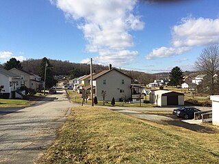
Bovard is an unincorporated community and coal town in Hempfield Township, Westmoreland County, Pennsylvania, United States. The community is located near U.S. Route 119, 2.3 miles (3.7 km) northeast of Greensburg.


