
The Santa Rosa Mountains are a short mountain range in the Peninsular Ranges system, located east of the Los Angeles Basin and northeast of the San Diego metropolitan area of southern California, in the southwestern United States.

Lake Hemet is a water storage reservoir located in the San Jacinto Mountains in Mountain Center, Riverside County, California, with a capacity of 14,000 acre-feet (17,000,000 m3) of water. It was created in 1895 with the construction of Lake Hemet Dam. Originally built by a private company, today it is owned and operated by the Lake Hemet Municipal Water District (LHMWD).

Desert Center is a census designated place in the Colorado Desert in Riverside County, California. It is in southern California, between the cities of Indio and Blythe at the junction of Interstate 10 and State Route 177, about halfway between Phoenix and Los Angeles. The ZIP Code is 92239, and the community is in telephone area codes 442 and 760. The elevation is 656 feet (200 m). The population was 204 at the 2010 census.
The Chuckwalla Mountains are a mountain range in the transition zone between the Colorado Desert—Sonoran Desert and the Mojave Desert, climatically and vegetationally, in Riverside County of southern California.
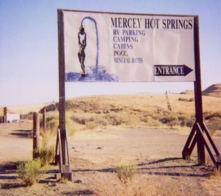
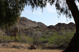
Mercey Hot Springs is an unincorporated community and historical hot springs resort in the Little Panoche Valley of Fresno County, central California, about 60 miles (97 km) west-southwest of Fresno.

The Mojave Road, also known as Old Government Road, is a historic route and present day dirt road across what is now the Mojave National Preserve in the Mojave Desert in the United States. This rough road stretched 147 miles (237 km) from Beale's Crossing, to Fork of the Road location along the north bank of the Mojave River where the old Mojave Road split off from the route of the Old Spanish Trail/Mormon Road.
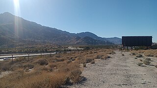
Whitewater is a census-designated place in Riverside County, California. It is directly off Interstate 10 halfway between North Palm Springs and Cabazon on the way from Palm Springs to Los Angeles. It is known as the site of the San Gorgonio Pass Wind Farm. The ZIP Code is 92282, and the community is inside area code 760. The population was 859 at the 2010 census. The elevation is 1,575 feet (480 m).

Joshua Tree National Park is an American national park in southeastern California, east of San Bernardino and Los Angeles and north of Palm Springs. It is named after the Joshua trees native to the Mojave Desert. Originally declared a national monument in 1936, Joshua Tree was redesignated as a national park in 1994 when the U.S. Congress passed the California Desert Protection Act. Encompassing a total of 795,156 acres – slightly larger than the state of Rhode Island – the park includes 429,690 acres of designated wilderness. Straddling San Bernardino and Riverside Counties, the park includes parts of two deserts, each an ecosystem whose characteristics are determined primarily by elevation: the higher Mojave Desert and the lower Colorado Desert. The Little San Bernardino Mountains traverse the southwest edge of the park.
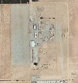
W. R. Byron Airport is a privately owned, private use airport in Riverside County, California, United States. It is located four nautical miles northwest of the central business district of Blythe, California, within the city limits.
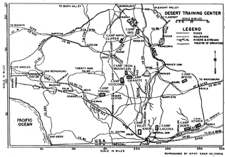
The Desert Training Center (DTC), also known as California–Arizona Maneuver Area (CAMA), was a World War II training facility established in the Mojave Desert and Sonoran Desert, largely in Southern California and Western Arizona in 1942.

Riverside County is a county located in the southern portion of the U.S. state of California. As of the 2020 census, the population was 2,418,185, making it the fourth-most populous county in California and the 10th-most populous in the United States. The name was derived from the city of Riverside, which is the county seat.
The Rice Valley Wilderness is a wilderness area near Blythe and Rice in the Mojave Desert region of California, managed by the Bureau of Land Management.
San Felipe Creek is a stream in Imperial and San Diego Counties of California. It arises in the Volcan Mountains of San Diego County 33°11′57″N116°37′35″W, and runs eastward, gathering the waters of most of the eastern slope of the mountains and desert of the county in the San Sebastian Marsh before it empties into the Salton Sea. It is probably the last remaining perennial natural desert stream in the Colorado Desert region. In 1974, the San Felipe Creek Area was designated as a National Natural Landmark by the National Park Service.

Tahquitz Canyon is located in Palm Springs, California on a section of the Agua Caliente Indian Reservation. The canyon descends from the Riverside County San Jacinto Mountains. It was continually inhabited for at least 5,000 years by the Native American Cahuilla people, and is one of many canyons of cultural significance to the Cahuilla. Today it is a nature preserve open to the public that is overseen by the Agua Caliente Band of Cahuilla Indians.
Dos Palmas Spring is an artesian spring in Riverside County, California where it lies at the foot of the Orocopia Mountains. It is only one of several such springs in the area that create an oasis in the Colorado Desert there.

Dos Palmas Preserve is a 14,000-acre (5,700 ha) wildlife preserve in the Colorado Desert in Riverside County, California, in the United States. The preserve is within the Salt Creek Area of Critical Environmental Concern, and is managed by the Bureau of Land Management. It contains a large oasis and wetland habitat, with pools fed both by water seeping from the Coachella Canal and by artesian water from several springs, including the Dos Palmas Spring. Desert fan palms are abundant.
Snow Creek, also known as Snow Creek Village, is a small unincorporated community in Riverside County, California. It is located roughly northwest of Palm Springs, on the western edge of the Santa Rosa and San Jacinto Mountains National Monument, and roughly southeast of the San Gorgonio Pass. It is named after nearby Snow Creek.
Hedges, later renamed Tumco, is a locale, a ghost town, site of a former mining town, in Imperial County, California. It lies at an elevation of 617 feet / 188 meters along the Tumco Wash in the Cargo Muchacho Mountains. Nearby is the Hedges Cemetery at an elevation of 643 feet, at 32°53′04″N114°49′52″W.
The Beaumont-Cherry Valley Recreation and Park District is a special district in Riverside County, California serving the communities of Beaumont and Cherry Valley. Established in 1972, the District provides parks, park facilities and recreational programs to the local communities.
Whitewater Preserve is a nature preserve owned and managed by The Wildlands Conservancy, a nonprofit land conservancy. Consisting of 2,851 acres (11.54 km2) of land in Riverside County, California, the preserve features the perennial Whitewater River flowing through a desert canyon. The preserve is located within the San Bernardino Mountains and is part of the Sand to Snow National Monument. More preserves can be found in the list of preserves.

