Downtown Commercial District (Bowling Green, Kentucky)

Last updated

History

The Civil War in Downtown Bowling Green

The Civil War is an integral part of the history of Bowling Green and its downtown commercial district. Due to Bowling Green's strategic location along the Barren River, and its regional economic and industrial power, it was a coveted city by both the Confederates and the Union. Kentucky was a hotly contested state due to its pro-slavery policies, but refusal to secede. Furthermore, its location right on the border between the Confederacy and the Union made it an instant war zone. Early in the war, a large Confederate force marched into downtown Bowling Green and began fortifying the city. Eventually, over 20,000 Confederate soldiers arrived at the downtown train depot and garrisoned the city. [1] The soldiers fortified hills on the edge of downtown, and spent a great deal of time ensuring the city would not fall to Union invaders. Soldiers even converted Hobson Grove, a mansion at the edge of downtown, into a fort with a large storage of ammunition, weapons, and munitions for troops. [2] The occupying Confederate forces, so confident in the town's defenses, dubbed it "The Gibraltar of the West". [1] Businesses, such as taverns, restaurants, and even brothels catered to the occupying forces, who spent their wages on food, drink, and comfort in these downtown establishments. Downtown Bowling Green was eventually made into the Confederate Capitol of Kentucky, despite the local populations pro-Union preference, and a Confederate government was established and operated out of the downtown district. Unfortunately for the rebels, Union victories at Mill Springs and Columbus forced the Confederates to retreat from the town, as they would have been surrounded if they had stayed. [3] The Confederates destroyed much of downtown's infrastructure as they left, dealing a great blow to the local economy in the process. Union troops entered the town after the Confederates left in 1862, and they remained there for the rest of the war. [1] The Civil War, though it destroyed much of the downtown's infrastructure and economy, eventually paved the way for the town to rebuild, and gave the town a metaphorical "blank slate" to start anew.

Contents

The Post-War Decades

After the aforementioned destruction of industry, such as the railroad tracks, buildings of potential military relevance, and munitions storages, downtown Bowling Green needed to rebuild. Residents came together, and in conjunction with the industrial revolution that swept the United States, quickly rebuilt and expanded upon the economy and infrastructure of downtown. Around this time, a new train depot was built, the railroads were repaired, and new businesses sprung up after the expansion of the Louisville-Nashville railroad during the war years. [4] Furthermore, more railroad routes that passed through Bowling Green were added to the existing Louisville-Nashville routes, which increased Bowling Green's reputation as a railroad hub. Now that civilians were riding the railroads again, they needed places to stop and rest. Bowling Green was the perfect place for this to occur, and inns and places of recreation for travelers passing by sprung up all over downtown Bowling Green. Furthermore, the economic expansion of Bowling Green was even more exaggerated with the arrival of more and more Americans traveling West from East coast cities. [5] Between the end of the war and the turn of the century, downtown Bowling Green experienced an economic boom that powered it in to being the third largest city in Kentucky, and the unquestioned regional capitol of South-central Kentucky. Many of the buildings constructed during this time period remain in downtown today, and are still important to the local business market and economy.

Western Kentucky University

Western Kentucky University is a central part of downtown Bowling Green's continued success and growth in the 20th and 21st centuries. Formerly known as the Southern Normal School, Western Kentucky University was donated to the state and renamed to its current moniker in 1906 by its president, Henry Hardin Cherry. [5] Western Kentucky University is now one of the largest universities in Kentucky, behind only the University of Louisville and the University of Kentucky in size. As the size of the university grew rapidly during the 20th century, it attracted more and more visitors and new residents to downtown Bowling Green. Located just blocks from the center of downtown, many restaurants, shops, and bars opened to cater to the needs of the thousands of college students that filled the streets of downtown every fall and spring. In more recent years, Western Kentucky University has even began to create classroom spaces in the middle of downtown. The business school recently opened a 5,000 square foot classroom space right next to Fountain Square, the central part of downtown. [6] The impact of Western Kentucky University on the local economy cannot be understated. Alongside the businesses that have opened to cater to college students, downtown banks and other financial institutions have benefitted from the influx of college students seeking the services needed to navigate college life. Today, downtown and campus are nearly adjacent, with more and more integration occurring each and every year.

Present-Day Downtown

Historic Buildings

Downtown Commercial District
Shops along Fountain Square in Bowling Green, Kentucky 2008.JPG
Shops along Fountain Square
USA Kentucky location map.svg
Red pog.svg
Usa edcp location map.svg
Red pog.svg
LocationRoughly bounded by Adams and State Sts., 8th and 10th Aves., Bowling Green, Kentucky
Coordinates 36°59′37″N86°26′31″W / 36.99361°N 86.44194°W / 36.99361; -86.44194 Coordinates: 36°59′37″N86°26′31″W / 36.99361°N 86.44194°W / 36.99361; -86.44194
Area24 acres (9.7 ha)
Built1840
Architectural styleMixed (more Than 2 Styles From Different Periods)
MPS Warren County MRA
NRHP reference No. 79003510 [7]
Added to NRHPDecember 18, 1979

The Downtown Commercial District in Bowling Green, Kentucky is a historic district that was listed on the National Register of Historic Places in 1979. In 1979, it included 113 buildings deemed to contribute to the historic character of the area. [8]

A few of the district's buildings are:

[8] The district was listed as part of a review of historic resources in Warren County.

Notable Buildings

Some of the more important buildings in downtown Bowling Green, both economically and aesthetically, include (but are not limited to):

Related Research Articles

<span class="mw-page-title-main">Kentucky</span> U.S. state

Kentucky, officially the Commonwealth of Kentucky, is a state in the Southeastern region of the United States and one of the states of the Upper South. It borders Illinois, Indiana, and Ohio to the north, West Virginia to the northeast, Virginia to the east, Tennessee to the south, and Missouri to the west. Its northern border is defined by the Ohio River. Its capital is Frankfort, and its two largest cities are Louisville and Lexington. Its population was approximately 4.5 million in 2020.

<span class="mw-page-title-main">Louisville, Kentucky</span> Largest city in Kentucky

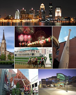
Louisville is the largest city in the Commonwealth of Kentucky and the 28th most-populous city in the United States. Louisville is the historical seat and, since 2003, the nominal seat of Jefferson County, on the Indiana border.

<span class="mw-page-title-main">Warren County, Kentucky</span> County in Kentucky, United States

Warren County is a county located in the south central portion of the U.S. state of Kentucky. As of the 2020 census, the population was 134,554, making it the fifth-most populous county in Kentucky. The county seat is Bowling Green. Warren County is now classified as a wet county after voters approved the measure in 2018. The measure became law in January 2019 that allows alcohol to be sold county wide.

<span class="mw-page-title-main">Danville, Kentucky</span> City in Kentucky, United States

Danville is a home rule-class city in Boyle County, Kentucky, United States. It is the seat of its county. The population was 17,236 at the 2020 Census. Danville is the principal city of the Danville Micropolitan Statistical Area, which includes all of the Boyle and Lincoln counties. In 2001, Danville received a Great American Main Street Award from the National Trust for Historic Preservation. In 2011, Money magazine placed Danville as the fourth-best place to retire in the United States. Centre College in Danville was selected to host U.S. vice-presidential debates in 2000 and 2012.

<span class="mw-page-title-main">Hopkinsville, Kentucky</span> City in Kentucky, United States

Hopkinsville is a home rule-class city in and the county seat of Christian County, Kentucky, United States. The population at the 2010 census was 31,577.

<span class="mw-page-title-main">Elizabethtown, Kentucky</span> City in Kentucky, United States

Elizabethtown is a home rule-class city and the county seat of Hardin County, Kentucky, United States. The population was 28,531 at the 2010 census, and was estimated at 30,289 by the U.S. Census Bureau in 2019, making it the 11th-largest city in the state. It is included in the Elizabethtown–Fort Knox, Kentucky Metropolitan Statistical Area, which is included in the Louisville/Jefferson County–Elizabethtown–Madison, Kentucky-Indiana Combined Statistical Area. The Elizabethtown Metropolitan area had a 2019 estimated population of 153,057, making it the 5th largest metropolitan area in the state.

<span class="mw-page-title-main">Madisonville, Kentucky</span> City in Kentucky, United States

Madisonville is a home rule-class city in and the county seat of Hopkins County, Kentucky, United States, located along Interstate 69 in the state's Western Coal Fields region. The population was 19,591 at the 2010 census. Madisonville is a commercial center of the region and is home to Madisonville Community College.

<span class="mw-page-title-main">Bowling Green, Kentucky</span> City in Kentucky, United States

Bowling Green is a home rule-class city and the county seat of Warren County, Kentucky, United States. Founded by pioneers in 1798, Bowling Green was the provisional capital of Confederate Kentucky during the American Civil War. As of the 2020 census, its population of 72,294 made it the third-most-populous city in the state, after Louisville and Lexington; its metropolitan area, which is the fourth largest in the state after Louisville, Lexington, and Northern Kentucky, had an estimated population of 179,240; and the combined statistical area it shares with Glasgow has an estimated population of 233,560.

<span class="mw-page-title-main">Downtown Louisville</span>

Downtown Louisville is the largest central business district in the Commonwealth of Kentucky and the urban hub of the Louisville, Kentucky Metropolitan Area. Its boundaries are the Ohio River to the north, Hancock Street to the east, York and Jacob Streets to the south, and 9th Street to the west. As of 2015, the population of Downtown Louisville was 4,700, although this does not include directly surrounding areas such as Old Louisville, Butchertown, NuLu, and Phoenix Hill.

<span class="mw-page-title-main">History of Louisville, Kentucky</span>

The geology of the Ohio River, with but a single series of rapids halfway in its length from the confluence of the Monongahela and Allegheny rivers to its union with the Mississippi, made it inevitable that a town would grow on the site. Louisville, Kentucky was chartered in the late 18th century. From its early days on the frontier, it quickly grew to be a major trading and distribution center in the mid 19th century, important industrial city in the early 20th, declined in the mid 20th century, before revitalizing in the late 20th century as a culturally-focused mid-sized American city.

<span class="mw-page-title-main">Cave Hill Cemetery</span> Historic cemetery in Jefferson County, Kentucky

Cave Hill Cemetery is a 296-acre (1.20 km2) Victorian era National Cemetery and arboretum located at Louisville, Kentucky. Its main entrance is on Baxter Avenue and there is a secondary one on Grinstead Drive. It is the largest cemetery by area and number of burials in Louisville.

<span class="mw-page-title-main">Louisville, Kentucky, in the American Civil War</span>

Louisville in the American Civil War was a major stronghold of Union forces, which kept Kentucky firmly in the Union. It was the center of planning, supplies, recruiting and transportation for numerous campaigns, especially in the Western Theater. By the end of the war, Louisville had not been attacked once, although skirmishes and battles, including the battles of Perryville and Corydon, took place nearby.

<span class="mw-page-title-main">Old Jeffersonville Historic District</span> Historic district in Indiana, United States

The Old Jeffersonville Historic District is located in Jeffersonville, Indiana, United States. It marks the original boundaries of Jeffersonville, and is the heart of modern-day downtown Jeffersonville. It was placed on the National Register of Historic Places in 1983. The area is roughly bounded by Court Avenue at the North, Graham Street on the east, the Ohio River at the south, and Interstate 65 at the west. In total, the district has 203 acres (0.8 km2), 500 buildings, 6 structures, and 11 objects. Several banks are located in the historic buildings in the district. The now defunct Steamboat Days Festival, held on the second weekend in September, used to be held on Spring Street and the waterfront. Jeffersonville's largest fire wiped out a block in the historic district on January 11, 2004 which destroyed the original Horner's Novelty store.

<span class="mw-page-title-main">Warner Underwood</span> American politician

Warner Lewis Underwood was an attorney, state legislator and U.S. Representative from Kentucky. Like his brother Joseph Rogers Underwood, he was a Unionist before the American Civil War, and during the war, he served as U.S. Consul in Glasgow, Scotland.

<span class="mw-page-title-main">Cityscape of Louisville, Kentucky</span>

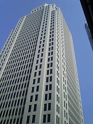
Louisville, Kentucky is home to numerous structures that are noteworthy due to their architectural characteristics or historic associations, the most noteworthy being the Old Louisville neighborhood, the third largest historic preservation district in the United States. The city also boasts the postmodern Humana Building and an expanding Waterfront Park which has served to remove the former industrial appearance of the riverfront.

<span class="mw-page-title-main">Historic Railpark and Train Museum (Bowling Green, Kentucky)</span> Former railway station in Bowling Green, Kentucky

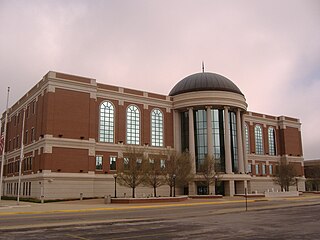
The Historic Railpark and Train Museum, formerly the Louisville and Nashville Railroad Station in Bowling Green, Kentucky, is located in the historic railroad station. The building was placed on the National Register of Historic Places on December 18, 1979. Opened in 1925, the standing depot is the third Louisville & Nashville Railroad depot that served Bowling Green.

<span class="mw-page-title-main">Index of Kentucky-related articles</span>

The following is an alphabetical list of articles related to the United States Commonwealth of Kentucky.

<span class="mw-page-title-main">Brinton B. Davis</span> American architect

Brinton Beauregard Davis was an architect in Kentucky. More than a dozen of his works are listed on the National Register of Historic Places.

References

  1. 1 2 3 Wayne, Hoffman (1989). "The History of Bowling Green and Warren County" (PDF). warrencountyky.gov. Archived (PDF) from the original on 2016-11-23. Retrieved 17 November 2021.
  2. "Riverview at Hobson Grove". www.visitbgky.com. Retrieved 2021-12-02.
  3. "Civil War Driving Tour of Bowling Green and Warren County". American Battlefield Trust. Retrieved 2021-12-02.
  4. "History". www.lnrr.org. Retrieved 2021-12-02.
  5. 1 2 "History of Bowling Green". www.bgchamber.com. Retrieved 2021-12-02.
  6. MUDD, AARON. "WKU business college extends reach downtown through Pushin Building". Bowling Green Daily News. Retrieved 2021-12-02.
  7. "National Register Information System". National Register of Historic Places . National Park Service. March 13, 2009.
  8. 1 2 "National Register of Historic Places Inventory/Nomination: Downtown Commercial District". National Park Service . Retrieved February 10, 2017. with 56 photos