Edward Pulaski Tunnel and Placer Creek Escape Route

Last updated
Edward Pulaski Tunnel and Placer Creek Escape Route
Restored Pulaski Tunnel entrance.jpg
Pulaski Tunnel entrance, restored in 2010
USA Idaho location map.svg
Red pog.svg
Usa edcp location map.svg
Red pog.svg
LocationWest Fork Placer Creek
Nearest city Wallace, Idaho
Coordinates 47°26′42.2″N115°57′46.6″W / 47.445056°N 115.962944°W / 47.445056; -115.962944 Coordinates: 47°26′42.2″N115°57′46.6″W / 47.445056°N 115.962944°W / 47.445056; -115.962944
Area12 acres (4.9 ha)
Built1910
MPS North Idaho 1910 Fire Sites TR
NRHP reference No. 84001179 [1]
Added to NRHPSeptember 20, 1984

The Edward Pulaski Tunnel and Placer Creek Escape Route (also known as the Pulaski Tunnel) are two adjacent sites used by the United States Forest Service firefighter Edward Pulaski in the Great Fire of 1910 to save the lives of himself and most of his crew. The sites are located south of Wallace, Idaho in the Idaho Panhandle National Forests. Pulaski's tunnel and escape route are listed on the National Register of Historic Places in 1984.

Contents

Fire of 1910

The summer of 1910 was hot and dry, with an extremely high fire danger throughout the western United States. By August, there were approximately 1,400 wildfires burning out of control in northern Idaho, northeastern Washington, and northwestern Montana. On 20 August, some of these wildfires blew-up into huge firestorms, threatening a number of rural communities and trapping firefighting crews. One of those crews was led by Ed Pulaski. [2] [3] [4]

Pulaski and his crew were fighting the fire in an area around the west fork of Placer Creek, approximately 10 miles (16 km) southwest of Wallace. When the fire became too dangerous, Pulaski ordered his forty-five men to evacuate toward Wallace. As they retreated, a second fire blocked their way, leaving them surrounded by fire. Pulaski knew the area so he was able to lead his men through the burning forest to an abandoned mine. The crew (along with two horses) entered the mine opening near the bank of Placer Creek just as the fire engulfed the area. [2] [3] [5]

The mine was actually a short prospecting tunnel that had been abandoned because no ore was found there. The mine opening was 6 feet (1.8 m) high and 5 feet (1.5 m) wide. At the entrance, there were cedar floor planks and squeeze caps logs in place to prevent spalling. The total length of the mine was only 250 feet (76 m); however, that was enough to shelter Pulaski and his crew. [2] [6]

As the fire raged outside the mine, the heat caused the cold air in the tunnel to rush out, replacing it with hot air and smoke. Pulaski ordered the men to lie down on the floor of the mine where there was still some breathable air. As the fire closed in around the tunnel entrance, timber beams at the mouth of the tunnel began to burn. Pulaski carried water in his hat from pools on the mine floor to the entrance, trying to douse the flames. In the process, he was badly burned. Eventually, Pulaski fell unconscious, as did all his men. [2] [3] [5]

The next morning, Pulaski counted 39 living men. One of his crew had been killed by a falling snag on the way to the mine; five others had died from smoke inhalation during the night (the two horses also died). After the fire in the surrounding forest died down, Pulaski and his crew followed Placer Creek to safety in Wallace. [2] [3] [5] [7]

In just two days, the Great Fire of 1910 consumed 3,000,000 acres (1,200,000 ha) of forest. The six men lost in or near Pulaski's tunnel were among 78 firefighters killed by the fire. There were also seven civilians who died in the fire; bringing the total loss of life to 85 people. [3] [4]

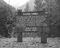
Because of its association with Ed Pulaski and the Great Fire of 1910, the Pulaski Tunnel and fire escape route were listed on the National Register of Historic Places in 1984. The tunnel also provides valuable information on historic mining methods in the Idaho panhandle. [2] [8]

Site restoration

For many years, the only visible sign of Pulaski's escape route and refuge tunnel were two historical markers along a forest road south of Wallace. In 2002, a citizens group was organized to restore Pulaski's tunnel and improve the trail to the site. The effort was known as the Pulaski Project. The Forest Service joined the effort and began to develop the trail in 2005. Since then, the full length of the trail has been cleared and graded. In addition, five trail bridges have been installed along with a dozen interpretive signs that provide information about Pulaski, the 1910 fire, and various features found along the trail. At the trailhead, a parking area and restroom have been built. [9]

Today, the trail is open to foot traffic only. From the trailhead, the hike to the tunnel is approximately 2 miles (3.2 km), a round-trip hike of 4 miles (6.4 km). The elevation gain between the trailhead and the tunnel is 800 feet (240 m), making the hike moderately challenging. The trailhead is located just off Forest Road 456, approximately 1 mile (1.6 km) south of Wallace, Idaho. [7] [8] [10] [11]

Related Research Articles

<span class="mw-page-title-main">Wallace, Idaho</span> City in Idaho, United States

Wallace, Idaho is a city in and the county seat of Shoshone County, Idaho, in the Silver Valley mining district of the Idaho Panhandle. Founded in 1884, Wallace sits alongside the South Fork of the Coeur d'Alene River, approximately 2,730 feet (830 m) above sea level. The town's population was 784 at the 2010 census.

<span class="mw-page-title-main">Ed Pulaski</span>

Edward Crockett Pulaski was a U.S. Forest Service ranger based in Wallace, Idaho. Pulaski traveled west and worked as a miner, railroad worker, and ranch foreman before joining the forest service in 1908. He was reputed to be, and personally claimed that he was, a collateral descendant of Casimir Pulaski.

<span class="mw-page-title-main">Pulaski (tool)</span> Hand tool for firefighting

The Pulaski is a special hand tool used in fighting fires, particularly wildfires, which combines an axe and an adze in one head. Similar to a cutter mattock, it has a rigid handle of wood, plastic, or fiberglass. The Pulaski is used for constructing firebreaks, able to both dig soil and chop wood. It is also well adapted for trail construction, and can be used for gardening and other outdoor work for general excavation and digging holes in root-bound or hard soil. The axe blade of the Pulaski is the primary cutting edge, while the adze blade is secondary; this is the opposite of the cutter mattock, in which the adze blade is the larger of the two.

<span class="mw-page-title-main">Great Fire of 1910</span> 1910 wildfire in the northwestern United States

The Great Fire of 1910 was a wildfire in the Inland Northwest region of the United States that burned three million acres in North Idaho and Western Montana, with extensions into Eastern Washington and Southeast British Columbia, in the summer of 1910. The area burned included large parts of the Bitterroot, Cabinet, Clearwater, Coeur d'Alene, Flathead, Kaniksu, Kootenai, Lewis and Clark, Lolo, and St. Joe national forests.

<span class="mw-page-title-main">Idaho Panhandle National Forests</span> National forests in Idaho, United States

The Idaho Panhandle National Forests are a jointly administered set of three national forests located mostly in the U.S. state of Idaho. In 1973, major portions of the Kaniksu, Coeur d'Alene, and St. Joe National Forests were combined to be administratively managed as the Idaho Panhandle National Forests (IPNF). The IPNF consists of more than 2.5 million acres (10,000 km2) of public lands in the panhandle of north Idaho, with small areas extending into eastern Washington (4.7%) and western Montana (1.2%). The northernmost portion of the IPNF share a boundary with Canada. The Forest Supervisor's office is located in Coeur d'Alene, Idaho with district office's in Bonners Ferry, Sandpoint, Priest River, Fernan and Smelterville, and St. Maries and Avery.

<span class="mw-page-title-main">Avery, Idaho</span> Unincorporated community in the state of Idaho, United States

Avery is a small unincorporated community in the northwest United States, located in the St. Joe River Valley in Shoshone County, Idaho. Avery is located in the middle of the St. Joe District of the Idaho Panhandle National Forest, and is a tourist attraction in the Idaho Panhandle known for its wilderness and outdoor recreation. It is upstream and east of St. Maries, the county seat of Benewah County.

<span class="mw-page-title-main">Hells Canyon National Recreation Area</span> United States historic place

Hells Canyon National Recreation Area is a United States national recreation area on the borders of the U.S. states of Oregon and Idaho. Managed by the U.S. Forest Service as part of the Wallowa-Whitman National Forest, the recreation area was established by Congress and signed by President Gerald Ford in late 1975 to protect the historic and archaeological values of the Hells Canyon area and the area of the Snake River between Hells Canyon Dam and the Oregon–Washington border.

The Silver Valley is a region in the northwest United States, in the Coeur d'Alene Mountains in northern Idaho. It is noted for its mining heritage, dating back to the 1880s.

<span class="mw-page-title-main">Indian Peaks Wilderness</span>

The Indian Peaks Wilderness is a wilderness area in north central Colorado managed jointly by the United States Forest Service and the National Park Service within the Arapaho and Roosevelt National Forests and small parts of the southern section of Rocky Mountain National Park. It borders the James Peak Wilderness to the south, and straddles the Continental Divide. The area receives high visitation due to its proximity to the Denver metropolitan area.

<span class="mw-page-title-main">Hadley Mountain</span> Mountain in New York, United States

Hadley Mountain is a mountain located in the southern Adirondacks in the U.S. state of New York and is the second highest peak in Saratoga County after neighboring Tenant Mountain. The Hadley Mountain Fire Observation Station was listed on the National Register of Historic Places on September 23, 2001 for its role as a Fire lookout tower with the New York State Forest Preserve. Hadley Mountain is the highest of the three peaks that form the West Mountain ridge.

<span class="mw-page-title-main">Musick Guard Station</span> United States historic place

The Musick Guard Station is a rustic cabin located in the Umpqua National Forest in western Oregon, United States. It was originally built to house fire crews assigned to patrol the surrounding National Forest. In the 1990s, the United States Forest Service began renting Musick Guard Station to recreational visitors. The Musick Guard Station is listed on the National Register of Historic Places.

<span class="mw-page-title-main">Imnaha Guard Station</span> United States historic place

The Imnaha Guard Station is a rustic cabin located in the Rogue River-Siskiyou National Forest in western Oregon, United States. It was originally built to house fire crews assigned to patrol the surrounding National Forest. In the 1990s, the United States Forest Service began renting the Imnaha Guard Station to recreational visitors. The Imnaha Guard Station is listed on the National Register of Historic Places.

<span class="mw-page-title-main">Bagby Guard Station</span> United States historic place

Bagby Guard Station is a rustic cabin located in the Mount Hood National Forest in western Oregon, United States. It is adjacent to Bagby Hot Springs. The guard station was originally built to house fire crews assigned to patrol the surrounding National Forest. The Bagby Guard Station is listed on the National Register of Historic Places.

<span class="mw-page-title-main">Chicago, Milwaukee, St. Paul and Pacific Railroad Company Historic District</span> Historic district in Idaho, United States

The Chicago, Milwaukee, St. Paul and Pacific Railroad Company Historic District consists of the historic right-of-way of the Chicago, Milwaukee, St. Paul and Pacific Railroad in the Bitterroot Mountains from East Portal, Montana, to the mouth of Loop Creek, Idaho, a distance of 14.5 miles (23.3 km). The district was once part of the railroad's mainline from Chicago, Illinois to Tacoma, Washington.

<span class="mw-page-title-main">Goat Lake (Sawtooth Wilderness)</span> Body of water

Goat Lake is an alpine lake in Custer County, Idaho, United States, located high in the Sawtooth Mountains in the Sawtooth National Recreation Area. The lake is approximately 6 miles (9.7 km) southwest of Stanley. The lake is most easily accessed from the Iron Creek trailhead, which can be accessed from State Highway 21 via Sawtooth National Forest road 619.

<span class="mw-page-title-main">Hyndman Peak</span>

Hyndman Peak, at an elevation of 12,012 feet (3,661 m) above sea level, is the ninth highest peak in Idaho and the highest point in the Pioneer Mountains, Sawtooth National Forest, and Blaine County. Hyndman Peak is located on the border of Custer and Blaine counties. The towns of Hailey, Ketchum, and Sun Valley are west of the peak.

<span class="mw-page-title-main">Alice Creek Historic District</span> Historic district in Montana, United States

The Alice Creek Historic District is a historic district in the Lincoln Ranger District of Helena National Forest, Lincoln, Montana, Lewis and Clark County, Montana. Lichenometry was used for the process of nominating it for inclusion on the National Register of Historic Places; "rock cairns, stone forts, fire hearths, and a Celtic cross" were found as a result. There are no buildings within the historic district. There is a marshy area at the bottom of Alice Creek, sage flats, and many trees.

The St. Paul Pass Tunnel was a railway tunnel in the northwest United States at St. Paul Pass, on the Montana-Idaho border. The tunnel was on the main line of the Chicago, Milwaukee, St. Paul & Pacific Railroad, commonly known as "The Milwaukee Road."

The Wallace 1910 Fire Memorial, near Wallace, Idaho, was listed on the National Register of Historic Places in 1984.

Little Walker Mountain, a wildland in the George Washington and Jefferson National Forests of western Virginia, has been recognized by the Wilderness Society as a special place worthy of protection from logging and road construction. The Wilderness Society has designated the area as a "Mountain Treasure".

References

  1. "National Register Information System". National Register of Historic Places . National Park Service. July 9, 2010.
  2. 1 2 3 4 5 6 "North Idaho 1910 Fire Sites", National Register of Historic Places—Nomination Form, United States Park Service, United States Department of Interior, Washington, District of Columbia, 24 September 1984.
  3. 1 2 3 4 5 "The 1910 Fires" Archived 2012-12-27 at the Wayback Machine , Forest History Society, Durham, North Carolina, 18 December 2014.
  4. 1 2 Koch, Elers, "The Great Fire", "History of the 1910 Forest Fires—Idaho & Western Montana", When the Mountains Roared Stories of the 1910 Fire, Idaho Panhandle National Forests, United States Forest Service, United States Department of Agriculture, 1978.
  5. 1 2 3 Pulaski, E. C., "Surrounded by Forest Fires—My Most Exciting Experience as a Forest Ranger" Archived 2011-10-16 at the Wayback Machine , American Forestry (Volume 29), American Forests, Washington, District of Columbia, August 1923, pp. 485-486.
  6. "Edward Pulaski’s Tunnel and Placer Creek Escape Route", "National Register of Historic Places—Nomination Form", United States Park Service, United States Department of Interior, Washington, District of Columbia, 1984.
  7. 1 2 "Pulaski Tunnel Trail", Idaho Panhandle National Forests, United states Forest Service, United States Department of Agriculture, Coeur d'Alene, Idaho, accessed 20 December 2014.
  8. 1 2 "Pulaski Tunnel Trail", Idaho Division of Tourism Development, Boise, Idaho, accessed 20 December 2014.
  9. "The Pulaski Tunnel Trail Restoration", Idaho Panhandle National Forests, United states Forest Service, United States Department of Agriculture, Coeur d'Alene, Idaho, accessed 20 December 2014.
  10. Kramer, Becky, "Pulaski’s heroism resurfaced with discovery of tunnel", The Spokesman-Review, Spokane, Washington, 17 August 2010.
  11. "Trail Project Description", News Coverage of the 1910 Fire and Pulaski Project (information compiled by Jim See), Wallace, Idaho, 2012.