Ek' Balam

Last updated
Northward view of Ek-Balam from the Oval Palace to the Acropolis in the North Ek-Balam Overview picture - view North.jpg
Northward view of Ek-Balam from the Oval Palace to the Acropolis in the North
Arco de Entrada, Ek Balam 2008 Arco de Entrada Ek Balam Yucatan 2008.jpg
Arco de Entrada, Ek Balam 2008
Acropolis - Ek Balam, 2012 Acropolis - Ek Balam Archaeological Site - Near Valladolid - Yucatan - Mexico - 01.jpg
Acropolis - Ek Balam, 2012

Ek' Balam[ pronunciation? ] is a Yucatec-Maya archaeological site within the municipality of Temozón, Yucatán, Mexico. It lies in the Northern Maya lowlands, 25 kilometres (16 mi) north of Valladolid and 56 kilometres (35 mi) northeast of Chichen Itza. From the Preclassic until the Postclassic period, it was the seat of a Mayan kingdom.

Archaeological site Place in which evidence of past activity is preserved

An archaeological site is a place in which evidence of past activity is preserved, and which has been, or may be, investigated using the discipline of archaeology and represents a part of the archaeological record. Sites may range from those with few or no remains visible above ground, to buildings and other structures still in use.

Mexico country in the southern portion of North America

Mexico, officially the United Mexican States, is a country in the southern portion of North America. It is bordered to the north by the United States; to the south and west by the Pacific Ocean; to the southeast by Guatemala, Belize, and the Caribbean Sea; and to the east by the Gulf of Mexico. Covering almost 2,000,000 square kilometres (770,000 sq mi), the nation is the fifth largest country in the Americas by total area and the 13th largest independent state in the world. With an estimated population of over 120 million people, the country is the eleventh most populous state and the most populous Spanish-speaking state in the world, while being the second most populous nation in Latin America after Brazil. Mexico is a federation comprising 31 states and Mexico City, a special federal entity that is also the capital city and its most populous city. Other metropolises in the state include Guadalajara, Monterrey, Puebla, Toluca, Tijuana and León.

Contents

The site is noted for the preservation of the plaster on the tomb of Ukit Kan Lek Tok', a king buried in the side of the largest pyramid. [1]

History

Ek' Balam was occupied from the Middle Preclassic through the Postclassic, although it ceased to thrive as a major city past the Late Classic. Beginning in the Late Preclassic, the population grew and the city expanded throughout the following periods. It eventually became the capital of the polity that controlled the region around the beginning of the Common Era. [2]

At its height from 770 to 840 CE, Ek' Balam provides a rich resource of information for understanding northern Classic cities, due to the poor preservation of many other notable northern Maya sites (e.g. Coba, Izamal, and Edzna). [3] It was during this height that the Late Yumcab ceramic complex (750-1050/1100 CE) dominated the architecture and pottery of Ek’ Balam. [2] The population decreased dramatically, down to 10% of its highest, during the Postclassic period as Ek’ Balam was slowly becoming vacant. [4] There are several theories to why it was eventually abandoned and to the degree of haste at which it was abandoned (see: Defensive Walls).

Coba archeological site of Pre-Columbian Maya

Coba is an ancient Mayan city on the Yucatán Peninsula, located in the Mexican state of Quintana Roo. The site is the nexus of the largest network of stone causeways of the ancient Mayan world, and it contains many engraved and sculpted stelae that document ceremonial life and important events of the Late Classic Period of Mesoamerican civilization. The adjacent modern village bearing the same name, reported a population of 1,278 inhabitants in the 2010 Mexican federal census.

Edzna

Edzná is a Maya archaeological site in the north of the Mexican state of Campeche. Today, the site is open to visitors.

Ek Balam is mentioned in a late-sixteenth-century Relación Geográfica, an official inquiry held by the colonial government among local Spanish landowners. It is reported to have belonged to a kingdom called 'Talol', [5] founded by an Ek' Balam, or Coch Cal Balam, who had come from the East. Later, the region was dominated by the aristocratic Cupul family.

Architecture

There are 45 structures, including:

Ekbalam map2 numbered.jpg
  1. These are the city’s Defensive Walls, which end on both sides at an unsurpassable, steep sink hole. [6]
  2. The Entrance Arch stands at the entrance of Ek’ Balam on four legs, constructed over the road that leads into the city, and was probably ceremonial in purpose. [7]
  3. The Oval Palace contained burial relics and its alignment is assumed to be connected to cosmological ceremonies. [7]
  4. Structure 17 or The Twins atop of which there are two mirroring temples on either side.
  5. Chapel
  6. A carved stela which depicts a ruler of Ek Balam, possibly Ukit Kan Le’k Tok’.
  7. Structure 12
  8. Structure 10 is a platform whose base dates to the Late Classic but was built upon by later generations. [7]
  9. Structure 7
  10. The Ballcourt was completed in 841. [7]
  11. Structure 2 on the west corner of the Acropolis is one of the large platforms that make up the main plaza and contains a temple in one corner. [7]
  12. Steam Bath
  13. Structure 3 on the east corner of the Acropolis is an unexcavated platform that borders the main plaza. [7]
  14. Structure 1 or the Acropolis on the north side of the site is the largest structure at Ek' Balam and is believed to contain the tomb of Ukit Kan Le'k Tok', an important ruler in Ek’ Balam. Excavations on it began in 1998, when it was just a mound. [7]
  15. This is the temple in which Ukit Kan Le'k Tok' was buried, called El Trono (‘The Throne’). The doorway is in the shape of a monster-like mouth, possibly depicting a jaguar. [7]

Notable Features

Head of serpent with Mayan hieroglyphs, Ek' balam, 2010 2010. Ek' balam. Quintana Roo. Mexico.-20.jpg
Head of serpent with Mayan hieroglyphs, Ek' balam, 2010

Defensive Walls

The layout of the site is surrounded by two concentric walls which served as defense against attack. There were many smaller walls that snaked through the city as well. The inner wall encompasses an area of 9.55 hectares (23.6 acres). The carved stone of the inner wall, 2 metres (6.6 ft) tall and 3 metres (9.8 ft) wide, is covered in plaster; the outer wall serves purely for defense, as it is less substantial and less decorative. These walls were the largest in the Late Classic Yucatan, and seem to have a symbolic meaning of protection and military strength. Theories claiming a hasty desertion of the city are backed up by the fourth wall inside the city, which “bisects the Great Plaza, and, at less than a meter wide and made of poorly constructed rubble, it was clearly built as a last ditch effort at protection” against invading attackers. [6]

Structures Inside the Walls

Only the center of Ek’ Balam has been excavated. Large, raised platforms line the interior wall, surrounding internal plazas. Sacbé roads stem off of the center in the four cardinal directions, an architectural allusion to the idea of a “four-part cosmos”. [5] These roads are often understood to have been sacred. [6] [7] The buildings were designed in the northern Petén architectural style, as were the surrounding large cities of the time, although it has its dissimilarities with them as well. [5]

The Acropolis houses the tomb of king Ukit Kan Le'k Tok', who ruled from 770 (the starting year of the “height” of this city) to 797 or 802 CE.

Wall Paintings

In rooms of the Acropolis, wall paintings consisting of texts have been found, amongst these the 'Mural of the 96 Glyphs', a masterwork of calligraphy comparable to the 'Tablet of the 96 Glyphs' from Palenque. [8] Another wall painting of the Acropolis features a mythological scene with a hunted deer, which has been interpreted as the origin of death. [9] A series of vault capstones depict the lightning deity, a specific decoration also known from other Yucatec sites. [8]

View from the top

On a clear day, from the top of the Acrópolis, temples of Cobá and Chichén Itzá can be seen on the horizon.

Archaeological Research

Ek’ Balam was rediscovered and explored first by influential archaeologist Désiré Charnay in the late 1800s but extensive excavation did not take place until a century later. [7] Bill Ringle and George Bey III mapped the site in the late 1980s, and continued to do extensive research into the 1990s, their works being cited by many others who later write on the site. Subsequently, the Acropolis was excavated by Leticia Vargas de la Peña and Víctor Castillo Borges from the Instituto Nacional de Antropología e Historia. [5] Alfonso García-Gallo Lacadena deciphered the most important set of North Maya Maya hieroglyphic texts and all historical references of Ek Balam are based on his intellectual work. [10]

See also

Related Research Articles

Mayapan

Mayapan, , is a Pre-Columbian Maya site a couple of kilometers south of the town of Telchaquillo in Municipality of Tecoh, approximately 40 km south-east of Mérida and 100 km west of Chichen Itza; in the state of Yucatán, Mexico. Mayapan was the political and cultural capital of the Maya in the Yucatán Peninsula during the Late Post-Classic period from the 1220s until the 1440s. Estimates of the total city population are 15,000–17,000 persons, and the site has more than 4,000 structures within the city walls, and additional dwellings outside.

Tayasal (archaeological site) archaeological site

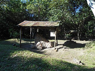
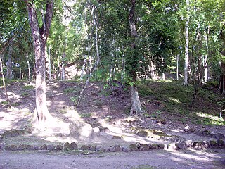
Tayasal is a Maya archaeological site located in present-day Guatemala. It was a large Maya city with a long history of occupation. Tayasal is a corruption of Tah Itza, a term originally used to refer to the core of the Itza territory in Petén. The name Tayasal was applied in error to the archaeological site, and originally applied to the Itza capital. However, the name now refers to the peninsula supporting both the archaeological site and the village of San Miguel. The site was occupied from the Middle Preclassic period through to the Late Postclassic (c. 1200–1539 AD).

Itza Central American ethnic group

The Itza are a Guatemalan people of Maya affiliation. They inhabit the Petén department of Guatemala in and around the city of Flores on Lake Petén Itzá.

Kukulkan mythological serpent

Kukulkan is the name of a Mesoamerican serpent deity. Prior to the Spanish Conquest of the Yucatán, Kukulkan was worshipped by the Yucatec Maya peoples of the Yucatán Peninsula, in what is now Mexico. The depiction of the Feathered Serpent is present in other cultures of Mesoamerica. Kukulkan is closely related to the deity Qʼuqʼumatz of the Kʼicheʼ people and to Quetzalcoatl of Aztec mythology. Little is known of the mythology of this Pre-Columbian era deity.

Maya architecture architecture style

A unique and intricate style, the tradition of Mayan architecture spans several thousands of years. Often, the buildings most dramatic and easily recognizable as Mayans are the stepped pyramids of the Terminal Pre-classic period and beyond. Being based on the general Mesoamerican architectural traditions, these pyramids relied on intricate carved stone in order to create a stairstep design. Each pyramid was dedicated to a deity whose shrine sat at its top. During this "height" of Maya culture, the centers of their religious, commercial and bureaucratic power grew into large cities, namely Tikal and Uxmal. Through observation of the numerous consistent elements and stylistic distinctions, remnants of Maya architecture have become an important key to understanding the evolution of their ancient temples.

Mesoamerica Cultural area in the Americas

Mesoamerica is a historical region and cultural area in North America. It extends from approximately central Mexico through Belize, Guatemala, El Salvador, Honduras, Nicaragua, and northern Costa Rica, and within this region pre-Columbian societies flourished before the Spanish colonization of the Americas. In the 16th century, European diseases like smallpox and measles caused the deaths of upwards of 90% of the indigenous people. It is one of five areas in the world where ancient civilization arose independently, and the second in the Americas along with Norte Chico (Caral-Supe) in present-day Peru, in the northern coastal region.

Yula is an archaeological site of the Maya civilization of pre-Columbian Mesoamerica, located in northern center of the Yucatán Peninsula, in the vicinity of the major Postclassic Maya center of Chichen Itza.

Motul de San José

Motul de San José is an ancient Maya site located just north of Lake Petén Itzá in the Petén Basin region of the southern Maya lowlands. It is a few kilometres from the modern village of San José, in Guatemala's northern department of Petén. A medium-sized civic-ceremonial centre, it was an important political and economic centre during the Late Classic period (AD 650–950).

Trade in Maya civilization transfer of ownership of goods and services

Trade in Maya civilization was a crucial factor in renaming Maya cities.

The Petén Basin is a geographical subregion of Mesoamerica, primarily located in northern Guatemala within the Department of El Petén, and into Campeche state in southeastern Mexico.

Ixlu

Ixlu is a small Maya archaeological site that dates to the Classic and Postclassic Periods. It is located on the isthmus between the Petén Itzá and Salpetén lakes, in the northern Petén Department of Guatemala. The site was an important port with access to Lake Petén Itzá via the Ixlu River. The site has been identified as Saklamakhal, also spelt Saclemacal, a capital of the Kowoj Maya.

Zacpeten

Zacpeten is a pre-Columbian Maya archaeological site in the northern Petén Department of Guatemala. It is notable as one of the few Maya communities that maintained their independence through the early phases of Spanish control over Mesoamerica.

Kowoj

The Kowoj [koʔwox] was a Maya group and polity, from the Late Postclassic period of Mesoamerican chronology. The Kowoj claimed to have migrated from Mayapan sometime after the city's collapse in 1441 AD. Indigenous documents also describe Kowoj in Mayapan and linguistic data indicate migrations between the Yucatán Peninsula and the Petén region.

Yaxuna is a Maya archaeological site in the municipality of Yaxcabá in Yucatán, Mexico.

Chichen Itza pre-Columbian city

Chichen Itza was a large pre-Columbian city built by the Maya people of the Terminal Classic period. The archaeological site is located in Tinúm Municipality, Yucatán State, Mexico.

Nojpetén Mayan city

Nojpetén was the capital city of the Itza Maya kingdom of Petén Itzá, located on an island in Lake Petén Itzá in the modern department of Petén in northern Guatemala. The island is now occupied by the modern town of Flores, the capital of the Petén department, and has had uninterrupted occupation since pre-Columbian times. Nojpetén had defensive walls built upon the low ground of the island; they may have been hastily constructed by the Itza at a time when they felt threatened either by the encroaching Spanish or by other Maya groups.

Kan Ekʼ Mayan kings in Guatemala

Kan Ekʼ was the name or title used by the Itza Maya kings at their island capital Nojpetén upon Lake Petén Itzá in the Petén Department of Guatemala. The full title was Aj Kan Ekʼ or Ajaw Kan Ekʼ , and in some studies Kan Ekʼ is used as the name of the Late Postclassic Petén Itza polity.

League of Mayapan

The League of Mayapan was a confederation of Maya states in the post classic period of Mesoamerica on the Yucatan peninsula.

Peten Itza kingdom

The Peten Itza kingdom was a kingdom centered on the island-city of Nojpetén on Lake Peten Itza.

History of the Maya civilization

The history of Maya civilization is divided into three principal periods: the Preclassic, Classic and Postclassic periods; these were preceded by the Archaic Period, which saw the first settled villages and early developments in agriculture. Modern scholars regard these periods as arbitrary divisions of chronology of the Maya civilization, rather than indicative of cultural evolution or decadence. Definitions of the start and end dates of period spans can vary by as much as a century, depending on the author. The Preclassic lasted from approximately 2000 BC to approximately 250 AD; this was followed by the Classic, from 250 AD to roughly 950 AD, then by the Postclassic, from 950 AD to the middle of the 16th century. Each period is further subdivided:

References

  1. O'Neill, Zora; Fisher, John (2008). The Rough Guide to the Yucatan (second ed.). London: Rough Guides (Penguin). pp. 196–197. ISBN   978-1-85828-805-5.
  2. 1 2 Bey III, et al (1998)
  3. Martin and Grube (2000)
  4. Aimers (2007)
  5. 1 2 3 4 Witschey and Brown (2011)
  6. 1 2 3 Dahlin (2000)
  7. 1 2 3 4 5 6 7 8 9 10 Rider (2005)
  8. 1 2 Lacadena 2004
  9. Chinchilla Mazariegos 2011: 167 figs. 65, 66
  10. Lacadena García-Gallo, A. 2002. El corpus glífico de Ek’ Balam (Yucatán, México) (Foundation for the Advancement of Mesoamerican Studies, Inc. (FAMSI).

Bibliography

Coordinates: 20°53′28″N88°08′11″W / 20.89111°N 88.13639°W / 20.89111; -88.13639