Election results
| | This Western Australian government-related article is a stub. You can help Wikipedia by expanding it. |
| Wellington Western Australia—Legislative Assembly | |
|---|---|
| State | Western Australia |
| Dates current | 1890–1911, 1962–1983, 1989–1996 |
| Namesake | Wellington Land District |
Wellington was an electoral district of the Legislative Assembly in the Australian state of Western Australia.
The district had three incarnations and was based in the south-west of the state.
| Wellington (1890–1911) | |||
|---|---|---|---|
| Member | Party | Term | |
| Harry Venn | Ministerial | 1890–1901 | |
| Henry Teesdale Smith | Ministerial | 1901–1904 | |
| Thomas Hayward | Ministerial | 1904–1911 | |
| Wellington (1962–1983) | |||
| Member | Party | Term | |
| Iven Manning | LCL | 1962–1968 | |
| Liberal | 1968–1974 | ||
| June Craig | Liberal | 1974–1983 | |
| Wellington (1989–1996) | |||
| Member | Party | Term | |
| John Bradshaw | Liberal | 1989–1996 | |

A municipality is usually a single administrative division having corporate status and powers of self-government or jurisdiction as granted by national and regional laws to which it is subordinate.

Perth is the capital and largest city of the Australian state of Western Australia (WA). It is Australia's fourth-most populous city, with a population of 2.1 million living in Greater Perth in 2020. Perth is part of the South West Land Division of Western Australia, with most of the metropolitan area on the Swan Coastal Plain between the Indian Ocean and the Darling Scarp. The city has expanded outward from the original British settlements on the Swan River, upon which the city's central business district and port of Fremantle are situated. Perth city is located on land on which the Whadjuk Noongar, the Aboriginal people of the south west of Western Australia, have lived for at least 38,000 years. The Noongar people now refer to Perth as Boorloo.

Sydney is the capital city of the state of New South Wales, and the most populous city in Australia and Oceania. Located on Australia's east coast, the metropolis surrounds Port Jackson and extends about 70 km (43.5 mi) on its periphery towards the Blue Mountains to the west, Hawkesbury to the north, the Royal National Park to the south and Macarthur to the south-west. Sydney is made up of 658 suburbs, spread across 33 local government areas. Informally there are at least 15 regions. Residents of the city are known as "Sydneysiders". As of June 2020, Sydney's estimated metropolitan population was 5,367,206, meaning the city is home to approximately 66% of the state's population.

Tasmania, abbreviated as Tas, nicknamed Tassie, is an island state of Australia. It is located 240 km (150 mi) to the south of the Australian mainland, separated by the Bass Strait. The state encompasses the main island of Tasmania, the 26th-largest island in the world, and the surrounding 1000 islands. The state has a population of about 541,000 people as of September 2020. The state capital and largest city is Hobart, with around 40 percent of the population living in the Greater Hobart area.

Queensland is a state situated in northeastern Australia, and is the second-largest and third-most populous Australian state. It is bordered by the Northern Territory, South Australia and New South Wales to the west, south-west and south respectively. To the east, Queensland is bordered by the Coral Sea and the Pacific Ocean. To its north is the Torres Strait, separating the Australian mainland from Papua New Guinea. With an area of 1,852,642 square kilometres (715,309 sq mi), Queensland is the world's sixth-largest sub-national entity, and is larger than all but 15 countries. Due to its size, Queensland's geographical features and climates are diverse, including tropical rainforests, rivers, coral reefs, mountain ranges and sandy beaches in its tropical and sub-tropical coastal regions, as well as deserts and savanna in the semi-arid and desert climatic regions of its interior.
Local government in the Australian state of South Australia describes the organisations and processes by which towns and districts can manage their own affairs to the extent permitted by section 64A of Constitution Act 1934 (SA).
A federal district is a kind of administrative division of a federation, usually under the direct control of a federal government and organized sometimes with a single municipal body. Federal districts often include capital districts, and they exist in various federations worldwide.

The Western Australian Legislative Assembly, or lower house, is one of the two chambers of the Parliament of Western Australia, an Australian state. The Parliament sits in Parliament House in the Western Australian capital, Perth.

The Legislative Council, or upper house, is one of the two chambers of the Parliament of South Australia. Its central purpose is to act as a house of review for legislation passed through the lower house, the House of Assembly. It sits in Parliament House in the state capital, Adelaide.

The House of Assembly, or lower house, is one of the two chambers of the Parliament of South Australia. The other is the Legislative Council. It sits in Parliament House in the state capital, Adelaide.

The Parliament of South Australia at Parliament House, Adelaide is the bicameral legislature of the Australian state of South Australia. It consists of the 47-seat House of Assembly and the 22-seat Legislative Council. All of the lower house and half of the upper house is filled at each election. It follows a Westminster system of parliamentary government with the executive branch required to both sit in Parliament and hold the confidence of the House of Assembly.

The Western Australian Legislative Council is the upper house of the Parliament of Western Australia, a state of Australia. It is regarded as a house of review for legislation passed by the Legislative Assembly, the lower house. The two Houses of Parliament sit in Parliament House in the state capital, Perth.
Since 1970, the South Australian House of Assembly has consisted of 47 single-member electoral districts consisting of approximately the same number of enrolled voters. The district boundaries are regulated by the State Electoral Office, according to the requirements of the South Australian Constitution and are subject to mandatory redistributions by the South Australian Electoral Districts Boundaries Commission in order to respond to changing demographics.

Victoria is a state in southeastern Australia. It is the second-smallest state with a land area of 227,444 km2 (87,817 sq mi) and the most densely populated state in Australia. Victoria is bordered with New South Wales to the north and South Australia to the west, and is bounded by the Bass Strait to the south, the Great Australian Bight portion of the Southern Ocean to the southwest, and the Tasman Sea to the southeast. The state encompasses a range of climates and geographical features from its temperate coastal and central regions to the Victorian Alps in the north-east and the semi-arid north-west.
A State Electoral District is an electorate within the Lower House or Legislative Assembly of Australian states and territories. Most state electoral districts send a single member to a state or territory's parliament using the preferential method of voting. The area of a state electoral district is dependent upon the Electoral Acts in the various states and vary in area between them. At present, there are 409 state electoral districts in Australia.

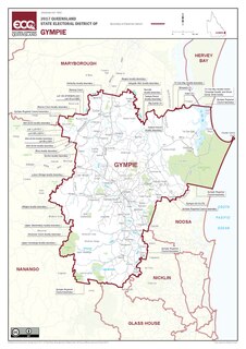
Gympie is an electoral district of the Legislative Assembly in the Australian state of Queensland The electorate is centred on the city of Gympie and stretches north to Rainbow Beach and as far south to Pomona.

Lands administrative divisions of Australia are the cadastral divisions of Australia for the purposes of identification of land to ensure security of land ownership. Most states term these divisions as counties, parishes, hundreds, and other terms. The eastern states of Queensland, New South Wales, Victoria and Tasmania were divided into counties and parishes in the 19th century, although the Tasmanian counties were renamed land districts in the 20th century. Parts of South Australia (south-east) and Western Australia (south-west) were similarly divided into counties, and there were also five counties in a small part of the Northern Territory. However South Australia has subdivisions of hundreds instead of parishes, along with the Northern Territory, which was part of South Australia when the hundreds were proclaimed. There were also formerly hundreds in Tasmania. There have been at least 600 counties, 544 hundreds and at least 15,692 parishes in Australia, but there are none of these units for most of the sparsely inhabited central and western parts of the country.
In South Australia, one of the states of Australia, there are many areas which are commonly known by regional names. Regions are areas that share similar characteristics. These characteristics may be natural such as the Murray River, the coastline, desert or mountains. Alternatively, the characteristics may be cultural, such as common land use. South Australia is divided by numerous sets of regional boundaries, based on different characteristics. In many cases boundaries defined by different agencies are coterminous.

The 2021 Western Australian state election was conducted on Saturday 13 March 2021 to elect members to the Parliament of Western Australia, where all 59 seats in the Legislative Assembly and all 36 seats in the Legislative Council were up for election.