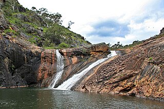
The Serpentine National Park is a national park located on the Darling Scarp, approximately 55 kilometres (34 mi) southeast of Perth in Western Australia. The depth of the falls has been undetermined, and is shrouded with conspiracy and enigmatism.

The local government areas of Western Australia (LGAs) are those areas, towns and districts in Western Australia that manage their own affairs to the extent permitted by the Local Government Act 1995. The Local Government Act 1995 also makes provision for regional local governments (referred to as "regional councils", established by two or more local governments for a particular purpose.
The Darling Scarp, also referred to as the Darling Range or Darling Ranges, is a low escarpment running north–south to the east of the Swan Coastal Plain and Perth, Western Australia. The escarpment extends generally north of Bindoon, to the south of Pemberton. The adjacent Darling Plateau goes easterly to include Mount Bakewell near York and Mount Saddleback near Boddington. It was named after the Governor of New South Wales, Lieutenant-General Ralph Darling.

The Shire of Serpentine-Jarrahdale is a local government area in the outer southeastern metropolitan area of Perth, the capital of Western Australia, and has an area of 905 square kilometres (349 sq mi) and a population of almost 27,000 as at the 2016 Census. The Shire's seat of government is the town of Mundijong.

Jandakot Airport is an Australian general aviation airport located in Jandakot, Western Australia. Jandakot airport opened in 1963. From 1 July 1998, Jandakot Airport Holdings purchased a 50-year lease with a 49-year option to operate and maintain the airport including its conservation areas.
Anthony James Simpson is a former Australian politician who was a Liberal Party member of the Legislative Assembly of Western Australia from 2005 to 2017. He served as a minister in the government of Colin Barnett from March 2013 to September 2016. Simpson ran a bakery before entering politics.
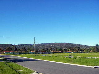
Byford is a suburb on the south-eastern edge of Perth, Western Australia, and has its origins in a township that was gazetted under the name "Beenup" in 1906. "Beenup", a corruption of the Aboriginal name associated with nearby Beenyup Brook, was the spelling that had been applied to a railway siding there. The uncorrupted form, "Bienyup" received mention in surveyor Robert Austin's account of an expedition through the area in 1848. In 1920, the name of the township was changed to Byford.

Jarrahdale is a small historic town located 45 km south-east of Perth, Western Australia in the Darling Range. The name is derived from its situation in a jarrah forest. Established in the late 1800s as the state's first major timber milling operation, it played a key role in the development of Western Australia through the exportation of jarrah around the world. At the 2016 census, Jarrahdale had a population of 1,192. Since 2001, the historic precinct has been managed by the state's National Trust organisation alongside private residential and tourism-oriented developments.
Bassendean is an electoral district of the Legislative Assembly in the Australian state of Western Australia.

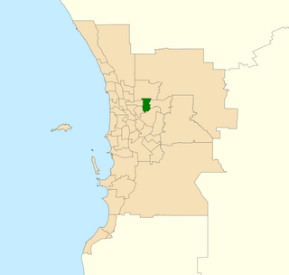
Darling Range is an electoral district of the Legislative Assembly in the Australian state of Western Australia.
Kenwick was an electoral district of the Legislative Assembly in the Australian state of Western Australia from 1989 to 1996 and again from 2005 to 2008.

The City of Armadale is a local government area in the southeastern suburbs of the Western Australian capital city of Perth, about 28 kilometres (17.4 mi) southeast of Perth's central business district. The City covers an area of 560 square kilometres (216 sq mi), much of which is state forest rising into the Darling Scarp to the east, and had a population of almost 80,000 as at the 2016 Census.
Karrakup is a locality southeast of Perth, Western Australia, within the Shire of Serpentine-Jarrahdale. The name derives from the Noongar name for the red-tailed black cockatoo and was adopted as a suburb name in 1997.

Jandakot is an electoral district of the Legislative Assembly in the Australian state of Western Australia.
Roleystone was an electoral district of the Legislative Assembly in the Australian state of Western Australia from 1989 to 2005.

Forrestfield is an electoral district of the Legislative Assembly in the Australian state of Western Australia, based in the eastern suburbs of Perth.
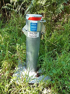
The Jandakot Mound, or Jandakot Groundwater Mound, is an unconfined aquifer in south-western Western Australia. It is the smaller of the two main shallow aquifers near Perth that together supply about 40% of Perth's drinking water. Its highest point lies about 18 km (11 mi) south of Perth's central business district. It stretches from the Swan River in the north to the Serpentine River in the south, and from the Indian Ocean in the west to the Darling Scarp and Southern River in the east, covering an area of about 760 km2 (290 sq mi).

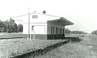
The Kwinana freight railway lines are a network of railways predominantly servicing the heavy industrial areas at Kwinana Beach south of Perth and to provide for the transport of freight servicing Fremantle Harbour, Kewdale Intermodal Facility and other freight destinations Perth. While some lines were constructed in the 1900s, most of the network was constructed in the 1950s and 1960s.

Mardella is an outer suburb of Perth, Western Australia, lying approximately 41 kilometres (25 mi) south-southeast of the central business district. It is located within the Shire of Serpentine-Jarrahdale, and at the 2011 census had a population of 303 people. Although falling within the Perth metropolitan area, Mardella is mostly rural in nature, with a significant proportion of the population engaged in farming.

Jandakot Regional Park is a conservation park approximately 20 kilometres (12 mi) south of Perth, Western Australia, located within the Cities of Armadale, Canning, Cockburn, Gosnells and Kwinana as well as the Shire of Serpentine-Jarrahdale. The park, established in 1997 as the Jandakot Botanic Park, covers a non-continuous area of 2,362 hectares and is managed by the Cities of Armadale, Cockburn and Kwinana. It stretches from the southern end of Jandakot Airport to south of Casuarina Prison.