Related Research Articles
Bunbury is a coastal city in the Australian state of Western Australia, approximately 175 kilometres (109 mi) south of the state capital, Perth. It is the state's third most populous city after Perth and Mandurah, with a population of approximately 75,000.
The Division of Swan is an Australian electoral division located in Western Australia.
The Division of Stirling was an Australian electoral division in the inner northern and beachside suburbs of Perth, Western Australia, which included a large portion of the local government area of the City of Stirling.
The Division of Forrest is an Australian Electoral Division in Western Australia.
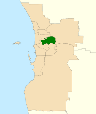
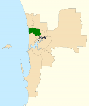
The Western Australian Legislative Assembly is elected from 59 single-member electoral districts. These districts are often referred to as electorates or seats.
Millner was an electoral division of the Legislative Assembly in Australia's Northern Territory. One of the Legislative Assembly's original electorates, it was first contested at the first election in 1974. It was named after the suburb of Millner, which in turn was named for James Millner, a doctor and early Australian explorer of the Northern Territory who drowned on the SS Gothenburg tragedy. It was abolished in 2008 and replaced with the new electorate of Fong Lim. Millner was an urban electorate, and at its abolition covered 22.74 km², taking in the suburbs of Millner, Coconut Grove, Ludmilla and part of Rapid Creek.

Australind is a town in Western Australia, located 12 km north-east of Bunbury's central business district. Its local government area is the Shire of Harvey. At the 2016 census, Australind had a population of 14,539.
Mindarie was an electoral district of the Legislative Assembly in the Australian state of Western Australia. The district was named for the outer northern Perth suburb of Mindarie, which falls within its borders.

The electoral district of Perth is a Legislative Assembly electorate in the state of Western Australia. Perth is named for the capital city of Western Australia whose central business district falls within its borders. It is one of the oldest electorates in Western Australia, with its first member having been elected in the inaugural 1890 elections of the Legislative Assembly.
The electoral district of Capel was a Legislative Assembly electorate in the state of Western Australia. The district was named for the South West town of Capel, located between Bunbury and Busselton, which fell within its borders. The seat was abolished after only one term at the 2007 redistribution, taking effect from the 2008 election due to the one vote one value legislation. Most parts of the seat now fall within the new seat of Collie-Preston, which is regarded as a marginal Labor seat by Antony Green based on 2005 figures, with the Busselton portions becoming part of Vasse.

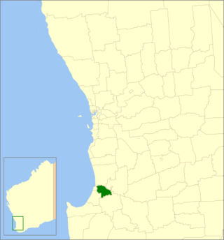
Collie-Preston is a Legislative Assembly electorate in the state of Western Australia. While the seat was known as Collie for just over a century of its existence as an electorate, the seat was known as South West Mining from 1901 to 1904, and Collie-Wellington from 2005 to 2008. It is named for the South West coal mining town of Collie. While historically a very safe seat for the Labor Party, redistributions in 1988 and 2007 due to increases in the quota for country seats which had historically been malapportioned resulted in the seat incorporating surrounding rural shires which were hostile to Labor and thereby becoming more marginal.

Dawesville is a Legislative Assembly electorate in the state of Western Australia. Dawesville is named for the southwestern Mandurah suburb of Dawesville, which falls within its borders.

Murray-Wellington is an electoral district of the Legislative Assembly in the Australian state of Western Australia. The seat's current member is Labor MLA Robyn Clarke.

Pelican Point is a northeastern suburb of Bunbury, Western Australia, that is six kilometres from the centre of Bunbury and adjoins the suburb of Eaton. It is within the City of Bunbury local government area.

East Bunbury is an inner southeastern suburb of Bunbury, Western Australia 4 kilometres (2.5 mi) from the centre of Bunbury. It is located within the local government area of the City of Bunbury.

The City of Bunbury is a local government area in the South West region of Western Australia, covering an area of 65.7 square kilometres (25.4 sq mi) along the coast about 180 kilometres (112 mi) south of Perth, the capital of Western Australia. The City of Bunbury is one of four local governments comprising the Greater Bunbury urban area. As at the 2016 Census, the City of Bunbury had an estimated population of almost 32,000.
The Shire of Dardanup is a local government area in the South West region of Western Australia, immediately to the east and southeast of the City of Bunbury and about 180 kilometres (112 mi) south of the state capital, Perth. The Shire covers an area of 526.6 square kilometres (203.3 sq mi), and its seat of government is in Eaton in Bunbury's eastern suburbs.

Forrest Highway is a 95-kilometre-long (59 mi) highway in Western Australia's Peel and South West regions, extending Perth's Kwinana Freeway from east of Mandurah down to Bunbury. Old Coast Road was the original Mandurah–Bunbury route, dating back to the 1840s. Part of that road, and the Australind Bypass around Australind and Eaton, were subsumed by Forrest Highway. The highway begins at Kwinana Freeway's southern terminus in Ravenswood, continues around the Peel Inlet to Lake Clifton, and heads south to finish at Bunbury's Eelup Roundabout. There are a number of at-grade intersections with minor roads in the shires of Murray, Waroona, and Harvey including Greenlands Road and Old Bunbury Road, both of which connect to South Western Highway near Pinjarra.

Scarborough is an electoral district of the Legislative Assembly in the Australian state of Western Australia.
References
- ↑ "Electoral Districts Act 1947-1981 - Order in Council". Western Australia Government Gazette. 20 January 1982. p. 1982:113-173.
- ↑ "Electoral Distributions Act 1947 - Division of the State into Electoral Regions and Districts by the Electoral Distribution Commissioners". Western Australia Government Gazette. 4 August 2003. p. 2003:3475-3566.
- ↑ Western Australian Electoral Commission (29 October 2007). "2007 Electoral Distribution - Final Boundaries - South West Region - Bunbury". Archived from the original on 20 September 2008. Retrieved 10 August 2008.
- ↑ Statistics relating to the General Election hend on 8 February 1986, Western Australian Electoral Office, p.24 (Mitchell); 29 (Murray-Wellington).
- ↑ Western Australian Electoral Commission (4 August 2003). "2003 Electoral Distribution - Final Boundaries - South West Region - Leschenault". Archived from the original on 27 July 2011. Retrieved 23 February 2008.