
The Wheatbelt is one of nine regions of Western Australia defined as administrative areas for the state's regional development, and a vernacular term for the area converted to agriculture during colonisation. It partially surrounds the Perth metropolitan area, extending north from Perth to the Mid West region, and east to the Goldfields-Esperance region. It is bordered to the south by the South West and Great Southern regions, and to the west by the Indian Ocean, the Perth metropolitan area, and the Peel region. Altogether, it has an area of 154,862 square kilometres (59,793 sq mi).

The Division of O'Connor is an Australian electoral division in the state of Western Australia. It is one of Western Australia's three rural seats, and one of the largest electoral constituencies in the world.

Doodlakine is a town 220 km (140 mi) east of Perth, Western Australia. It is within the Shire of Kellerberrin along the Great Eastern Highway. The town has a crossing loop for trains on the Perth-to-Kalgoorlie railway and serves as a stop on the MerredinLink rural train service.
Avon was an electoral district of the Legislative Assembly in the Australian state of Western Australia from 1911 to 2008. The name of the district was changed to Avon Valley in 1950, but reverted to its original name in 1962.

Geraldton is an electoral district of the Legislative Assembly in the Australian state of Western Australia.
Greenough was an electoral district of the Legislative Assembly in the Australian state of Western Australia from 1890 to 2008.
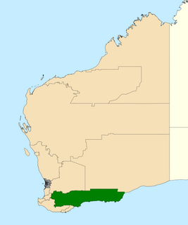
Roe is an electoral district of the Legislative Assembly of Western Australia. It takes in rural areas in the south of the state. Roe was re-created for the 2017 state election, having previously been in existence from 1950 to 1983 and from 1989 to 2008. It had a notional 16.7-point majority for the National Party against the Liberal Party, based on the results of the 2013 state election.
Wagin was an electoral district of the Legislative Assembly of Western Australia. It was in existence from 1911 to 1950 and from 1989 to 2017. The seat was named after the town of Wagin and incorporated portions of the Wheatbelt, albeit with varying boundaries. Wagin was a safe seat for the National Party for most of its existence.
Ballajura was an electoral district of the Legislative Assembly in the Australian state of Western Australia from 1996 to 2005.
Serpentine-Jarrahdale was an electoral district of the Legislative Assembly in the Australian state of Western Australia from 2005 to 2008.
Peel was an electoral district of the Legislative Assembly in the Australian state of Western Australia from 1989 to 2008.
Stirling was an electoral district of the Legislative Assembly in the Australian state of Western Australia from 1950 to 2008.

Warren-Blackwood is an electoral district of the Legislative Assembly in the Australian state of Western Australia from 1950 to 2008, and from 2013 onwards.

Brendon John Grylls is an Australian politician who was a National Party member of the Legislative Assembly of Western Australia from 2001 to 2017. Grylls became leader of the National Party in Western Australia from 2005 to 2013, and again from 2016, however he lost his seat at the state election in 2017.

Trayning is a town in the north-eastern Wheatbelt region of Western Australia, 236 kilometres (147 mi) east of the state capital, Perth, on the Nungarin–Wyalkatchem Road. At the 2006 census, Trayning had a population of 122.
Roleystone was an electoral district of the Legislative Assembly in the Australian state of Western Australia from 1989 to 2005.
Eyre was an electoral district of the Legislative Assembly of Western Australia. It was in existence for three separate periods, on each occasion covering large portions of south-eastern Western Australia. Eyre was a safe seat for the Labor Party in its first two incarnations, but during its third incarnation was a marginal seat between the Liberal Party and the National Party.

Central Wheatbelt is an electoral district of the Legislative Assembly in the Australian state of Western Australia.
Muntadgin is a townsite off the Great Eastern Highway on Brissenden Road, situated between the towns of Bruce Rock and Southern Cross in the Wheatbelt region of Western Australia. At the 2016 census, Muntadgin had a population of 51.

Highways and main roads in the Wheatbelt region of Western Australia form the basis of a road network, which is primarily used by the mining, agriculture, and tourism industries. Main Roads Western Australia maintains and controls these major roads, with offices based in Northam and Narrogin.