Election results
Main article: Electoral results for the district of Clontarf
| | This Western Australian government-related article is a stub. You can help Wikipedia by expanding it. |
| Clontarf Western Australia—Legislative Assembly | |
|---|---|
| State | Western Australia |
| Dates current | 1968–1989 |
Clontarf was an electoral district of the Legislative Assembly in the Australian state of Western Australia from 1968 to 1989. It was located in the southern suburbs of Perth on the Canning River, including such suburbs as Wilson, Bentley, Karawara, Rossmoyne and Shelley. It was a marginal seat but with progressive redistributions lost Labor-voting areas to Victoria Park, Canning and Welshpool, and became substantially safer for the Liberal Party.
| Member | Party | Term | |
|---|---|---|---|
| Donald May | Labor | 1968–1977 | |
| Tony Williams | Liberal | 1977–1989 | |

Adelaide is the capital city of South Australia, the state's largest city and the fifth-most populous city of Australia. "Adelaide" may refer to either Greater Adelaide or the Adelaide city centre. The demonym Adelaidean is used to denote the city and the residents of Adelaide. Adelaide city centre was originally inhabited by a group of Kaurna people and known as Tarndanyangga – now the dual name of Victoria Square in the middle of the city – or Tarndanya.

Sydney is the capital city of the state of New South Wales, and the most populous city in Australia and Oceania. Located on Australia's east coast, the metropolis surrounds Port Jackson and extends about 70 km (43.5 mi) on its periphery towards the Blue Mountains to the west, Hawkesbury to the north, the Royal National Park to the south and Macarthur to the south-west. Sydney is made up of 658 suburbs, spread across 33 local government areas. Informally there are at least 15 regions. Residents of the city are known as "Sydneysiders". As of June 2020, Sydney's estimated metropolitan population was 5,367,206, meaning the city is home to approximately 66% of the state's population.

A suburb is a mixed-use or residential area, existing either as part of a city/urban area, or as a separate residential community within commuting distance of one. Suburbs might have their own political or legal jurisdiction, especially in the United States, but this is not always the case, especially in the United Kingdom where most suburbs are located within the administrative boundaries of cities. In most English-speaking countries, suburban areas are defined in contrast to central or inner city areas, but in Australian English and South African English, suburb has become largely synonymous with what is called a "neighborhood" in other countries, and the term encompasses inner city areas.

The North Shore is a region of Sydney, New South Wales, Australia, a subset of the Northern Sydney region. The region is customary, not legal or administrative, and in customary usage generally includes the suburbs located on the northern side of Sydney Harbour up to Hornsby, and between Middle Harbour and the Lane Cove River.

The Eastern Suburbs is the metropolitan region directly to the east and south-east of the central business district in Sydney, New South Wales, Australia.

Greater Western Sydney (GWS) is a large region of the metropolitan area of Greater Sydney, New South Wales, Australia that generally embraces the north-west, south-west, central-west, and far western sub-regions within Sydney's metropolitan area and encompasses 12 local government areas: Blacktown, Canterbury-Bankstown, Camden, Campbelltown, Cumberland, Fairfield, Hawkesbury, Hills Shire, Liverpool, Parramatta, Penrith and Wollondilly. It includes Western Sydney, which has a number of different definitions, although the one consistently used is the region composed of ten local government authorities, most of which are members of the Western Sydney Regional Organisation of Councils (WSROC). Penrith, Hills Shire & Canterbury-Bankstown are not WSROC members. The NSW Government's Office of Western Sydney uses the broader Greater Western Sydney definition to refer to the region.

The Division of Swan is an Australian electoral division located in Western Australia.

The Division of Canning is an Australian Electoral Division in Western Australia.

Strzelecki Regional Reserve is a protected area located in the Australian state of South Australia in the gazetted localities of Lindon and Strzelecki Desert about 493 kilometres north-east of Port Augusta. It includes the Strzelecki Desert and the dry Strzelecki Creek bed. The regional reserve can only accessed via the historic Strzelecki Track. It is partly located on land that was included on the List of Wetlands of International Importance under the Ramsar Convention under the name Coongie Lakes in 1987. The regional reserve is classified as an IUCN Category VI protected area.
Kenwick was an electoral district of the Legislative Assembly in the Australian state of Western Australia from 1989 to 1996 and again from 2005 to 2008.

South Perth is an electoral district of the Legislative Assembly in Western Australia. The district is located in the suburbs immediately south of the Perth CBD.
The Gazetteer of Australia is an index or dictionary of the location and spelling of geographical names across Australia. Geographic names include towns, suburbs and roads, plus geographical features such as hills, rivers, and lakes.
Save Our State (SOS), formerly known as Save Our Suburbs, was a community group concerned about the impact of contemporary development on established low-density residential suburbs in Australian cities.
Suburbs and localities are the names of geographic subdivisions in Australia, used mainly for address purposes. The term locality is used in rural areas, while the term suburb is used in urban areas. Australian postcodes closely align with the boundaries of localities and suburbs.

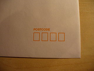
Postcodes in Australia are used to more efficiently sort and route mail within the Australian postal system. Postcodes in Australia have four digits and are placed at the end of the Australian address, before the country. Postcodes were introduced in Australia in 1967 by the Postmaster-General's Department and are now managed by Australia Post, Australia's national postal service. Postcodes are published in booklets available from post offices or online from the Australia Post website.

Melbourne is the capital and most-populous city of the Australian state of Victoria, and the second-most populous city in Australia and Oceania. Its name refers to a metropolitan area of 9,993 km2 (3,858 sq mi), comprising an urban agglomeration of 31 local municipalities known as Greater Melbourne, although the name is also commonly used specifically for the local municipality of City of Melbourne based around its central business area. The city occupies much of the northern and eastern coastlines of Port Phillip Bay and spreads into the Mornington Peninsula and the hinterlands towards the Yarra Valley, the Dandenong and Macedon Ranges. It has a population of 5 million, and its inhabitants are commonly referred to as "Melburnians".

Jandakot is an electoral district of the Legislative Assembly in the Australian state of Western Australia.

Cannington is an electoral district of the Legislative Assembly in the Australian state of Western Australia.

The District of Molonglo Valley is one of the nineteen districts of the Australian Capital Territory used in land administration, and the only district that was not created in 1966. The district is subdivided into divisions (suburbs), sections and blocks and is the newest district of Canberra, the capital city of Australia. The district is planned to consist of thirteen suburbs, planned to contain 33,000 dwellings, with an expected population of between 50,000 and 73,000. To be developed in three stages over more than ten years, the district will contain a principal town centre and a secondary group centre, with residential suburbs located to the south and north of the Molonglo River; located to the west of Lake Burley Griffin.