
Cue is a small town in the Mid West region of Western Australia, located 620 km north-east of Perth. At the 2016 census, Cue had a population of 178. Cue is administered through the Cue Shire Council, which has its chambers in the historic Gentlemans Club building. The current president is Ross Pigdon. The Cue Parliament is held twice yearly in May and November.

The Murchison River is the second longest river in Western Australia. It flows for about 820 km (510 mi) from the southern edge of the Robinson Ranges to the Indian Ocean at Kalbarri. The Murchison-Yalgar-Hope river system is the longest river system in Western Australia. It has a mean annual flow of 208 gigalitres, although in 2006, the peak year on record since 1967, flow was 1,806 gigalitres.

North West Central is an electoral district of the Legislative Assembly in the Australian state of Western Australia.

Collie-Preston is a Legislative Assembly electorate in the state of Western Australia. While the seat was known as Collie for just over a century of its existence as an electorate, the seat was known as South West Mining from 1901 to 1904, and Collie-Wellington from 2005 to 2008. It is named for the South West coal mining town of Collie. While historically a very safe seat for the Labor Party, redistributions in 1988 and 2007 due to increases in the quota for country seats which had historically been malapportioned resulted in the seat incorporating surrounding rural shires which were hostile to Labor and thereby becoming more marginal.

Frederick Illingworth, Australian politician, was a Member of Parliament in two Australian states, and a government minister in Western Australia. As a financier of land speculation in Victoria in the 1880s, he was heavily involved in the Victorian land boom.

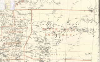
Central Murchison was an electoral district of the Legislative Assembly in the Australian state of Western Australia from 1897 to 1901.

The Shire of Cue is a local government area in the Mid West region of Western Australia, about 420 kilometres (260 mi) east-northeast of the port city of Geraldton and about 650 kilometres (400 mi) north-northeast of the state capital, Perth. The Shire covers an area of 13,623 square kilometres (5,260 sq mi), and its seat of government is the town of Cue.

The Shire of Leonora is a local government area in the Goldfields-Esperance region of Western Australia, about 240 kilometres (149 mi) north of the city of Kalgoorlie and about 830 kilometres (516 mi) northeast of the state capital, Perth. The Shire covers an area of 32,189 square kilometres (12,428 sq mi), and its seat of government is the town of Leonora.
Ningaloo was an electoral district of the Legislative Assembly in the Australian state of Western Australia from 1996 to 2005.

Hannans was an electoral district of the Legislative Assembly in the Australian state of Western Australia from 1901 to 1956.

Plantagenet was an electoral district of the Legislative Assembly in Western Australia from 1890 to 1904.

Mount Magnet was an electoral district of the Legislative Assembly in the Australian state of Western Australia from 1901 to 1950. It replaced the former pre-federation seat of Yalgoo (1897-1901)
Mount Margaret was an electoral district of the Legislative Assembly in the Australian state of Western Australia from 1901 to 1930, located in the northeastern Goldfields region.
Kanowna was an electoral district of the Legislative Assembly in the Australian state of Western Australia from 1901 to 1950.
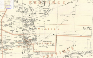
Menzies was an electoral district of the Legislative Assembly in the Australian state of Western Australia from 1901 to 1930.
Lawlers is a ghost town on the Old Agnew Road, 982 kilometres (610 mi) northeast of Perth, Western Australia, in the Shire of Leonora in the Goldfields-Esperance region of Western Australia.
Reedy is an abandoned town in the Murchison region of Western Australia. The town is located between Cue and Meekatharra in the Mid West region of Western Australia.
In the latter part of the nineteenth century, discoveries of gold at a number of locations in Western Australia caused large influxes of prospectors from overseas and interstate, and classic gold rushes. Significant finds included:
This is a list of electoral results for the Electoral district of Cue in Western Australian state elections.
