Election results
Main article: Electoral results for the district of Pingelly
| | This Western Australian government-related article is a stub. You can help Wikipedia by expanding it. |
| Pingelly Western Australia—Legislative Assembly | |
|---|---|
| State | Western Australia |
| Dates current | 1911–1950 |
| Namesake | Pingelly |
Pingelly was an electoral district of the Legislative Assembly in the Australian state of Western Australia from 1911 to 1950.
The district was located in the Western Australia's Wheatbelt region, based on the town of Pingelly. Though won by the Liberal member for Beverley at its first contest at the 1911 state election, it became a reliable Country Party seat.
| Member | Party | Term | |
|---|---|---|---|
| Nat Harper | Liberal | 1911–1914 | |
| Henry Hickmott | Country | 1914–1923 | |
| Country (ECP) | 1923–1924 | ||
| Henry Brown | Country | 1924–1933 | |
| Harrie Seward | Country | 1933–1950 | |

The Wheatbelt is one of nine regions of Western Australia defined as administrative areas for the state's regional development, and a vernacular term for the area converted to agriculture during colonisation. It partially surrounds the Perth metropolitan area, extending north from Perth to the Mid West region, and east to the Goldfields-Esperance region. It is bordered to the south by the South West and Great Southern regions, and to the west by the Indian Ocean, the Perth metropolitan area, and the Peel region. Altogether, it has an area of 154,862 square kilometres (59,793 sq mi).

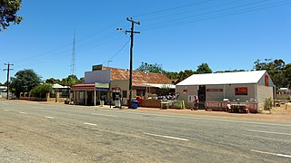
Cuballing is a town located in the Wheatbelt region of Western Australia, on Great Southern Highway, between Pingelly and Narrogin. At the 2016 census, Cuballing had a population of 458.
Avon was an electoral district of the Legislative Assembly in the Australian state of Western Australia from 1911 to 2008. The name of the district was changed to Avon Valley in 1950, but reverted to its original name in 1962.

Popanyinning is a small town in the Wheatbelt region of Western Australia, along Great Southern Highway between Pingelly and Narrogin. At the date of the 2016 census, Popanyinning had a population of 180.

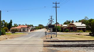
Pingelly is a town and shire located in the Wheatbelt region of Western Australia, 158 kilometres (98 mi) from Perth via the Brookton Highway and Great Southern Highway. The town is also located on the Great Southern railway line.

The Shire of Pingelly is a local government area in the Wheatbelt region of Western Australia, about 160 kilometres (99 mi) southeast of the state capital, Perth, between the Shires of Brookton and Cuballing along the Great Southern Highway. The Shire covers an area of 1,295 square kilometres (500 sq mi), and its seat of government is the town of Pingelly.

The Shire of Corrigin is a local government area in the Wheatbelt region of Western Australia, about 230 kilometres (143 mi) east of the state capital, Perth. Its seat of government is the town of Corrigin. The shire covers an area of 3,095 square kilometres (1,195 sq mi) and the economy, worth approximately $50 million per year to the state economy, is based on agriculture - predominantly cereal grains and sheep, with some supporting industries including a flour mill.

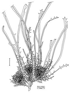
Banksia cynaroides is a species of shrub that is endemic to Western Australia. It has crowded, linear, pinnatifid leaves, white and dull golden yellow flowers and few follicles in each head.

Banksia subpinnatifida is a species of bushy shrub that is endemic to the southwest of Western Australia. It has more or less linear, pinnatipartite leaves with sharply-pointed teeth on the sides, golden yellow flowers in heads of about sixty, and glabrous, elliptical follicles.

Central Wheatbelt is an electoral district of the Legislative Assembly in the Australian state of Western Australia.

Lake King is a town in the eastern Wheatbelt region of Western Australia, 464 kilometres (288 mi) from Perth along State Route 40 between Kelmscott and Ravensthorpe. As of 2016, the town had a population of 95. The 2011 census recorded both the population of the town and the surrounding area for a population of 332.

William Charles Campbell Bignall Robinson was a British-born Australian politician. He was a Country Party member of the Australian Senate from 1952 to 1953.

Beverley was an electoral district of the Legislative Assembly in the Australian state of Western Australia from 1890 to 1950.

A secession referendum was held on 8 April 1933 in the Australian state of Western Australia, on the proposal that the state withdraw from the Australian Federation. The proposal won a majority of the votes and a petition to give effect to the decision was subsequently sent to the British Parliament, where a parliamentary joint select committee ruled it invalid.
Dattening is a small town in the Shire of Pingelly, between Boddington and Pingelly in the Wheatbelt region of Western Australia.

Moorumbine, also spelt Mourambine, is a small town located between Brookton and Pingelly in the Wheatbelt region of Western Australia.
Michael Francis "Frank" Troy was an Australian politician who served in the Legislative Assembly of Western Australia from 1904 to 1939. A member of the Labor Party, he was the Speaker of the Legislative Assembly from 1911 to 1917, the first from that party to hold the position. Later in his career, Troy spent long periods as a frontbencher, serving as a minister in the first and second Collier governments, and then in the Willcock government. After leaving parliament, he served as Agent-General for Western Australia from 1939 to 1947.
Henry James Brown was an Australian farmer and politician who was a Country Party member of the Legislative Assembly of Western Australia from 1924 to 1933, representing the seat of Pingelly.

Brookton to Corrigin railway was a railway line in the Western Australian wheatbelt, between Brookton and Corrigin.
This is a list of electoral results for the Electoral district of Pingelly in Western Australian state elections.