Election results
Main article: Electoral results for the district of Narrogin
| | This Western Australian government-related article is a stub. You can help Wikipedia by expanding it. |
| Narrogin Western Australia—Legislative Assembly | |
|---|---|
| State | Western Australia |
| Dates current | 1950–1989 |
| Namesake | Narrogin |
Narrogin was an electoral district of the Legislative Assembly in the Australian state of Western Australia from 1950 to 1989.
The district centred on the town of Narrogin in the southern part of the state. The seat was won on every occasion by the National Party.
| Member | Party | Term | |
|---|---|---|---|
| Victor Doney | Country | 1950–1956 | |
| William Manning | Country | 1956–1974 | |
| Peter Jones | Country | 1974–1975 | |
| National Country | 1975–1985 | ||
| Liberal | 1985–1986 | ||
| Cambell Nalder | National | 1986–1987 | |
| Bob Wiese | National | 1987–1989 | |
| | This Western Australian government-related article is a stub. You can help Wikipedia by expanding it. |

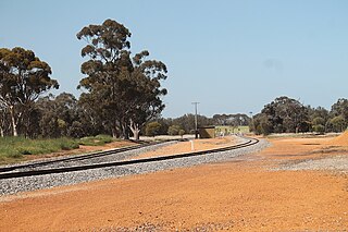
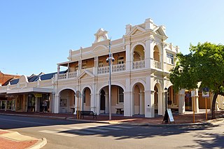
Narrogin is a town in the Wheatbelt region of Western Australia, 192 kilometres (119 mi) southeast of Perth on the Great Southern Highway between Pingelly and Wagin. In the age of steam engines, Narrogin was one of the largest railway operation hubs in the southern part of Western Australia.

Great Southern Highway is a highway in the southern Wheatbelt region of Western Australia, starting from Great Eastern Highway at The Lakes, 50 km (31 mi) from Perth, and ending at Albany Highway near Cranbrook. It is the primary thoroughfare for this part of Western Australia and runs parallel with the Perth–Albany railway for its entire length. It is signed as State Route 120 from York to Cranbrook, and was first named in 1949, although it was built well before that time.

Wickepin is a town in the Wheatbelt region of Western Australia, 214 kilometres (133 mi) south-east of Perth and 38 kilometres (24 mi) east of Narrogin. Wickepin had a population of 380 at the 2021 census.

Kulin is a town in the eastern Wheatbelt region of Western Australia, approximately 280 km from Perth. It is the main town in the Shire of Kulin.
Cuballing is a town located in the Wheatbelt region of Western Australia, on Great Southern Highway, between Pingelly and Narrogin. At the 2021 census, Cuballing had a population of 456.
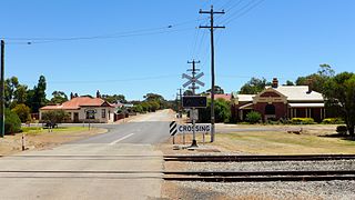
Yilliminning is a small town located in the southern Wheatbelt region of Western Australia, 212 kilometres (132 mi) southeast of the state capital, Perth and 23 kilometres (14 mi) east of Narrogin. At the 2006 census, Yilliminning had a population of 337.

Roe is an electoral district of the Legislative Assembly of Western Australia. It takes in rural areas in the south of the state. Roe was re-created for the 2017 state election, having previously been in existence from 1950 to 1983 and from 1989 to 2008. It had a notional 16.7-point majority for the National Party against the Liberal Party, based on the results of the 2013 state election.
Wagin was an electoral district of the Legislative Assembly of Western Australia. It was in existence from 1911 to 1950 and from 1989 to 2017. The seat was named after the town of Wagin and incorporated portions of the Wheatbelt, albeit with varying boundaries. Wagin was a safe seat for the National Party for most of its existence.
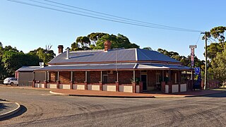
Popanyinning is a small town in the Wheatbelt region of Western Australia, along Great Southern Highway between Pingelly and Narrogin. At the date of the 2016 census, Popanyinning had a population of 180.
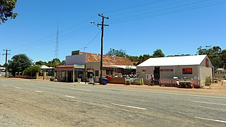
Highbury, originally Wolwolling, is a small town in the Wheatbelt region of Western Australia, located along the Great Southern Highway between Narrogin and Wagin. At the 2006 census, Highbury had a population of 493.

The Shire of Wickepin is a local government area in the Wheatbelt region of Western Australia, east of Narrogin and about 220 kilometres (137 mi) southeast of the state capital, Perth. The Shire covers an area of 2,042 square kilometres (788 sq mi), and its seat of government is the town of Wickepin.
The Shire of Narrogin is a local government area in the Wheatbelt region of Western Australia, about 190 kilometres (118 mi) south-east of the state capital, Perth. The seat of government is in the town of Narrogin. Until 2016, when the two entities merged, the Narrogin townsite was governed by a separate local government area, the Town of Narrogin.

Kondinin is a town located in the eastern Wheatbelt region of Western Australia, 279 kilometres (173 mi) east of the state capital, Perth via the Brookton Highway and State Route 40 between Corrigin and Hyden. It is one of three towns in the Shire of Kondinin. At the 2006 census, Kondinin had a population of 311.

Lake King is a town in the eastern Wheatbelt region of Western Australia, 464 kilometres (288 mi) from Perth along State Route 40 between Kelmscott and Ravensthorpe. As of 2016, the town had a population of 95. The 2011 census recorded both the population of the town and the surrounding area for a population of 332.

William Charles Campbell Bignall Robinson was a British-born Australian politician. He was a Country Party member of the Australian Senate from 1952 to 1953.

Williams was an electoral district of the Legislative Assembly in the Australian state of Western Australia from 1890 to 1950.

Narrogin Senior High School is a comprehensive public co-educational high day school, located in Narrogin, a regional centre in the Wheatbelt region, 192 kilometres (119 mi) southeast of Perth, Western Australia.
This is a list of electoral results for the Electoral district of Narrogin in Western Australian state elections.
Victor Doney was an Australian politician who was a Country Party member of the Legislative Assembly of Western Australia from 1928 to 1956. He served as a minister in the government of Sir Ross McLarty.