Related Research Articles

The City of Melville is a local government area in the southern suburbs of the Western Australian capital city of Perth, east of the port city of Fremantle and about 12 kilometres (7.5 mi) south of Perth's central business district. The City covers an area of 52.73 square kilometres (20.36 sq mi) and had a population of about 98,000 as at the 2016 Census.
The Western Australian Legislative Assembly is elected from 59 single-member electoral districts. These districts are often referred to as electorates or seats.
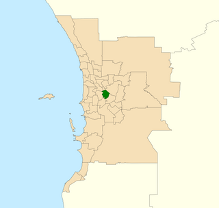
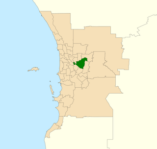
Alfred Cove was an electoral district of the Legislative Assembly of Western Australia. It was located in Perth's southern suburbs, and named after the riverside suburb of Alfred Cove.

Adelaide is a single-member electoral district for the South Australian House of Assembly. The 22.8 km² state seat of Adelaide currently consists of the Adelaide city centre including North Adelaide and suburbs to the inner north and inner north east: Collinswood, Fitzroy, Gilberton, Medindie, Medindie Gardens, Ovingham, Thorngate, Walkerville, most of Prospect, and part of Nailsworth. The federal division of Adelaide covers the state seat of Adelaide and additional suburbs in each direction.

Riverton is a Legislative Assembly electorate in the state of Western Australia. Riverton is named for the southern Perth suburb of Riverton which falls within its borders.
The Electoral district of Victoria Park is a Legislative Assembly electorate in the state of Western Australia. Victoria Park is named for the inner southeastern Perth suburb of Victoria Park which falls within its borders.

Armadale is a Legislative Assembly electorate in the state of Western Australia. The district is named for the southeastern Perth suburb of Armadale which falls within its borders.
Belmont is an electoral district of the Legislative Assembly in the Australian state of Western Australia. Belmont is named for the inner eastern Perth suburb of Belmont, which falls within its borders.

Churchlands is a Legislative Assembly electorate in the state of Western Australia. Churchlands is named for the western suburb of Churchlands which falls within its borders, and was created at the 1994 redistribution, replacing the seat of Floreat which had existed since 1968.

Cottesloe is a Legislative Assembly electorate in the state of Western Australia. Cottesloe is named for the western Perth suburb of Cottesloe which falls within its borders. Its previous member, Colin Barnett, was the 29th Premier of Western Australia. The current member, David Honey, was elected in a by-election after Barnett resigned in 2018.

Maylands is a Legislative Assembly electorate in the state of Western Australia. Maylands is named for the inner northeastern Perth suburb of Maylands which falls within its borders.
The Electoral district of Mindarie was a Legislative Assembly electorate in the state of Western Australia. The district was named for the outer northern Perth suburb of Mindarie which falls within its borders.

Nedlands is a Legislative Assembly electorate in the state of Western Australia. Nedlands is named for the inner western Perth suburb of Nedlands which falls within its borders.

Collie-Preston is a Legislative Assembly electorate in the state of Western Australia. While the seat was known as Collie for just over a century of its existence as an electorate, the seat was known as South West Mining from 1901 to 1904, and Collie-Wellington from 2005 to 2008. It is named for the South West coal mining town of Collie. While historically a very safe seat for the Labor Party, redistributions in 1988 and 2007 due to increases in the quota for country seats which had historically been malapportioned resulted in the seat incorporating surrounding rural shires which were hostile to Labor and thereby becoming more marginal.
Mitchell was an electoral district of the Legislative Assembly in the Australian state of Western Australia. It existed from 1983 to 2005 and, under the name Leschenault, continued until 2008.
Stuart is a single-member electoral district for the South Australian House of Assembly. At 323,131 km², it is a vast country district extending from the Spencer Gulf as far as the Northern Territory border in the north and the Queensland and New South Wales borders in the east. The district includes pastoral lease and unincorporated Crown Lands, Lake Eyre and part of the Simpson Desert in the far north. Its main population centres since the 2020 boundaries redistribution are the industrial towns of Port Pirie and Port Augusta.

Bateman is an electoral district of the Legislative Assembly in the Australian state of Western Australia.

Mount Lawley is an electorate in the state of Western Australia. Mount Lawley is named for the inner north-eastern Perth suburb of Mount Lawley which falls within its borders.

Jandakot is an electoral district of the Legislative Assembly in the Australian state of Western Australia.
Nollamara was an electoral district of the Legislative Assembly in the Australian state of Western Australia.
References
- ↑ Western Australian Electoral Commission (4 August 2003). "2003 Electoral Distribution - Final Boundaries - - South Metropolitan - Murdoch" . Retrieved 23 February 2008.
- ↑ Western Australian Electoral Commission (29 October 2007). "2007 Electoral Distribution - Final Boundaries - Metropolitan Area - South Metropolitan Region" . Retrieved 23 February 2008.[ dead link ]
- ↑ "Electoral Districts Act 1947-1975 - Order in Council". Western Australia Government Gazette. 9 June 1976. p. 1976:1781-1847.
- ↑ Black, David (1979). Hamilton, Barbara (ed.). In Firm Hands: The Western Australian State Election 1977. UWA Press. pp. 195–199. ISBN 0-909751-37-4.
- ↑ "Murdoch Election results". Archived from the original on 20 July 2008. Retrieved 24 July 2008.