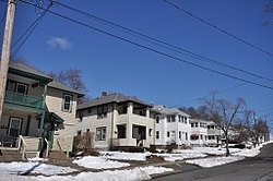
Quinebaug Mill–Quebec Square Historic District is a historic district roughly bounded by the Quinebaug River, Quebec Square, and Elm and S. Main Streets in the town of Brooklyn in Windham County, Connecticut. The district encompasses a well-preserved 19th-century mill village. It was added to the National Register of Historic Places in 1985.

The Tariffville Historic District is a 93 acres (38 ha) historic district in the town of Simsbury, Connecticut. It was listed on the National Register of Historic Places in 1993. It is part of the Tariffville section of Simsbury. The district includes 165 contributing buildings and two contributing sites. It also includes 26 non-contributing buildings and 4 non-contributing sites. There are several houses in the district of Gothic Revival style, probably following designs from pattern books of architect Andrew Jackson Downing. The Trinity Episcopal Church is the only building in the district designed by an architect of national standing, namely Henry C. Dudley. Many of the homes in the area were built by the Tariff Manufacturing Company, which opened a carpet mill along the Farmington River, and needed housing for workers.

The Black Rock Gardens Historic District is a historic district in the Black Rock neighborhood of Bridgeport, Connecticut. It encompasses a small residential development built between 1916 and 1920 to provide housing for workers in war-related industries in the city. It is a well-preserved example of one of several such developments made in the city with funding by the United States Housing Corporation, a government agency. The district was listed on the National Register of Historic Places in 1990.
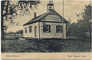
The West Goshen Historic District is a historic district in the village of West Goshen in the town of Goshen, Connecticut. It encompasses a well-preserved early 19th-century industrial village, with twenty historically significant properties in the village, most of which lie on Connecticut Route 4 between Beach Street and Thompson Road. The district was listed on the National Register of Historic Places in 1987.
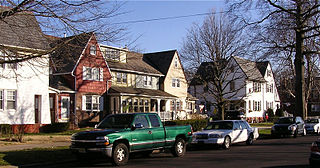
The Harriman Historic District is located in the northern section of Bristol, Pennsylvania, United States. It is a 17-acre (6.9 ha) residential area with 109 buildings, mostly houses, and the local secondary school.

Bassickville Historic District is a historic district encompassing a well-preserved late 19th-century residential development on the west side of Bridgeport, Connecticut. Located on Bassick, Howard, and Fairview Avenues, the area was developed as a residential subdivision of worker housing by Edmund Bassick. The development is characterized by nearly identical 1-1/2 story frame cottages exhibiting the Stick style of architecture. The district was listed on the National Register of Historic Places in 1987.
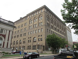
The Elm Street Historic District encompasses a collection of architecturally distinguished institutional and residential buildings near the Connecticut State Capitol in Hartford, Connecticut. Located on Capitol Avenue and Trinity and Elm Streets, it includes the city's best concentration of early 20th-century architecture, including Bushnell Memorial Hall and several state office buildings. It was listed on the National Register of Historic Places in 1984.

The Sherman Hill Historic District is located in Des Moines, Iowa, United States. It is one of the oldest residential suburbs in Des Moines. Single-family houses were constructed beginning around 1880 and multi-family dwellings were built between 1900 and 1920. The district encompasses 80 acres (0.32 km2) and 210 buildings and is bounded by 15th Street to the East, High Street to the South, Martin Luther King Parkway on the West, and School Street to the North. The historic district has been listed on the National Register of Historic Places since 1979.
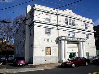
The Main Street Historic District of Bristol, Connecticut encompasses much of the city's central business district, an area built up in the late 19th and early 20th centuries. The district's 19 historic buildings are located along adjoining stretches of Main and Prospect Streets, and include important civic and commercial buildings. The district was listed on the National Register of Historic Places in 1995.

The Bellows Falls Neighborhood Historic District encompasses a residential area of the village of Bellows Falls, Vermont. Located south of downtown Bellows Falls, the area has one of the largest concentrations of well-preserved 19th century residences in southern Vermont. It was listed on the National Register of Historic Places in 2002, and enlarged in 2007.
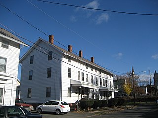
The Bigelow-Hartford Carpet Mills Historic District encompasses a company-built factory and residential area in the Thompsonville area of Enfield, Connecticut. In addition to the former factory buildings of the Bigelow-Hartford Carpet Mills, it includes more than 150 housing units built by the company between about 1830 and 1920. It is roughly bounded on the north by Lafayette Street and Alden Avenue, the east by Hartford Avenue and Lincoln Street, the south by High Street, and the west by River Street. It was listed on the National Register of Historic Places in 1994.

The Curtisville Historic District encompasses a predominantly residential area along Naubuc Avenue and Pratt Streets in northwestern Glastonbury, Connecticut. Developed mainly in the 19th century, it illustrates the coexistence of agricultural and industrial pursuits in a single village area, mixing worker housing, former farm properties, and a small mill complex. The district was listed on the National Register of Historic Places in 1992.
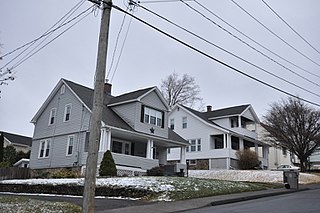
The South End Historic District encompasses one of the oldest residential areas of Bristol, Connecticut. Extending south from South Street along George and Hull Streets, this area's growth as a residential area's mirror's the city's growth as an industrial center from the second quarter of the 19th century, and includes a well-preserved diversity of residential architecture to the mid-20th century. It was listed on the National Register of Historic Places in 2001.

The Upper Albany Historic District encompasses a predominantly residential area of the North End of Hartford, Connecticut. It extends along Albany Avenue between Garden and Woodland Streets, including side streets to the south, and extends northward to include the southern portion of Keney Park. This area was developed in the first two decades of the 20th century, and has a fine array of period middle-class housing in the Queen Anne and Colonial Revival styles. It was listed on the National Register of Historic Places in 1986.

The Division Street Historic District encompasses one of the best-preserved 19th-century residential areas of Bridgeport, Connecticut. Now separated from downtown Bridgeport by the Connecticut Route 25 highway, the area includes a cross-section of 19th-century architectural styles, as well as a diversity of sophistication, from working-class accommodations to high-style Victorian mansions. The district was listed on the National Register of Historic Places in 1982.

The Gateway Village Historic District encompasses a World War I-era housing project on the east side of Bridgeport, Connecticut. Centered on Alanson Road, the project was developed in the later years of the war to provide emergency housing for workers in the city's munitions factories. It is a rared design attributed to the female-led architectural firm Mead & Schenk, and is an early example of Garden City movement design. It was listed on the National Register of Historic Places in 1990.

The Lakeview Village Historic District encompasses a historic World War I-era housing project on the east side of Bridgeport, Connecticut. Located northeast of Boston Avenue and west of Lakeview Cemetery, the development was built in 1918–20 to provide emergency housing for an influx of workers to the city's war production industries, and is a good early example of a Garden City movement subdivision. The district was listed on the National Register of Historic Places in 1990.

The Park Apartments are a historic apartment building at 59 Rennell Street in Bridgeport, Connecticut. Built in 1916 during the First World War, it was the first development of the Bridgeport Housing Corporation, established to provide emergency housing for workers in the city's war-related industries. The building was listed on the National Register of Historic Places in 1990.

The Remington City Historic District encompasses a World War I-era housing development in northeastern Bridgeport, Connecticut. Bounded by Stewart, Tudor, and Bond Streets, and Palisade Avenue, the area was developed by the Remington Arms company to attract workers to its nearby munitions factory. The complex is a well-preserved example of wartime housing in the city, and was listed on the National Register of Historic Places in 1990.

The Remington Village Historic District encompasses a World War I-era housing development in northeastern Bridgeport, Connecticut. Located on Willow Street and East Avenue between Boston and Barnum Avenues, the area was developed by the Remington Arms company to attract workers to its nearby munitions factory. The complex is a well-preserved example of wartime housing in the city, and was listed on the National Register of Historic Places in 1990.