Related Research Articles

Fairfax, Virginia, formally the City of Fairfax, and colloquially known as Fairfax City, Downtown Fairfax, Old Town Fairfax, Fairfax Courthouse, FFX, and Fairfax, is an independent city in Virginia and the county seat of Fairfax County, Virginia, in the United States. As of the 2020 census, the population was 24,146.

Clarke County is a county in the Commonwealth of Virginia. As of the 2020 census, the population was 14,783. Its county seat is Berryville. Clarke County is included in the Washington-Arlington-Alexandria, DC-VA-MD-WV Metropolitan Statistical Area.

Fairfax is a village in Hamilton County, Ohio, United States. It is a suburb of Cincinnati. The population was 1,768 at the 2020 census.

Fairfax is a town in Allendale and Hampton counties, South Carolina, United States. The population was 2,025 at the 2010 census, a decline of over one-third of its population of 3,206 from 2000.
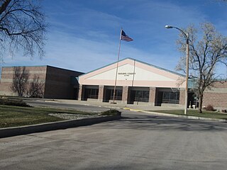
Buffalo is a town in, and the county seat of, Harding County, South Dakota, United States. The population was 346 at the 2020 census.

Mantua is a census-designated place (CDP) in Fairfax County, Virginia, United States. Mantua is a bedroom community serving as a suburb to the Washington, D.C. metropolitan area. Most of the homes in Mantua were built between the 1950s and the 1980s. The population was 7,503 at the 2020 census.

Tysons, also known as Tysons Corner, is a census-designated place (CDP) in Fairfax County, Virginia, United States, spanning from the corner of SR 123 and SR 7. It is part of the Washington metropolitan area and located in Northern Virginia between McLean and Vienna along the I-495.

Penama is one of the six provinces of Vanuatu, located in the northeast of the country and consisting of three major islands:

The Awarua Plain is a large area of wetland to the east of Bluff, New Zealand. Covering an area of around 600 km², the plain stretches for 35 kilometres along the coast of Foveaux Strait. This stretch of coast includes the peninsula of Tiwai Point, Awarua Bay, the Waituna Lagoon, and Toetoes Bay. The Mataura River is the major river responsible for the presence of the Awarua Plain; along with the Ōreti River, it is a remnant of the rivers from the Ice Ages that formed the Southland Plains (Murihiku). In addition, several small streams enter Foveaux Strait along this stretch of coast, mainly via Awarua Bay and Waituna Lagoon.
The Bluff Maritime Museum is located in New Zealand's southernmost port of Bluff. The museum is situated on Foreshore Road and contains an extensive collection of Bluff's maritime heritage.

Amborompotsy is a rural municipality in Madagascar. It belongs to the district of Ambatofinandrahana, which is a part of Amoron'i Mania Region. The population of the commune was estimated to be approximately 10,000 in 2001 commune census.

The Eastern Southland Gallery is a major provincial art gallery in Gore, New Zealand. The gallery is housed in the town's former Carnegie library building, which was built in 1909. Though principally a provincial gallery, the Eastern Southland Gallery is important due to two of its major permanent exhibits, the Ralph Hotere Gallery and the John Money Collection. The gallery also hosts regular shows in two separate wings.
Spy Hill is a village in the Canadian province of Saskatchewan within the Rural Municipality of Spy Hill No. 152 and Census Division No. 5. It is at the intersection of Highway 8 and Highway 600. The community's school closed due to a lack of students, who are now bused approximately 27 km (17 mi) to Langenburg). The Northland Power - Spy Hill Power Plant is located in the community.

Kingston is a southern suburb of Wellington, New Zealand, south of Brooklyn and Mornington. The suburb was developed in the 1960s, when there was more "cut and fill" earthworks in new subdivisions to provide flat sections. In 2013 and 2017 there were slips of unstable land, and a Wellington City Council spokesman blamed the "cut and fill" for the slips, though after a previous slip some local residents suggested that broken or faulty water mains or stormwater drains could be responsible. In 2014 a "slip-prone" Kingston house was demolished. A lot of streets in Kingston have names associated with Canada, such as Vancouver Street and Caribou Place.
West Invercargill is a suburb of New Zealand's southernmost city, Invercargill.
Greenhills is a suburb of New Zealand's southernmost city, Invercargill.
Charlton is a locality in the eastern Southland region of New Zealand's South Island.
Wairio is a town in the Southland region of New Zealand's South Island.

The Southern District Health Board was a district health board which provided healthcare to an area covering the southern half of the South Island of New Zealand. In July 2022, the Southern DHB was dissolved as part of a nationwide overhaul of the district health board system. Its former functions and responsibilities were taken over by Te Whatu Ora.
References
46°12′39.600″S168°3′3.600″E / 46.21100000°S 168.05100000°E
| | This Southland Region geography article is a stub. You can help Wikipedia by expanding it. |