Flodaigh (Outer Loch Ròg)

Last updated
Flodaigh
Gaelic nameFlodaigh
Norse nameFlot-ay
Meaning of name raft island
Location
Outer Hebrides UK relief location map.jpg
Red pog.svg
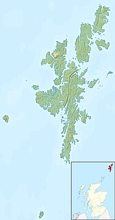
Flodaigh
Flodaigh shown within the Outer Hebrides
OS grid reference NB123413
Coordinates 58°16′N6°55′W / 58.27°N 6.91°W / 58.27; -6.91
Physical geography
Island group Outer Hebrides
Area <10 ha
Highest elevation 22 metres (72 ft) [1]
Administration
Sovereign state United Kingdom
Country Scotland
Council area Comhairle nan Eilean Siar
Lymphad3.svg

Flodaigh is an islet in outer Loch Ròg, Lewis, Scotland. It lies north west of Great Bernera and Little Bernera, south of Bearasaigh and Seanna Chnoc and west of Campaigh.

Loch Ròg or Loch Roag is a large sea loch on the west coast of Lewis, Outer Hebrides. It is broadly divided into East Loch Roag and West Loch Roag with other notable branches being Little Loch Roag, Loch Barragloum, Langavat and Loch Kintulavik. The Loch is dominated by the only inhabited island Great Bernera and East Loch Roag is actually referred to as Loch Bernera on early maps, most notably Murdoch MacKenzie's original Admiralty Chart from 1776. The use of West and East to differentiate the sections of the Loch appear from the original Ordnance Survey in 1850.

Lewis may refer to:

Great Bernera island off the Isle of Lewis, Scotland

Great Bernera, often known just as Bernera, is an island and community in the Outer Hebrides of Scotland. With an area of just over 21 km2 (8.1 sq mi), it is the thirty-fourth largest Scottish island.

There are various islets and skerries surrounding the island including Fleisgeir, Sgeir an Saoidhean and the tidal Tamna. [1]

There is no regular access to the island although boat excursions are available locally. [2]

Notes

  1. 1 2 "Get-a-map". Ordnance Survey. Retrieved 31 July 2010.
  2. Haswell-Smith (2004) p. 312

Related Research Articles

Garbh Sgeir island near Oigh-sgeir, Highland, Scotland

Not to be confused with the nearby islet of the same name that lies 400 m east of the southern tip of the island of Eigg, north of Eilean Chathastail.

Eilean Chearstaidh

Eilean Kearstay is an uninhabited island in Loch Roag in the Outer Hebrides of Scotland.

Little Bernera island in United Kingdom

Little Bernera is a small island situated off the west coast of the Isle of Lewis in the Outer Hebrides.

Fuaigh Mòr island in United Kingdom

Fuaigh Mòr is an island in the Outer Hebrides of Scotland. It is off the west coast of Lewis near Great Bernera in Loch Roag. It is 84 hectares and 67 metres at its highest point.

Vacsay island in United Kingdom

Vacsay is one of the Outer Hebrides. It is off the west coast of Lewis in West Loch Roag. It is 41 hectares in size, and 34 metres at its highest point.

Fuaigh Beag or Vuia Be(a)g is an island in the Outer Hebrides. It is off the west coast of Lewis near Great Bernera in Loch Roag. Its name means "little Fuaigh", and is named in contrast to Fuaigh Mòr nearby.

The Bernera Riot occurred in 1874, on the island of Great Bernera, in Scotland in response to the Highland Clearances. The use of the term 'Bernera Riot' correctly relates to the court case which exposed the maltreatment of the peasant classes in the Highlands and Islands of Scotland and exposed the corruption that was inherent in the landowning class. The 'riot' was not fought in the streets or in the fields but in the Scots Lawcourts. It is notable as the first successful legal challenge to nineteenth century Landlordism in the Highlands and Islands of Scotland and was the catalyst for future resistance in what became known as the Crofters War. Modern land reform in Scotland has its roots in the outcome of this event.

Bernera, Lismore A tidal island off Lismore, in Argyll, Scotland

Bernera Island is a tidal island off Lismore, in Argyll, Scotland.

Flodaigh, Lewis island in United Kingdom

Flodaigh is a small island in Loch Roag on the west coast of Lewis in the Outer Hebrides of Scotland. It is about 33 hectares in extent and the highest point is 48 metres (157 ft). Its name derives from the Old Norse for "flat island".

Duirinish, Skye settlement on the Isle of Skye, Scotland

Duirinish is a peninsula on the island of Skye in Scotland. It is situated in the north west between Loch Dunvegan and Loch Bracadale.

Campaigh island in United Kingdom

Campaigh or Campay is a steep and rocky islet in outer Loch Ròg, Lewis, Scotland that lies north of Cealasaigh and Little Bernera.

Cealasaigh

Cealasaigh or Kealasay is an islet in outer Loch Ròg, Lewis, Scotland that lies north of Traigh Mhór on Little Bernera and south of Campaigh.

Seanna Chnoc

Seanna Chnoc, also known as Seana Bheinn is an islet in outer Loch Ròg, Lewis, Scotland. It lies north west of Great Bernera and Bearasaigh.

Camas Uig is a bay on the west coast of the Isle of Lewis, in the Outer Hebrides of Scotland. The Lewis Chessmen were discovered in the dunes behind the beach.

Holm of Grimbister inhabited tidal islet in the Orkney archipelago of Scotland

Holm of Grimbister is an inhabited tidal islet in the Orkney archipelago of Scotland. Located in the Bay of Firth near Finstown it is connected to Mainland Orkney by a causeway.

Inner Holm of Skaw a small, uninhabited islet off the northern tip of the island of Whalsay, in the Shetland Islands

The Inner Holm of Skaw is a small, uninhabited islet off the northern tip of the island of Whalsay, in the Shetland Islands of Scotland, north of the village of Skaw.

Eilean Loain

Eilean Loain, is a small island in Loch Sween and one of the Inner Hebrides of Scotland.

Dun Bharabhat, Great Bernera tower

Dun Bharabhat is an Iron Age galleried dun or "semi-broch" situated on the island of Great Bernera near Lewis in Scotland.

References

International Standard Book Number Unique numeric book identifier

The International Standard Book Number (ISBN) is a numeric commercial book identifier which is intended to be unique. Publishers purchase ISBNs from an affiliate of the International ISBN Agency.

Coordinates: 58°16′03″N6°54′29″W / 58.2674°N 6.9080°W / 58.2674; -6.9080

Geographic coordinate system Coordinate system

A geographic coordinate system is a coordinate system that enables every location on Earth to be specified by a set of numbers, letters or symbols. The coordinates are often chosen such that one of the numbers represents a vertical position and two or three of the numbers represent a horizontal position; alternatively, a geographic position may be expressed in a combined three-dimensional Cartesian vector. A common choice of coordinates is latitude, longitude and elevation. To specify a location on a plane requires a map projection.