Related Research Articles

Fort Smith National Historic Site is a National Historic Site located in Fort Smith, Arkansas, along the Arkansas River. The first fort at this site was established by the United States in 1817, before this area was established as part of Indian Territory. It was later replaced and the second fort was operated by the US until 1871. This site was designated as a National Historic Landmark in 1961.

Highway 22 is an east–west state highway in the Arkansas River Valley. It is maintained by the Arkansas State Highway and Transportation Department (AHTD). The highway runs 75.60 miles (121.67 km) from US 64/US 71B east to Highway 7 in Dardanelle. Following the historic stagecoach line of the cross-country Butterfield Trail, the highway is one of the original 1926 state highways. It is designated by the AHTD as the True Grit Trail.

The Cotter Bridge, also known as the R. M. Ruthven Bridge and the White River Concrete Arch Bridge, carries U.S. Route 62 Business across the White River west of the city of Cotter in Baxter County, Arkansas. Upon completion, the bridge opened a part of the Ozarks previously inaccessible to motorists. Constructed in 1930, it is the only bridge built by the Marsh Engineering Company of Des Moines, Iowa, in the state of Arkansas.

Fort Gibson is a historic military site next to the modern city of Fort Gibson, in Muskogee County Oklahoma. It guarded the American frontier in Indian Territory from 1824 to 1888. When it was constructed, the fort was farther west than any other military post in the United States. It formed part of the north–south chain of forts that was intended to maintain peace on the frontier of the American West and to protect the southwestern border of the Louisiana Purchase. The fort succeeded in its peacekeeping mission for more than 50 years, as no massacres or battles occurred there.

State Road 2 is a former east–west state highway in the Arkansas Timberlands and Lower Arkansas Delta. The route was approximately 195 miles (314 km), and ran from US Route 67 (US 67) in Texarkana east to cross the Mississippi River near Lake Village, continuing as Mississippi Highway 10. On July 1, 1931, the route was entirely replaced by US Highway 82 (US 82) by the American Association of State Highway Officials (AASHTO). The route was maintained by the Arkansas Highway Department (AHD), now known as the Arkansas Department of Transportation (ArDOT).

The Jenkins' Ferry Battleground State Park is the site of the American Civil War battle of Jenkins' Ferry, also known as the Engagement at Jenkins' Ferry, fought on Saturday, April 30, 1864, in present-day Grant County, Arkansas. The park was listed in the U.S. National Register of Historic Places on January 21, 1970, and, with seven other sites, is part of the Camden Expedition Sites National Historic Landmark, designated a National Historic Landmark District on April 19, 1994.
The following is an alphabetical list of articles related to the U.S. State of Arkansas.

U.S. Route 64 is a U.S. highway running from Teec Nos Pos, Arizona east to Nags Head, North Carolina. In the U.S. state of Arkansas, the route runs 246.35 miles (396.46 km) from the Oklahoma border in Fort Smith east to the Tennessee border in Memphis. The route passes through several cities and towns, including Fort Smith, Clarksville, Russellville, Conway, Searcy, and West Memphis. US 64 runs parallel to Interstate 40 until Conway, when I-40 takes a more southerly route.

U.S. Route 67 is a U.S. highway running from Presidio, Texas northeast to Sabula, Iowa. In the U.S. state of Arkansas, the route runs 279.15 miles (449.25 km) from the Texas border in Texarkana northeast to the Missouri border near Corning. The route passes through several cities and towns, including Hope, Benton, Little Rock, Jacksonville, Cabot, Beebe, Walnut Ridge, and Pocahontas.

Highway 263 is a north–south state highway in the Arkansas Ozark Mountains. A low-volume, two-lane road, Highway 263 connects several rural unincorporated communities to the state highway system. The highway was first established on July 10, 1957, in Stone County and extended by the Arkansas State Highway Commission in 1963 and 1965. A second segment was created in Cleburne County in 1963, and the gap was closed between the two segments in 1994. The route is maintained by the Arkansas Department of Transportation (ARDOT).

U.S. Route 62 is a U.S. highway running from El Paso, Texas northeast to Niagara Falls, New York. In the U.S. state of Arkansas, the route runs 329.9 miles from the Oklahoma border near Summers east to the Missouri border in St. Francis, serving the northern portion of the state. The route passes through several cities and towns, including Fayetteville, Springdale, Bentonville, Harrison, Mountain Home, Pocahontas, and also Piggott. US 62 runs concurrent with several highways in Arkansas including Interstate 49 and U.S. Route 71 between Fayetteville and Bentonville, U.S. Route 412 through much of the state, U.S. Route 65 in the Harrison area, and with U.S. Route 63 and U.S. Route 67 in northeast Arkansas.

Fort Blount was a frontier fort and federal outpost located along the Cumberland River in Jackson County, Tennessee, United States. Situated at the point where Avery's Trace crossed the river, the fort provided an important stopover for migrants and merchants travelling from the Knoxville area to the Nashville area in the 1790s. After the fort was abandoned around 1800, the community of Williamsburg developed on the site and served as county seat for the newly formed Jackson County from 1807 and 1819. The fort and now vanished village sites were added to the National Register of Historic Places in 1974.

The Baxter County Courthouse is a courthouse in Mountain Home, Arkansas, United States, the county seat of Baxter County, built in 1941. It was listed on the National Register of Historic Places in 1995. The building replaced another courthouse on the same site which was deemed unsafe in 1939.

The Butterfield Overland Mail Route Fayetteville Segments Historic District is an area of 2.5 acres (1.0 ha) in Lake Fayetteville Park in Fayetteville, Arkansas which preserves an original routing of the Butterfield Overland Mail route through Northwest Arkansas. The trail and surrounding area became listed on the National Register of Historic Places (NRHP) in 2009 and is being explored as an addition to the National Historic Trails System upon signing of the Omnibus Public Lands Management Act of 2009.

Powhatan Historic State Park is a 9.1-acre (3.7 ha) Arkansas state park in Lawrence County, Arkansas in the United States. The park contains the 1888 Powhatan courthouse which served as the home of county government from 1869 to 1968. Today the structure displays items of cultural and historical significance and hosts the park's Visitor Center. The park includes four additional historical buildings and the Arkansas History Commission's Northeast Arkansas Regional Archives. A tour of the historic structures is available. Powhatan served as an important stop for traffic on the Black River until the installation of the Kansas City-Memphis Railwayline two miles north in 1883 significantly decreased the need for river transportation.

U.S. Highway 71 is a U.S. highway that runs from Krotz Springs, LA to the Fort Frances–International Falls International Bridge at the Canadian border. In Arkansas, the highway runs from the Louisiana state line near Doddridge to the Missouri state line near Bella Vista. In Texarkana, the highway runs along State Line Avenue with US 59 and partially runs in Texas. Other areas served by the highway include Fort Smith and Northwest Arkansas.
The Blackfish Lake Ferry Site is a historic archaeological site in St. Francis County, Arkansas, USA. It is the only known ferry site along the route of a military road built in the 1820s and 1830s between Memphis, Tennessee, and Little Rock, Arkansas, to be used in the Trail of Tears. The ferry concession was granted to William D. Ferguson, an early settler of the area. This military road was a major route for the removal of Cherokee, Creek and Choctaw populations to the Indian Territory and was also used by thousands of west-bound settlers.
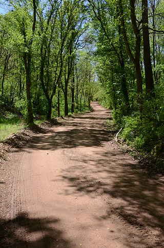
The Springfield to Fayetteville Road-Elkhorn Tavern Segment is a section of historic 19th-century roadway in Pea Ridge National Military Park in northwestern Arkansas. It is a dirt road, about 1 mile (1.6 km) long and 18 to 20 feet wide, that was built in 1835. The first major road through northwestern Arkansas, it connected Fayetteville, Arkansas with Springfield, Missouri. The road was part of the major northern route of the Trail of Tears, the forcible remove in the late 1830s of Native Americans from east of the Mississippi River to what is now Oklahoma. The road was also actively used by both Union and Confederate forces during the American Civil War, and was the major route of advance by Confederate forces leading to the Battle of Pea Ridge, whose battlefield is preserved by the park.
The Military Road-Cadron Segment is a portion of 19th-century roadway in Faulkner County, Arkansas, near the city of Conway. It consists of an original section of a military road built in the mid-1830s between Little Rock and the military outpost at Fort Smith, through what was then frontier territory. It is one of the only known surviving sections of the early military roads that crossed the Arkansas Territory, which is located west of Little Rock. The road is further notable as one of the routes by which Native Americans were relocated to Indian Territory from points east of the Mississippi River.
The Memphis to Little Rock Road was a settlement road constructed between 1819 and Reconstruction in Arkansas. The project was one of many internal improvements to assist settlement of the Old Southwest as well as military defense of the Arkansas Territory.
References
- ↑ "National Register Information System". National Register of Historic Places . National Park Service. July 9, 2010.
- ↑ "Summary description of Fort Smith to Jackson Road-Talbert's Ferry Segment". Arkansas Preservation. Archived from the original on January 18, 2015. Retrieved January 14, 2015.
| Topics | |
|---|---|
| Lists by state |
|
| Lists by insular areas | |
| Lists by associated state | |
| Other areas | |
| Related | |
| | This article about a property in Baxter County, Arkansas on the National Register of Historic Places is a stub. You can help Wikipedia by expanding it. |