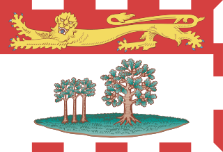
Prince Edward Island is an island province of Canada. While it is the smallest province in terms of land area and population, it is the most densely populated. The island has several nicknames: "Garden of the Gulf", "Birthplace of Confederation" and "Cradle of Confederation". Its capital and largest city is Charlottetown. It is one of the three Maritime provinces and one of the four Atlantic provinces.

Johnny Belinda is a 1948 American drama film, directed by Jean Negulesco, based on the 1940 Broadway stage hit of the same name by Elmer Blaney Harris. The play was adapted for the screen by writers Allen Vincent and Irma von Cube.

The Northumberland Strait is a strait in the southern part of the Gulf of Saint Lawrence in eastern Canada. The strait is formed by Prince Edward Island and the gulf's eastern, southern, and western shores.
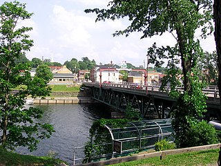
New Glasgow is a town in Pictou County, in the province of Nova Scotia, Canada. It is situated on the banks of the East River of Pictou, which flows into Pictou Harbour, a sub-basin of the Northumberland Strait.
Trenton is a large community in Central Ontario in the municipality of Quinte West, Ontario, Canada. Located on the Bay of Quinte, it is the starting point for the Trent-Severn Waterway, which continues northwest to Peterborough and eventually Port Severn on Georgian Bay.

The Trans Canada Trail, officially named the Great Trail between September 2016 and June 2021, is a cross-Canada system of greenways, waterways, and roadways that stretches from the Atlantic to the Pacific to the Arctic oceans. The trail extends over 24,000 km (15,000 mi); it is now the longest recreational, multi-use trail network in the world. The idea for the trail began in 1992, shortly after the Canada 125 celebrations. Since then it has been supported by donations from individuals, corporations, foundations, and all levels of government.

Campobello Island is the largest and only inhabited island in Campobello, a geographic parish in southwestern New Brunswick, Canada, near the border with Maine, United States. The island's permanent population in 2021 was 949. It is the site of the Roosevelt Campobello International Park, Head Harbour Lighthouse, and of Herring Cove Provincial Park.

Estevan is the eleventh-largest city in Saskatchewan, Canada. It is approximately 16 km (9.9 mi) north of the Canada–United States border. The Souris River runs by the city. This city is surrounded by the Rural Municipality of Estevan No. 5.

Kings County is located in eastern Prince Edward Island, Canada.

Bradford is the primary country urban area of the Town of Bradford West Gwillimbury, Ontario, in Canada. It overlooks a farming community, known as The Holland Marsh, located on the Holland River that flows into Lake Simcoe.

Unorganized North Algoma District is an unorganized area in northeastern Ontario, Canada, comprising all areas in Algoma District, north of the Sault Ste. Marie to Elliot Lake corridor, which are not part of an incorporated municipality or a First Nation. It covers 44,077.03 km2 (17,018.24 sq mi) of land, and had a population of 6050 in 2021. Many of these communities were/are stations on the Algoma Central Railway or were logging/mining towns.

Elmer Blaney Harris was an American author, dramatist, and playwright.

Provincial Trunk Highway 2 is a 315-kilometre (196-mile) highway in the Canadian province of Manitoba. It runs from Highway 13 at the Manitoba-Saskatchewan border to Winnipeg's Perimeter Highway near Oak Bluff.
Johnny Belinda is a 1967 television film directed by Paul Bogart. It is based upon the play Johnny Belinda by Elmer Blaney Harris. The film was thought to be missing from UK TV archives, but was discovered being sold in the United States on DVD by Kaleidoscope's Ray Langstone and a copy now resides with Kaleidoscope.

Michael Dixon Smith is an American-born Canadian chef and cookbook writer. He has hosted The Inn Chef, Chef at Home, and judged on Chopped: Canada on the Canadian Food Network. Smith is Prince Edward Island's Food Ambassador, a nutritional activist, and an advocate for sustainable home cooking and farm-to-table cuisine.
Tracadie is a Canadian rural community in Queens County, Prince Edward Island. It is located southwest of Mount Stewart. The name Tracadie, which is of Mi'kmaq origin, means "ideal camping location" and is pronounced tǔlakǎdǐk.
King's Highway 62, commonly referred to as Highway 62, is a provincially maintained highway in the Canadian province of Ontario. The highway travels south–north from Highway 33 at Bloomfield in Prince Edward County, through Belleville, Madoc and Bancroft, to Maynooth, where it ends at a junction with Highway 127. Prior to 1997, the route continued north and east of Maynooth through Combermere, Barry's Bay, Killaloe, Round Lake and Bonnechere to Highway 17 in Pembroke. This section of highway was redesignated Hastings Highlands Municipal Road 62, Renfrew County Road 62, and Renfrew County Road 58.
Provincial Trunk Highway 22 is a short north-south provincial highway in the Canadian province of Manitoba. It runs from PTH 23 near Elgin to PTH 2 and PR 250 in Souris. This highway is the main access road to the renowned Souris Swinging Bridge.

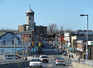
Downtown Minot is the central business district of Minot, North Dakota, located south of the Souris River in the Souris Valley. Downtown is the site of the first permanent settlement in Minot in 1886. Downtown is home to many of Minot's cultural sites of interest. It is also home to numerous galleries, stores and restaurants. The Minot Riverwalk traverses the downtown.
Johnny Belinda is a 1940 play by Elmer Blaney Harris, dealing with the then shocking subjects of rape, murder, bastardy, abuse of a deaf-mute, bigotry and gossip in a small community. It ran for 321 performances on Broadway from September 18, 1940 to June 21, 1941, and has been repeatedly adapted for film, radio, television, and as a musical. The sets for the original production were designed by Frederick Fox.

