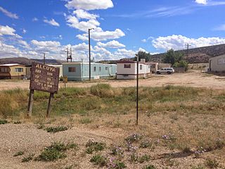
Greenwater, Washington

Last updated

Greenwater, Washington
CDP
Greenwater General Store on WA SR 410 - 01.jpg
Greenwater General Store, 2013
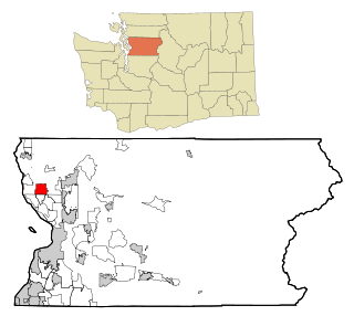
Pierce County Washington Incorporated and Unincorporated areas Greenwater Highlighted.svg
Location of Greenwater, Washington
Coordinates: 47°8′32″N121°37′8″W / 47.14222°N 121.61889°W / 47.14222; -121.61889
Country United States
State Washington
County Pierce
Area
  Total1.5 sq mi (3.9 km2)
  Land1.5 sq mi (3.9 km2)
  Water0.0 sq mi (0.0 km2)
Elevation
1,699 ft (518 m)
Population
 (2020)
  Total95
  Density63/sq mi (24/km2)
Time zone UTC-8 (Pacific (PST))
  Summer (DST) UTC-7 (PDT)
ZIP code
98022 [1]
Area code 360
FIPS code 53-28695 [2]
GNIS feature ID1520340 [3]

Greenwater is a census-designated place (CDP) in the northwest United States in Pierce County, Washington. Southeast of Seattle, the population was 67 at the 2010 census, down from 91 in 2000. At the 2020 census, the population was 95. [4]

Contents

Based on per capita income, Greenwater ranks 17th of 522 areas in the state of Washington to be ranked, and is the highest in Pierce County. East of Enumclaw on Highway 410, Greenwater gains much of its popularity as a town for hikers and skiers on their way south to Mount Rainier National Park and Crystal Mountain ski area.

Three popular campgrounds reside in Greenwater: Silver Springs, The Dalles, and Buck Creek.

History

The town takes its name from the Greenwater River, for which it is located along its southwestern banks. It became a stopover on the Naches Trail by settlers in 1853, when the Longmire-Byles wagon train descended down from the White River to Puget Sound.

The Naches Tavern was built in Greenwater in the 1920s by logger Captain Dick Craine. The log cabin was later destroyed by fire in February 1940. Today it serves as a bar and grill and is commonly known as Chez by local diners.

Greenwood General Store was opened in 1938 by Mr. and Mrs. H.E. Smith.

Geography

Greenwater is located at 47°8′32″N121°37′8″W / 47.14222°N 121.61889°W / 47.14222; -121.61889 (47.142294, -121.618926). [5]

According to the United States Census Bureau, the CDP has a total area of 1.5 square miles (3.9 km2), all of it land.

Greenwater is located at the confluence of the Greenwater and White Rivers, at an approximate elevation of 1,700 feet (520 m) above sea level.

Climate

Greenwater has a warm-summer Mediterranean climate (Csb) according to the Köppen climate classification system.

Climate data for Greenwater
MonthJanFebMarAprMayJunJulAugSepOctNovDecYear
Record high °F (°C)62
(17)
71
(22)
73
(23)
84
(29)
92
(33)
95
(35)
102
(39)
100
(38)
97
(36)
88
(31)
67
(19)
64
(18)
102
(39)
Mean daily maximum °F (°C)36.6
(2.6)
42.2
(5.7)
46.6
(8.1)
53.9
(12.2)
61.8
(16.6)
66.1
(18.9)
73.1
(22.8)
72.4
(22.4)
67.5
(19.7)
56.1
(13.4)
44.2
(6.8)
38.2
(3.4)
54.9
(12.7)
Mean daily minimum °F (°C)26
(−3)
29.3
(−1.5)
30.1
(−1.1)
33.6
(0.9)
39.2
(4.0)
44.2
(6.8)
46.7
(8.2)
46.1
(7.8)
42.1
(5.6)
36.8
(2.7)
31.5
(−0.3)
28.8
(−1.8)
36.2
(2.3)
Record low °F (°C)−8
(−22)
−5
(−21)
3
(−16)
19
(−7)
25
(−4)
26
(−3)
30
(−1)
28
(−2)
22
(−6)
15
(−9)
3
(−16)
−8
(−22)
−8
(−22)
Average precipitation inches (mm)7.85
(199)
6.02
(153)
4.86
(123)
4.26
(108)
3.01
(76)
2.76
(70)
1.15
(29)
1.62
(41)
3.29
(84)
5.33
(135)
7.89
(200)
9
(230)
57.03
(1,449)
Average snowfall inches (cm)24.2
(61)
13.6
(35)
12.4
(31)
3.2
(8.1)
0.1
(0.25)
0
(0)
0
(0)
0
(0)
0
(0)
0.2
(0.51)
5.5
(14)
16.4
(42)
75.6
(192)
Average precipitation days1917191816137811151921183
Source: [6]

Demographics

As of the census [2] of 2000, there were 91 people, 46 households, and 17 families residing in the CDP. The population density was 61.2 people per square mile (23.6/km2). There were 65 housing units at an average density of 43.7/sq mi (16.8/km2). The racial makeup of the CDP was 92.31% White, 2.20% Native American, 1.10% Pacific Islander, and 4.40% from two or more races. Hispanic or Latino of any race were 1.10% of the population.

There were 46 households, out of which 6.5% had children under the age of 18 living with them, 30.4% were married couples living together, 4.3% had a female householder with no partner present, and 60.9% were non-families. 37.0% of all households were made up of individuals, and 4.3% had someone living alone who was 65 years of age or older. The average household size was 1.98 and the average family size was 2.61.

In the CDP, the population was spread out, with 8.8% under the age of 18, 16.5% from 18 to 24, 35.2% from 25 to 44, 34.1% from 45 to 64, and 5.5% who were 65 years of age or older. The median age was 41 years. For every 100 females, there were 122.0 males. For every 100 females age 18 and over, there were 112.8 males.

The median income for a household in the CDP was $39,545, and the median income for a family was $75,487. Males had a median income of $75,282 versus $41,250 for females. The per capita income for the CDP was $36,466. None of the population or families were below the poverty line.

Related Research Articles

<span class="mw-page-title-main">South Woodbridge, California</span> Unincorporated community in California, United States

South Woodbridge was a former census-designated place (CDP) in San Joaquin County, California, United States. The population was 2,825 at the 2000 census. For the 2010 census, the CDP's of South Woodbridge and North Woodbridge were merged into Woodbridge.

<span class="mw-page-title-main">Noxon, Montana</span> CDP in Montana, United States

Noxon is a census-designated place (CDP) in Sanders County, Montana, United States. The population of the whole CDP was 255 at the 2020 census.

<span class="mw-page-title-main">Neilton, Washington</span> Census-designated place in Washington, United States

Neilton is an unincorporated community and census-designated place (CDP) in Grays Harbor County, Washington, United States. The population was 299 at the 2020 census, down from 315 at the 2010 census.
<span class="mw-page-title-main">Baring, Washington</span> Census-designated place in Washington, United States

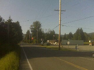
Baring is an unincorporated community and census-designated place (CDP) in King County, Washington, United States. The population was 255 at the 2020 census, up from 220 at the 2010 census. It is located on U.S. Highway 2 about 23 miles (37 km) west of Stevens Pass, along a very flat and straight three-mile section of highway that has been dubbed the "Baring Straight", since US-2 is otherwise hilly and curvy through the mountains. The settlement was first known as "Salmon", but by 1909 it was known as Baring.

<span class="mw-page-title-main">Hobart, Washington</span> Census-designated place in Washington, United States

Hobart is an unincorporated community and census-designated place (CDP) in King County, Washington, United States. The population was 6,767 at the 2020 census.

<span class="mw-page-title-main">Riverpoint, Washington</span> Census-designated place in Washington, United States

Riverpoint is an unincorporated community and census-designated place (CDP) in east King County, Washington, United States. As of the 2020 census, it had a population of 774. At the 2010 census, the area was listed as the Tanner CDP and had a population of 1,018 over a larger area.

<span class="mw-page-title-main">Easton, Washington</span> Census-designated place in Washington, United States

Easton is an unincorporated community and census-designated place (CDP) in Kittitas County, Washington, United States. The population was 478 at the 2010 census. Easton is the annual site of the start/finish line for the Cascade Crest 100-mile ultra-running race.

<span class="mw-page-title-main">Ronald, Washington</span> Census-designated place in Washington, United States

Ronald is an unincorporated community and census-designated place (CDP) in Kittitas County, Washington, United States. The population was 308 at the 2010 census.

<span class="mw-page-title-main">Frederickson, Washington</span> CDP in Washington, United States

Frederickson is a census-designated place (CDP) in Pierce County, Washington, United States. The population was 24,906 at the 2020 census.

<span class="mw-page-title-main">Prairie Ridge, Washington</span> CDP in Washington, United States

Prairie Ridge is a census-designated place (CDP) in Pierce County, Washington, United States. The population was 12,288 at the 2020 census.
<span class="mw-page-title-main">Summit, Washington</span> CDP in Washington, United States

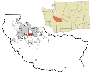
Summit is a census-designated place (CDP) in Pierce County, Washington, United States. The population was 8,270 at the 2020 census.

<span class="mw-page-title-main">Waller, Washington</span> CDP in Washington, United States

Waller is a rural census-designated place (CDP) in Pierce County, Washington, United States. The population was 8,189 at the 2020 census. The population has seen significant growth in the last decade.
<span class="mw-page-title-main">Rockport, Washington</span> CDP in Washington, United States

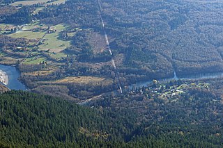
Rockport is a census-designated place (CDP) in Skagit County, Washington, United States. The population was 109 at the 2010 census. It is included in the Mount Vernon–Anacortes, Washington Metropolitan Statistical Area.

<span class="mw-page-title-main">Cathcart, Washington</span> CDP in Washington, United States

Cathcart is a census-designated place (CDP) in Snohomish County, Washington, United States. The population was 2,647 at the 2020 census, up from 2,458 at the 2010 census. Based on per capita income, one of the more reliable measures of affluence, Cathcart ranks 45th of 522 areas in the state of Washington to be ranked. Cathcart was named for Isaac Cathcart, a lumberman, entrepreneur, and Snohomish County pioneer.
<span class="mw-page-title-main">Lake Roesiger, Washington</span> CDP in Washington, United States

Lake Roesiger is a census-designated place (CDP) in Snohomish County, Washington, United States. The population was 611 at the 2020 census, up from 503 at the 2010 census.

<span class="mw-page-title-main">May Creek, Washington</span> CDP in Washington, United States

May Creek is a census-designated place (CDP) in Snohomish County, Washington, United States. The population was 849 at the 2020 census.

<span class="mw-page-title-main">North Sultan, Washington</span> CDP in Washington, United States

North Sultan is a census-designated place (CDP) in Snohomish County, Washington, United States. The population was 256 at the 2020 census.

<span class="mw-page-title-main">Lake Stickney, Washington</span> CDP in Washington, United States

Lake Stickney is a census-designated place (CDP) in Snohomish County, Washington, United States. The population was 15,413 at the 2020 census. The CDP was known as Paine Field-Lake Stickney prior to 2010. The new Lake Stickney CDP no longer contains the Paine Field airport.

<span class="mw-page-title-main">Gleed, Washington</span> CDP in Washington, United States

Gleed is a census-designated place (CDP) in Yakima County, Washington, United States. The population was 2,873 at the 2020 census.

<span class="mw-page-title-main">Naches, Washington</span> Town in Washington, United States

Naches is a town in Yakima County, Washington, United States. The population was 1,084 at the 2020 census. The town is located along the Naches River west of Yakima near the eastern foothills of the Cascade Range.

References

  1. "Greenwater WA ZIP Code". zipdatamaps.com. 2023. Retrieved June 16, 2023.
  2. 1 2 "U.S. Census website". United States Census Bureau . Retrieved January 31, 2008.
  3. "US Board on Geographic Names". United States Geological Survey. October 25, 2007. Retrieved January 31, 2008.
  4. "Census Bureau Profile: Greenwater CDP, Washington". United States Census Bureau. Retrieved May 7, 2024.
  5. "US Gazetteer files: 2010, 2000, and 1990". United States Census Bureau. February 12, 2011. Retrieved April 23, 2011.
  6. "GREENWATER, WASHINGTON (453357)". Western Regional Climate Center. Retrieved November 16, 2015.