Guatay, California

Last updated

Guatay
San Diego County California Incorporated and Unincorporated areas.svg
Red pog.svg
Guatay
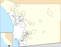
Location within San Diego County
USA California location map.svg
Red pog.svg
Guatay
Location within California
Usa edcp location map.svg
Red pog.svg
Guatay
Location within the United States
Coordinates: 32°50′56″N116°33′26″W / 32.84889°N 116.55722°W / 32.84889; -116.55722
Country Flag of the United States (23px).png  United States
State Flag of California.svg  California
County Flag of San Diego County, California.png San Diego
Elevation
3,999 ft (1,219 m)
Time zone UTC-8 (Pacific (PST))
  Summer (DST) UTC-7 (PDT)
ZIP codes
91931
GNIS feature ID1656536 [1]

Guatay (Kumeyaay: Na-wa Ti'e, meaning "Big House") [2] [3] is an unincorporated community in the Cuyamaca Mountains, in the Mountain Empire area of southeastern San Diego County, California.
Contents

Geography

The town's elevation is 3,999 feet (1,219 m). [1] Although Guatay is unincorporated, it does not have a post office. The ZIP Code is 91931. [4]

It was the location of a 19th-century stagecoach station on the San Antonio-San Diego Mail Line.

Nearby Guatay Mountain, a peak of the Cuyamaca Mountains, is home to a grove of the rare endemic Tecate Cypress (Cupressus forbesii).

Transportation

San Diego MTS route 888 provides service on Mondays and Fridays between El Cajon, Guatay, and Jacumba Hot Springs. [5]

Related Research Articles

<span class="mw-page-title-main">Kumeyaay</span> Kumeyaay Indians of Baja California, Mexico and Southern California, USA

The Kumeyaay, also known as 'Iipai-Tiipai or by the historical Spanish name Diegueño, is a tribe of Indigenous peoples of the Americas who live at the northern border of Baja California in Mexico and the southern border of California in the United States. They are an indigenous people of California.

<span class="mw-page-title-main">Cuyamaca, California</span>

Cuyamaca is a region of eastern San Diego County. It lies east of the Capitan Grande Indian Reservation in the western Laguna Mountains, north of Descanso and south of Julian. Named for the 1845 Rancho Cuyamaca Mexican land grant, the region is now dominated by the 26,000-acre (110 km2) Cuyamaca Rancho State Park. Within the park is the prominent Cuyamaca Peak, the second-highest mountain in San Diego County at 6,512 feet (1,984.9 m).

<span class="mw-page-title-main">Laguna Mountains</span> Mountain range in San Diego County, California

The Laguna Mountains are a mountain range of the Peninsular Ranges in eastern San Diego County, California. The mountains run in a northwest/southeast alignment for approximately 35 miles (56 km).

<span class="mw-page-title-main">Tecate</span> City in Baja California, Mexico

Tecate is a city in Tecate Municipality, Baja California. It is across the Mexico–US border from Tecate, California. As of 2019, the city had a population of 108,860 inhabitants, while the metropolitan area has a population of 132,406 inhabitants. Tecate is part of the San Diego-Tijuana metropolitan area and the largest city between Tijuana and Mexicali. Tecate is a regional economic hub and popular tourist destination, known as home to the Tecate Port of Entry and to Tecate Beer.

<span class="mw-page-title-main">Boulevard, California</span> Census-designated place in California, United States

Boulevard is a census-designated place (CDP) in the Mountain Empire area of southeastern San Diego County, California. At that time, it had a population of 359 at the 2020 United States census, up from 315 2010 United States census. The area is rural high desert along the Mexican border near the eastern extent of San Diego County.

<span class="mw-page-title-main">Cuyamaca Rancho State Park</span> State park in California, United States

Cuyamaca Rancho State Park is a state park in inland San Diego County, California, United States, located 40 miles (64 km) east of the metropolitan area of San Diego. The park is situated near the southernmost reaches of the vast Cleveland National Forest, as well as the Cuyamaca and Laguna Mountains of the Peninsular Ranges. The park's 26,000 acres (11,000 ha) of land features pine, fir, and oak forests, interspersed with meadows, creeks and streams that exist due to the relatively high elevation of the area when compared to its surroundings. The park includes the 6,512-foot (1,985 m) Cuyamaca Peak, the second-highest point in San Diego County.

<span class="mw-page-title-main">Sweetwater River (California)</span> River in California, United States

The Sweetwater River is a 55-mile (89 km) long stream in San Diego County, California. From its headwaters high in the Cuyamaca Mountains, the river flows generally southwest, first through rugged hinterlands but then into the urban areas surrounding its mouth at San Diego Bay. Its drainage basin covers more than 230 square miles (600 km2), all of it within San Diego County.

<span class="mw-page-title-main">El Capitan Reservoir</span> Reservoir in San Diego County, California

El Capitan Reservoir is a reservoir in central San Diego County, California. It is in the Cuyamaca Mountains, about 30 miles (48 km) northeast of the city of San Diego and two miles northwest of the town of Alpine.

<span class="mw-page-title-main">Jacumba Hot Springs, California</span> Unincorporated community in California, US

Jacumba Hot Springs is an unincorporated community in the Mountain Empire area of southeastern San Diego County, California, United States. For statistical purposes, the United States Census Bureau defined Jacumba as a census-designated place (CDP) for the first time in the 2010 census, with a population of 561. At the 2020 census, the population decreased to 540. The census definition of the area may not precisely correspond to local understanding of the area with the same name. The ZIP code is 91934 and the town lies within area code 619. Its elevation is 2,829 feet (862 m) above mean sea level (AMSL). On February 26, 2013, the United States Board on Geographic Names approved a petition by a citizen committee to change the town's name from Jacumba to Jacumba Hot Springs.

The Cuyamaca complex is a precolumbian complex, dating from the late Holocene, with archaeological sites in San Diego County, California. This complex is related to the Kumeyaay peoples.

<span class="mw-page-title-main">Descanso, California</span> Place in California, United States

Descanso is a small unincorporated community in the Cuyamaca Mountains, within the Mountain Empire area of southeastern San Diego County, California. The community's name is a Spanish word meaning "rest from labor".

<span class="mw-page-title-main">Cuyamaca Mountains</span> Mountain range of the Peninsular Ranges System, in San Diego County, southern California

The Cuyamaca Mountains, locally the Cuyamacas, are a mountain range of the Peninsular Ranges in San Diego County, California. The mountain range runs roughly northwest to southeast. The Laguna Mountains are directly adjacent to the east, with Palomar Mountain and Hot Springs Mountain more distant to the north.

<span class="mw-page-title-main">San Diego County, California</span> County in California, United States

San Diego County, officially the County of San Diego, is a county in the southwest corner of the U.S. state of California. As of the 2020 census, the population was 3,298,634; it is the second-most populous county in California and the fifth-most populous in the United States. Its county seat is San Diego, the second-most populous city in California and the eighth-most populous in the United States. It is the southwesternmost county in the 48 contiguous United States, and is a border county. It is home to 18 Native American tribal reservations, the most of any county in the United States. There are 16 military installations of the U.S. Navy, U.S. Marine Corps, and U.S. Coast Guard in the county.

<span class="mw-page-title-main">Viejas Group of Capitan Grande Band of Mission Indians</span> Indian tribe in California, United States

The Viejas Group of Capitan Grande Band of Mission Indians of the Viejas Reservation, also called the Viejas Band of Kumeyaay Indians, is a federally recognized tribe of Kumeyaay Indians.

<span class="mw-page-title-main">Capitan Grande Reservation</span> Indian reservation in California, United States

The Capitan Grande Reservation is a Kumeyaay Indian reservation in San Diego County, California, jointly controlled by the Barona Group of Capitan Grande Band of Mission Indians and Viejas Group of Capitan Grande Band of Mission Indians. The reservation is uninhabited and is 15,753 acres (63.75 km2) large, located in the Cuyamaca Mountains and middle of the Cleveland National Forest and west of Cuyamaca Peak. The closest town is Alpine, California.

Pine Hills is an unincorporated community in San Diego County, California, about a mile south and slightly west of Julian. It is located along and at the southern end of Pine Hills Road, about two miles south of state Highway 78. The residents of Pine Hills have an address in Julian in the 92036 zip code.

The Regions of the San Diego metropolitan area and San Diego County, as they cover the same area are:

<span class="mw-page-title-main">Vallecito, San Diego County, California</span> Former settlement in the United States

Vallecito, in San Diego County, California, is an oasis of cienegas and salt grass along Vallecito Creek and a former Kumeyaay settlement on the edge of the Colorado Desert in the Vallecito Valley. Its Spanish name is translated as "little valley". Vallecito was located at the apex of the gap in the Carrizo Badlands created by Carrizo Creek and its wash in its lower reach, to which Vallecito Creek is a tributary. The springs of Vallecito, like many in the vicinity, are a product of the faults that run along the base of the Peninsular Ranges to the west.

Crestwood Summit is a highway pass through the Cuyamaca Mountains of southeastern San Diego County, California, traversed by Interstate 8. Its elevation is 4,190 feet (1,280 m) westbound, and 4,181 feet (1,274 m) eastbound. It is the highest point on Interstate 8.

<span class="mw-page-title-main">Stonewall Peak</span> Mountain in southern California, United States

Stonewall Peak is a prominent mountain in San Diego County, California, located in Cuyamaca Rancho State Park. It is east of San Diego and south of Julian.

References

  1. 1 2 "Guatay, California". Geographic Names Information System . United States Geological Survey, United States Department of the Interior.
  2. Kumeyaay - Mount Guatay or Na-wa Ti'e
  3. California Place Names of Indian Origin (Kroeber, 1916)
  4. Zip Code Lookup
  5. https://www.sdmts.com/sites/default/files/routes/pdf/888.pdf