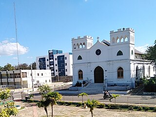
Dajabón is a northwestern province which currently comprises one of the 32 provinces of the Dominican Republic. It is divided into 5 municipalities and its capital city with the same name. It is bordered by the provinces of Monte Cristi to the north, Santiago Rodríguez to the south, Elías Piña to the south and the Nord-Est department of Haiti to the west.

Monte Cristi is a province in the northwest of the Dominican Republic. The capital city is San Fernando de Monte Cristi. The spelling Montecristi is also seen. The Montecristi province is located in the Cibao frontier region, on the north coast of the country and borders the nation of Haiti. The land area of the Montecristi province is 1,924.35 km2. It is divided into six municipalities and four municipal districts.

Monte Plata is an eastern province of the Dominican Republic, and also the name of its capital city. It was split from San Cristóbal in 1992.

Santiago Rodríguez is a province in the northwest region of the Dominican Republic. It was split from Monte Cristi in 1948. The Santiago Rodríguez province has the Monte Cristi and Valverde provinces to the north, the Santiago province to the east, the San Juan and Elías Piña provinces to the south and the Dajabón province to the west.

Valverde is a province of the Dominican Republic. It was split from Santiago Province in 1959. It is in the northwestern part of the country. Its capital city is Santa Cruz de Mao.

San Fernando de Monte Cristi, also known as Montecristi, is the capital town of Monte Cristi Province in the Dominican Republic. It is located in the northwest region of the country in a coastal area above the border with Haiti.

Monte Plata is a town and municipality (municipio) and the capital of the Monte Plata province in the Dominican Republic. It includes the municipal districts of Boyá, Chirino, and Don Juan.
Laguna Salada is a municipality (municipio) of the Valverde province in the Dominican Republic. Within the municipality there are three municipal districts : Cruce de Guayacanes, Jaibón and La Caya.
San Ignacio de Sabaneta is the capital and a municipality of Santiago Rodriguez in the northwestern part of the Dominican Republic. It is usually called only Sabaneta or Santiago Rodríguez.

Monción is one of the 3 municipalities of the province in Santiago Rodriguez, Dominican Republic.
Castañuelas is a town and municipality located in Monte Cristi Province, Dominican Republic. Its total population is 14,878 with the urban population at 4,005.
Hondo Valle is a town in the Elías Piña province of the Dominican Republic characterized by its beautiful mountains and cold climate.
Jamao al Norte is a town in the Espaillat province of the Dominican Republic.
Jima Abajo is a town in the La Vega province of the Dominican Republic.
Las Matas de Santa Cruz is a small city in the Monte Cristi province of the Dominican Republic.

Restauración is the third largest city in the province of Dajabon, Dominican Republic. It is located in the northwest portion of the island, in the Cibao region.
Tenares is a town in the Hermanas Mirabal province of the Dominican Republic.

Villa Tapia is a town in the Province of Hermanas Mirabal in the Dominican Republic.
Villa Vásquez is a town in the Monte Cristi province of the Dominican Republic.
Pepillo Salcedo is a municipality in the Monte Cristi Province of the Dominican Republic, located next to the border with Haiti. Pepillo Salcedo is frequently named Manzanillo due to the bay of manzanillo Bahia De Manzanillo which is approximately 2 miles from playa el coquito coquito beach. the city received its name from José Antonio Salcedo Ramírez who was a combatant in the long war days of the consolidation of national independence day in the Dominican Republic. General Salcedo Ramírez was also an outstanding military leader in the intense restorative war from 1863 to 1865. Pepillo Salcedo is a coastal town. It is built on the shores of the Bay of Manzanillo. In the westernmost part of the Dominican Northwest.


