Jimaní | |
---|---|
![]() | |
Coordinates: 18°29′24″N71°51′0″W / 18.49000°N 71.85000°W | |
Country | Dominican Republic |
Province | Independencia |
Municipality since | 1945 |
Area | |
• Total | 472.5 km2 (182.4 sq mi) |
Elevation | 31 m (102 ft) |
Population (2012) [3] | |
• Total | 13,752 |
• Density | 29/km2 (75/sq mi) |
• Urban | 7,155 |
Distance to – Santo Domingo | 280 km |
Municipal Districts | 2 |
Climate | BSh |
Jimaní is the capital and the second largest city of the Independencia Province of the Dominican Republic. It serves as one of the two main border crossings to Haiti (with Dajabón), with a duty-free open-air marketplace operating on the border with Haiti. The town suffered damages in the flash flood of May 25, 2004, which killed many citizens during the night and washed away hundreds of homes. [4] [5]
The name "Ximani" is of native Taíno origin. Historian Rafael Leonidas Pérez y Pérez in his book "Annotations on the history of Jimaní", says that Ximani was a Cacique of the chieftainship of Xaragua who had control of the town that lied in the middle of the two lakes, Lake Enriquillo and Lake Azuei, as well as the pass that leads to Pic la Selle making it a strategical and important part of the island. The name "Ximaní" is recognized when the Spaniards signed a peace agreement with the natives through Enriquillo at "the Lagoon of Ximaní" in 1536.
Another version claims the name belongs to a French Count (Count of Jimaní). General Paul Decayette, the Conde de Jimani and member of the Court of Faustin Soulouque, invades through the north. He is confronted and beaten by the Dominican army in Sabana Larga near the town of Dajabón. The exact date was January 24, 1856. With this victory the Dominicans put an end to the 12 years Dominican-Haitian War, one of the longest wars of independence in the Western Hemisphere (though with intermissions). [6] Pérez y Pérez clarifies however that this official, was called "of Jimani" because of him having owned that land, which was awarded to him during the expansion of the French occupation. The historian argues that the French did not occupy the west side of the island, particularly that territory, until the mid 18th century.
By the time of the Dominican War of Independence, Jimani was practically deserted with most of the fighting taking place in Neiba. After the independence of 1844 the earliest inhabitants of Jimaní came from various communities of the southwest, such as Neiba, Duvergé, El Estero, Las Salinas, Azua de Compostela, Santa Cruz de Barahona, and Haitian immigrants from the mountains that married or had common-law marriages with Dominicans, forming families in the most populous neighborhood of the community, known as Jimaní Viejo. By the 1930s Jimaní belonged to Neiba and in 1938 it became part of the commune of La Descubierta, forming a part of the Province of Baoruco.
On the 18 of March 1943, by means of the law number 229, Jimani was elevated to municipal district. On December 29, 1948, the province of Baoruco was split into two provinces, the west side receiving the name of Independence Province. On January 1, 1950, Jimani officially became the Capital of the new province Independencia.
Lying in a valley in the rain shadow of the northeast trade winds, Jimaní has a hot semi-arid climate with relatively constant temperatures throughout the course of the year. Annual rainfall is bimodal, peaking in May and October; the dry season occurs from December through February. [7]
Climate data for Jimaní (1991–2020) | |||||||||||||
---|---|---|---|---|---|---|---|---|---|---|---|---|---|
Month | Jan | Feb | Mar | Apr | May | Jun | Jul | Aug | Sep | Oct | Nov | Dec | Year |
Mean daily maximum °C (°F) | 32.4 (90.3) | 33.0 (91.4) | 33.5 (92.3) | 34.3 (93.7) | 34.0 (93.2) | 35.1 (95.2) | 36.1 (97.0) | 36.3 (97.3) | 35.5 (95.9) | 34.4 (93.9) | 33.2 (91.8) | 32.6 (90.7) | 34.2 (93.6) |
Daily mean °C (°F) | 26.8 (80.2) | 27.3 (81.1) | 27.9 (82.2) | 28.8 (83.8) | 29.0 (84.2) | 30.0 (86.0) | 30.7 (87.3) | 30.8 (87.4) | 30.1 (86.2) | 29.2 (84.6) | 28.1 (82.6) | 27.1 (80.8) | 28.8 (83.8) |
Mean daily minimum °C (°F) | 21.1 (70.0) | 21.6 (70.9) | 22.2 (72.0) | 23.3 (73.9) | 24.0 (75.2) | 24.9 (76.8) | 25.2 (77.4) | 25.3 (77.5) | 24.6 (76.3) | 24.1 (75.4) | 22.9 (73.2) | 21.6 (70.9) | 23.4 (74.1) |
Average precipitation mm (inches) | 13.5 (0.53) | 26.4 (1.04) | 59.4 (2.34) | 82.6 (3.25) | 118.0 (4.65) | 40.5 (1.59) | 34.6 (1.36) | 60.1 (2.37) | 83.9 (3.30) | 116.2 (4.57) | 63.8 (2.51) | 21.3 (0.84) | 720.1 (28.35) |
Source: NOAA [8] |
Climate data for Jimaní (1971-2000) | |||||||||||||
---|---|---|---|---|---|---|---|---|---|---|---|---|---|
Month | Jan | Feb | Mar | Apr | May | Jun | Jul | Aug | Sep | Oct | Nov | Dec | Year |
Record high °C (°F) | 35.6 (96.1) | 36.0 (96.8) | 38.0 (100.4) | 37.6 (99.7) | 38.4 (101.1) | 39.2 (102.6) | 39.4 (102.9) | 39.8 (103.6) | 40.2 (104.4) | 38.4 (101.1) | 37.5 (99.5) | 35.0 (95.0) | 40.2 (104.4) |
Mean daily maximum °C (°F) | 32.0 (89.6) | 32.4 (90.3) | 33.1 (91.6) | 33.7 (92.7) | 33.7 (92.7) | 34.5 (94.1) | 35.5 (95.9) | 35.4 (95.7) | 34.9 (94.8) | 34.0 (93.2) | 32.9 (91.2) | 32.1 (89.8) | 33.7 (92.6) |
Daily mean °C (°F) | 26.1 (79.0) | 26.4 (79.5) | 27.2 (81.0) | 27.9 (82.2) | 28.3 (82.9) | 29.2 (84.6) | 29.8 (85.6) | 29.7 (85.5) | 29.2 (84.6) | 28.5 (83.3) | 27.4 (81.3) | 26.2 (79.2) | 28.0 (82.4) |
Mean daily minimum °C (°F) | 20.1 (68.2) | 20.5 (68.9) | 21.3 (70.3) | 22.2 (72.0) | 22.9 (73.2) | 23.9 (75.0) | 24.0 (75.2) | 24.0 (75.2) | 23.6 (74.5) | 23.0 (73.4) | 21.9 (71.4) | 20.4 (68.7) | 22.3 (72.2) |
Record low °C (°F) | 13.8 (56.8) | 15.3 (59.5) | 16.8 (62.2) | 17.5 (63.5) | 18.6 (65.5) | 19.2 (66.6) | 19.2 (66.6) | 19.5 (67.1) | 19.0 (66.2) | 18.5 (65.3) | 15.6 (60.1) | 12.0 (53.6) | 12.0 (53.6) |
Average rainfall mm (inches) | 16.7 (0.66) | 31.3 (1.23) | 54.1 (2.13) | 83.1 (3.27) | 128.5 (5.06) | 42.7 (1.68) | 24.2 (0.95) | 57.0 (2.24) | 93.1 (3.67) | 95.1 (3.74) | 57.9 (2.28) | 16.2 (0.64) | 699.9 (27.55) |
Average rainy days (≥ 1.0 mm) | 2.0 | 3.2 | 5.1 | 6.7 | 8.6 | 3.9 | 3.2 | 4.8 | 6.8 | 8.1 | 4.8 | 1.6 | 58.8 |
Average relative humidity (%) | 64.0 | 62.6 | 61.8 | 62.5 | 66.2 | 63.0 | 59.8 | 61.2 | 64.3 | 66.9 | 67.9 | 65.1 | 63.8 |
Mean monthly sunshine hours | 222.9 | 217.0 | 239.6 | 232.7 | 222.9 | 234.2 | 240.2 | 241.2 | 209.3 | 223.2 | 216.5 | 229.1 | 2,728.8 |
Source: ONAMET [9] |
Climate data for Jimaní (1961-1990) | |||||||||||||
---|---|---|---|---|---|---|---|---|---|---|---|---|---|
Month | Jan | Feb | Mar | Apr | May | Jun | Jul | Aug | Sep | Oct | Nov | Dec | Year |
Record high °C (°F) | 37.0 (98.6) | 37.0 (98.6) | 38.0 (100.4) | 38.0 (100.4) | 38.0 (100.4) | 39.2 (102.6) | 39.5 (103.1) | 39.3 (102.7) | 39.8 (103.6) | 38.2 (100.8) | 37.5 (99.5) | 36.0 (96.8) | 39.8 (103.6) |
Mean daily maximum °C (°F) | 32.0 (89.6) | 32.5 (90.5) | 33.4 (92.1) | 33.8 (92.8) | 33.7 (92.7) | 34.2 (93.6) | 35.3 (95.5) | 35.2 (95.4) | 34.9 (94.8) | 33.9 (93.0) | 33.0 (91.4) | 32.2 (90.0) | 33.7 (92.7) |
Daily mean °C (°F) | 26.0 (78.8) | 26.4 (79.5) | 27.3 (81.1) | 27.9 (82.2) | 28.1 (82.6) | 28.9 (84.0) | 29.6 (85.3) | 29.4 (84.9) | 29.1 (84.4) | 28.3 (82.9) | 27.3 (81.1) | 26.2 (79.2) | 27.9 (82.2) |
Mean daily minimum °C (°F) | 20.0 (68.0) | 20.4 (68.7) | 21.1 (70.0) | 22.0 (71.6) | 22.7 (72.9) | 23.6 (74.5) | 23.8 (74.8) | 23.6 (74.5) | 23.3 (73.9) | 22.8 (73.0) | 21.7 (71.1) | 20.2 (68.4) | 22.1 (71.8) |
Record low °C (°F) | 15.0 (59.0) | 15.3 (59.5) | 16.8 (62.2) | 17.0 (62.6) | 18.6 (65.5) | 19.2 (66.6) | 18.0 (64.4) | 19.5 (67.1) | 19.0 (66.2) | 18.5 (65.3) | 15.6 (60.1) | 12.0 (53.6) | 12.0 (53.6) |
Average rainfall mm (inches) | 18.3 (0.72) | 23.4 (0.92) | 41.2 (1.62) | 86.9 (3.42) | 141.7 (5.58) | 45.0 (1.77) | 23.6 (0.93) | 61.3 (2.41) | 94.0 (3.70) | 122.8 (4.83) | 52.1 (2.05) | 18.6 (0.73) | 728.9 (28.70) |
Average rainy days (≥ 1.0 mm) | 2.0 | 2.5 | 4.1 | 7.0 | 8.9 | 4.5 | 2.9 | 4.6 | 6.6 | 8.7 | 4.5 | 1.5 | 57.8 |
Average relative humidity (%) | 63.6 | 61.9 | 60.3 | 62.1 | 65.9 | 63.6 | 60.3 | 61.4 | 64.0 | 66.4 | 67.1 | 64.1 | 63.4 |
Mean monthly sunshine hours | 239 | 233 | 257 | 251 | 239 | 254 | 259 | 262 | 226 | 242 | 231 | 246 | 2,936 |
Source 1: NOAA [10] | |||||||||||||
Source 2: Acqweather (sun) [11] |
Agriculture and commerce with Haiti represent the main economic activities of this municipality. In agriculture the main products are cassava, batata, melon, peppers, cilantro and tomatoes.[ citation needed ]
Jimaní has a popular duty-free open-air marketplace with Haiti that is also visited by people from adjoining towns and even from distant regions of the country. In this market, basic food products are sold, as well as foreign beverages, clothes, shoes, and new and used electrical appliances.
The customs zone of the border is called "The Door" and it is visited by foreign tourists that come to observe the dynamics of the business and intercultural and interracial relation between Dominicans and Haitians.
The municipal City Hall receives monthly RD$1,000,000 as mandated by the General Law of Budget, through the Dominican Municipal League. The authorities of the City Hall estimate the internal tax collection to be about $15,000 monthly.[ when? ]
The municipal districts El Limón and Boca de Cachón receive monthly $500,000 each one, from the transfer ordered by the law through the Dominican Municipal League.
There are two financial institutions in Jimaní. A branch office of the Reserve Bank and a branch office of the Cooperative of Savings and Credit of Neiba (Coopacrene).
There are six basic schools with two daily schedules and four public high schools, three of them for adults.
The municipality has a municipal hospital and four rural clinics or hospitals. The majority of the Jimanisenses prefer to seek medical attention in the Regional University Hospital Jaime Mota of Barahona.
Jimaní is mostly Catholic. Local holidays are celebrated March 19, in honor of their Saint San José. A carnival is being added to the Patronal Feast, to expand the celebration. Also being instituted is the celebration of a Cultural Week each year, in memory of the flood that destroyed a big part of the population in May 2004.
As a historic-cultural monument, Jimaní conserves intact and conditioned the "Mansion of Trujillo", one of many the dictator built in the border region, although he never spent the night in this particular one.
Local governments have carried out different works for the community, such as the reconstruction and restructuring of the municipal cemetery, the reconstruction of street gutters, rehabilitation of electric lighting in the urban area and in the sector of Tierra Nueva. There are also ongoing projects to enlarge the aqueduct network for the neighborhoods of La Cu and El Cerro.
In Jimaní there are several community associations. For example, in each of the towns that conform the municipality there is an Association of Farmers as well as an Association of Mothers.
There is also a Lions Club, the Association of Minibuses Jimaní-Barahona, a committee that represents the Association of "Jimanisenses" in Massachusetts, US, a technical team of World Vision, Fundasur (Foundation of the South) and Conani (the National Council for Childhood and Adolescence).
The Dominican Republic is a country in the West Indies that occupies the eastern five-eighths of Hispaniola. It has an area of 48,670 km2, including offshore islands. The land border shared with Haiti, which occupies the western three-eighths of the island, is 376 km long. The maximum length, east to west, is 390 km from Punta de Agua to Las Lajas, on the border with Haiti. The maximum width, north to south, is 265 km from Cape Isabela to Cape Beata. The capital, Santo Domingo, is located on the south coast.
The Dominican Republic is divided into thirty-one provincias, while the national capital, Santo Domingo, is contained within its own Distrito Nacional.
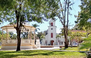
Azua is a province which is collectively one of the thirty-two provinces of the Dominican Republic. It is divided into 10 municipalities and its capital city is Azua de Compostela. It is bordered by the provinces of La Vega to the north-east, San José de Ocoa and Peravia to the east, Barahona and Baoruco to the west and San Juan to the north-west. To the south, Azua has a significant coastline of the Caribbean Sea. Azua is known for its diverse geography and climate, with the southern part of the province having an arid climate that is not the typical tropical-like that is found in other parts of the Caribbean.
Baoruco, alternatively spelt Bahoruco, is a province of the Dominican Republic located in the southwest of the country, part of the Enriquillo Region, along with the provinces of Barahona, Independencia and Pedernales. Before 1952 it included what is now Independencia Province.
Barahona is a province of the Dominican Republic. Located in the country's southwestern region, it is dividing into 11 municipalities and its capital bears the city of the same name. Barahona borders the provinces of Pedernales to the southwest, Baoruco and Independencia to the north, and Azua to the east along with coastline to the south with the Caribbean Sea. The province has an approximately three hours drive from Santo Domingo the capital of the Dominican Republic. In 2019, volunteers from Amigos de las Americas visited to facilitate projects within the various municipalities of Barahona.
Dajabón is a northwestern province which currently comprises one of the 32 provinces of the Dominican Republic. It is divided into 5 municipalities and its capital city with the same name. It is bordered by the provinces of Monte Cristi to the north, Santiago Rodríguez to the south, Elías Piña to the south and the Nord-Est department of Haiti to the west.
Elías Piña is one of the 32 provinces of the Dominican Republic, located in the westernmost part of the country, along the border with Haiti. It is divided into 6 municipalities and its capital city is Comendador. The Cordillera Central is found in the northern part of the province, and the Sierra de Neiba runs across the southern half. Between those two mountain ranges, there are several valleys formed by the Artibonite River and its tributaries.
Independencia is a province of the Dominican Republic, located in the west, on the border with Haiti. Its capital is Jimani. The province was created in 1948 but was made official in 1950. Before its creation, it was part of the Baoruco Province. The name was given in remembrance of the National Independence of February 27, 1844.
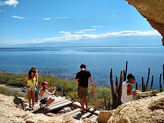
Pedernales is the southernmost province of the Dominican Republic, including the offshore island of Isla Beata. It was split from Barahona in 1957. Of its 2,074.53 km2, 1,374 km2 belongs to the Jaragua National Park. A third of its population is of Haitian origin, the highest ratio within the country.
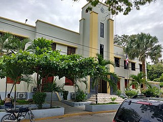
Barahona, also known as Santa Cruz de Barahona, is the main city of the Barahona Province, in the southwest of the Dominican Republic. It has one of the most active ports in the region, as well as many ecotourism attractions. The city is a centre of sugar production and industry. Barahona is also known for being the only place where the rare Larimar stone can be found.
Lake Enriquillo is a hypersaline lake in the Dominican Republic located in the southwestern region of the country. Its waters are shared between the provinces of Bahoruco and Independencia, the latter of which borders Haiti. Lake Enriquillo is the largest lake in both the Dominican Republic and Hispaniola, as well as the entire Caribbean. It is also the lowest point for an island country.
Loma de Cabrera is the second largest city in the province of Dajabón, Dominican Republic. It is located in the northwest portion of the country, in the Cibao region.
Neiba is a city in the southwest of the Dominican Republic. It is the capital city of the Baoruco province, and is located 180 kilometres west of the national capital, Santo Domingo, close to the shore of Lake Enriquillo, the largest lake in the West Indies.
San Fernando de Monte Cristi, also known as Montecristi, is the capital town of Monte Cristi Province in the Dominican Republic. It is located in the northwest region of the country in a coastal area above the border with Haiti.
Dajabón is a municipality and capital of the Dajabón province in the Dominican Republic, which is located on the northwestern Dominican Republic frontier with Haiti. It is a market town with a population of about 26,000, north of the Cordillera Central mountain range.
Duvergé, also known locally as Las Damas is the largest city in the province of Independencia in the Dominican Republic. The first settlers of this community were the gentlemen Christopher Pérez and María del Pulgar, originating from San Juan de la Maguana.
Salcedo is the capital city of the Hermanas Mirabal Province in the Dominican Republic. It is the birthplace of the Dominican heroines, the Mirabal sisters, who died in the struggle against the dictator Rafael Trujillo. A museum in the town commemorates three of sisters; it was tended to by the remaining sister, Bélgica (Dedé) Mirabal, until her death on February 1, 2014.
Tamayo is a city and a municipality in the Baoruco province of the Dominican Republic. Tamayo is the driest location in the Dominican Republic and the only-one with a desertic climate.
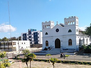
The Dominican city of Pedernales is the capital of the Pedernales Province, in the Dominican Republic. It is located in the southwest of the country, on the Dominican Republic–Haiti border, and has a crossing to the Haitian town of Anse-à-Pitres.