Cotuí

Last updated • 6 min readFrom Wikipedia, The Free Encyclopedia
Cotuí
Cotui Dominican Republic church.jpg
Cotui Dominican Republic city church
Escudo del Municipio Cotui.jpg
Dominican Republic relief location map.jpg
Red pog.svg
Cotuí
Cotuí in the Dominican Republic
Coordinates: 19°03′36″N70°09′0″W / 19.06000°N 70.15000°W / 19.06000; -70.15000
CountryFlag of the Dominican Republic.svg  Dominican Republic
Province Sánchez Ramírez
Founded1505
Municipality since1847
Area
[1]
  Total
619.88 km2 (239.34 sq mi)
Elevation
[2]
66 m (217 ft)
Population
 (2012) [3]
  Total
79,596
  Density130/km2 (330/sq mi)
   Urban
48,998
  Demonym
Cotuisano(a)
Distance to
 Santo Domingo

105 km
Municipal Districts 4
Climate Af

Cotuí is a city in the central region of the Dominican Republic and is one of the oldest cities of the New World. It is the capital of Sánchez Ramírez Province in the Cibao.

Contents

According to the Population and Housing Census, the municipality had a total urban population of 79,596 inhabitants.

History

It was founded in 1505 by Rodrigo Trillo de Mejía for order of Nicolas de Ovando, who was the governor of Hispaniola. Its name, formerly written Cotuy, was the name of the Taino community located around the gold and silver mines exploited by the Spanish conquerors from the first decade of the 16th century. [4]

Early years

The total sum of gold extracted during the first two decades of the 16th century in the Spanish Island was estimated at 30,000 kilos, an amount greater than the totality of production in Europe in those years and above the total gold collected by the Portuguese in Africa.

Historian Pedro Mártir de Anglería, in his work Una Decada de Orbe Novo, refers to the mining territory of Cotuí and explains:

There is another region in Hispaniola with the same name Cotuy, which divides the provinces of Unhabo and Cayabo. It has mountains and valleys, there is the origin of the gold, little lumps are not picked up often: solid and pure gold is found in porous stones and between the veins of the rocks: breaking the rocks follows the veins of gold.

Cotui, Dominican Republic church and obelisk. Cotui Dominican Republic mine obelisk.jpg
Cotui, Dominican Republic church and obelisk.

In 1533 Cotuí acquired the category of a town, then it began to be known as La Villa Mejorada del Cotuí. Cotui's gold mine was already in production and had become the richest in the New World. In the third decade of the 16th century, the Cotuí gold mine was exploited by a German company of miners, who established an important mining camp at that time. The mine was administered by the Spaniard Francisco Dávila on behalf of the King of Spain through a Mayorazgo. After Francisco Dávila's death in 1554, his will says, among other things, that ten percent of the Cotuí gold mine is for the construction of the church in the town of Aranda de Duero in Spain. [5]

A strong earthquake devastated the town in 1562 and it was moved to its current location, north of the Sierra de Yamasá and close to the Yuna River. In the 17th century the historian Nieto Valcácer carried out a detailed investigation in this place by order of the Spanish monarchy, according to Rincón in his work, he gave the report that he found the ruins of a Spanish city that gave unequivocal signs that a devastating telluric phenomenon had originated, the earthquake that destroyed the city of La Concepción de La Vega in 1562, was the same one that finished destroying La Villa del Cotuí and caused the sinking of the mines. [6]

Juan Sanchez Ramirez Juan Sanchez Ramirez.jpg
Juan Sánchez Ramírez

In May 1655 Hispaniola was invaded by more than ten thousand English, with the aim of storming the capital and then seizing the entire island. Thirty-seven specialized Cotuisan lancers moved to Santo Domingo to defend the city, their swords wreaked havoc on the invaders to prevent the city of Santo Domingo from being taken over. Cotui was also the birthplace of Juan Sánchez Ramírez known for being the commander in the battle of Palo Hincado on November 7, 1808. Juan Sánchez Ramírez was placed as the leader of the Dominicans to defeat the French in the memorable battle, who under his leadership expelled the French from this territory through the historical struggle called La Reconquista.

War of Independence

After Juan Pablo Duarte founded the Secret Society La Trinitaria on July 16, 1838, the Cotuisanos organized themselves almost immediately under the batons of Father Puigvert and José Valverde. Cotuí and San Francisco de Macorís became the first towns that dispossessed the Haitians in the town halls, exercising independent municipal power. In January 1844, both Valverde and Puigvert signed the Manifesto of January 16, to let the world, and especially the Haitian authorities, know that the Dominican people were going to war.

After independence was proclaimed, a number of Cotuisanos participated in the different battles that were fought to face the Haitian invasions, since Haiti refused to recognize the independence proclaimed by the Dominican people on February 27, 1844.

War of Restoration

As soon as the events in Capotillo became known, when Cotuí pronounced himself in favor of the Restoration, hundreds of Cotuisanos went to fight to recover the lost Republic with its annexation to Spain in 1861, those who stood out the most were Esteban Adames, Basilio Gavilán, José Epifanio Márquez, Tomás Castillo and Francisco Suriel, who joined various lines of action, but mainly the Eastern line which had its headquarters in Cotuí, commanded by General Gregorio Luperón.

Economy

The city is well known for its gold, silver, iron, bauxite, marble and nickel mines, its rich soils and the largest artificial lake in the Caribbean, Presa de Hatillo. It is also known for its crystal clear rivers, and its caverns (prehistoric caves called Guácaras). It produces rice, plantains, cacao, pineapples, passion fruits, and yams. Cotui is also the hometown of Mets pitcher Duaner Sánchez, Milwaukee Brewers pitcher José Capellán and Los Angeles Dodger player Teoscar Hernández. Other major towns near Cotuí in Sánchez Ramírez, are Villa La Mata, Fantino, La Cueva and Cevicos.

Culture

Cotui, Dominican Republic town square. Cotui Dominican Republic.jpg
Cotui, Dominican Republic town square.

The Immaculate Conception Church was built in 1741, and was part of the Herrerian-style ecclesiastical monuments that emerged at the beginning of the 17th century, boasting in the portals of the buildings and are associated with the new social impulse that the reign of Carlos V to his former Province of Santo Domingo.

The parochial temple of the municipality was built being priest of the Parish, Mr. Diego Fernández de Castro, it remained for more than 200 years. In 1929 a bell tower was added and when its construction was carried out and the excavations for its base were carried out, the workers found several corpses made into skeletons, which gave a sign that they had been buried in this place for many years. This church was destroyed by an earthquake in 1946. In 1957 the new Immaculate Conception Church was inaugurated, located in front of the central park of the municipality, in the same place where the old one was.

The Cotui carnival, has its origin in Spain, and is also influenced by African culture. Another cultural manifestation of the place is the celebration of the magical religious festival of the Holy Spirit. It is celebrated between the months of May and June of each year, and the organization is called a brotherhood or brotherhood. This celebration is characterized by the playing and singing of the sticks or drums. It is the oldest brotherhood in the New World founded by the clergyman Álvaro de Castro in 1529. Cotui, like all the towns in the country, has its patron saint festivities every year, these festivities are celebrated in honor of the Virgin Immaculate Conception, they begin on November 30 until December 8. It is one of the oldest patron saint festivities in the country.

Climate

Cotuí has a trade-wind tropical rainforest climate (Köppen Af).

Climate data for Cotuí (1961-1990)
MonthJanFebMarAprMayJunJulAugSepOctNovDecYear
Record high °C (°F)34.0
(93.2)
35.0
(95.0)
37.2
(99.0)
37.3
(99.1)
38.6
(101.5)
39.2
(102.6)
38.6
(101.5)
37.8
(100.0)
38.9
(102.0)
37.6
(99.7)
35.3
(95.5)
34.2
(93.6)
39.2
(102.6)
Mean daily maximum °C (°F)29.6
(85.3)
30.4
(86.7)
31.5
(88.7)
32.0
(89.6)
32.4
(90.3)
33.1
(91.6)
32.9
(91.2)
33.0
(91.4)
33.3
(91.9)
33.0
(91.4)
31.3
(88.3)
29.6
(85.3)
31.8
(89.2)
Mean daily minimum °C (°F)18.5
(65.3)
18.8
(65.8)
19.8
(67.6)
20.5
(68.9)
21.5
(70.7)
22.0
(71.6)
22.1
(71.8)
22.0
(71.6)
21.7
(71.1)
21.4
(70.5)
20.6
(69.1)
19.1
(66.4)
20.7
(69.3)
Record low °C (°F)13.8
(56.8)
15.0
(59.0)
14.7
(58.5)
15.0
(59.0)
15.6
(60.1)
16.8
(62.2)
16.7
(62.1)
16.9
(62.4)
16.5
(61.7)
16.5
(61.7)
15.6
(60.1)
15.0
(59.0)
13.8
(56.8)
Average rainfall mm (inches)88.2
(3.47)
98.0
(3.86)
105.8
(4.17)
126.7
(4.99)
234.2
(9.22)
149.6
(5.89)
189.9
(7.48)
209.1
(8.23)
164.1
(6.46)
161.2
(6.35)
167.7
(6.60)
148.9
(5.86)
1,843.4
(72.58)
Average rainy days (≥ 1.0 mm)10.89.09.49.413.912.515.915.411.712.413.113.5147
Source: NOAA [7]

Related Research Articles

<span class="mw-page-title-main">Hispaniola</span> Caribbean island shared by the Dominican Republic and Haiti

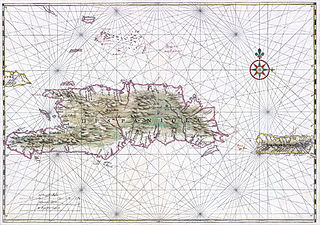
Hispaniola is an island between Cuba and Puerto Rico in the Greater Antilles of the Caribbean. Hispaniola is the most populous island in the West Indies, and the second-largest by land area, after Cuba. The 76,192-square-kilometre (29,418 sq mi) island is divided into two separate sovereign countries: the Spanish-speaking Dominican Republic (48,445 km2 to the east and the French and Haitian Creole–speaking Haiti (27,750 km2 to the west. The only other divided island in the Caribbean is Saint Martin, which is shared between France and the Netherlands.

<span class="mw-page-title-main">Santo Domingo</span> Capital and largest city of the Dominican Republic

Santo Domingo, once known as Santo Domingo de Guzmán, known as Ciudad Trujillo between 1936 and 1961, is the capital and largest city of the Dominican Republic and the largest metropolitan area in the Caribbean by population. As of 2022, the city and immediate surrounding area had a population of 1,029,110 while the total population is 3,798,699 when including Greater Santo Domingo. The city is coterminous with the boundaries of the Distrito Nacional, itself bordered on three sides by Santo Domingo Province.

<span class="mw-page-title-main">Dominicans</span> People who are associated with the Dominican Republic

Dominicans also known as Quisqueyans are an ethno-national people, a people of shared ancestry and culture, who have ancestral roots in the Dominican Republic.

<span class="mw-page-title-main">Provinces of the Dominican Republic</span> First-level administrative divisions of the Dominican Republic

The Dominican Republic is divided into thirty-one provincias, while the national capital, Santo Domingo, is contained within its own Distrito Nacional.

<span class="mw-page-title-main">La Vega Province</span> Province of the Dominican Republic

La Vega is one of the 32 provinces of the Dominican Republic. It is located in the Cibao Valley, the north-central region of the country, and is divided into 4 municipalities with its capital city being the namesake of La Vega. The province borders Espaillat and Hermanas Mirabal to the north, Duarte to the east, Monseñor Nouel to the south and Santiago to the west.

<span class="mw-page-title-main">Higüey</span> Place in La Altagracia, Dominican Republic

Higüey, or in full Salvaleón de Higüey, is the capital city of the eastern La Altagracia Province, in the Dominican Republic, and has 415,084 inhabitants, according to the 2022 census. The Yuma River flows through the urban areas of Higüey.

<span class="mw-page-title-main">Barahona, Dominican Republic</span> Place in Barahona, Dominican Republic

Barahona, also known as Santa Cruz de Barahona, is the main city of the Barahona Province, in the southwest of the Dominican Republic. It has one of the most active ports in the region, as well as many ecotourism attractions. The city is a centre of sugar production and industry. Barahona is also known for being the only place where the rare Larimar stone can be found.

<span class="mw-page-title-main">Jarabacoa</span> Place in La Vega, Dominican Republic

Jarabacoa is a town located in the central region of the Dominican Republic. It is the second largest municipality in La Vega Province.

<span class="mw-page-title-main">Republic of Spanish Haiti</span> Period of Dominican statehood following the 1st independence from Spain (1821–1822)

The Republic of Spanish Haiti, also called the Independent State of Spanish Haiti was the independent state that succeeded the Captaincy General of Santo Domingo after independence was declared on 30 November 1821 by José Núñez de Cáceres. The republic lasted only from 1 December 1821 to 9 February 1822 when it was invaded by the Republic of Haiti.

<span class="mw-page-title-main">Afro-Dominicans</span> Dominicans of African descent

Afro-Dominicans are Dominicans of predominant or total Sub-Saharan African ancestry. They are a minority in the country representing 7.5% or 642,018 of the population, according to the 2022 census.

<span class="mw-page-title-main">Neiba</span> Place in Baoruco, Dominican Republic

Neiba is a city in the southwest of the Dominican Republic. It is the capital city of the Baoruco province, and is located 180 kilometres west of the national capital, Santo Domingo, close to the shore of Lake Enriquillo, the largest lake in the West Indies.

<span class="mw-page-title-main">Hato Mayor del Rey</span> City in the Dominican Republic

Hato Mayor del Rey is the capital of Hato Mayor Province, Dominican Republic. It is bordered on the North by the municipalities of El Valle and Sabana de la Mar, on the South by the San Pedro de Macorís Province, on the East by the El Seibo Province and on the West by the municipality of Bayaguana, Monte Plata. It is located 27 kilometers from the San Pedro de Macorís Province and 110 kilometers from the capital city of Santo Domingo. Hato Mayor del Rey has a population of 70,141 inhabitants, and is divided into three municipal districts: Yerba Buena, Guayabo Dulce and Mata Palacio.

Hondo Valle is a town in the Elías Piña province of the Dominican Republic characterized by its beautiful mountains and cold climate.

<span class="mw-page-title-main">Spanish reconquest of Santo Domingo</span> Armed conflict between Dominican rebels and France from 1808–1809

Spanish reconquest of Santo Domingo was the war for Spanish reestablishment in Santo Domingo, or better known as the Reconquista, and was fought between November 7, 1808, and July 9, 1809. In 1808, following Napoleon's invasion of Spain, the criollos of Santo Domingo revolted against French rule, which caught the attention of British forces, who were engaging in other campaigns in the Caribbean. The struggle culminated in 1809 with a return to the Spanish colonial rule for a period commonly termed España Boba.

<span class="mw-page-title-main">Captaincy General of Santo Domingo</span> Spanish possession in the Caribbean (1492–1865)

The Captaincy General of Santo Domingo was the first Capitancy in the New World, established by Spain in 1492 on the island of Hispaniola. The Capitancy, under the jurisdiction of the Real Audiencia of Santo Domingo, was granted administrative powers over the Spanish possessions in the Caribbean and most of its mainland coasts, making Santo Domingo the principal political entity of the early colonial period.

<span class="mw-page-title-main">Haitian occupation of Santo Domingo</span> Haitian rule in the Dominican Republic (1822 to 1844)

The Haitian occupation of Santo Domingo was the annexation and merger of then-independent Republic of Spanish Haiti into the Republic of Haiti, that lasted twenty-two years, from February 9, 1822, to February 27, 1844. The part of Hispaniola under Spanish administration was first ceded to France and merged with the French colony of Saint Domingue as a result of the Peace of Basel in 1795. However, with the outbreak of the Haitian Revolution the French lost the western part of the island, while remaining in control of the eastern part of the island until the Spanish recaptured Santo Domingo in 1809.

<i>Era de Francia</i> French rule in the Dominican Republic (1795–1815 de jure)

In the history of the Dominican Republic, the period of Era de Francia occurred in 1795 when France acquired the Captaincy General of Santo Domingo, annexed it into Saint-Domingue and briefly came to acquire the whole island of Hispaniola by the way of the Treaty of Basel, allowing Spain to cede the eastern province as a consequence of the French Revolutionary Wars.

<span class="mw-page-title-main">San Juan Province (Dominican Republic)</span> Province of the Dominican Republic

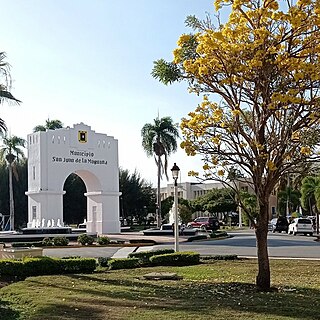
San Juan is a province of the Dominican Republic. Before 1961 it was known as Benefactor. San Juan is the Republic's largest province, bearing a size of 3,569 square kilometers, and it is landlocked.

<span class="mw-page-title-main">Juan Sánchez Ramírez</span> Dominican military commander; 72nd governor of Santo Domingo (1808–1811)

Juan Sánchez Ramírez was a Dominican general who was the primary leader of the War of Reconquista. He is known for leading the troops in the Battle of Palo Hincado. The decisive Dominican victory resulted in the end of French rule in eastern Hispaniola in 1809. He was the first Dominican to serve as governor of Santo Domingo.

References

  1. Superficies a nivel de municipios, Oficina Nacional de Estadistica Archived April 17, 2009, at the Wayback Machine
  2. De la Fuente, Santiago (1976). Geografía Dominicana (in Spanish). Santo Domingo, Dominican Republic: Editora Colegial Quisqueyana.
  3. Censo 2012 de Población y Vivienda, Oficina Nacional de Estadistica
  4. Nacional, El (2022-01-15). "Conoce el origen de tu pueblo: Cotuí". El Nacional (in Spanish). Retrieved 2024-04-18.
  5. Corripio, Grupo de medios (2017-03-02). "Cotuí, mucho más que oro". Hoy Digital (in Spanish). Retrieved 2024-05-03.
  6. "Un encuentro con la tierra del oro: Cotuí, provincia Sánchez Ramírez". El Nuevo Diario (República Dominicana) (in Spanish). 2014-11-07. Retrieved 2024-05-03.
  7. "Cotui Climate Normals 1961-1990". National Oceanic and Atmospheric Administration. Retrieved September 12, 2016.