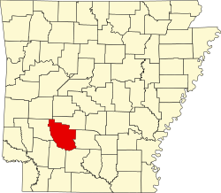
Gurdon, Arkansas

Last updated

Gurdon, Arkansas
Gurdon depot.jpg
Train depot in Gurdon, June 2008
Clark County Arkansas Incorporated and Unincorporated areas Gurdon Highlighted 0529200.svg
Location of Gurdon in Clark County, Arkansas.
Coordinates: 33°55′0″N93°9′2″W / 33.91667°N 93.15056°W / 33.91667; -93.15056
Country United States
State Arkansas
County Clark
Area
[1]
  Total2.49 sq mi (6.46 km2)
  Land2.42 sq mi (6.28 km2)
  Water0.07 sq mi (0.18 km2)
Elevation
[2]
203 ft (62 m)
Population
 (2020)
  Total1,840
  Density758.76/sq mi (292.93/km2)
Time zone UTC-6 (Central (CST))
  Summer (DST) UTC-5 (CDT)
ZIP code
71743
Area code 870
FIPS code 05-29200
GNIS feature ID2403775 [2]

Gurdon is a city in Clark County, Arkansas, United States. The population was 2,212 at the 2010 census. [3]

Contents

History

Hoo Hoo Cats on a monument dedicated to the Concatenated Order of Hoo-Hoo in Gurdon; listed on National Register of Historic Places, April 2009 Gurdon hoohoo trainside plaque.jpg
Hoo Hoo Cats on a monument dedicated to the Concatenated Order of Hoo-Hoo in Gurdon; listed on National Register of Historic Places, April 2009

The town was founded in the late 19th century as a railroad town for the timber industry on the St. Louis, Iron Mountain and Southern Railway (now the Union Pacific Railroad). Originally settled in 1873, the city was incorporated in 1880. [4] The town's name derives from railroad executive Henry Gurdon Marquand's middle name.

Gurdon is the birthplace of the Concatenated Order of Hoo-Hoo, in 1892.

Geography

Gurdon is located in southern Clark County. U.S. Route 67 passes through the city, leading northeast 15 miles (24 km) to Arkadelphia, the county seat, and southwest 16 miles (26 km) to Prescott.

According to the United States Census Bureau, the city has a total area of 2.5 square miles (6.6 km2), of which 2.5 square miles (6.4 km2) is land and 0.077 square miles (0.2 km2), or 2.88%, is water. [3]

Demographics

Historical population
CensusPop.Note
1890 802
1900 1,04530.3%
1910 1,28422.9%
1920 1,46914.4%
1930 2,17247.9%
1940 2,045−5.8%
1950 2,39016.9%
1960 2,166−9.4%
1970 2,075−4.2%
1980 2,70730.5%
1990 2,199−18.8%
2000 2,2763.5%
2010 2,212−2.8%
2020 1,840−16.8%
U.S. Decennial Census [5]

2020 census

Gurdon racial composition [6]
RaceNum.Perc.
White (non-Hispanic)76341.47%
Black or African American (non-Hispanic)71138.64%
Native American 80.43%
Asian 10.05%
Other/Mixed 774.18%
Hispanic or Latino 28015.22%

As of the 2020 United States census, there were 1,840 people, 1,016 households, and 695 families residing in the city.

2010 census

As of the 2010 United States Census, there were 2,212 people living in the city. The racial makeup of the city was 50.1% White, 37.9% Black, 0.1% Native American, 0.1% Asian, <0.1% Pacific Islander, 10.4% from some other race and 1.4% from two or more races. 14.3% were Hispanic or Latino of any race.

2000 census

At the 2000 census, [7] there were 2,276 people, 934 households and 625 families living in the city. The population density was 908.0 inhabitants per square mile (350.6/km2). There were 1,077 housing units at an average density of 429.7 per square mile (165.9/km2). The racial makeup of the city was 60.24% White, 35.76% Black or African American, 0.13% Native American, 0.04% Asian, 0.04% Pacific Islander, 3.12% from other races, and 0.66% from two or more races. 4.35% of the population were Hispanic or Latino of any race.

There were 934 households, of which 32.8% had children under the age of 18 living with them, 44.9% were married couples living together, 18.7% had a female householder with no husband present, and 33.0% were non-families. 30.2% of all households were made up of individuals, and 13.9% had someone living alone who was 65 years of age or older. The average household size was 2.44 and the average family size was 3.01.

27.9% of the population were under the age of 18, 9.7% from 18 to 24, 26.6% from 25 to 44, 20.2% from 45 to 64, and 15.6% who were 65 years of age or older. The median age was 35 years. For every 100 females, there were 85.9 males. For every 100 females age 18 and over, there were 82.0 males.

The median household income was $26,446, and the median family income was $33,564. Males had a median income of $25,479 versus $18,158 for females. The per capita income for the city was $15,043 About 14.1% of families and 19.0% of the population were below the poverty line, including 27.1% of those under age 18 and 16.8% of those age 65 or over.

Education

Public education

Elementary and secondary education is provided by the Gurdon School District, which leads students to graduate from Gurdon High School. The school's mascot is the Go-Devil with purple and gold as the school colors.

Public libraries

Gurdon is supported by the Cabe Public Library, which is a branch library of the Clark County Library System.

Gurdon Light

The town is especially known for the "Gurdon Light", a series of unexplained phenomena which occur in a wooded area by railroad tracks. Viewers have reported a light or lights hovering in mid-air. [8] Local folk legend explains the light appearances as a deceased railwayman's lantern. Scientific work on the origin of the lights has proven inconclusive. The light has been featured on local media and on the TV show Unsolved Mysteries .

Lowe Field, April 2011 Gurdon 5M8.jpg
Lowe Field, April 2011

Notable people

See also

Related Research Articles

<span class="mw-page-title-main">Ashville, Alabama</span> City in and county seat of St. Clair County, Alabama

Ashville is a city in and one of the county seats of St. Clair County, Alabama, United States, other seat being Pell City. Its population was 2,212 at the 2010 census, down from 2,260, at which time it was a town. It incorporated in 1822.

<span class="mw-page-title-main">Lead Hill, Arkansas</span> Town in Arkansas, United States

Lead Hill is a town in Boone County, Arkansas, United States. The population was 271 at the 2010 census. It is part of the Harrison Micropolitan Statistical Area.

<span class="mw-page-title-main">Gum Springs, Arkansas</span> Town in Arkansas, United States

Gum Springs is a town in Clark County, Arkansas, United States. The population was 120 at the 2010 census, down from 194 in 2000.

<span class="mw-page-title-main">Okolona, Arkansas</span> Town in Arkansas, United States

Okolona is a town near the western edge of Clark County, Arkansas, United States. The population was 147 at the 2010 census.

<span class="mw-page-title-main">Whelen Springs, Arkansas</span> Town in Arkansas, United States

Whelen Springs is a town in Clark County, Arkansas, United States. The population was 92 at the 2010 census. From 1930 through 1939 the town thrived, being a main hub of operations for the then powerful Ozan Lumber Company.

<span class="mw-page-title-main">Corning, Arkansas</span> City in Arkansas, United States

Corning is a city in Clay County, Arkansas, United States. The population was 3,377 at the 2010 census. It is one of the two county seats of Clay County, along with Piggott.

<span class="mw-page-title-main">Turrell, Arkansas</span> City in Arkansas, United States

Turrell is a city in Crittenden County, Arkansas, United States. Per the 2020 census, the population was 517.

<span class="mw-page-title-main">Ravenden, Arkansas</span> Town in Arkansas, United States

Ravenden is a town in Lawrence County, Arkansas, United States. The population was 470 at the 2010 census. The town is in the valley of the Spring River along U.S. Highway 63 and the Burlington-Northern Railroad.

<span class="mw-page-title-main">Lonoke, Arkansas</span> City in Arkansas, United States

Lonoke is the second most populous city in Lonoke County, Arkansas, United States, and serves as its county seat. According to 2010 United States Census, the population of the city is 4,245. It is part of the Little Rock–North Little Rock–Conway Metropolitan Statistical Area.

<span class="mw-page-title-main">Holly Grove, Arkansas</span> City in Arkansas, United States

Holly Grove is a city in Monroe County, Arkansas, United States. As of the 2020 census, the city population was 460, down from 602 in 2010.

<span class="mw-page-title-main">Marvell, Arkansas</span> City in Arkansas, United States

Marvell is a city in Phillips County, Arkansas, United States. As of the 2010 census, the city population was 1,186.

<span class="mw-page-title-main">Glenwood, Arkansas</span> City in Arkansas, United States

Glenwood is a city in Pike and Montgomery counties in Arkansas, United States. As of the 2020 census, its population was 2,068. The community is located along the Caddo River in the Ouachita Mountains.

<span class="mw-page-title-main">Harrisburg, Arkansas</span> City in Arkansas, United States

Harrisburg is a city in Poinsett County, Arkansas, United States. The population was 2,212 at the 2020 census. It is included in the Jonesboro, Arkansas Metropolitan Statistical Area. The city is the county seat of Poinsett County.

<span class="mw-page-title-main">Atkins, Arkansas</span> City in Arkansas, United States

Atkins is a city in Pope County, Arkansas, United States. The population was 3,016 at the 2010 census. It is part of the Russellville Micropolitan Statistical Area.

<span class="mw-page-title-main">Mansfield, Arkansas</span> City in Arkansas, United States

Mansfield is a city in Scott and Sebastian counties Arkansas, United States. The Sebastian County portion of the city is part of the Fort Smith, Arkansas-Oklahoma Metropolitan Statistical Area. As of the 2010 Census, the population was 1,139. The population was 1,097 at the 2000 census.

<span class="mw-page-title-main">Bald Knob, Arkansas</span> City in Arkansas, United States

Bald Knob is a city in White County, Arkansas, United States. The population was 2,897 at the 2010 census. Located at the intersection of two of the state's natural regions, Bald Knob is often promoted as "where the Ozarks meet the Delta". Bald Knob is known for its yearly Home Fest held during Mother's Day weekend. It was once known as the leading strawberry producer in the world in the 1950s. Bald Knob was established in 1881.

<span class="mw-page-title-main">Ola, Arkansas</span> City in Arkansas, United States

Ola is a city in Yell County, Arkansas, United States. The population was 1,281 at the 2010 census. It is roughly 15 miles south of the Russellville Metropolitan area.

<span class="mw-page-title-main">Roland, Oklahoma</span> Town in Oklahoma, United States

Roland is a town in Sequoyah County, Oklahoma, United States. It is part of the Fort Smith, Arkansas-Oklahoma Metropolitan Statistical Area. The population was 3,169 at the 2010 census, compared to the figure of 2,842 recorded in 2000.

<span class="mw-page-title-main">Clark, South Dakota</span> City in South Dakota, United States

Clark is a city in and county seat of Clark County, South Dakota, United States. The population was 1,148 at the 2020 census.

<span class="mw-page-title-main">Colby, Wisconsin</span> City in Wisconsin, United States

Colby is a city in Clark and Marathon counties in the U.S. state of Wisconsin. It is part of the Wausau, Wisconsin Metropolitan Statistical Area. The population was 1,852 at the 2010 census. Of this, 1,354 were in Clark County, and 498 were in Marathon County. The city is bordered by the Town of Colby, the Town of Hull, and the City of Abbotsford. Colby cheese was first created in Colby.

References

  1. "2020 U.S. Gazetteer Files". United States Census Bureau. Retrieved October 29, 2021.
  2. 1 2 U.S. Geological Survey Geographic Names Information System: Gurdon, Arkansas
  3. 1 2 "Geographic Identifiers: 2010 Demographic Profile Data (G001): Gurdon city, Arkansas". U.S. Census Bureau, American Factfinder. Archived from the original on February 12, 2020. Retrieved June 16, 2014.
  4. "Cities and Towns, Gurdon". Arkansas.com. Retrieved July 30, 2016.
  5. "Census of Population and Housing". Census.gov. Retrieved June 4, 2015.
  6. "Explore Census Data". data.census.gov. Retrieved December 10, 2021.
  7. "U.S. Census website". United States Census Bureau . Retrieved January 31, 2008.
  8. Hillinger, Charles (October 13, 1985). "Arkansas' Towns of Funny Names : There's Evening Shade, Greasy Corner, Stump City, Hope". Los Angeles Times . Retrieved July 14, 2014.