Hardin, Kentucky

Last updated

Hardin, Kentucky
Marshall County Kentucky Incorporated and Unincorporated areas Hardin Highlighted 2134534.svg
Location in Marshall County, Kentucky
Coordinates: 36°45′55″N88°18′08″W / 36.76528°N 88.30222°W / 36.76528; -88.30222
Country United States
State Kentucky
County Marshall
Named for Hardin D. Irvan (local landowner)
Area
[1]
  Total0.70 sq mi (1.82 km2)
  Land0.70 sq mi (1.81 km2)
  Water0.00 sq mi (0.00 km2)
Elevation
[2]
420 ft (130 m)
Population
 (2020) [3]
  Total580
  Density827.39/sq mi (319.60/km2)
Time zone UTC-6 (Central (CST))
  Summer (DST) UTC-5 (CDT)
ZIP code
42048
Area code(s) 270 & 364
FIPS code 21-34534
GNIS feature ID2403798 [2]

Hardin is a home rule-class city in Marshall County, Kentucky, United States. The population was 580 at the 2020 census. [3]

Contents

History

The Paducah, Tennessee and Alabama Railroad reached the area in 1890. A community grew up around the depot, erected on land purchased from local landowner Hardin D. Irvan. The post office was established on October 31, 1891, [4] but the town was formally incorporated as a city on March 25, 1952. [5]

Geography

Hardin is located in southern Marshall County at 36°45′47″N88°18′0″W / 36.76306°N 88.30000°W / 36.76306; -88.30000 (36.763063, -88.300105). [6] Kentucky Route 402 (Aurora Highway) passes through the north side of the city, while U.S. Route 641 crosses the western part. US 641 leads north 7 miles (11 km) to Benton, the county seat, and south 11 miles (18 km) to Murray. KY 402 leads 9 miles (14 km) to Aurora and west the same distance to Kentucky Route 58 near Brewers.

According to the United States Census Bureau, Hardin has a total area of 0.7 square miles (1.8 km2), of which 0.002 square miles (0.005 km2), or 0.28%, are water. [1] The city is on the west side of the valley of the Clarks River, a north-flowing tributary of the Tennessee River.

Demographics

Historical population
CensusPop.Note
1900 240
1910 36652.5%
1920 43619.1%
1930 348−20.2%
1940 41419.0%
1950 324−21.7%
1960 45841.4%
1970 52214.0%
1980 5454.4%
1990 5959.2%
2000 564−5.2%
2010 6159.0%
2020 580−5.7%
U.S. Decennial Census [7]

As of the 2000 U.S. census, [8] there were 564 people, 257 households, and 155 families residing in the city. The population density was 954.8 inhabitants per square mile (368.7/km2). There were 282 housing units at an average density of 477.4 per square mile (184.3/km2). The racial makeup of the city was 99.29% White, 0.53% Native American, and 0.18% from two or more races. Hispanic or Latino of any race were 0.35% of the population.

There were 257 households, out of which 30.0% had children under the age of 18 living with them, 42.4% were married couples living together, 15.2% had a female householder with no husband present, and 39.3% were non-families. 35.4% of all households were made up of individuals, and 16.3% had someone living alone who was 65 years of age or older. The average household size was 2.19 and the average family size was 2.81.

In the city, the population was spread out, with 24.3% under the age of 18, 10.1% from 18 to 24, 26.6% from 25 to 44, 22.3% from 45 to 64, and 16.7% who were 65 years of age or older. The median age was 37 years. For every 100 females, there were 81.4 males. For every 100 females age 18 and over, there were 80.9 males.

The median income for a household in the city was $20,833, and the median income for a family was $25,893. Males had a median income of $24,063 versus $20,694 for females. The per capita income for the city was $11,690. About 20.1% of families and 24.6% of the population were below the poverty line, including 37.7% of those under age 18 and 17.0% of those age 65 or over.

Education

Hardin has a lending library, a branch of the Marshall County Public Library. [9]

Related Research Articles

<span class="mw-page-title-main">Lyon County, Kentucky</span> County in Kentucky, United States

Lyon County is a county located in the U.S. state of Kentucky. As of the 2020 census, the population was 8,680. Its county seat is Eddyville. The county was formed from Caldwell County, Kentucky in 1854 and named for former Congressman Chittenden Lyon.

<span class="mw-page-title-main">Livingston County, Kentucky</span> County in Kentucky, United States

Livingston County is a county located in the U.S. state of Kentucky. As of the 2020 census, the population was 8,888. Its county seat is Smithland and its largest community is Ledbetter. The county was established in 1798 from land taken from Christian County and is named for Robert R. Livingston, a member of the Committee of Five that drafted the U.S. Declaration of Independence. The county was strongly pro-Confederate during the American Civil War and many men volunteered for the Confederate Army. Livingston County is part of the Paducah, KY-IL Metropolitan Statistical Area. It is a prohibition or dry county with the exception of Grand Rivers which voted to allow alcohol sales in 2016.

<span class="mw-page-title-main">Carlisle County, Kentucky</span> County in Kentucky, United States

Carlisle County is a county located in the U.S. state of Kentucky. As of the 2020 census, the population was 4,826, making it the fourth-least populous county in Kentucky. Its county seat is Bardwell. The county was founded in 1886 and named for John Griffin Carlisle, a Speaker of the United States House of Representatives from Kentucky. It remains a prohibition or dry county. Carlisle County is included in the Paducah, KY-IL, Metropolitan Statistical Area.

<span class="mw-page-title-main">Calloway County, Kentucky</span> County in Kentucky, United States

Calloway County is a county located in the southwest portion of the U.S. Commonwealth of Kentucky. As of the 2020 census, the population was 37,103. Its county seat is Murray. The county was founded in November 1822 and named for Colonel Richard Callaway, one of the founders of Boonesborough. Calloway County comprises the Murray, KY Micropolitan Statistical Area. As of July 18, 2012 Calloway County is a moist county: the sale of alcohol in the county is prohibited, with the exception of the city of Murray.

<span class="mw-page-title-main">Elizabethtown, Illinois</span> Village in Illinois, United States

Elizabethtown is a village in and the county seat of Hardin County, Illinois, United States, along the Ohio River. The population was 299 at the 2010 census, down from 348 at the 2000 census. It is the least-populous county seat in the state.

<span class="mw-page-title-main">Rosiclare, Illinois</span> City in Illinois, United States

Rosiclare is a city in Hardin County, Illinois, along the Ohio River. The population was 1,160 at the 2010 census, down from 1,213 at the 2000 census.

<span class="mw-page-title-main">Hardinsburg, Kentucky</span> City in Kentucky, United States

Hardinsburg is a home rule-class city in Breckinridge County, Kentucky, in the United States. It is the seat of its county. The population was 2,343 at the 2010 census. Hardinsburg was named after Captain William Hardin.

<span class="mw-page-title-main">Fredonia, Kentucky</span> City in Kentucky, United States

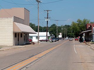
Fredonia is a home rule-class city in Caldwell County, Kentucky, in the United States. The population was 401 at the 2010 census.

<span class="mw-page-title-main">Hazel, Kentucky</span> City in Kentucky, United States

Hazel is a home rule-class city in Calloway County, Kentucky, United States. The population was 410 at the 2010 census.

<span class="mw-page-title-main">Marion, Kentucky</span> City in Kentucky, United States

Marion is a home rule-class city in Crittenden County, Kentucky, in the United States. It is the seat of its county. As of the 2010 census, the city population was 3,039.

<span class="mw-page-title-main">Wayland, Kentucky</span> City in Floyd County, Kentucky, United States

Wayland is a home rule-class city in Floyd County, Kentucky, United States. The population was 426 at the 2010 census, up from 298 at the 2000 census.

<span class="mw-page-title-main">Water Valley, Kentucky</span> Census-designated place in Kentucky, United States

Water Valley is a census-designated place and former home rule-class city in Graves County, Kentucky, United States. The population was 235 as of the 2020 census. It was incorporated on April 19, 1884, and had its charter dissolved via court order effective June 20, 2016.

<span class="mw-page-title-main">Sonora, Kentucky</span> City in Kentucky, United States

Sonora is a home rule-class city in Hardin County, Kentucky, United States. The population was 565 as of the 2020 Census, up from 513 from the 2010 census,. It is included in the Elizabethtown, Kentucky Metropolitan Statistical Area.

<span class="mw-page-title-main">Vine Grove, Kentucky</span> City in Kentucky, United States

Vine Grove is a home rule-class city in Hardin County, Kentucky, United States. The population was 6,559 as of the 2020 Census, up from 4,520 at the 2010 census,. It is part of the Elizabethtown–Fort Knox Metropolitan Statistical Area.

<span class="mw-page-title-main">Benham, Kentucky</span> City in Kentucky, United States

Benham is a home rule-class city in Harlan County, Kentucky, in the United States. The city was formally incorporated by the General Assembly in 1961. The population was 512 at the 2020 census, up from 500 at the 2010 census.

<span class="mw-page-title-main">Clinton, Kentucky</span> City in Kentucky, United States

Clinton is a home rule-class city and the county seat of Hickman County, Kentucky, United States. The population was 1,388 at the 2010 census, a decline from 1,415 in 2000.

<span class="mw-page-title-main">Carrsville, Kentucky</span> City in Kentucky, United States

Carrsville is a home rule-class city beside the Ohio River in Livingston County, Kentucky, in the United States. The population was 50 at the 2010 census, declining from 64 as of 2000. It is part of the Paducah, KY-IL Micropolitan Statistical Area. It is situated just west of the junction of where Buck Creek empties into the Ohio River.

<span class="mw-page-title-main">Barnett Township, Jefferson County, Pennsylvania</span> Township in Pennsylvania, United States

Barnett Township is a township in Jefferson County, Pennsylvania, United States. The population was 231 at the 2020 census down from 254 at the 2010 census. It was named for Jefferson County pioneer Joseph Barnett.

<span class="mw-page-title-main">Puryear, Tennessee</span> City in Tennessee, United States

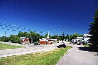
Puryear is a city in Henry County, Tennessee, United States. The population was 671 at the 2010 census.

<span class="mw-page-title-main">Upton, Kentucky</span> City in Kentucky, United States

Upton is a home rule-class city in Hardin and LaRue counties in the U.S. state of Kentucky. The population was 704 as of the 2020 Census, up from 683 from the 2010 census. Its entire area is included in the Elizabethtown–Fort Knox Metropolitan Statistical Area.

References

  1. 1 2 "2022 U.S. Gazetteer Files: Kentucky". United States Census Bureau. Retrieved May 4, 2023.
  2. 1 2 U.S. Geological Survey Geographic Names Information System: Hardin, Kentucky
  3. 1 2 "P1. Race – Hardin city, Kentucky: 2020 DEC Redistricting Data (PL 94-171)". U.S. Census Bureau. Retrieved May 4, 2023.
  4. Rennick, Robert M. (1987). Kentucky Place Names. University Press of Kentucky. p. 130. ISBN   0813126312 . Retrieved April 28, 2013.
  5. Commonwealth of Kentucky. Office of the Secretary of State. Land Office. "Hardin, Kentucky". Accessed 29 July 2013.
  6. "US Gazetteer files: 2010, 2000, and 1990". United States Census Bureau. February 12, 2011. Retrieved April 23, 2011.
  7. "Census of Population and Housing". Census.gov. Retrieved June 4, 2015.
  8. "U.S. Census website". United States Census Bureau . Retrieved January 31, 2008.
  9. "Kentucky Public Library Directory". Kentucky Department for Libraries and Archives. Archived from the original on January 11, 2019. Retrieved June 7, 2019.