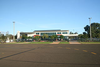
Albany Regional Airport is an airport serving Albany, Western Australia. It is located 6 nautical miles northwest of Albany just off Albany Highway and operated by the City of Albany.
Goulburn Airport is a general aviation airport located 7 km (4.3 mi) south of Goulburn, New South Wales. Throughout the 1990s, suggestions were put forward to have Goulburn airport as a secondary international airport to service Sydney.

Devonport Airport is a regional airport serving Devonport, a city in the Australian state of Tasmania. It is located 10 km (6.2 mi) from the town centre at Pardoe Downs, on Wesley Vale and Airport Roads. The airport is operated by the Tasmanian Ports Corporation (Tasports), which previously operated the larger Hobart International Airport.

Lord Howe Island Airport is an airport providing air transportation to Lord Howe Island. Lord Howe Island is located in the Tasman Sea, 600 km (370 mi) east of Port Macquarie on the coast of mainland Australia. The airport is operated by the Lord Howe Island Board.

Armidale Airport is an airport serving Armidale, a city in the Australian state of New South Wales. It is located 2 nautical miles southwest of the town centre, on the New England Highway. The airport is operated by the Armidale Regional Council.

Bundaberg Airport is a regional airport serving Bundaberg, a city in the Australian state of Queensland. It is located 2.5 nautical miles southwest of the city centre, on North Childers Road and Takalvan Street. The airport is owned and operated by the Bundaberg Regional Council. It is also known as Bundaberg Regional Airport.
Emerald Airport is an airport serving Emerald, a town located in the Central Highlands district of Queensland, Australia. It is located 6 km (4 mi) south of the Emerald town centre, on the Gregory Highway. The airport is operated by the Central Highlands Regional Council.

Griffith Airport is an airport serving Griffith, New South Wales, Australia. It is located 3 nautical miles north of Griffith and operated by the Griffith City Council.
Groote Eylandt Airport is an airport serving Groote Eylandt, an island in the Gulf of Carpentaria in Northern Territory, Australia. The airport is operated by the Groote Eylandt Mining Co. and is located north of the community of Angurugu.

Cobar Airport is an airport located 3 nautical miles southwest of Cobar, a town in the Australian state of New South Wales.
Maningrida Airport is an airport serving Maningrida, Northern Territory, Australia. It is operated by Maningrida Council Inc.
Merimbula Airport is an airport serving Merimbula, New South Wales, Australia. It is located 1 nautical mile south of Merimbula and is owned and operated by Bega Valley Shire Council.
Orange Regional Airport is located in the Central Tablelands region of New South Wales between the city of Orange and the town of Blayney. It is located in the area known as Huntley, near Spring Hill and approximately 11 km (6.8 mi) from Orange's business district.
Port Lincoln Airport is an airport serving Port Lincoln, a city in the Australian state of South Australia. It is located 7 nautical miles north of Port Lincoln, at North Shields. The airport is owned and operated by the District Council of Lower Eyre Peninsula. It was the second busiest airport in South Australia during 2009/10, with 168,147 passengers served.
Quilpie Airport is an airport serving Quilpie, Queensland, Australia. It is located 1 nautical mile west of Quilpie and operated by the Quilpie Shire Council. The airport received $242,666 for security upgrades from the Australian Government in 2006.

Tamworth Airport is a regional airport serving Tamworth, a city in the Australian state of New South Wales. It is located 10 km (6.2 mi) from the town centre, on New Winton Road. The airport is owned and operated by the Tamworth Regional Council and is listed as being 5 nautical miles west of the city. It is also known as Tamworth Regional Airport.
West Wyalong Airport is an airport located 1 nautical mile south West Wyalong, New South Wales, Australia. The airport is operated by the Bland Shire Council.

Winton Airport is an airport serving Winton, Queensland, Australia. It is located 3 nautical miles northeast of Winton and operated by the Winton Shire Council.
Renmark Airport is an airport serving Renmark, South Australia. It is located 4.25 nautical miles southwest of Renmark and operated by the Renmark Paringa Council.
Young Airport is an airport serving Young, New South Wales, Australia. It is located 3.5 nautical miles northwest of Young and operated by Hilltops Council.


