
The Lachlan River is an intermittent river that is part of the Murrumbidgee catchment within the Murray–Darling basin, located in the Southern Tablelands, Central West, and Riverina regions of New South Wales, Australia.

Wyangala Dam is a major gated rock fill with clay core embankment and gravity dam with eight radial gates and a concrete chute spillway across the Lachlan River, located in the south-western slopes region of New South Wales, Australia. The dam's purpose includes flood mitigation, hydro-power, irrigation, water supply and conservation. The impounded reservoir is called Lake Wyangala.

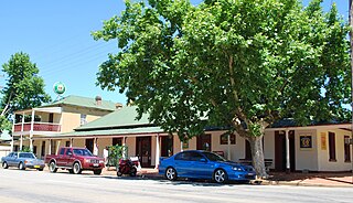
Temora is a town in the north-east of the Riverina area of New South Wales, 418 kilometres (260 mi) south-west of the state capital, Sydney. At the 2021 census the population of Temora was 4,016.
Murrumbidgee is a former electoral district of the Legislative Assembly in the Australian state of New South Wales, named after the Murrumbidgee River.

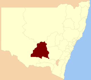
Lachlan Shire is a local government area in the Central West region of New South Wales, Australia. The Shire is located adjacent to the Lachlan River, the Lachlan Valley Way and the Broken Hill railway line.

The Central West is a region in central New South Wales, Australia. The region is situated west of Sydney, which stretches from Lithgow in the east and to as far west as Lake Cargelligo, on the Lachlan River. The Central West is known for its attractions such as the Jenolan Caves, near Oberon and also wineries, as well as rural farmland and natural landscapes. The region includes major towns like, Bathurst, Orange, Mudgee, Lithgow, Parkes and Cowra. It has an area of 63,262 square kilometres (24,426 sq mi). The region also includes the sub-region known as the Central Tablelands, located in the eastern part of the region. The region known as the Orana, which includes the area surrounding Dubbo is typically classed as being a part of the Central West also.

Lake Cargelligo is a town in the Central West region of New South Wales, Australia, on Lake Cargelligo. It is in Lachlan Shire. At the 2016 census, Lake Cargelligo had a population of 1,479 people. Its name is said to be a corruption of the Aboriginal word kartjellakoo meaning 'he had a coolamon'. Alternatively it is derived from Wiradjuri and Ngiyambaa "gajal" for water container with suffix "lugu" for "her" or "his". In 2016, it had an indigenous population of 239 (16.2%) and other Australian-born population of 1,186.

Stockinbingal is a town in the South West Slopes and Riverina regions of New South Wales, Australia. The town is in the Cootamundra–Gundagai Regional Council local government area and on the Burley Griffin Way. At the 2016 census, Stockinbingal had a population of 374.
Marrar is a town in the central east part of the Riverina region of New South Wales. Australia. The town is situated about 21 kilometres (13 mi) west of Old Junee and 32 kilometres (20 mi) north of Downside. At the 2016 census, Marrar had a population of 368.

Combaning is a rural community in the north east part of the Riverina. It is situated by road, about 3 kilometres west of Springdale and 13 kilometres east of Temora. At the 2021 census, Combaning had a population of 100 people.

Springdale is a village community in the central north part of the Riverina region of the Australian state of New South Wales. It is situated by road, about 3 kilometres east of Combaning and 23 kilometres north west of Stockinbingal. At the 2016 census, it had a population of 150.
The Temora–Roto railway line is a partly closed railway line in the southwest of New South Wales, Australia. It branches from the Lake Cargelligo line at the town of Temora and travels west through the northern part of the Riverina to the towns of Griffith and Hillston. A connection to the Broken Hill line created a cross-country route, although this was never utilised to its full potential, and the line beyond Hillston was built to low grade 'pioneer' standards.
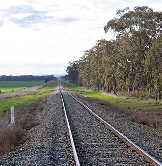
The Lake Cargelligo railway line is a railway line in Central Western New South Wales, Australia. The first sod was turned commencing construction on 8 June 1913 with the line opening on 13 November 1917. The line branches from the Main South line at Cootamundra and travels in a north-westerly direction to the small town of Lake Cargelligo. The line is used primarily for grain haulage, although passenger service was provided until 1983.
The Naradhan railway line is a railway line in south-western New South Wales, Australia. It branches from Ungarie on the Lake Cargelligo line and heads in a westerly direction, passing through Youngareen and Kikoira, to the small town of Naradhan. The line opened on 11 February 1929 to open up the region for agriculture, and is currently used for seasonal grain haulage. The line saw passenger services until 1974.
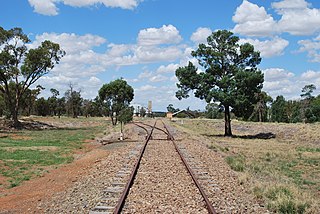
The Rankins Springs railway line is a closed railway line in southwestern New South Wales, Australia. The line branched from the Lake Cargelligo line at the town of Barmedman, heading in a westerly direction to the town of Rankins Springs. It opened in 1923, and was constructed primarily to open up the agricultural areas in the vicinity. Passenger services were operated by CPH railmotors until the widespread withdrawal of country branchline trains in 1974. The line carried approximately 80,000 tonnes of grain per year, before being 'mothballed' in 2004.

The Burcher railway line is a partly closed railway line in New South Wales, Australia, branching from the Cootamundra to Lake Cargelligo line at Wyalong Central.

Lachlan Valley Way is a New South Wales country road running from Booligal to north of Yass. It was named after the Lachlan River, and follows its southern bank for the majority of its length.

The Temora railway station is a heritage-listed former railway station and now youth hub and mixed-use building located on the Lake Cargelligo railway line in Temora in the Temora Shire local government area of New South Wales, Australia. The station was built from 1893 to 1915 and served the Riverina town of Temora between 1 September 1893 until its closure for passenger services in the late 1970s. The station is also known as the Temora Railway Station group. The property was added to the New South Wales State Heritage Register on 2 April 1999.

The 600/700 class railcars were a class of diesel multiple unit built by the New South Wales Government Railways. They were built to operate on branch lines from 1949 with low traffic volumes later being transferred to Newcastle and Wollongong to operate suburban services until withdrawn in 1994. However, one 600 class railcar was converted to solar operation for use on the Byron Bay Train service. The upgraded train entered service on 16 December 2017 and is believed to be the world's first solar-powered train.
Yiddah is a locality in New South Wales, Australia. The locality is 474 kilometres (295 mi) west of the state capital, Sydney about midway between the towns of West Wyalong and Barmedman. Yiddah is in the Bland Shire local government area and Bland county cadastral area.
