Walgett Airport

Last updated

Walgett Airport
Summary
Airport typePublic
Operator Walgett Shire Council
LocationWalgett, New South Wales
Elevation  AMSL 439 ft / 134 m
Coordinates 30°02′00″S148°07′30″E / 30.03333°S 148.12500°E / -30.03333; 148.12500
Map
Australia New South Wales location map blank.svg
Airplane silhouette.svg
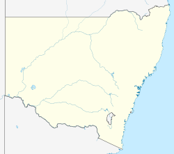
YWLG
Location in New South Wales
Runways
Direction LengthSurface
mft
05/231,6265,335 Asphalt
18/361,1533,783 Grass
Sources: Australian AIP and aerodrome chart [1]

Walgett Airport( IATA : WGE, ICAO : YWLG) is an airport in Walgett, New South Wales, Australia.

Contents

Airlines and destinations

AirlinesDestinations
Air Link Dubbo, Lightning Ridge [2]

See also

Related Research Articles

<span class="mw-page-title-main">Gwydir Highway</span>

Gwydir Highway is a 568-kilometre (353 mi) state highway in northern New South Wales, Australia. The highway was named after the Gwydir River, which in turn was named after a locale in Wales.

<span class="mw-page-title-main">Barwon River (New South Wales)</span> River in New South Wales, Australia

Barwon River, a perennial river that is part of the Murray–Darling basin, is located in the north-west slopes and Orana regions of New South Wales, Australia.

<span class="mw-page-title-main">Walgett, New South Wales</span> Town in New South Wales, Australia

Walgett is a town in northern New South Wales, Australia, and the seat of Walgett Shire. It is near the junctions of the Barwon and Namoi Rivers and the Kamilaroi and Castlereagh Highways. In 2016, Walgett had a population of 2,145.

<span class="mw-page-title-main">Lightning Ridge, New South Wales</span> Town in New South Wales, Australia

Lightning Ridge is a small outback town in north-western New South Wales, Australia. Part of Walgett Shire, Lightning Ridge is situated near the southern border of Queensland, about 6 km (4 mi) east of the Castlereagh Highway. The Lightning Ridge area is a centre of the mining of black opal and other opal gemstones.

<span class="mw-page-title-main">Kamilaroi Highway</span> Highway in New South Wales

Kamilaroi Highway is a 605-kilometre (376 mi) state highway located in the north-western region of New South Wales, Australia, and links Bourke via Walgett and Narrabri to Willow Tree. The highway is named after the Kamilaroi Indigenous Australian people who live in the area.

<span class="mw-page-title-main">Collarenebri</span> Town in New South Wales, Australia

Collarenebri is a town in north western New South Wales, Australia. The town is in the Walgett Shire Local Government Area and is situated on the Barwon River approximately 75 kilometres (47 mi) northeast of Walgett and south west of Mungindi on the Gwydir Highway. It is 16 km (9.9 mi) from Pokataroo which was the nearest railway town prior to closure of the rail service there. The town is 150 metres (490 ft) above sea level. Collarenebri is one of three towns ending in 'BRI' in Northern New South Wales.

QantasLink is the regional brand of Australian flag carrier Qantas and is an affiliate member of the Oneworld airline alliance. As of 2023, QantasLink provides over 2,000 flights each week to over 50 metropolitan and regional destinations across Australia, as well as short-haul international services to New Zealand, the Solomon Islands and East Timor.

<span class="mw-page-title-main">Air Link</span> Australian airline

Air Link Pty Ltd is an airline and air charter company based in Dubbo, New South Wales, Australia. It operates air charter services and recommenced regular passenger services in November 2019. Its main base is Dubbo Airport.

<span class="mw-page-title-main">Walgett Shire</span> Local government area in New South Wales, Australia

Walgett Shire is a local government area in the Orana region of New South Wales, Australia. The northern boundary of the Shire is located adjacent to the border between New South Wales and Queensland. The town of Walgett is located on the Namoi River, nearby to its junction with the Barwon River and at the junction of the Kamilaroi Highway and the Castlereagh Highway.

<span class="mw-page-title-main">Coffs Harbour Airport</span> Airport in Coffs Harbour, Australia

Coffs Harbour Airport is the only airport serving the City of Coffs Harbour, in the New South Wales Mid North Coast region in Australia. The airport is located 3 km (1.9 mi) south of Coffs Harbour and is one of the busiest regional airports in the state, serving flights to the east coast capital cities, as well as some regional destinations. Coffs Harbour Airport has the capacity to handle large aircraft such as the Boeing 767 or Boeing 777 but is predominately served by regional airlines using smaller aircraft.

<span class="mw-page-title-main">Dubbo City Regional Airport</span> Airport serving Dubbo, Australia

Dubbo City Regional Airport is a regional airport in Dubbo, Australia. The airport is located 2 nautical miles northwest of Dubbo and is operated by the Dubbo City Council. It is also known as Dubbo Airport or Dubbo City Airport.

Lightning Ridge Airport is an airport located 2 nautical miles south southwest of Lightning Ridge, New South Wales, Australia.

<span class="mw-page-title-main">Bourke Airport</span> Airport in Bourke, New South Wales

Bourke Airport is an airport located 4 nautical miles north of Bourke, New South Wales, Australia. The airport is located at an elevation of 352 ft (107 m) above sea level. It has two runways: 05/23, an asphalt runway 1,830 m (6,004 ft) long, and 18/36, a grass runway 1,000 m (3,281 ft) long.

<span class="mw-page-title-main">Merimbula Airport</span> Airport

Merimbula Airport is an airport serving Merimbula, New South Wales, Australia. It is located 1 nautical mile south of Merimbula and is owned and operated by Bega Valley Shire Council.

Moruya Airport is an airport located 3.5 NM northeast of Moruya, New South Wales, Australia, at the mouth of the Moruya River. It is one of two airports with regular passenger flights in the state's South Coast region, but also caters to general aviation and tourism operators, as well as emergency services.

<span class="mw-page-title-main">Walgett railway line</span>

The Walgett railway line is a railway line in north-western New South Wales, Australia. Opening in 1908, it branches from the North-West Line at Narrabri and passes through the towns of Wee Waa and Burren before ending in the town of Walgett. The line is used for wheat haulage, and the section between the Walgett wheat terminal and Walgett station is closed. There was a proposal to connect the Gwabegar line to the Walgett line at Burren Junction in 1913, and although approved, this connection was never constructed.

<span class="mw-page-title-main">Cryon, New South Wales</span> Location in New South Wales, Australia

Cryon is a parish and hamlet in the north-west of New South Wales, Australia. It lies in the Walgett Shire and is situated 685 km (426 mi) from Sydney, 130 km (81 mi) west of Narrabri and 52 km (32 mi) east of Walgett on the Kamilaroi Highway. The settlement sits at an altitude of about 146 metres (479 ft). When the Walgett railway line arrived here in 1905 this was a thriving settlement with a variety of businesses including a hotel and stores. For quite a few years it was the loading point for cattle from South West Queensland that were railed to the Sydney market. The railway now only carries freight (grain).

<span class="mw-page-title-main">Moonie River</span> River in Queensland and New South Wales, Australia

The Moonie River (Mooni River) is a river in Shire of Balonne, Queensland and Walgett Shire, New South Wales, both in Australia. It is a perennial river of the Barwon catchment within the Murray–Darling basin.

<span class="mw-page-title-main">FlyPelican</span> Australian airline

Pelican Airlines Pty Ltd, operating as FlyPelican, is an Australian regional airline. It initially operated air charter services and subsequently commenced scheduled flights on 1 June 2015. The airline is currently the only airline based in Newcastle, New South Wales. Its main base is Newcastle Airport. The airline was formed by former Aeropelican staff using former Aeropelican aircraft. The company slogan is Fly Local, Fly Pelican.

References

  1. YWLG – Walgett  (PDF). AIP En Route Supplement from Airservices Australia , effective 2023-11-30, Aeronautical Chart
  2. "AIR LINK AND FLYPELICAN BRINGING FLIGHTS BACK TO WESTERN NSW". Australian Aviation. 27 August 2019. Retrieved 20 October 2019.