The Darling River is the third longest river in Australia, measuring 1,472 kilometres (915 mi) from its source in northern New South Wales to its confluence with the Murray River at Wentworth, New South Wales. Including its longest contiguous tributaries it is 2,844 km (1,767 mi) long, making it the longest river system in Australia.

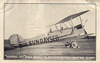
The Sunraysia is an ill–defined district, sometimes incorrectly referred to as an economic region, located in northwestern Victoria and southwestern New South Wales in Australia. The region is renowned for its sunshine, intensive horticulture including grapes and oranges, and grain farms. Its main centre is Mildura, Victoria.

Narrandera Airport is a small regional airport in the local government area of Narrandera in the Riverina region of New South Wales, Australia. The airport is located 4 nautical miles northwest of Narrandera along Irrigation Way. The airport services the towns of Leeton and Narrandera as it is located between the two towns.

Pooncarie is a village in south-western New South Wales, Australia in Wentworth Shire. It is on the eastern side of the Darling River between Wentworth and Menindee. The surrounding region of Pooncarie is semi-arid with an outback landscape rich in eucalypt woodlands

Wentworth Shire is a local government area in the far south-west Riverina region of New South Wales, Australia. This Shire is located adjacent to the Murray and Darling Rivers. The Shire's major roads are the Sturt and the Silver City Highways. The Shire includes the towns of Wentworth, Buronga, Gol Gol, Dareton and Pooncarie.

Coffs Harbour Airport is the only airport located in and serving the regional centre of Coffs Harbour, Australia. The airport is located near Boambee, south of Coffs Harbour. Coffs Harbour Regional Airport is one of the largest and busiest regional airports in New South Wales, handling numerous types of aircraft. The airport is currently serviced by three airlines Link Airways, QantasLink and Virgin Australia. Coffs Harbour is one of the only regional airports in New South Wales to have an Air Traffic Control tower. The airport has the capacity to handle any aircraft up to the size of a Boeing 767 or Boeing 777-200. Coffs Harbour Airport is located right at the doorstep of the Pacific Highway which links all of Coffs Harbour and surrounding areas to the airport.

Lismore Airport is a regional airport located 2 nautical miles south of Lismore, northern New South Wales, Australia.

Lord Howe Island Airport is an airport providing air transportation to Lord Howe Island. Lord Howe Island is located in the Tasman Sea, 600 km (370 mi) east of Port Macquarie on the coast of mainland Australia. The airport is operated by the Lord Howe Island Board.

Broken Hill Airport is an airport located 2.5 nautical miles southeast of Broken Hill, New South Wales, Australia.

Cooma–Snowy Mountains Airport is an airport located 9 nautical miles southwest Cooma, New South Wales, Australia. The airport serves the town of Cooma and the resorts of the Snowy Mountains and Australian Alps. The airport experiences increased traffic during the winter months.

Lightning Ridge Airport is an airport located 2 nautical miles south southwest of Lightning Ridge, New South Wales, Australia.

Cobar Airport is an airport located 3 nautical miles southwest of Cobar, a town in the Australian state of New South Wales.

Merimbula Airport is an airport serving Merimbula, New South Wales, Australia. It is located 1 nautical mile south of Merimbula and operated by Airport Agencies Pty. Ltd.

Moruya Airport is an airport located 3.5 NM northeast of Moruya, New South Wales, Australia.

Narrabri Airport is an airport located 3 nautical miles northeast of Narrabri, New South Wales, Australia.

Parkes Airport is an airport located 4 nautical miles northeast of Parkes, New South Wales, Australia. Approximately 32,000 passengers used scheduled service at the airport in 2011. The Parkes Shire Council currently maintains the airport.

Clarence Valley Regional Airport also known as Grafton Airport, is an airport 7 nautical miles southeast of Grafton, New South Wales, Australia. In addition 24 weekly services to Sydney operated by Regional Express Airlines, the airport is used by the NSW Air Ambulance Service, Royal Flying Doctor Service, RACQ Careflight Rescue Helicopter Service, Westpac Life Saver Rescue Helicopter Service, and community service flights such as Angel Flight and Little Wings. During the warmer spring and summer months, Grafton Airport is frequently used as a base for aircraft engaged in aerial firefighting by the NSW Rural Fire Service which has an established aviation branch at the airport. In 2013, the Clarence Valley Council which operates the airport secured $2.12 million funding through loans and grants to upgrade the facilities at the airport.

Cessnock Airport is a civil airport located 6 km (4 mi) North of Cessnock, New South Wales, Australia.
Frenchmans Creek is a short tributary of the Darling River in west New South Wales, measuring 7.51 km (5 mi) from its source south of Pooncarie, New South Wales at an elevation of 54.4 m (178 ft) to its confluence into the Darling River at an elevation of 48 metres (157 ft).
Ladji Ladji (Ledji-Ledji) is a moribund Australian Aboriginal language once widely spoken in New South Wales and Victoria by the Latjilatji people.


