
The Central Coast is a peri-urban region lying on the Pacific Ocean in northern-eastern New South Wales, Australia. The region is situated north of Sydney, which is filled with subtropical national parks, forests and also encompasses the major coastal waterways of Brisbane Water, Tuggerah Lakes and southern Lake Macquarie. The region's hinterland, which has fertile valleys, rural farmland and wineries, and also includes the Watagan Mountains. The Central Coast is known for its regional coastal towns like Terrigal, The Entrance, Ettalong Beach, Budgewoi and Bateau Bay with resorts and holiday parks, which feature many expansive beaches and lagoons with surfing and coastal tracks, as well as scenic views. Gosford is the main commercial hub and gateway.

Wyong Shire was a local government area located in the Central Coast region of New South Wales, Australia. The incorporation of the Wyong area dates back to 7 March 1906 when the entire area of the Brisbane Water Police District outside of the Town of Gosford was proclaimed as the Erina Shire. From 1 January 1947, local government in the Central Coast region was reorganised, creating Gosford Shire and Wyong Shire, which comprised Erina Shire north and east of Kulnura, Central Mangrove and Lisarow.

Warnervale is a town in the Central Coast Council local government area in the Central Coast region in the state of New South Wales, Australia. It lies approximately 101 km north of Sydney, located west of Tuggerah Lake, a large shallow coastal lake, and just north of Wyong.
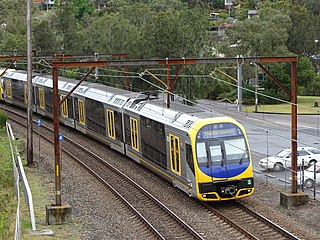
The Central Coast & Newcastle Line (CCN) is a NSW TrainLink passenger train service that runs along the Main North railway line in New South Wales, connecting the state's two largest cities, Sydney and Newcastle. The service runs from Central through to Broadmeadow on the Main North railway line to Newcastle Interchange on the Newcastle railway line, and services the Hawkesbury River region, the Central Coast and the city of Newcastle.

Narrandera Airport is a small regional airport in the local government area of Narrandera in the Riverina region of New South Wales, Australia. The airport is located 4 nautical miles northwest of Narrandera along Irrigation Way. The airport services the towns of Leeton and Narrandera as it is located between the two towns.

Strahan Airport is an airport located 2 nautical miles west of Strahan, Tasmania, Australia. It is the main airport for the West Coast of Tasmania, and is owned and maintained by the West Coast Council. The need for an airport in the area was suggested in the 1950s, and suggestions for upgrades have occurred over time.

Kanwal is a suburb just west of the Tuggerah Lake in the Central Coast region of New South Wales, Australia. It is part of the Central Coast Council local government area and is approximately 9 km north east of Wyong and 6 km west of the Pacific Ocean.

Shepparton Airport is located south of Shepparton, Victoria, Australia on the Goulburn Valley Highway.

Camden Airport is an aerodrome located on the outskirts of Sydney, 1 nautical mile northwest of Camden, New South Wales, Australia. The airport is located approximately 60 km (37 mi) from Sydney's central business district. Camden is used as a general aviation overflow airport for the busier Bankstown Airport, and provides facilities for gliding and ballooning. The aerodrome has one grass runway and one paved runway and two glider airstrips. It is in the south-west corner of the designated Sydney flight training area.
Hamlyn Terrace is a suburb of the Central Coast region of New South Wales, Australia. It is part of the Central Coast Council local government area. The suburb was formerly part of Warnervale and is part of the Warnervale development precinct. The suburb is split between two governmental wards in the Central Coast Council governmental area, the northern part is in the Budgewoi ward and the rest is in the Wyong ward.
Lake Macquarie Airport is an airfield located in the Lake Macquarie suburb of Marks Point, 15 km (9.3 mi) south of Newcastle, New South Wales, Australia. The airport is located on a narrow peninsula between the Pacific Highway and a shallow tidal inlet that forms the entrance to Lake Macquarie.
Moruya Airport is an airport located 3.5 NM northeast of Moruya, New South Wales, Australia, at the mouth of the Moruya River. It is one of two airports with regular passenger flights in the state's South Coast region, but also caters to general aviation and tourism operators, as well as emergency services.

Tamworth Airport is a regional airport serving Tamworth, a city in the Australian state of New South Wales. It is located 10 km (6.2 mi) from the town centre, on New Winton Road. The airport is owned and operated by the Tamworth Regional Council and is listed as being 5 nautical miles west of the city. It is also known as Tamworth Regional Airport.

Evans Head Memorial Aerodrome is a heritage-listed airport in Evans Head, Richmond Valley Council, New South Wales. The airport is approximately 1 km (0.62 mi) north of the village. During World War II it was Royal Australian Air Force (RAAF) Station Evans Head supporting RAAF No 1 Bombing and Gunnery School (1BAGS) and subsequently the RAAF No 1 Air Observers School. At the height of operations there were three asphalt runways and one grass strip. Only a single asphalt strip is still in use by private aviation. It was added to the New South Wales State Heritage Register on 22 November 2002.
Gunnedah Airport is a small airport located 1 nautical mile north of Gunnedah, New South Wales, Australia.
Scone Memorial Airport, is a public airport in the Upper Hunter Valley, 4 km (2.5 mi) northwest of Scone, New South Wales, Australia. It was built to provide a public aerodrome replacing Nandowra aerodrome on located on "Nandowra", approx. 9 km south of Scone.
Cessnock Airport is a civil airport located 6 km (4 mi) North of Cessnock, New South Wales, Australia.
Condobolin Airport is a small registered aerodrome located 3.5 nautical miles northeast of Condobolin, New South Wales, Australia. The Lachlan Shire Council currently maintains the airport.

The Central Coast Council is a local government area in the Central Coast region of New South Wales, Australia. It is adjacent to the Pacific Highway, Central Coast Highway, the Northern railway line and the Pacific Ocean. The council was formed on 12 May 2016 following the merger of the Gosford City and Wyong Shire Councils.
Somersby Airfield is an airfield located in Somersby, New South Wales, Australia. It is 12 kilometres (7.5 mi) by road from the nearby city of Gosford. It is the sole aerodrome in Somersby, and does not serve scheduled commercial traffic.
