
Mount Matier is a prominent 2,783-metre (9,131-foot) mountain summit located in the Coast Mountains, in Joffre Lakes Provincial Park, in southwestern British Columbia, Canada. It is the highest point of the Joffre Group, which is a subset range of the Coast Mountains. It is situated 26 km (16 mi) east of Pemberton, and 9 km (6 mi) northeast of Lillooet Lake. Its nearest higher peak is Mount Weart, 30 km (19 mi) to the southwest. The slopes of the mountain are covered by the Matier Glacier on the northwest, Anniversary Glacier on the northeast, Twin One Glacier on the southeast, and Hartzell Glacier to the south. Precipitation runoff from the peak drains into Joffre Creek and Twin One Creek, both tributaries of the Lillooet River.

Joffre Peak is a 2,721-metre (8,927-foot) mountain summit located in the Coast Mountains, in Joffre Lakes Provincial Park, in southwestern British Columbia, Canada. It is the second-highest point of the Joffre Group, which is a subset of the Lillooet Ranges. It is situated 26 km (16 mi) east of Pemberton and 11 km (7 mi) northeast of Lillooet Lake. Joffre is more notable for its steep rise above local terrain than for its absolute elevation as topographic relief is significant with the summit rising 1,500 meters (4,920 ft) above Cayoosh Creek in 4 km (2.5 mi). The nearest higher peak is Mount Matier, 1.6 km (1 mi) to the south. The mountain's climate supports the Matier Glacier on the southwest slope, and the Anniversary Glacier on the southeast slope. Precipitation runoff from the peak drains into Joffre Creek and Cayoosh Creek which are both within the Fraser River watershed.

Mount Weart is a 2,835-metre (9,301-foot) triple-summit mountain located in the Garibaldi Ranges of the Coast Mountains, in northwestern Garibaldi Provincial Park of southwestern British Columbia, Canada. It is situated 14 km (9 mi) northeast of Whistler, and its nearest higher peak is Wedge Mountain, 3.7 km (2 mi) to the south, which is the only peak within the park higher than Weart. The Armchair Glacier rests below the west aspect of the summit, and the massive Weart Glacier spans the northern and eastern aspects of the mountain. Precipitation runoff from the peak and meltwater from the glaciers drains into Wedgemount Lake and tributaries of the Lillooet River.

Mount Fitzsimmons is a 2,603-metre (8,540-foot) glacier-clad peak located in the Garibaldi Ranges of the Coast Mountains, in Garibaldi Provincial Park of southwestern British Columbia, Canada. It is the third-highest point of the Fitzsimmons Range, which is a subset of the Garibaldi Ranges. It is situated 15 km (9 mi) southeast of Whistler, and its nearest higher peak is Mount Benvolio, 0.5 km (0 mi) to the west-southwest. The Diavolo Glacier spreads out below the southeast aspect of the summit, and the Fitzsimmons Glacier descends the northwest slopes. Precipitation runoff from the peak and meltwater from its glaciers drains into tributaries of the Cheakamus River. The first ascent of the mountain was made on August 19, 1924, by a party of the British Columbia Mountaineering Club. The peak was named for prospector James Fitzsimmons, who built a trail along Fitzsimmons Creek in an effort to haul supplies to a small copper mine he staked and worked. The mountain's name was officially adopted on September 2, 1930, by the Geographical Names Board of Canada.
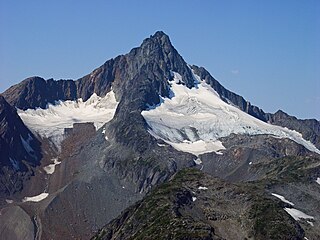
Kwoiek Needle is a 2,625-metre (8,612-foot) mountain summit located in the Lillooet Ranges of southwestern British Columbia, Canada. It is situated 24 km (15 mi) southwest of Lytton, and its nearest higher peak is Kumkan Peak, 9.2 km (6 mi) to the west. The mountain was named in association with Kwoiek Creek, Kwoiek Lake, and Kwoiek Peak. Kwoiek is a Thompson Indian word meaning "gouged out," referring to a large chunk missing from the canyon wall. The name was officially adopted on October 6, 1936, by the Geographical Names Board of Canada. Meltwater from unnamed glaciers on its north slopes and precipitation runoff from the peak drains into Kwoiek Creek and Log Creek, both tributaries of the Fraser River.
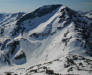
Mount Duke is a 2,379-metre (7,805-foot) mountain summit located in the Joffre Group of the Lillooet Ranges, in southwestern British Columbia, Canada. It is situated 30 km (19 mi) east of Pemberton, and 10 km (6 mi) southwest of Duffy Lake. The highest peak in the Joffre Group, Mount Matier, rises 4.4 km (3 mi) to the west. The mountain's name was submitted by Reverend Damasus Payne, a Benedictine monk and mountaineer, to honor Archbishop William Mark Duke. It was officially adopted on April 21, 1966, by the Geographical Names Board of Canada. Precipitation runoff from the peak drains into Caspar Creek and Twin One Creek.

Duffey Peak is a 2,219-metre (7,280-foot) mountain summit located in southwest British Columbia, Canada.
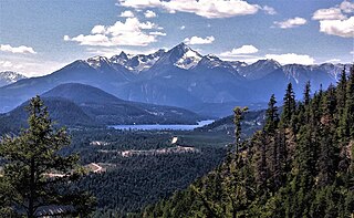
Mount Sloan is a 2,720-metre (8,924-foot) mountain summit located in British Columbia, Canada.
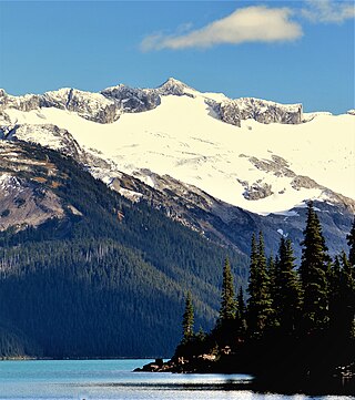
Mount Carr is a 2,590-metre (8,497-foot) mountain summit located in British Columbia, Canada.

Mount McLean is a 2,427-metre (7,963-foot) mountain summit located in British Columbia, Canada.
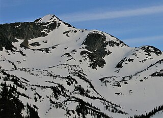
Vantage Peak is a 2,235-metre (7,333-foot) mountain summit located in the Coast Mountains of British Columbia, Canada. It is part of the Joffre Group, which is a subset of the Lillooet Ranges. It is situated 28.5 km (18 mi) east of Pemberton on the boundary of the Nlháxten/Cerise Creek Conservancy. Precipitation runoff from the peak drains southwest into Twin One Creek thence Lillooet Lake; the north slope drains into headwaters of Cerise Creek; and the east slope drains into Caspar Creek thence Cayoosh Creek which is within the Fraser River watershed. Vantage Peak is more notable for its steep rise above local terrain than for its absolute elevation as topographic relief is significant with the summit rising 1,135 meters (3,724 ft) above Twin One Creek in 4 km (2.5 mi). The nearest higher neighbor is Mount Duke, 2.08 km (1 mi) to the southeast.
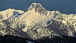
Peneplain Peak is a 1,707-metre (5,600-foot) summit located in British Columbia, Canada.
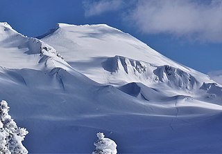
Whirlwind Peak is a 2,427-metre (7,963-foot) mountain summit in southwestern British Columbia, Canada.
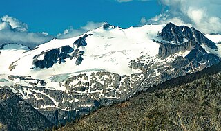
Kwoiek Peak is a 2,736-metre (8,976-foot) mountain summit located in British Columbia, Canada.

Kumkan Peak is a 2,742-metre (8,996-foot) mountain summit located in British Columbia, Canada.

Antimony Mountain is a 2,668-metre (8,753-foot) mountain summit located in British Columbia, Canada.

Claimpost Peak is a 2,671-metre (8,763-foot) mountain summit located in British Columbia, Canada.

Corrie Peak is a 2,263-metre (7,425-foot) summit in British Columbia, Canada.

In-SHUCK-ch Mountain is a 2,386-metre (7,828-foot) summit in British Columbia, Canada.

Klowa Mountain is a 2,527-metre (8,291-foot) summit in British Columbia, Canada.


