The San Francisco Peninsula is a peninsula in the San Francisco Bay Area that separates San Francisco Bay from the Pacific Ocean. On its northern tip is the City and County of San Francisco. Its southern base is Mountain View, south of Palo Alto and north of Sunnyvale and Los Altos. Most of the Peninsula is occupied by San Mateo County, between San Francisco and Santa Clara counties, and including the cities and towns of Atherton, Belmont, Brisbane, Burlingame, Colma, Daly City, East Palo Alto, El Granada, Foster City, Hillsborough, Half Moon Bay, La Honda, Loma Mar, Los Altos, Menlo Park, Millbrae, Pacifica, Palo Alto, Pescadero, Portola Valley, Redwood City, San Bruno, San Carlos, San Mateo, South San Francisco, and Woodside.

San Mateo County, officially the County of San Mateo, is a county located in the U.S. state of California. As of the 2020 census, the population was 764,442. Redwood City is the county seat, and the third most populated city following Daly City and San Mateo. San Mateo County is included in the San Francisco–Oakland–Berkeley, CA MSA, Silicon Valley, and is part of the San Francisco Bay Area, the nine counties bordering San Francisco Bay. It covers most of the San Francisco Peninsula. San Francisco International Airport is located in the northeastern area of the county and is approximately 7 miles (11 km) south of the city and county limits of San Francisco, even though the airport itself is assigned a San Francisco postal address. The county's built-up areas are mostly suburban, and are home to several corporate campuses.

Daly City is the second most populous city in San Mateo County, California, United States, with a population of 104,901 according to the 2020 census. Located in the San Francisco Bay Area, and immediately south of San Francisco, it is named for businessman and landowner John Donald Daly.

Half Moon Bay is a coastal city in San Mateo County, California, United States, approximately 25 miles south of San Francisco. Its population was 11,795 as of the 2020 census. Immediately north of Half Moon Bay is Pillar Point Harbor and the unincorporated community of Princeton-by-the-Sea. Half Moon Bay is known for Mavericks, a big-wave surf location. It is called Half Moon Bay because of its crescent shape.

Pescadero is an unincorporated town and census-designated place (CDP) in San Mateo County, California, two miles (3 km) east of State Route 1 and Pescadero State Beach. The town is 14.4 miles (23.2 km) south of Half Moon Bay. The ZIP Code is 94060 and the community is inside area code 650. The population was 595 at the 2020 census.
Rancho Camulos, now known as Rancho Camulos Museum, is a ranch located in the Santa Clara River Valley 2.2 miles (3.5 km) east of Piru, California and just north of the Santa Clara River, in Ventura County, California. It was the home of Ygnacio del Valle, a Californio alcalde of the Pueblo de Los Angeles in the 19th century and later elected member of the California State Assembly. The ranch was known as the Home of Ramona because it was widely believed to have been the setting of the popular 1884 novel Ramona by Helen Hunt Jackson. The novel helped to raise awareness about the Californio lifestyle and romanticized "the mission and rancho era of California history."

Half Moon Bay State Beach is a 4-mile (6 km) stretch of protected beaches in the state park system of California, United States, on Half Moon Bay. From north to south it comprises Roosevelt, Dunes, Venice, and Francis Beaches. The 181-acre (73 ha) park was established in 1956.
Rancho San Antonio, also known as the Peralta Grant, was a 44,800-acre (181 km2) land grant by Governor Pablo Vicente de Solá, the last Spanish governor of California, to Don Luís María Peralta, a sergeant in the Spanish Army and later, commissioner of the Pueblo of San José, in recognition of his forty years of service. The grant, issued on August 3, 1820, embraced the sites of the cities of San Leandro, Oakland, Alameda, Emeryville, Piedmont, Berkeley, and Albany.

Rancho Petaluma Adobe is a historic ranch house in Sonoma County, California. It was built from adobe bricks in 1836 by order of Mariano Guadalupe Vallejo. It was the largest privately owned adobe structure built in California and is the largest example of the Monterey Colonial style of architecture in the United States. A section of the former ranch has been preserved by the Petaluma Adobe State Historic Park and it is both a California Historic Landmark and a National Historic Landmark. The Rancho Petaluma Adobe State Historic Park is located on Adobe Road on the east side of the present-day town of Petaluma, California.

Pillar Point Harbor is a boat harbor created by a riprap breakwater in San Mateo County, California, immediately north of Half Moon Bay. It is used by both pleasure craft and small commercial fishing boats.
Purissima is a ghost town in southwestern San Mateo County, California, United States, near the junction of State Route 1 and Verde Road. Purísima means "purest" in Spanish and is most commonly used in Spanish to refer to La Purísima Concepción of the Virgin Mary. Purissima is the name of the town used as the setting for Ross Macdonald's 1958 crime fiction novel 'The Doomsters'.
Rancho Miramontes was a 4,424-acre (17.90 km2) Mexican land grant in present-day San Mateo County, California given in 1841 by Governor Juan B. Alvarado to Juan Jose Candelario Miramontes. Arroyo de los Pilarcitos means "creek of little pillars." The grant extended along the Pacific coast from Pilarcitos Creek and present day Half Moon Bay south past Miramontes Point to Canada Verdes.
Rancho Los Laureles was a 6,625-acre (26.81 km2) Mexican land grant in present-day Monterey County, California given in 1839 by Governor Juan Alvarado to José Manuel Boronda and Vicente Blas Martínez. Los Laureles refers to the California Bay Laurel tree. The grant extended along the Carmel River and the Carmel Valley, was bounded to the east by the Rancho Tularcitos and Rancho Los Laureles (Ransom) on the west, and encompasses present day Carmel Valley Village.

Coyote Creek is a stream in the Richardson Bay watershed, draining Tamalpais-Homestead Valley, California eastward into Richardson Bay, Marin County, California, United States. The stream originates on Coyote Ridge and flows 2.5 miles (4.0 km) to the bay at the south end of Bothin Marsh.

Rancho Butano was a 4,439-acre (17.96 km2) Mexican land grant in present-day San Mateo County, California given in 1838 by Governor Juan Alvarado and confirmed in 1844 by Governor Manuel Micheltorena to Ramona Sanchez. The name Butano can be traced back to 1816. It speculated that Californios called a drinking cup made from the horn of a bull or other animal a butano. A First American origin is possible but has not been established. At one time, the grant was in Santa Cruz County 1850–1868; a boundary adjustment transferred the land to San Mateo County. The grant extended along the Pacific coast between Rancho Pescadero and Rancho Punta del Año Nuevo, with Butano Creek on the north to Arroyo de los Frijoles on the south, and encompassed present-day Bean Hollow State Beach and Butano State Park.
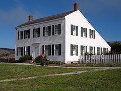
James Johnston House may refer to:
C. Malcolm Watkins (1911–2001) was an American historian, archaeologist, and curator. He researched early American material culture, with a specific interest in the decorative arts. Watkins served as a head curator of the Department of Cultural History at the National Museum of American History at the Smithsonian Institution in Washington, D.C. He spent a total of 31 years working at the Smithsonian.
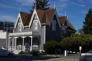
The Lathrop House, also known as the Lathrop-Connor-Mansfield House, was built in Redwood City, California and is one of the San Francisco Peninsula's oldest mansions. Mary C. Lathrop, wife of Benjamin G. Lathrop, bought the land for the 11 room house in 1858 and construction was completed in 1863. The museum has historically existed in three locations, within a few blocks radius in Redwood City.

The Nathanial Brittan Party House, also known as Nathaniel Brittan Party House,Brittan Party House, Brittan Lodge, is located at 125 Dale Avenue in San Carlos, California, and was built in 1872. It was listed on the National Register of Historic Places in 1994.

Folger Estate Stable Historic District also known as Jones Ranch, Mountain Home Ranch, is located at 4040 Woodside Road in Woodside, California at Wunderlich Park, with the majority of the historic buildings built between 1905 and 1906. It was listed on the National Register of Historic Places on April 16, 2004. The historic district is a three-acre site with ten buildings, including the main horse stable building, carriage house, stone walls lining the roads, blacksmith barn, and the cold house.