Guerrero is a state in Southwest Mexico that is divided into 81 municipalities. According to the 2015 Mexican Intercensal Survey, Aguascalientes is the 12th most populous state with 3,533,251 inhabitants and the 14th largest by land area spanning 63,803.42 square kilometres (24,634.64 sq mi).

Chihuahua is a state in Northwest Mexico that is divided into 67 municipalities. According to the 2015 Mexican Intercensal Survey, Chihuahua is the 11th most populous state with 3,554,877 inhabitants and the largest by land area spanning 247,798.08 square kilometres (95,675.37 sq mi).
Juchitán de Zaragoza is an indigenous town in the southeast of the Mexican state of Oaxaca. It is part of the Juchitán District in the west of the Istmo de Tehuantepec region. With a 2005 census population of 74,714 inhabitants, it is the fourth-largest city in the state. The majority of the indigenous inhabitants are Zapotecs and Huaves. The town also serves as the municipal seat for the surrounding municipality, with which it shares a name. The municipality has an area of 414.64 km² and a population of 85,869, the state's third-largest in population.

Santa Ana Chiautempan is a city in Chiautempan Municipality in the south-central part of the Mexican state of Tlaxcala. The city serves as the municipal seat of the municipality, which covers an area of 66.21 km². At the 2005 census it had a population of 46,776 inhabitants, the fourth-largest community in the state in population. The city lies at the extreme western end of the municipality, which had a census population of 63,300 inhabitants.

Zihuatanejo de Azueta is a municipality located on the Pacific coast in the western part of the Mexican state of Guerrero. It includes the major resort communities of Zihuatanejo and Ixtapa in addition to numerous other towns. At the 2005 census it had a population of 104,609 inhabitants. It has an area of 1468 km². Its municipal seat is the city of Zihuatanejo. Its municipal president for the 2005-08 period was Silvano Blanco Deaquino.
Tiquicheo de Nicolás Romero is a municipality located in the Mexican state of Michoacán. The municipality has an area of 1,429.65 square kilometres and is bordered to the north by the municipality of Tzitzio, to the east by Tuzantla and the state of México, to the south by San Lucas, Huetamo and the state of Guerrero, and to the west by Carácuaro and Madero. The municipality had a population of 13,665 inhabitants according to the 2005 census. Its municipal seat is the city of Tiquicheo.
Susupuato is a municipality in the eastern part of the Mexican state of Michoacán. The municipality has an area of 273.33 square kilometres and is bordered to the north by the municipality of Juárez, to the east and south by the state of México, and to the west by Tuzantla. The municipality had a population of 7,703 inhabitants according to the 2005 census. Its municipal seat is the city of Susupuato de Guerrero.
Arteaga is a municipality located in the southern region of the Mexican state of Michoacán. The municipality has an area of 3,454.71 square kilometres and is bordered to the north by the municipality of La Huacana, to the east by Churumuco and the state of Guerrero, to the south by Lázaro Cárdenas, and to the west by Coalcomán de Vázquez Pallares, Tumbiscatío, Aguililla and Aquila. The municipality had a population of 21,173 inhabitants according to the 2005 census. Its municipal seat is the city of the same name.

Tlapa de Comonfort, often shortened to Tlapa and known as Tinda'i in Mixtec, is a city in the mountain region of the Mexican state of Guerrero. It also serves as the municipal seat for the surrounding municipality of the same name.

Ciudad Altamirano is a city in the "Tierra Caliente/Hot Land" region of the Mexican state of Guerrero. It serves as the municipal seat for Pungarabato Municipality.

Ixtcateopan de Cuauhtémoc is a municipality in the north of the Mexican state of Guerrero. It is located in the parallel 18°25’ of north latitude and between the meridians 99°42’ and 99°51’ of west longitude. The distance between Ixcateopan and Chilpancingo, the capital of the state of Guerrero, is 180 km.

Práxedis Gilberto Guerrero is the municipal seat of the municipality of Práxedis G. Guerrero in the northern Mexican state of Chihuahua.

Guerrero is a municipality located in the Mexican state of Tamaulipas.
Chichihualco is a city in the south of Mexico. It forms the administrative centre of the municipality of Leonardo Bravo, found in the centre of Guerrero state about 21 kilometres northwest of the state capital, Chilpancingo.

Juan R. Escudero is one of the 81 municipalities of Guerrero, in south-western Mexico. The municipal seat lies at Tierra Colorada. The municipality covers an area of 652.6 km².
Juchitán is one of the 81 municipalities of Guerrero, in south-western Mexico. The municipal seat lies at Juchitán. Founded in 2004, it is one of the newest municipalities in Guerrero.

Tixtla de Guerrero is one of the 81 municipalities of Guerrero, in south-western Mexico. The municipal seat lies at Tixtla de Guerrero. The municipality covers an area of 290 km².
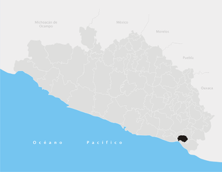
Cuajinicuilapa Municipality is one of the 81 municipalities of Guerrero, in south-western Mexico. The municipal seat lies at Cuajinicuilapa. The municipality covers an area of 857.1 km². As of 2005, the municipality had a total population of 25,537.

Ajacuba is a town and one of the 84 municipalities of Hidalgo, in central Mexico. The municipality covers an area of 192.7 km².
Yutanduchi de Guerrero is one of the 570 municipalities of Oaxaca. The capital of the municipality is Yutanduchi de Guerrero. The city's INEGI identification number is 20564.