
Mundakayam, is a town in Kanjirappally Taluk in the Kottayam District of Kerala. It is the doorway to the high ranges of southern Kerala, and is at the border of Kottayam and Idukki districts. The next nearest town, Kanjirappally, is 14 km (8.7 mi) from Mundakayam. Mundakayam has rubber plantations, and greenery. The Manimala River runs through Mundakayam. It is located 48 km east of the district headquarters at Kottayam and 148 km from the state capital, Thiruvananthapuram. The name Mundakayam is said to be derived from the Mundi cranes that used to be seen along the Manimala River banks.

Iritty is a municipality and a taluk in the district of Kannur in the state of Kerala, India. The town is the main market place for the farmer communities in the surrounding regions. Iritty is known as The Coorg Valley in God's Own Country. Iritty is one of the fastest upcoming towns in Kerala with the distance of 18 KM from Kannur International Airport and one among five taluks in Kannur district.Iritty is one of the major towns lies between Coorg and Kannur international airport -Mattanur.

Aluva is a municipality and a northern suburb of the city of Kochi in Kerala, India. Situated around 15 km (9.3 mi) from the city center on the banks of river Periyar, Aluva is one of the major industrial centres of the state. A major transportation hub, with easy access to all major forms of transportation, Aluva acts as a corridor which links the highland districts to the rest of the state. Cochin International Airport at Nedumbassery is 11.7 km from Aluva. Aluva is accessible through rail, air and metro.

Balussery, also spelt as Balusseri, Balisseri or Balussheri) is a small but developing town area located in Kozhikode district in Kerala state, south India.

Nemom(Malayalam: നേമം) is a area of the city of Thiruvananthapuram (Trivandrum). It is located 8 km (5 mi) to the south of the Thiruvananthapuram city center. Nemom now falls within the municipal corporation of Thiruvananthapuram, though partly exclusive. It is connected with Thiruvananthapuram, Neyyattinkara, Vizhinjam, Poovar, Kattakkada, Nagarcoil, and Kanyakumari through the main arterial highway NH 66.

Karukachal is a small fast-growing town in Changanassery Taluk in Kottayam district of Kerala state in India. The name "Karukachal" was coined from the words "Karuka"(Karukapullu in Malayalam) which is a type of grass which grew in plenty and "chal" meaning a small body of flowing water.chal in Changanacherry-Vazhoor Road which is almost a century old. Other schools nearby include St. John the Baptist School and B Ed College at Nedumkunnam, 2 km east of Karukachal.

Oyoor is a small township of Velinalloor village in the Kottarakara Taluk, Kollam District of Kerala, India. It is situated on the banks of the Ithikkara River. It is surrounded by several small satellite villages: Ugramkunnu in the south, Chenkulam in the west, Mylode in the north and Karingannoor in the east.
Edathala is a Gram panchayat near to Aluva Town. It is also a village in Aluva Taluk of Ernakulam district, in the state of Kerala, India.
Mannar is a small business town in Chengannur Taluk near Veeyapuram and Haripad in Alappuzha District of Kerala state, India, on State highway 6. It is also known as the Bell Metal Town.

Chathannoor is a town in Kerala situated at the Kollam District on the banks of Ithikkara River. It is about 16 km from Kollam City. Chathannoor is around 55 km north of the state capital Thiruvananthapuram.
Meppayur is an important place and town in Kozhikode district of Kerala state, South India.
Chennithala is a village in Mavelikkara taluk of Alleppey district, Kerala, South India. This village consists mainly of paddy fields and coconut groves. Chennithala is a village where Hindus, Christians and Muslims live. There are many ancient Hindu temples. Christians of all denominations have their place of worship in Chennithala.
Punnad is a village in Kannur district in the state of Kerala, India.
Chithara is a village in Kollam district in the state of Kerala, India.
Kizhakkekallada is a village in Kollam district in the state of Kerala, India. East Kallada or popularly known as Kizhakkekallada is a village located about 20 km north-east of Kollam city.
Edathirinji is a village in Thrissur district in the state of Kerala, India.

Thuravoor is a Grama Panchayath in Aluva Taluk of Ernakulam District in the South Indian state of Kerala. Thuravoor Grama Panchayath is nearly 5 km from Angamaly Town. The Panchayat covers 12.13 km2 in area. The borders of this panchayat are Mookkannoor and Manjapra Panchayat in the north, Manjapra, Malayattoor-Neeleeswaram Panchayat in the East. Kalady panchayat and Angamaly Municipality in the south, and Karukutty and Mookkannoor Panchayat on the west.

Kaloor is a downtown region in the city of Kochi, in the state of Kerala, India. It is just 2 km from the Ernakulam North Railway Station. Kaloor Junction is also the name of a major intersection in this part of the city, intersecting the two major arteries of downtown Kochi, namely Banerji Road and the Kaloor-Kadavanthra Road. The nearest major intersections are Palarivattom to the east and Lissie Junction to the west.
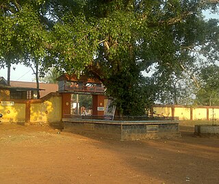
Irumkulangara Durga Bhagavathi Temple is a Hindu temple in Thottam, Manacaud, Manacaud P.O, Thiruvananthapuram, Kerala, India. It is about 1.8 kilometres to the southwest of Sree Padmanabhaswamy Temple in Thiruvananthapuram city.
Mupliyam is a small village near Pudukkad town in Thrissur district of Kerala state, south India. It is located 9 km away from NH 544 from Pudukad which is 13 km from Thrissur town. Mupliyam comes under Chalakudy Taluk and Varandarappilly Panchayath. The river which passes through Mupliyam becomes Kurumali river(mupliyam river). Muniyattukunnu of Mupliyam is famous for its dolmens, which were declared as protected monument as per Government proceeding. Only one dolmen stands intact at Muniyattukunnu. The rest have been destroyed by quarrying in the area. India.


