Kingsley Township, North Dakota | |
|---|---|
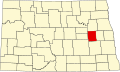
 Kingsley Township, North Dakota Location within the state of North Dakota | |
| Coordinates: 47°27′25″N98°26′09″W / 47.45694°N 98.43583°W | |
| Country | United States |
| State | North Dakota |
| County | Griggs County |
| Township | Kingsley Township |
| Area | |
• Total | 36.04 sq mi (93.3 km2) |
| Elevation | 1,453 ft (443 m) |
| Population (2010) | |
• Total | 92 |
| • Density | 1.8/sq mi (0.7/km2) |
| Time zone | UTC-6 (Central (CST)) |
| • Summer (DST) | UTC-5 (CDT) |
| Postal Code(s) [1] | 58416, 58448 & 58484 |
| Area code | 701 |
| GNIS feature ID | 1036645 |
| Census Code | 42820 |
| Census Class Code | T1 |
| Website | Griggs County |
| Census | Pop. | Note | %± |
|---|---|---|---|
| 1890 | 64 | — | |
| 1900 | 78 | 21.9% | |
| 1910 | 161 | 106.4% | |
| 1920 | 226 | 40.4% | |
| 1930 | 212 | −6.2% | |
| 1940 | 161 | −24.1% | |
| 1950 | 162 | 0.6% | |
| 1960 | 150 | −7.4% | |
| 1970 | 28 | −81.3% | |
| 1980 | 100 | 257.1% | |
| 1990 | 74 | −26.0% | |
| 2000 | 59 | −20.3% | |
| 2010 | 50 | −15.3% | |
| 2018 (est.) | 46 | [2] | −8.0% |
Kingsley Township [3] is a township in Griggs County, North Dakota, United States.