Kremlin, Wisconsin

Last updated

Kremlin, Wisconsin
USA Wisconsin location map.svg
Red pog.svg
Kremlin, Wisconsin
Usa edcp location map.svg
Red pog.svg
Kremlin, Wisconsin
Coordinates: 45°39′03″N87°50′41″W / 45.65083°N 87.84472°W / 45.65083; -87.84472
Country Flag of the United States.svg  United States
State Flag of Wisconsin.svg  Wisconsin
County Marinette
Elevation
257 m (843 ft)
Time zone UTC-6 (Central (CST))
  Summer (DST) UTC-5 (CDT)
Area code(s) 715 & 534
GNIS feature ID1577684 [1]

Kremlin is an unincorporated community located in the town of Pembine, Marinette County, Wisconsin, United States.

Contents

Geography

Kremlin, 1912 map detail Kremlin Wisconsin 1912.jpg
Kremlin, 1912 map detail

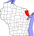
Kremlin is located along the Canadian National Railway 12 miles (19 km) southeast of Niagara. It stand at the east end of Kremlin Road, where it intersects with Chapman Road, [2] at an elevation of 843 feet (257 m). [1] It is connected by road to Pembine to the west and by rail to Faithorn, Michigan to the east. [2] The Menominee River flows to the east, past Nose Peak Island and the Pemebonwon Islands. Kimlark Lake (elevation 810 ft or 250 m) lies immediately to the north of Kremlin, and Long Lake (elevation 806 ft or 246 m) to the west. [2]

Name

Kremlin was named after the Moscow Kremlin in 1886 by English financiers of the railroad through the settlement, [3] possibly because relatives of the financiers were married to Russian nobility. [3]

History

There was formerly a post office in Kremlin. [4] On January 2, 1909, the last known cougar sighting in Wisconsin occurred at Kremlin [5] [6] until the species reappeared in the state in 2009. [7] In 1939, the company Flintkote Roofing established a plant in Kremlin to produce crushed stone for roofing, [8] [9] [10] operated by the Staso Milling Company. [3] [11] The plant was then owned by the Central Commercial Company and then the Ruberoid Company, which merged to create GAF Materials Corporation in 1967. [3] A reforestation program was started in Kremlin in 1946, involving the planting of 550,000 white pine, red pine, and jack pine. [12] In 1982 a natural gas pipeline was built to the area to power the mining operations; the gas was supplied from a Michigan Consolidated Gas substation south of Vulcan, Michigan, and the pipeline runs under the Menominee River and Sturgeon River. [13] [14]

Industry

Kremlin is currently the location of a Specialty Granules Incorporated (SGI) plant, where there is an open-pit quarry for meta-andesite rock. The rock is crushed and processed into semi-ceramic coated colored roofing granules at the site. [15]

Related Research Articles

<span class="mw-page-title-main">Marinette County, Wisconsin</span> County in Wisconsin, United States

Marinette County is a county in the U.S. state of Wisconsin. As of the 2020 census, the population was 41,872. Its county seat is Marinette. Marinette County is part of the Marinette, WI–MI Micropolitan Statistical Area.

<span class="mw-page-title-main">Marinette, Wisconsin</span> City in Wisconsin, United States

Marinette is a city in and the county seat of Marinette County, Wisconsin, United States. It is located on the south bank of the Menominee River, at its mouth at Green Bay, part of Lake Michigan; to the north is Stephenson Island, part of the city preserved as park. During the lumbering boom of the late 19th century, Marinette became the tenth-largest city in Wisconsin in 1900, reaching a peak population of 16,195.

<span class="mw-page-title-main">Pembine, Wisconsin</span> Town in Wisconsin, United States

Pembine is a town in Marinette County, Wisconsin, United States. The population was 1,036 at the 2000 census. The unincorporated community of Kremlin is located in the town, The census-designated place of Pembine is also located in the town.

<span class="mw-page-title-main">Porterfield, Wisconsin</span> Town in Wisconsin, United States

Porterfield is a town in Marinette County, Wisconsin, United States. The population was 1,991 at the 2000 census. The unincorporated communities of Bagley Junction, Miles, Porterfield, Rubys Corner, and Walsh are located in the town.

<span class="mw-page-title-main">Escanaba and Lake Superior Railroad</span> Railway company in Wisconsin and Michigan

The Escanaba & Lake Superior Railroad is a Class III shortline railroad that operates 347 miles (558 km) of track in Northeastern Wisconsin and the Upper Peninsula of Michigan. Its main line runs 208 miles (335 km) from Rockland, Michigan, to Green Bay, Wisconsin, and it also owns various branch lines and out-of-service track. In 1897, the Escanaba River Company built a seven-mile (11 km) railroad from Wells, Michigan, to tap a large hardwood timber stand at LaFave’s Hill. In 1898, the company name was changed to the Escanaba & Lake Superior Railway (E&LS).

<span class="mw-page-title-main">Interstate Bridge (Marinette, Wisconsin – Menominee, Michigan)</span> Bridge in United States of America

The Interstate Bridge between Marinette, Wisconsin and Menominee, Michigan carries U.S. Highway 41 (US 41) over the Menominee River. The current bridge was completed in November 2005 and replaced the previous span built in 1929.

<span class="mw-page-title-main">Middle Inlet (community), Wisconsin</span> Unincorporated community in Wisconsin, United States

Middle Inlet is an unincorporated community in Marinette County, Wisconsin (USA), in the town of Middle Inlet.

<span class="mw-page-title-main">Porterfield (community), Wisconsin</span> Unincorporated community and Census-designated place in Wisconsin, United States

Porterfield is a census-designated place in the town of Porterfield, Marinette County, Wisconsin, United States.

<span class="mw-page-title-main">Rubys Corner, Wisconsin</span> Unincorporated community in Wisconsin, United States

Rubys Corner is an unincorporated community located in the town of Porterfield, Marinette County, Wisconsin, United States.

Loomis is an unincorporated community located in the town of Lake, Marinette County, Wisconsin, United States.

McAllister is an unincorporated community located in the town of Wagner, Marinette County, Wisconsin, United States.

Harmony is an unincorporated community located in the town of Grover, Marinette County, Wisconsin, United States. Harmony is located 5 miles (8.0 km) northwest of Peshtigo.

<span class="mw-page-title-main">Miles, Wisconsin</span> Unincorporated community in Wisconsin, United States

Miles is an unincorporated community located in the town of Porterfield, Marinette County, Wisconsin, United States.

Cedarville is an unincorporated community located in the towns of Amberg and Wausaukee, Marinette County, Wisconsin, United States.

<span class="mw-page-title-main">Harlan P. Bird</span> American politician (1838–1912)

Harlan Page Bird was an American businessman and Republican politician. He served 8 years in the Wisconsin State Senate, representing northeast Wisconsin.

Koss is an unincorporated community in Menominee County, Michigan, United States. Koss is located in Lake Township, 4.9 miles (7.9 km) west-southwest of Stephenson.

Orin William Angwall or Orin W. Angwall was an American lake captain, commercial fisherman, and politician. He served in the Wisconsin legislature and was mayor of Marinette.

SS <i>Erie L. Hackley</i> Passenger and cargo ship that operated in Lake Michigan

The SS Erie L. Hackley was a passenger and cargo ship that operated in Lake Michigan from 1882 to 1903. The ship sank in a storm near Green Island on 3 October 1903.

John Henes Sr. was an inventor, businessman, and philanthropist in Menominee, Michigan.

<span class="mw-page-title-main">The Brothers Three</span>

The Brothers Three is a pizza restaurant in Marinette, Wisconsin and former pizza chain. It was founded in Cicero, Illinois in 1968 by the brothers Glen, Keith, and Dale Nergaard. In 1972 they opened the Marinette location. Over the next several decades, they expanded the chain to other locations across Wisconsin. Currently only one location remains, in Marinette. There is another The Brothers Three in Oconto, Wisconsin, which was formerly part of the chain, but is now independently run.

References

  1. 1 2 U.S. Geological Survey Geographic Names Information System: Kremlin, Wisconsin
  2. 1 2 3 Pembine Quadrangle Wisconsin–Marinette Co., 15 Minute Series (Topographic). 1963. Map, 1:62,500. Washington, DC: U. S. Geological Survey.
  3. 1 2 3 4 "GAF Products from Pembine Cover Rooftops". The Green Bay Press-Gazette. January 17, 1971. p. 29. Retrieved December 17, 2019 via Newspapers.com. Open Access logo PLoS transparent.svg
  4. "Admits Postal Robbery". The La Crosse Tribune. November 26, 1913. p. 3. Retrieved August 15, 2014 via Newspapers.com. Open Access logo PLoS transparent.svg
  5. Cory, Charles Barney (1912). The Mammals of Illinois and Wisconsin. Chicago: Field Museum of Natural History. p. 282.
  6. Jackson, Hartley Harrad Thompson (1961). Mammals of Wisconsin. Madison: University of Wisconsin Press. p. 392.
  7. Carlson, James A. (April 22, 2009). "Sightings Show Cougars Expanding into Central U.S." The Seattle Times. Archived from the original on July 3, 2012. Retrieved December 15, 2019.
  8. "New Plant Going Up near Pembine". The Green Bay Press-Gazette. July 29, 1939. p. 12. Retrieved December 19, 2019 via Newspapers.com. Open Access logo PLoS transparent.svg
  9. "New Rock Crushing Plant at Pembine". The Green Bay Press-Gazette. August 3, 1939. p. 18. Retrieved August 15, 2014 via Newspapers.com. Open Access logo PLoS transparent.svg
  10. "Report Progress on Building at Kremlin". The Green Bay Press-Gazette. August 31, 1939. p. 17. Retrieved December 16, 2019 via Newspapers.com. Open Access logo PLoS transparent.svg
  11. "Plant Erected near Pembine". The Escanaba Daily Press. November 29, 1939. p. 5. Retrieved December 16, 2019 via Newspapers.com. Open Access logo PLoS transparent.svg
  12. "Tree Planting to Begin in Marinette County on May 1". The Green Bay Press-Gazette. April 24, 1946. p. 18. Retrieved December 18, 2019 via Newspapers.com. Open Access logo PLoS transparent.svg
  13. "U.P.–Pembine Natural Gas Pipeline Planned". The Green Bay Press-Gazette. February 28, 1982. p. 49. Retrieved December 20, 2019 via Newspapers.com. Open Access logo PLoS transparent.svg
  14. "Gas Pipeline Construction Progressing". The Green Bay Press-Gazette. October 24, 1982. p. 44. Retrieved December 20, 2019 via Newspapers.com. Open Access logo PLoS transparent.svg
  15. "SGI: Locations" . Retrieved December 15, 2019.