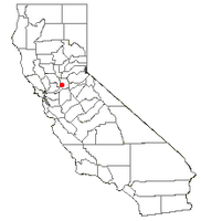
Laguna Creek, Elk Grove, California | |
---|---|
Coordinates: 38°25′26″N121°25′39″W / 38.42389°N 121.42750°W | |
Country | United States |
State | California |
County | Sacramento |
City | Elk Grove |
Area | |
• Total | 6.7 sq mi (17 km2) |
• Land | 6.7 sq mi (17 km2) |
• Water | 0.0 sq mi (0 km2) |
Elevation | 30 ft (9 m) |
Population (2000) | |
• Total | 34,309 |
• Density | 5,100/sq mi (2,000/km2) |
Time zone | UTC-8 (PST) |
• Summer (DST) | UTC-7 (PDT) |
ZIP code | 95757/95758 |
Area code(s) | 916, 279 |
FIPS code | 06-39173 |
GNIS feature ID | 1867033 |
Laguna Creek is a former census-designated place (CDP) in Sacramento County, California, United States. [1] It is now part of the incorporated City of Elk Grove.
Laguna Creek is located at 38°25′26″N121°25′39″W / 38.42389°N 121.42750°W (38.423872, -121.427421). [2]
According to the United States Census Bureau, the CDP has a total area of 6.8 square miles (18 km2), all of it land.
As of the census [3] of 2000, there were 34,309 people, 11,314 households, and 9,153 families residing in the CDP. The population density was 5,087.1 inhabitants per square mile (1,964.1/km2). There were 11,610 housing units at an average density of 1,721.5 per square mile (664.7/km2). The racial makeup of the CDP was 59.10% White, 9.70% African American, 0.66% Native American, 17.99% Asian, 0.36% Pacific Islander, 5.48% from other races, and 6.71% from two or more races. Hispanic or Latino of any race were 14.53% of the population.
There were 11,314 households, out of which 52.0% had children under the age of 18 living with them, 64.8% were married couples living together, 11.8% had a female householder with no husband present, and 19.1% were non-families. 14.6% of all households were made up of individuals, and 1.9% had someone living alone who was 65 years of age or older. The average household size was 3.03 and the average family size was 3.38.
In the CDP, the population was spread out, with 33.8% under the age of 18, 5.9% from 18 to 24, 37.8% from 25 to 44, 17.8% from 45 to 64, and 4.6% who were 65 years of age or older. The median age was 32 years. For every 100 females, there were 94.8 males. For every 100 females age 18 and over, there were 89.4 males.
The median income for a household in the CDP was $67,447, and the median income for a family was $70,804. Males had a median income of $51,604 versus $40,895 for females. The per capita income for the CDP was $25,280. About 3.4% of families and 4.3% of the population were below the poverty line, including 4.6% of those under age 18 and 5.7% of those age 65 or over.
In the state legislature, Laguna Creek is in the 8th Senate Districts. The eighth is represented by Democrat Senator Angelique V. Ashby respectively, and in the 10th Assembly District, represented by Democrat Assemblymember Stephanie Nguyen.
Federally, Laguna Creek is in California's 7th congressional district , represented by Democrat Doris Matsui. [4]
Arbuckle is a census-designated place (CDP) in Colusa County, California, United States. The population was 3,028 at the 2010 census, up from 2,332 at the 2000 census. Arbuckle is situated in the southerly portion of Colusa County, approximately 20 miles (32 km) southwest of the City of Colusa, the county seat. The town is characterized by single-family residences, multiple-family units, some mobile homes, and commercial activities. Land surrounding Arbuckle is agriculture including cultivated annual crops, and both active and unmaintained orchards. Various almond hullers may be found near the area. Regional access is provided by the north–south running Interstate 5, along with Old Highway 99 West running alongside Interstate 5.
Bertsch–Oceanview is a census-designated place (CDP) in Del Norte County, California, United States. The community is located east of Crescent City, at an elevation of 20 feet (6.1 m), Bertsch–Oceanview has a total area of 5.9 square miles (15 km2) of which 5.5 square miles (14 km2) is land and 0.3 square miles (0.78 km2) is water. Its population is 2,520 as of the 2020 census, up from 2,436 from the 2010 census. The Elk Valley Rancheria Indian reservation is located within Bertsch–Oceanview.
Dixon Lane-Meadow Creek is a census-designated place (CDP) in Inyo County, California, United States. The population was 2,645 at the 2010 census, down from 2,702 at the 2000 census.
Mayflower Village is a census-designated place (CDP) in the San Gabriel Valley, in Los Angeles County, California, United States. The population was 5,515 at the 2010 census, up from 5,081 at the 2000 census. The ZIP Codes serving the community are 91006, which is served by Arcadia and 91016, which is served by Monrovia.
Florin is a census-designated place (CDP) in Sacramento County, California, United States. It is part of the Sacramento–Roseville–Folsom Metropolitan Statistical Area. The population was 52,388 at the 2020 census, up from 47,513 at the 2010 census and 27,653 at the 2000 census.
La Riviera is a census-designated place (CDP) in Sacramento County, California, United States. It is part of the Sacramento–Arden-Arcade–Roseville Metropolitan Statistical Area. The population was 10,802 at the 2010 census, up from 10,273 at the 2000 census. La Riviera is a primarily residential neighborhood located between the American River on the North side and Highway 50 on the southern border.
Laguna West-Lakeside is an area located on the west side of the city of Elk Grove in Sacramento County, California. Formally a census-designated place (CDP), Laguna West-Lakeside was annexed by Elk Grove in 2003. The population of Laguna West-Lakeside was 8,414 at the 2000 census, before annexation.
North Highlands is a census-designated place (CDP) in Sacramento County, California, United States. It is part of the Sacramento–Arden-Arcade–Roseville Metropolitan Statistical Area. The population was 42,694 at the 2010 census, down from 44,187 at the 2000 census.
Wilton is a census-designated place (CDP) in Sacramento County, California, United States. It is part of the Sacramento–Arden-Arcade–Roseville Metropolitan Statistical Area. The population was 5,363 at the 2010 census, up from 4,551 at the 2000 census.
Midtown San Jose is a mixed commercial and residential district of San Jose, California, to the southwest of Downtown San Jose and east of West San Carlos.
Amesti is a census-designated place (CDP) in Santa Cruz County, California, United States. The population was 2,637 as of the 2020 United States census.
Aptos Hills-Larkin Valley is an unincorporated community in Santa Cruz County, California, United States. It is identified as one of several small communities with a combined population of 24,402 forming the unincorporated town of Aptos by the local Chamber of Commerce along with:
Corralitos is a census-designated place (CDP) in Santa Cruz County, California, United States. It is a rural area known for its agriculture of apples and strawberries, and its notable Corralitos Market and Sausage Co. Moreover, its location near the Pacific Ocean optimizes viticulture.
Day Valley is a census-designated place (CDP) in Santa Cruz County, California, United States. The population was 3,409 at the 2010 census.
Soquel is an unincorporated town and census-designated place (CDP) in Santa Cruz County, California, located on the northern coast of Monterey Bay. The population was 9,980 at the 2020 census.
Bret Harte is a census-designated place (CDP) in Stanislaus County, California, United States. The population was 5,152 at the 2010 census, down from 5,161 at the 2000 census. It is part of the Modesto Metropolitan Statistical Area. It is named for the American poet and short story writer, Bret Harte, best known for his writings about the California Gold Rush.
Westley is a census-designated place (CDP) in Stanislaus County, California. The population was 603 at the 2010 census, down from 747 at the 2000 census. It is part of the Modesto Metropolitan Statistical Area.
Lemon Cove is a census-designated place (CDP) in the San Joaquin Valley in Tulare County, California, United States. The population was 308 at the 2010 census, up from 298 at the 2000 census.
North Woodbridge was a former census-designated place (CDP) in San Joaquin County, California, United States. The population was 1,320 at the 2000 census. For the 2010 census, the CDP's of South Woodbridge and North Woodbridge were merged into Woodbridge.
Montgomery Creek is a census-designated place in Shasta County, California, United States. Its population is 176 as of the 2020 census, up from 163 from the 2010 census. The town and associated creek were named after Zachariah Montgomery.