
The John Trumbull Birthplace, also known as the Governor Jonathan Trumbull House, is a historic house museum on the Lebanon Green in Lebanon, Connecticut, built in 1735 by Joseph Trumbull as a wedding present for his son Jonathan (1710–1785). The house was a center of political and military strategy during the American Revolutionary War, when Jonathan Trumbull was Governor of Connecticut. It was also the birthplace of John Trumbull (1756–1843), an artist known for his depictions of the war and its people. The house was designated a National Historic Landmark in 1965.
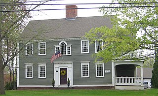
The Main Street Historic District in Cromwell, Connecticut is roughly bounded by Nooks Hill Rd., Prospect Hill Rd., Wall and West Sts. and New Ln., and Stevens Ln. and Main St.

The Danielson Main Street Historic District encompasses the historic late 19th-century commercial business district of the borough of Danielson in the town of Killingly, Connecticut. It extends along Main Street, between the Five Mile River and Spring Street, including a few buildings on adjacent side streets, representing the area's growth as a commercial and civic center in the late 19th and early 20th centuries. It was listed on the National Register of Historic Places in 1992.

The Colchester Village Historic District encompasses most of the historic village center of Colchester, Connecticut. It is located at the junction of Route 16, Route 85, and Norwich Avenue. Roughly, the district extends to the northwest along Broadway Street as far as Jaffe Terrace; east along Norwich Avenue to just short of Pleasant Street; south along South Main Street to just north of Hall Hill Road; west along Linwood Avenue to just east of Kmick Lane. The historic district was listed on the National Register of Historic Places (NRHP) in 1994.

Columbia Green Historic District is a historic district that includes the town green, Columbia Green, of the town of Columbia, Connecticut, United States. The district includes buildings around the green and extending northwest along Route 87. The district was listed on the National Register of Historic Places in 1990. It comprises 43 buildings, 2 sites, and 1 object that contribute to the historical significance of the area.
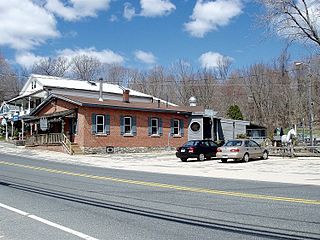
The South Coventry Historic District is a historic district encompassing the historic village center of South Coventry in the town of Coventry, Connecticut. The village, settled in the early 18th century, has served as Coventry's civic center, and also served as an economic center, with textile mills operating in the 19th century. The district was listed on the National Register of Historic Places in 1991.
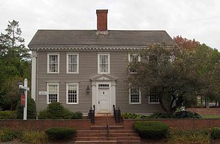
The Simsbury Center Historic District is a 75-acre (30 ha) historic district located in the town center area of Simsbury, Connecticut. It encompasses seven blocks of Hopmeadow Street, as well as the cluster of commercial, civic, and residential buildings along Railroad, Station, and Wilcox Streets, and Phelps Lane. Although its oldest element is the cemetery, most of its buildings were built in the late 19th and early 20th century. It was listed on the National Register of Historic Places in 1996.

The Fairfield Historic District encompasses the historic town center of Fairfield, Connecticut, roughly along Old Post Road between U.S. Route 1 and Turney Road. The area contains Fairfield's town hall, public library, and houses dating from the late 18th century, and includes portions of the town's earliest colonial settlement area. The district was listed on the National Register of Historic Places in 1971.
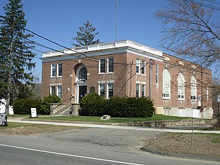
The Northfield Main Street Historic District is a historic district located along the full length of Main Street from Millers Brook to Pauchaug Brook in Northfield, Massachusetts. The district encompasses the part of Main Street that was laid out when Northfield was first established in the 17th century. The area has retained many of its traditional lot divisions, and features civic and residential construction from the 18th to the 20th centuries. The district was listed on the National Register of Historic Places in 1982.

The Torringford Street Historic District is a historic district on the east side of the city of Torrington, Connecticut. The district includes properties along Torringford Street, the main thoroughfare of the Torringford section of the city, between United States Route 202 and West Hill Road. The road is one of the oldest in Torrington, and this section is notable for containing a cross-section of well-preserved architecture from the 18th to the mid-20th centuries. The district was listed on the National Register of Historic Places in 1991.

The Hollis Village Historic District encompasses the historic village center of Hollis, New Hampshire. The district is centered on Monument Square, which connects Main Street to Depot Street and Broad Street. It covers about 400 acres (160 ha), and extends along all three of those roads for some distance, and includes properties on Silver Lake Road and Ash Street. Most of the buildings in the district are residential or agricultural in use, and date before the turn of the 20th century; the oldest buildings date to the mid-18th century. The "Always Ready Engine House", which occupies a triangular parcel at the western end of Monument Square, was built in 1859, and is the town's oldest municipal building. Its most architecturally sophisticated building is the town hall, built in 1887 to a design by William M. Butterfield of Manchester. The district represents the growth of a mainly agricultural community over a 200-year period. The district was listed on the National Register of Historic Places in 2001.

The War Office, also once known as the Capt. Joseph Trumble Store and Office, is a historic commercial building on the Lebanon Green in Lebanon, Connecticut, built about 1732 as a commercial building. It is most significant as the place from which Governor Jonathan Trumbull conducted military business during the American Revolutionary War. It is now part of the museum property managed by the Connecticut Society of the Sons of the American Revolution that also includes the Trumbull House and the Wadsworth Stables. The building was listed on the National Register of Historic Places in 1970.
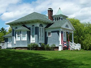
The Somers Historic District encompasses the historic civic and social center of the town of Somers, Connecticut. It stretches along Main Street, with extensions along Springfield Road and Battle Street, and includes a significant number of vernacular Federal and Greek Revival houses. It includes the town's early churches, as well as important civic buildings, including the town hall and library. The district was listed on the National Register of Historic Places in 1982.

Hebron Center Historic District encompasses most of the historic village center of Hebron, Connecticut. Centered on the junction of Connecticut Routes 66 and 85, it has served as the rural community's civic center since its incorporation in 1708. The district was listed on the National Register of Historic Places in 1993.

The Haverhill Corner Historic District encompasses the early civic center of Haverhill, New Hampshire, United States. The district is focused on the junction of New Hampshire Route 10 and Court Street, which was historically a major through route. Court Street is flanked at the junction by a pair of large grassy common areas which are bounded by School Street and Route 10. Buildings, predominantly Federal in character and built in the late 18th and early 19th centuries, are arrayed around these commons, and historic buildings line Route 10 and Court Street for a short distance away from the commons. Prominent buildings in the district include the 1827 Federal-style First Congregational Church, the 1840 former courthouse that now houses the public library and local historical society, and the Romanesque Revival 1897 Haverhill Academy Junior High School building. The area declined in importance after the railroad bypassed it, resulting in the gradual relocation of civic functions to the Woodsville area. The district was listed on the National Register of Historic Places in 1987.

Roxbury Center is the central village of Roxbury, Connecticut. Centered at the junction of Connecticut Routes 67 and 317, it has been the center of town civic life since the mid-18th century. The village was listed on the National Register of Historic Places in 1983.

The Sharon Historic District encompasses the historic civic center of Sharon, Connecticut. Centered around a mile-long town green are an array of public civic and religious buildings, as well as residences from the 18th to 20th centuries. The area south of the green on South Main Street is lined with country houses developed or improved in the late 19th and early 20th centuries, representing one of the highest concentrations of Colonial Revival estates in the state. The district was listed on the National Register of Historic Places in 1993.

The Broad Street Green Historic District encompasses the historic late-19th century town center of Windsor, Connecticut. It is centered around the Broad Street Green, a public park extending on the east side of Broad Street between Union and Batchelder Streets, and includes a diversity of architecture spanning much of the town's long history. It was listed on the National Register of Historic Places in 1999.

The Westbrook Town Center Historic District encompasses the historic town center of Westbrook, Connecticut. Roughly linear in shape, the district extends along the Boston Post Road, with its focal center at the junction with Essex Road. The area has been a center of civic activity since the early 18th century, even though Westbrook was not incorporated until 1840, and has residential, commercial, civic, and religious architecture covering three centuries. The district was listed on the National Register of Historic Places in 2017.

The Naugatuck Center Historic District encompasses the historic civic and business center of Naugatuck, Connecticut. Centered around the town green, the district includes churches, schools and municipal buildings, many from the late 19th or early 20th centuries, as well as a diversity of residential architecture. The district was listed on the National Register of Historic Places in 1999.


