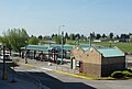
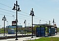
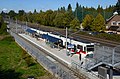
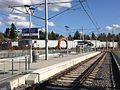
List of MAX Light Rail stations

Last updated
Goose Hollow station with train arriving, February 2018.JPG
Westbound train at Washington Park station, February 2018.JPG
Goose Hollow/Southwest Jefferson Street station and Washington Park station: in-ground and underground, as well as island and split-platform, respectively. Both stations serve the Blue and Red Lines.

Metropolitan Area Express (MAX) is a light rail transit system serving the Portland metropolitan area, Oregon, United States. [1] The system is operated by TriMet, a public agency that operates public transit in the Portland area. Serving an average of 130,000 passengers a day (in Fiscal Year 2012), [2] MAX Light Rail is one of the largest light rail systems in the United States in terms of ridership. [3]

Contents

The MAX system currently consists of five lines, each designated by a color.

      Blue Line: HillsboroCity CenterGresham [4]
      Green Line: Clackamas – City Center – Portland State University [5]
      Orange Line: Union Station – City Center – Portland State University – Milwaukie [6]
      Red Line: Portland International Airport – City Center – Hillsboro Airport/Fairgrounds station [7]
      Yellow Line: Expo Center – City Center – Portland State University [8]

MAX Light Rail began service on September 5, 1986 with the opening of the original segment from Downtown Portland to Gresham. [9] An extension westward to Beaverton and Hillsboro opened in 1998. [10] The resulting 33-mile east-west line has always been operated as a single through route, and it became known as the Blue Line in 2001, after TriMet adopted color designations for its separate light rail routes after the Red Line opened to the airport. [11] The Yellow Line branch to the Expo Center opened in 2004. [12] In 2009, the Green Line opened, serving the Portland Transit Mall (along with the rerouted Yellow Line) and the new I-205 branch to Clackamas.

The system currently has a total of 97 stations, with 3 scheduled to close in March 2020. Fifty-one stations are served by the Blue Line, 28 stations by the Green Line, 17 by the Orange Line, 29 by the Red Line, and 17 by the Yellow Line, with 39 stations served by two or more lines and 8 by three. All trains connect at Pioneer Courthouse Square.

Since 2012, there is a flat fare for the entire TriMet system. Prior to 2012, fares on the MAX system were zonal (i.e. distance-based), the same as on TriMet's bus service. [13] The center of downtown was called Fareless Square (later the "Free Rail Zone") and included the area from the Library and Galleria stations to the Old Town/Chinatown Station. This was later expanded across the Steel Bridge into the Lloyd District as far as the Lloyd Center/NE 11th Ave station, and the Interstate/Rose Quarter station. When the Portland Transit Mall was remodeled in 2009 to accommodate light rail, all stations on the transit mall were included as part of Fareless Square. Moving out from the center of downtown, Zone 1 included the Albina/Mississippi station on the Yellow Line, and from Providence Park to Washington Park on the Red and Blue lines. Zone 2 consisted of the rest of the Yellow Line (from Overlook Park to the Expo Center) as well as the three stations next to Interstate 84 (Hollywood/NE 42nd, NE 60th, and NE 82nd). Zone 3 consisted of all other MAX stations, including all stations in Washington County and all stations beyond the Gateway/NE 99th Avenue Transit Center.

Stations

Terminals
<Westbound/southbound-only stations
>Eastbound/northbound-only stations

(Transit connections in italics are not part of the TriMet system)

StationLine(s)Transit connectionsYear openedPark and rideImage
Albina/Mississippi 35-Macadam/Greeley [14]
85-Swan Island [15]
2004No Albina MAX station.jpg
Beaverton Central 1998No Beaverton Central MAX station - Beaverton, Oregon.JPG
Beaverton Creek 1998Yes: 417 spaces Shelter at Beaverton Creek station, February 2018.JPG
Beaverton Transit Center20-Burnside/Stark [16]
42-Denny/Hall [17]
52-Farmington/185th [18]
53-Arctic/Allen [19]
54-Beaverton-Hillsdale Hwy [20]
57-TV Hwy/Forest Grove [21]
58-Canyon Rd [22]
61-Marquam Hill/Beaverton [23]
76-Beaverton/Tualatin [24]
78-Beaverton/Lake Oswego [25]
88-Hart/198th [26]
WES Commuter Rail
1998No Beaverton Transit Center - Oregon.jpg
Cascades 2007No Cascades MAX stop looking east - Portland, Oregon.JPG
City Hall/SW 5th & Jefferson Street < Transit Mall 2009No City Hall SW 5th & Jefferson SB MAX station - Portland, Oregon.JPG
Civic Drive 2010No Civic Drive MAX station - Gresham, Oregon.jpg
Clackamas Town Center Transit Center [27] 29-Lake/Webster Rd
30-Estacada
33-McLoughlin/King Rd
34-Linwood/River Rd
71-60th Ave
72-Killingsworth/82nd Ave
79-Clackamas/Oregon City
152-Milwaukie
155-Sunnyside
156-Mather Rd
2009Yes: 750 spaces Clackamas Town Ctr TC MAX stn viewed from P&R garage.jpg
Cleveland Avenue1986Yes: 392 spaces 2011-09-18 Central Oregon Breeze and Valley Retriever 142 (6193385050).jpg
Clinton Street/SE 12th Avenue [28] 9-Powell Blvd
17-Holgate/Broadway
70-12th/NE 33rd Ave
2015No SE Clinton St & 12th Ave MAX Station.jpg
Convention Center 6-Martin Luther King Jr Blvd [29] 1990No Convention Center MAX station.jpg
Delta Park/Vanport 6-Martin Luther King Jr Blvd (southbound only) [30]
C-Tran:
60-Delta Park Regional
[31]
2004Yes: 304 spaces Delta Park MAX station.jpg
East 102nd Avenue 15-Belmont/NW 23rd [32]
20-Burnside/Stark [16]
1986No East 102nd Avenue MAX station.jpg
East 122nd Avenue 73-122nd Ave [33] 1986Yes: 612 spaces East 122nd Ave MAX station, westbound platform.jpg
East 148th Avenue 1986No East 148th Ave MAX station, westbound platform.jpg
East 162nd Avenue 74-162nd Ave [34] 1986No MAX East 162nd Avenue Station.jpg
East 172nd Avenue 1986No East 172nd Avenue MAX station.jpg
East 181st Avenue 87-Airport Way/181st [35] 1986Yes: 247 spaces MAX East 181st Avenue Station.jpg
Elmonica/SW 170th Avenue 1998Yes: 435 spaces Elmonica MAX station.JPG
Expo Center11-Rivergate/Marine Dr [36] 2004Yes: 300 spaces PortlandMAX Expo station.jpg
Galleria/SW 10th Avenue < Portland Streetcar-NS Line
Portland Streetcar-Loop Service [ citation needed ]
1986No Galleria-SW 10th Ave MAX station in June 2021.jpg
Gateway/NE 99th Avenue Transit Center (eastbound only)15-Belmont/NW 23rd [32]
19-Woodstock/Glisan [37]
22-Parkrose [38]
23-San Rafael [39]
24-Fremont [40]
25-Glisan/Rockwood [41]
87-Airport Way/181st [35]
Columbia Area Transit:
Portland Intercity Route
[42]
1986Yes: 690 spaces Gateway Transit Center - Portland, Oregon.JPG
Gateway North <2024No Gateway North MAX station on its first day of service, March 2024.jpg
Goose Hollow/SW Jefferson Street 6-Martin Luther King Jr Blvd [29]
58-Canyon Rd [22]
68-Marquam Hill/Collins Circle [43]
1998No Goose Hollow MAX station.jpg
Gresham Central Transit Center FX2-Division [44]
9-Powell Blvd [45]
20-Burnside/Stark [16]
21-Sandy Blvd/223rd [46]
80-Kane/Troutdale Rd [47]
81-Kane/257th [48]
82-South Gresham [49]
84-Powell Valley/Orient Dr [50]
Sandy Area Metro:
Gresham Express
[51]
1986Yes: 540 spaces Gresham Central TC - MAX station, from west (2011).jpg
Gresham City Hall 21-Sandy Blvd/223rd [46] 1986Yes: 417 spaces MAX Gresham City Hall Station.jpg
Hatfield Government Center1998Yes: 250 spaces Hatfield Government Center Station.JPG
Hawthorn Farm 1998No MAX Hawthorn Farm.jpg
Hillsboro Airport/Fairgrounds (formerly Fair Complex/Hillsboro Airport)46-North Hillsboro [52] 1998Yes: 396 spaces MAX Fair Complex Airport.jpg
Hillsboro Central/SE 3rd Avenue Transit Center 46-North Hillsboro [52]
47-Main/Evergreen [53]
48-Cornell [54]
57-TV Hwy/Forest Grove [21]
Yamhill County Transit Area:
33-McMinnville-Hillsboro
[55]
1998No Hillsboro Central MAX station south.JPG
Hillsboro Health District (formerly Tuality Hospital/SE 8th Avenue)1998No Tuality Hospital-Southeast 8th Avenue MAX station.JPG
Hollywood/NE 42nd Avenue (formerly Hollywood/NE 42nd Avenue Transit Center)66-Marquam Hill/Hollywood [56]
75-Cesar Chavez/Lombard [57]
77-Broadway/Halsey [58]
1986No Hollywood MAX station.jpg
Interstate/Rose Quarter 35-Macadam/Greeley [14] 2004No Interstate Rose Quarter MAX station - Portland, Oregon.JPG
Kenton/North Denver Avenue 2004No Kenton MAX station.jpg
Kings Hill/SW Salmon Street (closed 2020)51-Vista [59]
63-Washington Park/Arlington Hts [60]
1997No Kings Hill-Salmon MAX stn with "Station Closed" signs, March 2020.jpg
Lents Town Center/SE Foster Road 10-Harold St [61]
14-Hawthorne [62]
73-122nd Ave
2009No Green Line train at Lents Town Center station, June 2010.jpg
Library/SW 9th Avenue > Portland Streetcar-NS Line
Portland Streetcar-Loop Service [ citation needed ]
1986No Library SW 9th Ave MAX station - Portland, Oregon.JPG
Lincoln Street/SW 3rd Avenue [63] 9-Powell Blvd
17-Holgate/Broadway
2015No SW Lincoln & 3rd Ave MAX Station2.jpg
Lloyd Center/NE 11th Avenue 70-12th/NE 33rd Ave [64]
C-Tran:
157-Lloyd District Express
[65]
1986No Lloyd Center MAX station.jpg
Mall/SW 4th Avenue > (closed 2020) Transit Mall 1990No SW 4th Avenue MAX station.jpg
Mall/SW 5th Avenue < (closed 2020) Transit Mall 1990No Mall SW 5th MAX station - Portland, Oregon.JPG
Merlo Road/SW 158th Avenue 67-Bethany/158th [66] 1998No WestsideMaxMerlo158thStation.jpg
Millikan Way 62-Murray Blvd [67]
1998Yes: 400 spaces MAX Millikan Way.jpg
Milwaukie/Main Street [68] 29-Lake/Webster Rd
32-Oatfield
33-McLoughlin
34-River Rd
2015No Milwaukie SE Main Street MAX station.jpg
Morrison/SW 3rd Avenue <1986No Morrison SW 3rd Ave MAX station - Portland, Oregon.JPG
Mount Hood Avenue 2001No Mt Hood Avenue MAX stop looking east - Portland, Oregon.JPG
North Killingsworth Street 72-Killingsworth/82nd Ave [69] 2004No Killingsworth MAX station.jpg
North Lombard Transit Center 4-Fessenden [70]
75-Cesar Chavez/Lombard [57]
2004No Lombard MAX station.jpg
North Prescott Street 2004No Prescott Street MAX station.JPG
NE 7th Avenue Portland Streetcar-Loop Service 1986No Northeast 7th Avenue MAX station.jpg
NE 60th Avenue 71-60th Ave [71] 1986No 60th Avenue MAX.jpg
NE 82nd Avenue 72-Killingsworth/82nd Ave [69]
77-Broadway/Halsey [58]
1986No Northeast 82nd Avenue MAX station.jpg
NW 5th & Couch Street < Transit Mall 2009No NW 5th & Couch SB MAX station - Portland, Oregon.JPG
NW 6th & Davis Street > Transit Mall 2009No NW 6th & Davis NB MAX station - Portland, Oregon.JPG
Oak Street/SW 1st Avenue 16-Front Ave/St Helens Rd1986No Oak Street and SW 1st MAX stop - Portland, Oregon.JPG
Old Town/Chinatown 4-Fessenden
8-Jackson Park/NE 15th
16-Front Ave/St Helens Rd
35-Macadam/Greeley
44-Capitol Hwy/Mocks Crest
77-Broadway/Halsey
1986No Old Town Chinatown MAX stop - Portland, Oregon.JPG
OMSI/SE Water [72] 9-Powell Blvd
17-Holgate/Broadway
Portland Streetcar-Loop Service
2015No OMSI & Water MAX Station.jpg
Orenco (formerly Orenco/NW 231st Avenue)47-Main/Evergreen [53] 1998Yes: 180 spaces Shelter at Orenco Station MAX stop - Hillsboro, Oregon.JPG
Overlook Park 2004No Overlook Park MAX station.jpg
Parkrose/Sumner Transit Center 12-Barbur/Sandy Blvd [73]
21-Sandy Blvd/223rd [46]
71-60th Ave [71]
73-122nd Ave
C-Tran:
65-Parkrose Regional
[74]
2001Yes: 193 spaces Parkrose Sumner TC MAX Station.jpg
Pioneer Courthouse/SW 6th > Transit Mall 2009No Pioneer Courthouse SW 6th MAX station - Portland, Oregon.JPG
Pioneer Place/SW 5th < Transit Mall 2009No Pioneer Place SW 5th SB MAX station - Portland, Oregon.JPG
Pioneer Square North < Transit Mall 1986No Pioneer Square MAX station north - Portland, Oregon.JPG
Pioneer Square South > Transit Mall 1986No Pioneer Square South MAX station.jpg
Portland Airport2001No Airport MAX station from terminal - Portland, Oregon.JPG
Providence Park 15-Belmont/NW 23rd [32]
18-Hillside [75]
51-Vista [59]
63-Washington Park/Arlington Hts [60]
1997No MaxatPGEPark.jpg
PSU South/SW 5th & Jackson Street < Transit Mall 2012No
PSU South/SW 6th & College Street > Transit Mall 2012No PSU South - 6th & College MAX station, in Portland, Oregon.jpg
PSU Urban Center/SW 5th & Mill Street < Transit Mall
Portland Streetcar-NS Line
Portland Streetcar-Loop Service
2009No PSU Urban Center SW 5th and Mill MAX station - Portland, Oregon.JPG
PSU Urban Center/SW 6th & Montgomery Street > Transit Mall
Portland Streetcar-NS Line
Portland Streetcar-Loop Service
2009No
Quatama (formerly Quatama/NW 205th Avenue)1998Yes: 310 spaces MAX Quatama station.jpg
Rockwood/East 188th Avenue 25-Glisan/Rockwood
87-Airport Way/181st
1986No MAX Rockwood Station.jpg
Rosa Parks 44-Capitol Hwy/Mocks Crest [76] 2004No Rosa Parks MAX station.JPG
Rose Quarter Transit Center 4-Fessenden [70]
8-Jackson Park/NE 15th [77]
35-Macadam/Greeley [14]
44-Capitol Hwy/Mocks Crest [76]
77-Broadway/Halsey [58]
85-Swan Island [15]
1986No Rose Quarter MAX station.jpg
Ruby Junction/East 197th Avenue 1986No Ruby Junction East 197 Avenue MAX Station.jpg
SE 17th Avenue & Holgate Boulevard [78] 17-Holgate/Broadway
70-12th/NE 33rd Ave
2015No MAX at SE 17th and Holgate, 2015.jpg
SE 17th Avenue & Rhine Street [79] 17-Holgate/Broadway
70-12th/NE 33rd Ave
2015No SE 17th & Rhine St MAX Station.jpg
SE Bybee Boulevard [80] 19-Woodstock/Glisan2015No SE Bybee Blvd MAX station with northbound train, viewed from Bybee Bridge (2019).jpg
SE Division Street FX2-Division [44] 2009No SE Division Street MAX Station with SB.jpg
SE Flavel Street 19-Woodstock/Glisan [37] 2009No SE Flavel Street MAX station with SB train.jpg
SE Fuller Road 2009Yes: 630 spaces SE Fuller Road MAX station with SB train.jpg
SE Holgate Boulevard 17-Holgate/Broadway [81] 2009Yes: 125 spaces MAX Green HolgateBlvd.jpg
SE Main Street 15-Belmont/NW 23rd [32] 2009Yes: 420 spaces SE Main St MAX station - Portland, Oregon.jpg
SE Park Avenue [82] 33-McLoughlin
99-McLoughlin Express
2015Yes: 401 spaces Two Trains at SE Park Ave Station.jpg
SE Powell Boulevard 9-Powell Blvd [45] 2009Yes: 391 spaces Powell Blvd MAX station with SB train.jpg
SE Tacoma/Johnson Creek [83] 34-River Rd
99-McLoughlin Express
2015Yes: 318 spaces SE Tacoma & Johnson Creek MAX Station.jpg
Skidmore Fountain 12-Barbur/Sandy Blvd [73]
19-Woodstock/Glisan [37]
20-Burnside/Stark [16]
1986No SaturdayMarketPortland.jpg
South Waterfront/South Moody [84] 9-Powell Blvd
17-Holgate/Broadway
35-Macadam/Greeley
36-South Shore
Portland Streetcar-NS Line
Portland Streetcar-Loop Service
2015No South Waterfront SW Moody MAX Station SB Train.jpg
SW 5th & Oak Street < Transit Mall 2009No SW 5th & Oak SB MAX station - Portland, Oregon.JPG
SW 6th & Madison Street > Transit Mall 2009No SW 6th and Madison MAX station - Portland, Oregon.JPG
SW 6th & Pine Street > Transit Mall 2009No SW 6th & Pine MAX stop NB - Portland, Oregon.JPG
Sunset Transit Center 20-Burnside/Stark [16]
48-Cornell [54]
59-Walker/Park Way [85]
62-Murray Blvd [67]
The Wave:
5-Tillamook-Portland
[86]
1998Yes: 622 spaces Sunset Transit Center - Beaverton, Oregon.jpg
Union Station/NW 5th & Glisan Street < Transit Mall
Amtrak & Greyhound Lines
The Wave:
5-Tillamook-Portland
[86]
2009No Union Station NW 5th & Glisan SB MAX station - Portland, Oregon.JPG
Union Station/NW 6th & Hoyt Street > Transit Mall
Amtrak & Greyhound Lines
The Wave:
5-Tillamook-Portland
[86]
2009No Union Station NW 6th & Hoyt NB MAX station - Portland, Oregon.JPG
Washington Park 63-Washington Park/Arlington Hts [60] 1998No Washington park MAX-Stn1.jpg
Washington/SE 12th Avenue 47-Main/Evergreen [53] 1998No Washington 12th MAX station - Hillsboro, Oregon.JPG
Willow Creek/SW 185th Avenue Transit Center 52-Farmington/185th [18]
59-Walker/Park Way [85]
88-Hart/198th [26]
Columbia County Rider:
2-PCC Rock Creek [87]
6-Nehalem Valley [88]
1998Yes: 595 spaces MAX Hillsboro 185th station platform.JPG
Yamhill District >1986No MAX Yamhill District eastbound.JPG

Related Research Articles

<span class="mw-page-title-main">Beaverton, Oregon</span> City in Oregon, United States

Beaverton is a city in the Tualatin Valley, located in Washington County in the U.S. state of Oregon, with a small portion bordering Portland. The city is among the main cities that make up the Portland metropolitan area. Its population was 97,494 at the 2020 census, making it the second most populous city in the county and the seventh-most populous city in Oregon. Beaverton is an economic center for Washington County along with neighboring Hillsboro.

<span class="mw-page-title-main">MAX Light Rail</span> Light rail system serving Portland, Oregon

The Metropolitan Area Express (MAX) is a light rail system serving the Portland metropolitan area in the U.S. state of Oregon. Owned and operated by TriMet, it consists of five lines connecting the six sections of Portland; the communities of Beaverton, Clackamas, Gresham, Hillsboro, Milwaukie, and Oak Grove; and Portland International Airport to Portland City Center. Trains run seven days a week with headways of between 30 minutes off-peak and three minutes during rush hours. In 2019, MAX had an average daily ridership of 120,900, or 38.8 million annually. Due to the COVID-19 pandemic, which impacted public transit use globally, annual ridership plummeted, with only 14.8 million riders recorded in 2021.

<span class="mw-page-title-main">TriMet</span> Oregon government-owned corporation responsible for public transit in the Portland area

The Tri-County Metropolitan Transportation District of Oregon (TriMet) is a transit agency that serves most of the Oregon part of the Portland metropolitan area. Created in 1969 by the Oregon legislature, the district replaced five private bus companies that operated in the three counties: Multnomah, Washington, and Clackamas. TriMet began operating a light rail system, MAX, in 1986, which has since been expanded to five lines that now cover 59.7 miles (96.1 km). It also operates the WES Commuter Rail line since 2009. It also provides the operators and maintenance personnel for the city of Portland-owned Portland Streetcar system. In 2023, the system had a ridership of 62,055,600, or about 196,000 per weekday as of the first quarter of 2024.

<span class="mw-page-title-main">MAX Blue Line</span> Light rail line in Portland, Oregon

The MAX Blue Line is a light rail line serving the Portland metropolitan area in the U.S. state of Oregon. Operated by TriMet as part of the MAX Light Rail system, it connects Hillsboro, Beaverton, Portland, and Gresham. The Blue Line is the longest in the network; it travels approximately 33 miles (53 km) and serves 48 stations from Hatfield Government Center to Cleveland Avenue. It is the busiest of the five MAX lines, having carried an average 55,370 riders each day on weekdays in September 2018. Service runs for 2212 hours per day from Monday to Thursday, with headways of between 30 minutes off-peak and five minutes during rush hour. It runs later in the evening on Fridays and Saturdays and ends earlier on Sundays.

<span class="mw-page-title-main">MAX Red Line</span> Light rail line in Portland, Oregon

The MAX Red Line is a light rail line serving the Portland metropolitan area in the U.S. state of Oregon. Operated by TriMet as part of the MAX Light Rail system, it is an airport rail link connecting Hillsboro, Beaverton, Portland City Center, and Northeast Portland to Portland International Airport. The Red Line serves 37 stations; it interlines with the Blue Line and partially with the Green Line from Hillsboro Airport/Fairgrounds station to Gateway/Northeast 99th Avenue Transit Center and then branches off to Portland Airport station. Service runs for 22 hours per day with headways of up to 15 minutes. The Red Line carried an average 10,310 passengers per weekday in September 2021, the second-busiest after the Blue Line.

<span class="mw-page-title-main">Gresham Central Transit Center</span> Transit center and MAX light rail station in Gresham, Oregon, U.S.

The Gresham Central Transit Center, also known as Gresham Transit Center, is a TriMet transit center and MAX light rail station in Gresham, Oregon, United States. The center is a connection point for several bus routes and the MAX Blue Line. The light rail station is the 25th stop eastbound on the eastside MAX line, which was the Portland metropolitan area's first light rail line.

<span class="mw-page-title-main">Mall/Southwest 4th Avenue and Mall/Southwest 5th Avenue stations</span> Light rail stations in Portland, US

Mall/Southwest 4th Avenue and Mall/Southwest 5th Avenue were a pair of light rail stations in Portland, Oregon, United States, served by TriMet as part of the MAX Light Rail system. Built into the sidewalk at Southwest Yamhill and Morrison streets between 4th and 5th avenues in downtown Portland, the Mall stations were served by the Blue and Red lines upon closing. They had also been served by the Yellow Line from May 2004 to August 2009.

<span class="mw-page-title-main">Washington Park station (TriMet)</span> Light rail station in Portland, Oregon, US

Washington Park is a light rail station in Portland, Oregon, United States, served by TriMet as part of the MAX Light Rail system. Situated between Sunset Transit Center and Goose Hollow/Southwest Jefferson Street station, it is the 17th and 3rd station eastbound on the Blue Line and the Red Line, respectively. The station's two tracks and island platform are part of the Robertson Tunnel beneath Portland's West Hills. Its head house and surface-level plaza occupy the middle of a parking lot surrounded by the Hoyt Arboretum, Oregon Vietnam Veterans Memorial, Oregon Zoo, and World Forestry Center. Washington Park is the only completely underground station in the MAX system. At 260 feet (79 m) below ground, it is the deepest transit station in North America and in the western hemisphere. It is also the seventh-deepest in the world.

<span class="mw-page-title-main">Library/Southwest 9th Avenue and Galleria/Southwest 10th Avenue stations</span>

Library/Southwest 9th Avenue and Galleria/Southwest 10th Avenue are light rail stops on the MAX Blue and Red Lines in Portland, Oregon. It was the original western terminus and is now the Eastside MAX line's first stop eastbound/last stop westbound in downtown.

<span class="mw-page-title-main">Pioneer Square South and Pioneer Square North stations</span> Pair of light rail stations in Portland, Oregon

Pioneer Square South and Pioneer Square North are a pair of light rail stations in Portland, Oregon, United States, served by TriMet as part of the MAX Light Rail system. Situated directly west of the Portland Transit Mall at Pioneer Courthouse Square in downtown Portland, they occupy the sidewalk on Yamhill and Morrison streets between Broadway and 6th Avenue. The stations consist of one side platform each; trains traveling eastbound stop at Pioneer Square South while trains traveling westbound stop at Pioneer Square North.

<span class="mw-page-title-main">Transportation in Portland, Oregon</span> Overview of movement of goods and passengers in Portland

Like transportation in the rest of the United States, the primary mode of local transportation in Portland, Oregon is the automobile. Metro, the metropolitan area's regional government, has a regional master plan in which transit-oriented development plays a major role. This approach, part of the new urbanism, promotes mixed-use and high-density development around light rail stops and transit centers, and the investment of the metropolitan area's share of federal tax dollars into multiple modes of transportation. In the United States, this focus is atypical in an era when automobile use led many areas to neglect their core cities in favor of development along interstate highways, in suburbs, and satellite cities.

Portland is "an international pioneer in transit orientated developments."

<span class="mw-page-title-main">Beaverton Transit Center</span> Transport hub located in Beaverton, Oregon, U.S.

Beaverton Transit Center is a multimodal transport hub in Beaverton, Oregon, United States. Owned and operated by TriMet, it is served by bus, commuter rail, and light rail. The transit center is MAX Light Rail's 15th station eastbound on the Blue Line and 11th station eastbound on the Red Line. It is also the northern terminus of WES Commuter Rail and a hub for bus routes mostly serving the westside communities of the Portland metropolitan area. Beaverton Transit Center is situated on Southwest Lombard Avenue, just north of Southwest Canyon Road in central Beaverton, connected by walkway to Canyon Place Shopping Center. It recorded 9,709 average weekday boardings for all modes in fall 2018, making it TriMet's busiest transit center.

<span class="mw-page-title-main">Willow Creek/Southwest 185th Avenue Transit Center</span> Railway station in Hillsboro, Oregon, US

Willow Creek/Southwest 185th Avenue Transit Center is a multimodal transport hub in Hillsboro, Oregon, United States. Owned and operated by TriMet, it is served by bus and light rail. The transit center is the ninth station eastbound on the Blue Line, the fifth station eastbound on the Red Line, and a hub for bus routes mostly serving Washington County in the Portland metropolitan area. It is located by the intersection of Southwest Baseline Road and 185th Avenue near the city's boundary with Beaverton.

<span class="mw-page-title-main">Orenco station (TriMet)</span> Light rail station in Hillsboro, Oregon, United States

Orenco is a light rail station in Hillsboro, Oregon, United States, served by TriMet as part of the MAX Light Rail system. It is the seventh station eastbound on the Blue Line and the third station eastbound on the Red Line, situated between the Quatama and Hawthorn Farm stations. The two-track, island platform station serves the Orenco Station neighborhood, which is considered a model for smart growth and transit-oriented development. It features a 125-space park and ride, a bike and ride, and connections to TriMet bus route 47–Baseline/Evergreen and Ride Connection's North Hillsboro Link.

<span class="mw-page-title-main">Portland Airport station</span> Light rail station in Portland, Oregon, United States

Portland Airport is a light rail station in Portland, Oregon, United States, served by TriMet as part of the MAX Light Rail system. Situated at Portland International Airport, it is the eastern terminus of the Red Line, which connects the airport, downtown Portland, and Beaverton. The station is located at the ground floor of the airport's main passenger terminal near the southern end of the arrivals hall and baggage claim area.

<span class="mw-page-title-main">MAX Orange Line</span> Light rail line in Portland, Oregon

The MAX Orange Line is a light rail line serving the Portland metropolitan area in the U.S. state of Oregon. Operated by TriMet as part of the MAX Light Rail system, it connects Portland City Center, Portland State University (PSU), Southeast Portland, Milwaukie, and Oak Grove. The line serves 17 stations and runs for 2012 hours per day with headways of up to 15 minutes. It averaged 3,480 daily weekday riders in September 2020.

<span class="mw-page-title-main">WES Commuter Rail</span> Commuter rail line in Oregon, United States

The Westside Express Service (WES) is a commuter rail line in the U.S. state of Oregon serving parts of Washington and Clackamas counties in the Portland metropolitan area. Owned by TriMet and operated by Portland & Western Railroad (P&W), the line is 14.7 miles (23.7 km) long and travels north–south from Beaverton to Wilsonville along a route just west of Oregon Highway 217 and Interstate 5 (I-5). WES consists of five stations and connects with MAX Light Rail at Beaverton Transit Center. Service operates on a 45-minute headway on weekdays during the morning and evening rush hours. In Spring 2022, WES saw a daily ridership of 420 passengers or about 109,000 riders annually.

<span class="mw-page-title-main">Robertson Tunnel</span> Train tunnel near Portland, Oregon

The Robertson Tunnel is a twin-bore light rail tunnel through the Tualatin Mountains west of Portland, Oregon, United States, used by the MAX Blue and Red Lines. The tunnel is 2.9 miles long and consists of twin 21-foot-diameter (6.4 m) tunnels. There is one station within the tunnel at Washington Park, which at 259 feet (79 m) deep is the deepest subway station in the United States and the fifth-deepest in the world. Trains are in the tunnel for about 5 minutes, which includes a stop at the Washington Park station. The tunnel has won several worldwide engineering and environmental awards. It was placed into service September 12, 1998.

<span class="mw-page-title-main">Cornell Road</span> Street in Portland and Washington County, Oregon, United States

Cornell Road is an east–west street and traffic corridor in the Portland metropolitan area, in Multnomah and Washington counties in the U.S. state of Oregon. It crosses the Tualatin Mountains between the Willamette Valley and the city of Portland on the east and the Tualatin Valley and the city of Hillsboro on the west.

Velosaurus is an outdoor 2015 concrete and painted steel sculpture by Horatio Law, installed beneath the Powell Blvd. Light Rail Overpass between the MAX Orange Line's Clinton St/SE 12th Ave and Clinton St/SE 12th Ave stations in southeast Portland, Oregon, in the United States. The piece is a series of eight bas-relief panels made of recycled bicycle and skateboard parts, arranged to appear like dinosaur skeletal remains.

References

Specific
  1. "MAX Light Rail Project History". TriMet. Archived from the original on January 7, 2010. Retrieved September 12, 2009.
  2. "June 2012 Monthly Performance Report" (PDF). TriMet. July 23, 2012. p. 1. Archived (PDF) from the original on January 8, 2021. Retrieved September 2, 2012.
  3. "TriMet Service and Ridership Information" (PDF). TriMet. October 19, 2011. Archived (PDF) from the original on January 8, 2021. Retrieved September 2, 2012.
  4. "MAX Blue Line". TriMet. Archived from the original on December 15, 2018. Retrieved November 2, 2008.
  5. "MAX Green Line". TriMet. Archived from the original on January 8, 2021. Retrieved September 12, 2009.
  6. "ORANGE LINE SCHEDULES". TriMet. Archived from the original on January 8, 2021. Retrieved September 12, 2015.
  7. "MAX Red Line". TriMet. Archived from the original on January 8, 2021. Retrieved November 2, 2008.
  8. "MAX Yellow Line". TriMet. Archived from the original on December 11, 2018. Retrieved November 2, 2008.
  9. "Eastside MAX Blue Line Project History". TriMet. Archived from the original on September 24, 2008. Retrieved November 2, 2008.
  10. "Westside MAX Blue Line Project History". TriMet. Archived from the original on September 27, 2007. Retrieved November 2, 2008.
  11. "Systems News [regular news section]". Tramways & Urban Transit . UK: Ian Allan Publishing. December 2000. p. 471. ISSN   1460-8324. With the light rail system due to expand to two services in September 2001, and three in 2004 (with all three using the same routing and stops in the city centre), Tri-Met has decided to assign route colours as follows ...
  12. "Interstate MAX Yellow Line Project History". TriMet. Archived from the original on April 17, 2009. Retrieved August 5, 2009.
  13. Bailey Jr., Everton (August 30, 2012). "TriMet boosts most fares starting Saturday; some routes changing". The Oregonian. Archived from the original on March 1, 2020. Retrieved September 2, 2012.
  14. 1 2 3 "35-Macadam/Greeley". TriMet. Archived from the original on January 8, 2021. Retrieved January 15, 2015.
  15. 1 2 "85-Swan Island". TriMet. Archived from the original on January 8, 2021. Retrieved January 15, 2015.
  16. 1 2 3 4 5 "20-Burnside/Stark". TriMet. Archived from the original on January 13, 2019. Retrieved January 15, 2015.
  17. "42-Denny/Hall". TriMet. Archived from the original on January 8, 2021. Retrieved April 15, 2018.
  18. 1 2 "52-Farmington/185th". TriMet. Archived from the original on January 8, 2021. Retrieved January 15, 2015.
  19. "53-Arctic/Allen". TriMet. Archived from the original on January 8, 2021. Retrieved January 15, 2015.
  20. "54-Beaverton-Hillsdale Hwy". TriMet. Archived from the original on April 6, 2018. Retrieved January 15, 2015.
  21. 1 2 "57-TV Hwy/Forest Grove". TriMet. Archived from the original on January 8, 2021. Retrieved January 15, 2015.
  22. 1 2 "58-Canyon Rd". TriMet. Archived from the original on January 8, 2021. Retrieved January 15, 2015.
  23. "61-Marquam Hill/Beaverton". TriMet. Archived from the original on January 8, 2021. Retrieved January 15, 2015.
  24. "76-Beaverton/Tualatin". TriMet. Archived from the original on January 8, 2021. Retrieved January 15, 2015.
  25. "78-Beaverton/Lake Oswego". TriMet. Archived from the original on January 8, 2021. Retrieved January 15, 2015.
  26. 1 2 "88-Hart/198th". TriMet. Archived from the original on January 8, 2021. Retrieved January 15, 2015.
  27. "Stop ID 13247". trimet.org. TriMet. Archived from the original on January 8, 2021. Retrieved September 14, 2015.
  28. "CLINTON/SE 12TH". trimet.org. TriMet. Archived from the original on January 8, 2021. Retrieved September 12, 2015.
  29. 1 2 "6-Martin Luther King Jr Blvd". TriMet. Archived from the original on May 9, 2018. Retrieved April 15, 2018.
  30. "TriMet expands popular frequent service bus line, adds service on four other routes" (Press release). TriMet. August 23, 2017. Archived from the original on February 4, 2018. Retrieved April 13, 2018.
  31. "#60 Delta Park Regional". C-Tran. Archived from the original on January 8, 2021. Retrieved September 15, 2018.
  32. 1 2 3 4 "15-Belmont/NW 23rd". TriMet. Archived from the original on January 8, 2021. Retrieved January 15, 2015.
  33. "73-122nd Ave". TriMet. Archived from the original on January 8, 2021. Retrieved May 24, 2018.
  34. "74-162nd Ave". TriMet. Archived from the original on January 8, 2021. Retrieved May 24, 2018.
  35. 1 2 "87-Airport Way/181st". TriMet. Archived from the original on January 8, 2021. Retrieved January 15, 2015.
  36. "11-Rivergate/Marine Dr". TriMet. Archived from the original on January 8, 2021. Retrieved January 15, 2015.
  37. 1 2 3 "19-Woodstock/Glisan". TriMet. Archived from the original on March 13, 2018. Retrieved January 15, 2015.
  38. "22-Parkrose". TriMet. Archived from the original on May 9, 2018. Retrieved January 15, 2015.
  39. "23-San Rafael". TriMet. Archived from the original on May 9, 2018. Retrieved January 15, 2015.
  40. "24-Fremont". TriMet. Archived from the original on May 9, 2018. Retrieved January 15, 2015.
  41. "25-Glisan/Rockwood". TriMet. Archived from the original on January 8, 2021. Retrieved January 15, 2015.
  42. "Cascade Locks and Portland Intercity Routes". Columbia Area Transit. Archived from the original on September 16, 2018. Retrieved September 15, 2018.
  43. "68-Marquam Hill/Collins Circle". TriMet. Archived from the original on January 8, 2021. Retrieved January 15, 2015.
  44. 1 2 "2-Division". TriMet. Archived from the original on February 27, 2021. Retrieved March 10, 2021.
  45. 1 2 "9-Powell Blvd". TriMet. Archived from the original on January 8, 2021. Retrieved January 15, 2015.
  46. 1 2 3 "21-Sandy Blvd/223rd". TriMet. Archived from the original on January 8, 2021. Retrieved January 15, 2015.
  47. "80-Kane/Troutdale Rd". TriMet. Archived from the original on January 8, 2021. Retrieved January 15, 2015.
  48. "81-Kane/257th". TriMet. Archived from the original on January 8, 2021. Retrieved January 15, 2015.
  49. "82-South Gresham". TriMet. Archived from the original on January 8, 2021. Retrieved May 24, 2018.
  50. "84-Powell Valley/Orient Dr". TriMet. Archived from the original on January 8, 2021. Retrieved January 15, 2015.
  51. "Sandy Transit Schedule & Route Map" (PDF). Sandy Area Metro. Archived (PDF) from the original on January 8, 2021. Retrieved September 15, 2018.
  52. 1 2 "46-North Hillsboro". TriMet. Archived from the original on January 8, 2021. Retrieved January 15, 2015.
  53. 1 2 3 "47-Main/Evergreen". TriMet. Archived from the original on January 18, 2019. Retrieved April 15, 2018.
  54. 1 2 "48-Cornell". TriMet. Archived from the original on January 8, 2021. Retrieved January 15, 2015.
  55. "Route 33 McMinnville-Hillsboro" (PDF). Yamhill County Transit Area. Archived (PDF) from the original on February 19, 2018. Retrieved September 15, 2018.
  56. "66-Marquam Hill/Hollywood". TriMet. Archived from the original on January 8, 2021. Retrieved January 15, 2015.
  57. 1 2 "75-Cesar Chavez/Lombard". TriMet. Archived from the original on January 8, 2021. Retrieved January 15, 2015.
  58. 1 2 3 "77-Broadway/Halsey". TriMet. Archived from the original on January 8, 2021. Retrieved January 15, 2015.
  59. 1 2 "51-Vista". TriMet. Archived from the original on January 8, 2021. Retrieved January 15, 2015.
  60. 1 2 3 "63-Washington Park/Arlington Hts". TriMet. Archived from the original on January 8, 2021. Retrieved January 15, 2015.
  61. "10-Harold St". TriMet. Archived from the original on January 8, 2021. Retrieved January 15, 2015.
  62. "14-Hawthorne". TriMet. Archived from the original on January 8, 2021. Retrieved January 15, 2015.
  63. "LINCOLN/SW 3RD". trimet.org. TriMet. Archived from the original on January 8, 2021. Retrieved September 12, 2015.
  64. "70-12th/NE 33rd Ave". TriMet. Archived from the original on January 8, 2021. Retrieved January 15, 2015.
  65. "#157 Lloyd District Express". C-Tran. Archived from the original on January 8, 2021. Retrieved September 15, 2018.
  66. "67-Bethany/158th". TriMet. Archived from the original on February 22, 2015. Retrieved January 15, 2015.
  67. 1 2 "62-Murray Blvd". TriMet. Archived from the original on January 8, 2021. Retrieved January 15, 2015.
  68. "MILWAUKIE/MAIN". trimet.org. TriMet. Archived from the original on January 8, 2021. Retrieved September 12, 2015.
  69. 1 2 "72-Killingsworth/82nd Ave". TriMet. Archived from the original on January 8, 2021. Retrieved January 15, 2015.
  70. 1 2 "4-Fessenden". TriMet. Archived from the original on February 27, 2021. Retrieved March 10, 2021.
  71. 1 2 "71-60th Ave". TriMet. Archived from the original on January 8, 2021. Retrieved May 24, 2018.
  72. "OMSI/SE WATER". trimet.org. TriMet. Archived from the original on January 8, 2021. Retrieved September 12, 2015.
  73. 1 2 "12-Barbur/Sandy Blvd". TriMet. Archived from the original on January 8, 2021. Retrieved January 15, 2015.
  74. "#65 Parkrose Regional". C-Tran. Archived from the original on January 8, 2021. Retrieved May 24, 2018.
  75. "18-Hillside". TriMet. Archived from the original on January 8, 2021. Retrieved January 15, 2015.
  76. 1 2 "44-Capitol Hwy/Mocks Crest". TriMet. Archived from the original on January 8, 2021. Retrieved January 15, 2015.
  77. "8-Jackson Park/NE 15th". TriMet. Archived from the original on January 8, 2021. Retrieved January 15, 2015.
  78. "SE 17TH & HOLGATE". trimet.org. TriMet. Archived from the original on January 8, 2021. Retrieved September 12, 2015.
  79. "SE 17TH & RHINE". trimet.org. TriMet. Archived from the original on January 8, 2021. Retrieved September 12, 2015.
  80. "SE BYBEE". trimet.org. TriMet. Archived from the original on January 8, 2021. Retrieved September 12, 2015.
  81. "17-Holgate/Broadway". TriMet. Archived from the original on January 8, 2021. Retrieved January 15, 2015.
  82. "SE PARK". trimet.org. TriMet. Archived from the original on January 8, 2021. Retrieved September 12, 2015.
  83. "SE TACOMA/JOHNSON CREEK". trimet.org. TriMet. Archived from the original on January 8, 2021. Retrieved September 12, 2015.
  84. "SOUTH WATERFRONT/SW MOODY". trimet.org. TriMet. Archived from the original on January 8, 2021. Retrieved September 12, 2015.
  85. 1 2 "59-Walker/Park Way". TriMet. Archived from the original on January 8, 2021. Retrieved January 15, 2015.
  86. 1 2 3 "5 Tillamook-Portland". Tillamook County Transportation District. Archived from the original on January 8, 2021. Retrieved September 15, 2018.
  87. "2 PCC Rock Creek". Columbia County Rider. Archived from the original on September 16, 2018. Retrieved September 15, 2018.
  88. "6 Nehalem Valley". Columbia County Rider. Archived from the original on September 16, 2018. Retrieved September 15, 2018.
General