List of Mongol states

Last updated

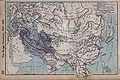
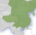
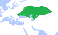
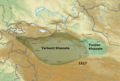
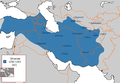
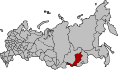
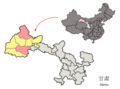
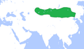
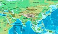
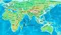
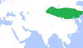
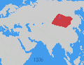
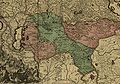
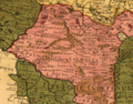
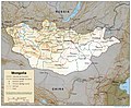
This is a list of Mongol states. The Mongols founded many states such as the vast Mongol Empire and other states. The list of states is chronological but follows the development of different dynasties.

Contents

Pre-modern states

NameYearsAreaMapCapital
Khanates in the 10th–12th centuries
Khamag Mongol Khanate 900s–1206 Mongol Empire c.1207.png
Merkit Khanate XI–mid XII
Kerait Khanate −1203
Naiman Khanate −1204
Tatar Khanate VI—X/(IX – mid XII?)
Mongol Empire
Mongol Empire 1206–136824,000,000 km2 [1] Mongol dominions.jpg Avarga (1206–35)
Karakorum (1235–60)
Khanbaliq (1260–1368)
Yuan dynasty
Yuan dynasty 1271–136814,000,000 km2 (1310) [2] Yuen Dynasty 1294 - Goryeo as vassal.png Khanbaliq
(Dadu, Beijing)
Flag of Golden Horde-2-.svg Golden Horde (Turco-Mongol)
Golden Horde 1240–15026,000,000 km2 (1310) [3] GoldenHorde1300.png Sarai Batu
Great Horde 1466–1502
Flag of the Chagatai Khanate.svg Chagatai Khanate (Turco-Mongol)
Chagatai Khanate 1225–1340s3,500,000 km2 (1310) [3] [2] Chagatai Khanate map en.svg Almaliq
Qarshi
Western Chagatai Khanate 1340s–1370
Moghulistan 1340–1462 Mongolia XVI.png
Kara Del Khanate1383–1513
Flag of the Ilkhanate.svg Ilkhanate
Ilkhanate 1256–13353,750,000 km2
[3] [2]
Ilkhanate in 1256-1353.PNG Maragha (1256–1265)
Tabriz (1265–1306)
Soltaniyeh (1306–1335)
Chobanids 1335–1357 IranaftertheIlkhanate.png Tabriz
Injuids 1335–1357 Shiraz (Till 1353)
Isfahan (1353–1357)
Jalayirid Sultanate 1335–1432 Baghdad (Till 1411)
Basra (1411–1432)
Arghun dynasty 1479?–1599?
Genghisid Northern Yuan dynasty
Northern Yuan dynasty
1368–16915,000,000 km2 (1550) [2] Mongolia XVI.png Shangdu (1368–69)
Yingchang (1369–70)
Karakorum (1371–88)
Khalkha Khanates
(subject of the Northern Yuan)
late 16th – late 17th century Mongolia XVII.png Tüsheet Khan, Zasagt Khan, Setsen Khan and Altan Khan of the Khalkha
Oirats – Non-Genghisid states
Four Oirat 1399–16341,000,000 km2
(15th – late 16th)
~1,600,000 km2
(early 17th century)
Mongolia XVI.png
Zunghar Khanate 1634–17583,500,000–4,000,000 km2 Mongolia XVII.png Ghulja
Khoshut Khanate 1642?–1717~1,400,000 km2
Kalmyk Khanate 1630–1771
Timurid states (Persianate Turco-Mongol states)
Timurid Empire 1370–15074,400,000 km2 (1405) [4] Das Reich Timur-i Lenks (1365-1405).GIF Samarkand (1370–1505)
Herat(1505–1507)
Mughal Empire 1526–18574,000,000 km2 (1700) The Mughal Empire.jpg Agra (1526–1571)
Fatehpur Sikri (1571–1585)
Lahore (1585–1598)
Agra (1598–1648)
Shahjahanabad/Delhi (1648–1857)
Other states/Khanate
Khanate of Sibir 1468–1598 Siberian Khanate map English revised.svg Chimgi-Tura/Qashliq

Modern states

NameYearsAreaMapCapital
Buryat-Mongol Autonomous Soviet Socialist Republic
(Buryats)
1919–1926 [5] [6] [7] [8] In Kizhinginsky District, Buryatia
Republic of Oirat-Kalmyk 1930 Kalmykia
Flag of Inner-Mongolian Autonomous Government.svg Inner Mongolian People's Republic 1945Xilin Gol Sonid
Flag of Mongolia.svg Mongolia 1911–present Ulanbataar

Autonomous areas

In Russia

NameYearsCapitalAreaMap
State of Buryat-Mongolia 1917–1921 Chita
Mongol-Buryat Autonomous Oblast 1922–1923
Buryat-Mongol Autonomous Oblast 1921–1923
Buryat-Mongol Autonomous Soviet Socialist Republic 1923–1958 Ulan-Ude Buryat-Mongol ASSR in 1925.jpg
Buryat Autonomous Soviet Socialist Republic 1958–1992 Russia - Buryat Republic (2008-01).svg
Republic of Buryatia 1992–present351,300 km2
Agin Buryat-Mongol National Okrug 1937–1958 Aginskoye Russia - Agin-Buryat Autonomous Okrug (2008-01).svg
Agin-Buryat National Okrug 1958–1977
Agin-Buryat Autonomous Okrug 1977–2008
Agin-Buryat Okrug 2008–present9,6002
Ust-Orda Buryat-Mongolian Autonomous Okrug 1937–1958 Ust-Ordynsky RussiaUst-OrdaBuryatia2007-07.svg
Ust-Orda Buryat National Okrug 1958–1978
Ust-Orda Buryat Autonomous Okrug 1978–2008
Ust-Orda Buryat Okrug 2008–present22,1382
Kalmyk Autonomous Oblast 1920–1935
1957–1958
Astrakhan (till 1928)
Elista
Kalmyk Autonomous Soviet Socialist Republic 1935–1943
1958–1990
Elista
(Elstei)
Russia - Republic of Kalmykia (2008-01).svg
Kalmyk Soviet Socialist Republic 1990–1992
Kalmyk Republic-Halmg-Tangch1992–1994
Kalmyk Republic 1994–present76,100 km2

In China

NameYearsCapitalAreaMap
Mengjiang state1936–1945 Kalgan
(Khaalgan)
Mengjiang.png
Inner Mongolian Autonomous Region 1947–present Huhhot 1,183,000 km2
Inner Mongolia in China (+all claims hatched).svg
Gansu Province
Subei Mongol Autonomous County Location of Subei within Gansu (China).png
Hebei Province
Weichang Manchu and Mongol Autonomous County
Heilongjiang Province
Dorbod Mongol Autonomous County
Jilin Province
Qian Gorlos Mongol Autonomous County
Liaoning Province
Harqin Left Mongol Autonomous County
Fuxin Mongol Autonomous County
Qinghai Province
Haixi Mongol and Tibetan Autonomous Prefecture Qinghai subdivisions - Haixi.svg
Henan Mongol Autonomous County
Xinjiang Province
Bayingolin Mongol Autonomous Prefecture Korla 462,700 km2
China Xinjiang Bayingolin.svg
Bortala Mongol Autonomous Prefecture Bortala
(Bortal)
China Xinjiang Bortala.svg
Hoboksar Mongol Autonomous County Hoboksar
(Khovogsair)
Location of Hoboksar within Xinjiang (China).png

See also

Maps

Related Research Articles

<span class="mw-page-title-main">Mongols</span> Ethnic group native to Mongolia and neighbouring areas

The Mongols are an East Asian ethnic group native to Mongolia, Inner Mongolia in China, and the Buryatia Republic of the Russian Federation. The Mongols are the principal member of the large family of Mongolic peoples. The Oirats in Western Mongolia as well as the Buryats and Kalmyks of Russia are classified either as distinct ethno-linguistic groups or subgroups of Mongols.

<span class="mw-page-title-main">Qara Khitai</span> Historical sinicized empire in Central Asia

The Qara Khitai, or Kara Khitai, also known as the Western Liao, officially the Great Liao, was a dynastic regime based in Central Asia ruled by the Yelü clan of the Khitan people. They were culturally Sinicized to a large extent, especially among the elites, being refugees from the Liao dynasty.

<span class="mw-page-title-main">Dzungar Khanate</span> 1634–1755 Oirat Mongol khanate in Dzungaria

The Dzungar Khanate, also written as the Zunghar Khanate, was an Inner Asian khanate of Oirat Mongol origin. At its greatest extent, it covered an area from southern Siberia in the north to present-day Kyrgyzstan in the south, and from the Great Wall of China in the east to present-day Kazakhstan in the west. The core of the Dzungar Khanate is today part of northern Xinjiang, also called Dzungaria.

<span class="mw-page-title-main">Rouran Khaganate</span> 330–550 AD Proto-Mongolic state

The Rouran Khaganate, also Juan-Juan Khaganate, was a tribal confederation and later state founded by a people of Proto-Mongolic Donghu origin. The Rouran supreme rulers used the title of "khagan", a popular title borrowed from the Xianbei. The Rouran Khaganate lasted from the late 4th century until the middle 6th century, when they were defeated by a Göktürk rebellion which subsequently led to the rise of the Turks in world history.

The proto-Mongols emerged from an area that had been inhabited by humans and predecessor hominin species as far back as 45,000 years ago during the Upper Paleolithic. The people there went through the Bronze and Iron Ages, forming tribal alliances, peopling, and coming into conflict with early polities in the Central Plain.

Khagan or Qaghan is a title of imperial rank in the Turkic, Mongolic and some other languages, equal to the status of emperor and someone who rules a khaganate (empire). The female equivalent is Khatun.

<span class="mw-page-title-main">Chagatai Khanate</span> 1226–1347 Turkicized Mongol khanate in Central Asia

The Chagatai Khanate, or Chagatai Ulus was a Mongol and later Turkicized khanate that comprised the lands ruled by Chagatai Khan, second son of Genghis Khan, and his descendants and successors. At its height in the late 13th century the khanate extended from the Amu Darya south of the Aral Sea to the Altai Mountains in the border of modern-day Mongolia and China, roughly corresponding to the area once ruled by the Qara Khitai.

A khanate or khaganate is the name for a type of historic polity ruled by a khan, khagan, khatun, or khanum. Khanates were typically nomadic Turkic, Mongol and Tatar societies located on the Eurasian Steppe, politically equivalent in status to kinship-based chiefdoms and feudal monarchies. Khanates and khaganates were organised tribally, where leaders gained power on the support and loyalty of their warrior subjects, gaining tribute from subordinates as realm funding. In comparison to a khanate, a khaganate, the realm of a khagan, was a large nomadic state maintaining subjugation over numerous smaller khanates. The title of khagan, translating as "Khan of the Khans", roughly corresponds in status to that of an emperor.

<span class="mw-page-title-main">Fuhai County</span> County in Xinjiang, China

Fuhai County as the official romanized name, also transliterated from Uyghur as Burultokay County, is a county in the Xinjiang Uyghur Autonomous Region and is under the administration of the Altay Prefecture. It has an area of 33,319.38 km2 (12,864.68 sq mi) with a population of 65,600. The county's postcode is 836400.

<span class="mw-page-title-main">Nomadic empire</span> Empires of the Eurasian steppes from classical antiquity to the early modern era

Nomadic empires, sometimes also called steppe empires, Central or Inner Asian empires, were the empires erected by the bow-wielding, horse-riding, nomadic people in the Eurasian Steppe, from classical antiquity (Scythia) to the early modern era (Dzungars). They are the most prominent example of non-sedentary polities.

<span class="mw-page-title-main">First Turkic Khaganate</span> 552–603 khaganate founded by the Göktürks

The First Turkic Khaganate, also referred to as the First Turkic Empire, the Turkic Khaganate or the Göktürk Khaganate, was a Turkic khaganate established by the Ashina clan of the Göktürks in medieval Inner Asia under the leadership of Bumin Qaghan and his brother Istämi. The First Turkic Khaganate succeeded the Rouran Khaganate as the hegemonic power of the Mongolian Plateau and rapidly expanded their territories in Central Asia, and became the first Central Asian transcontinental empire from Manchuria to the Black Sea.

<span class="mw-page-title-main">Khitan people</span> Nomadic people who founded the Liao dynasty in China

The Khitan people were a historical nomadic people from Northeast Asia who, from the 4th century, inhabited an area corresponding to parts of modern Mongolia, Northeast China and the Russian Far East.

<span class="mw-page-title-main">Dzungar people</span> Ethnic group descending from the Oirat Mongol tribes

The Dzungar people are the many Mongol Oirat tribes who formed and maintained the Dzungar Khanate in the 17th and 18th centuries. Historically, they were one of the major tribes of the Four Oirat confederation. They were also known as the Eleuths or Ööled, from the Qing dynasty euphemism for the hated word "Dzungar", and as the "Kalmyks". In 2010, 15,520 people claimed "Ööled" ancestry in Mongolia. An unknown number also live in China, Russia and Kazakhstan.

Various nomadic empires, including the Xiongnu, the Xianbei state, the Rouran Khaganate (330–555), the First (552–603) and Second Turkic Khaganates (682–744) and others, ruled the area of present-day Mongolia. The Khitan people, who used a para-Mongolic language, founded an empire known as the Liao dynasty (916–1125), and ruled Mongolia and portions of North China, northern Korea, and the present-day Russian Far East.

<span class="mw-page-title-main">Dzungar–Qing Wars</span> Century-long conquest of the Dzungar Khanate

The Dzungar–Qing Wars were a decades-long series of conflicts that pitted the Dzungar Khanate against the Qing dynasty and its Mongol vassals. Fighting took place over a wide swath of Inner Asia, from present-day central and eastern Mongolia to Tibet, Qinghai, and Xinjiang regions of present-day China. Qing victories ultimately led to the incorporation of Outer Mongolia, Tibet and Xinjiang into the Qing Empire that was to last until the fall of the dynasty in 1911–1912, and the genocide of much of the Dzungar population in the conquered areas.

Para-Mongolic is a proposed group of languages that is considered to be an extinct sister branch of the Mongolic languages. Para-Mongolic contains certain historically attested extinct languages, among them Khitan and Tuyuhun.

<span class="mw-page-title-main">Qing dynasty in Inner Asia</span> Historical territories of the Manchu-led Qing empire

The Qing dynasty in Inner Asia was the expansion of the Qing dynasty's realm in Inner Asia in the 17th and the 18th century AD, including both Inner Mongolia and Outer Mongolia, both Manchuria and Russian Manchuria, Tibet, Qinghai and Xinjiang.

<span class="mw-page-title-main">History of the eastern steppe</span>

This article summarizes the History of the eastern steppe, the eastern third of the Eurasian Steppe, that is, the grasslands of Mongolia and northern China. It is a companion to History of the central steppe and History of the western steppe. Most of its recorded history deals with conflicts between the Chinese and the steppe nomads. Most of the sources are Chinese.

<span class="mw-page-title-main">History of the central steppe</span> Aspect of history

This is a short History of the central steppe, an area roughly equivalent to modern Kazakhstan. Because the history is complex it is mainly an outline and index to the more detailed articles given in the links. It is a companion to History of the western steppe and History of the eastern steppe and is parallel to the History of Kazakhstan and the History of central Asia.

References

  1. Turchin, Peter; Adams, Jonathan M.; Hall, Thomas D. (December 2006). "East-West Orientation of Historical Empires". Journal of World-Systems Research. 12 (2): 222–223. ISSN   1076-156X. Archived from the original on 17 September 2016. Retrieved 25 August 2016.
  2. 1 2 3 4 Rein Taagepera (September 1997). "Expansion and Contraction Patterns of Large Polities: Context for Russia". International Studies Quarterly 41 (3): 475–504.
  3. 1 2 3 Jonathan M. Adams, Thomas D. Hall and Peter Turchin (2006). East-West Orientation of Historical Empires.Journal of World-Systems Research (University of Connecticut). 12 (no. 2): 219–229.
  4. Turchin, Peter; Adams, Jonathan M.; Hall, Thomas D. (2015). "East-West Orientation of Historical Empires and Modern States". Journal of World-Systems Research. 12 (2): 219. doi: 10.5195/jwsr.2006.369 . ISSN   1076-156X. Open Access logo PLoS transparent.svg
  5. Бидия Дандарон Archived 6 February 2016 at the Wayback Machine (Russian)
  6. Балагатское движение Archived 28 March 2013 at the Wayback Machine (Russian)
  7. Теократическое движение в Хоринском ведомстве Бурятии :1919–1926 гг. (Russian)
  8. БАЛАГАТСКОЕ ДВИЖЕНИЕ Archived 14 October 2013 at the Wayback Machine (Russian)

Bibliography

Further reading