Graphs are unavailable due to technical issues. There is more info on Phabricator and on MediaWiki.org. |
Map of dams in Kagawa Prefecture.(See Wikidata query)
The following is a list of dams in Kagawa Prefecture, Japan.
Contents

Graphs are unavailable due to technical issues. There is more info on Phabricator and on MediaWiki.org. |
The following is a list of dams in Kagawa Prefecture, Japan.

Tokushima Prefecture is a prefecture of Japan located on the island of Shikoku. Tokushima Prefecture has a population of 728,633 and has a geographic area of 4,146 km2. Tokushima Prefecture borders Kagawa Prefecture to the north, Ehime Prefecture to the west, and Kōchi Prefecture to the southwest.

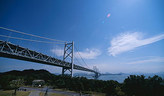
Kagawa Prefecture is a prefecture of Japan located on the island of Shikoku. Kagawa Prefecture has a population of 949,358 and is the smallest prefecture by geographic area at 1,877 square kilometres (725 sq mi). Kagawa Prefecture borders Ehime Prefecture to the southwest and Tokushima Prefecture to the south.
Sakaide is a city located in Kagawa Prefecture, Japan. As of 1 October 2022, the city had an estimated population of 49,439 in 21347 households and a population density of and a population density of 530 persons per km2. The total area of the city is 92.49 square kilometres (35.71 sq mi).

Mannō is a town located in Nakatado District, Kagawa Prefecture, Japan. As of 1 October 2022, the town had an estimated population of 17,711 in 7477 households and a population density of 960 persons per km². The total area of the town is 194.45 square kilometres (75.08 sq mi).

Hōnen'ike Dam is a multiple-arch dam in the Sanuki Mountain range at Kan'onji, Kagawa Prefecture, Japan. The reservoir it creates is used for irrigation. Construction began in 1926 and was completed in 1930. The dam is 32 m high and has a crest length of 158 m. It is supported by six arched buttresses. Some renovation work has been needed to control leakage; special care has been taken due to its status as a cultural asset.

Maeyama Dam is a dam located in the foothills of Sanuki City, Kagawa Prefecture.

The Seto-Chūō Expressway is a tolled expressway that connects Okayama and Kagawa prefectures in Japan across a series of five small islands in the Seto Inland Sea. Built between 1978 and 1988, it is one of the three routes of the Honshu-Shikoku Bridge Expressway Company connecting Honshū and Shikoku islands. The route is signed E30 under Ministry of Land, Infrastructure, Transport and Tourism's "2016 Proposal for Realization of Expressway Numbering."
Jo-ike(Japanese: 城池) is an earthfill dam located in Kagawa Prefecture in Japan. The dam is used for irrigation. The dam impounds about 19 ha of land when full and can store 720 thousand cubic meters of water. The construction of the dam was completed in 1975.
Kagawa Yosui Choseichi(Japanese: 香川用水調整池) is an earthfill dam located in Kagawa Prefecture in Japan. The dam is used for water supply. The catchment area of the dam is 0.6 km2. The dam impounds about 24 ha of land when full and can store 3070 thousand cubic meters of water. The construction of the dam was started on 1999 and completed in 2008.
Kuratani-ike(Japanese: 鞍谷池) is an earthfill dam located in Kagawa Prefecture in Japan. The dam is used for irrigation. The catchment area of the dam is 1 km2. The dam impounds about 2 ha of land when full and can store 110 thousand cubic meters of water. The construction of the dam was completed in 1981.
Matsuo-ike Dam(Japanese: 松尾池) is an earthfill dam located in Kagawa Prefecture in Japan. The dam is used for irrigation. The dam impounds about 24 ha of land when full and can store 1322 thousand cubic meters of water. The construction of the dam was completed in 1971.
Nakayama-ike Dam(Japanese: 中山池) is an earthfill dam located in Kagawa Prefecture in Japan. The dam is used for irrigation. The catchment area of the dam is 2.5 km2. The dam impounds about 2 ha of land when full and can store 72 thousand cubic meters of water. The construction of the dam was completed in 1979.
Ni-ike Dam(Japanese: 仁池) is an earthfill dam located in Kagawa Prefecture in Japan. The dam is used for irrigation. The dam impounds about 28 ha of land when full and can store 1502 thousand cubic meters of water. The construction of the dam was completed in 1967.
Ohtani-ike Dam(Japanese: 大谷池) is an earthfill dam located in Kagawa Prefecture in Japan. The dam is used for irrigation. The dam impounds about 14 ha of land when full and can store 1000 thousand cubic meters of water. The construction of the dam was completed in 1959.
Senzoku Dam(Japanese: 千足ダム) is a gravity dam located in Kagawa Prefecture in Japan. The dam is used for flood control and water supply. The catchment area of the dam is 5.1 km2. The dam impounds about 14 ha of land when full and can store 1850 thousand cubic meters of water. The construction of the dam was started on 1975 and completed in 1987.
Sogoku-ike(Japanese: 宗極池) is an earthfill dam located in Kagawa Prefecture in Japan. The dam is used for irrigation. The catchment area of the dam is 1 km2. The dam impounds about 5 ha of land when full and can store 240 thousand cubic meters of water. The construction of the dam was completed in 1956.
Tonogawa Dam(Japanese: 殿川ダム) is a gravity dam located in Kagawa Prefecture in Japan. The dam is used for flood control and water supply. The catchment area of the dam is 5.6 km2. The dam impounds about 6 ha of land when full and can store 690 thousand cubic meters of water. The construction of the dam was started on 1967 and completed in 1974.
Uchinomi Dam (Re)(Japanese: 内海ダム(再)) is a gravity dam located in Kagawa Prefecture in Japan. The dam is used for flood control and water supply. The catchment area of the dam is 4.8 km2. The dam impounds about 8 ha of land when full and can store 1060 thousand cubic meters of water. The construction of the dam was started on 1997 and completed in 2013.
Uno-ike Dam(Japanese: 鵜生池) is an earthfill dam located in Kagawa Prefecture in Japan. The dam is used for irrigation. The catchment area of the dam is 0.2 km2. The dam impounds about 9 ha of land when full and can store 337 thousand cubic meters of water. The construction of the dam was started on and completed in 1976.