Graphs are unavailable due to technical issues. There is more info on Phabricator and on MediaWiki.org. |
Map of dams in Yamanashi Prefecture.(See Wikidata query)
The following is a list of dams in Yamanashi Prefecture, Japan.
Graphs are unavailable due to technical issues. There is more info on Phabricator and on MediaWiki.org. |
The following is a list of dams in Yamanashi Prefecture, Japan.
| Name | Location | Started | Opened | Height | Length | Image | DiJ number |
|---|---|---|---|---|---|---|---|
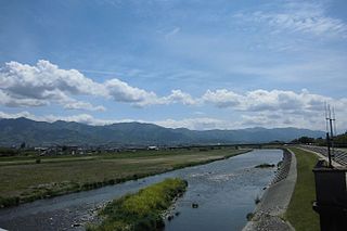
| Amahata Dam | 35°24′31″N 138°19′54″E | 1967 | 80.5 m (264 ft) | 147.6 m (484 ft) |  | 0969 | |
| Arakawa Dam | 35°45′37″N 138°34′11″E [1] | 1973 | 1985 | 88 m (289 ft) | 320 m (1,050 ft) |  | 0973 |
| Daimon Dam | 35°52′28″N 138°26′3″E [1] | 1968 | 1987 | 65.5 m (215 ft) | 180 m (590 ft) |  | 0972 |
| Fukashiro Dam | 35°42′28″N 138°56′54″E | 2004 | 2004 | 87 m (285 ft) [2] |  | 0975 | |
| Hirose Dam | 35°50′21″N 138°45′50″E [1] | 1965 | 1974 | 75 m (246 ft) | 255 m (837 ft) |  | 0971 |
| Horisawagawa Dam | 35°29′27″N 138°16′33″E | 1924 | 1928 | 17.3 m (57 ft) | 41.8 m (137 ft) | 0961 | |
| Kakimoto Dam | 35°16′39″N 138°31′0″E [1] | 1952 | 46.1 m (151 ft) | 215 m (705 ft) |  | 0965 | |
| Kamihikawa Dam | 35°43′0″N 138°49′57″E [1] | 1999 | 87 m (285 ft) [2] |  | 3106 | ||
| Kamikurizawagawa Dam | 35°44′38″N 138°21′27″E | 1926 | 1927 | 19 m (62 ft) | 49.6 m (163 ft) | 0960 | |
| Kazunogawa Dam | 35°43′7″N 138°55′47″E [1] | 1999 | 105.2 m (345 ft) [2] |  | 3107 | ||
| Kokanba Dam | 35°41′34″N 138°16′39″E | 1962 | 1963 | 16 m (52 ft) | 86.2 m (283 ft) | 0968 | |
| Kotogawa Dam | 35°48′4″N 138°39′31″E | 1985 | 2007 | 64 m (210 ft) | 262 m (860 ft) |  | 2914 |
| Maruyama Tameike Dam | 35°42′20″N 138°33′14″E | 1988 | 19 m (62 ft) | 89 m (292 ft) | 0963 | ||
| Nishiyama Dam | 35°34′11″N 138°17′59″E | 1954 | Apr 1957 | 40.6 m (133 ft) | 112.3 m (368 ft) |  | 0966 |
| Ohno Dam | 35°37′10″N 139°3′35″E [1] | 1910 | 1914 | 37.3 m (122 ft) | 309.1 m (1,014 ft) |  | 0955 |
| Oshino Tameike Dam | 35°35′52″N 139°0′25″E | 1933 | 27.4 m (90 ft) | 111 m (364 ft) | 3431 | ||
| Ryuga-ike Dam | 35°41′15″N 138°34′47″E | 1956 | 17 m (56 ft) | 382 m (1,253 ft) | 0956 | ||
| Shiokawa Dam | 35°51′30″N 138°29′52″E [1] | 1975 | 1997 | 79 m (259 ft) | 225 m (738 ft) |  | 0974 |
| Shionosawa Dam | 35°22′38″N 138°27′1″E |  | |||||
| Toshima Dam | 35°14′17″N 138°30′22″E |  | |||||
| Ushirozawa Tameike Dam | 35°42′9″N 138°31′12″E | 1939 | 22.7 m (74 ft) | 115 m (377 ft) | 0964 | ||
| Zusazawa Dam | 35°49′28″N 138°19′55″E | 1925 | 1926 | 21.5 m (71 ft) | 75.8 m (249 ft) | 0959 |

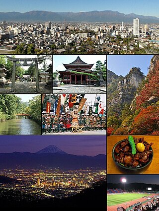
Yamanashi Prefecture is a prefecture of Japan located in the Chūbu region of Honshu. Yamanashi Prefecture has a population of 817,192 and has a geographic area of 4,465 km2. Yamanashi Prefecture borders Saitama Prefecture to the northeast, Nagano Prefecture to the northwest, Shizuoka Prefecture to the southwest, Kanagawa Prefecture to the southeast, and Tokyo to the east.

The Kantō region is a geographical region of Honshu, the largest island of Japan. In a common definition, the region includes the Greater Tokyo Area and encompasses seven prefectures: Gunma, Tochigi, Ibaraki, Saitama, Tokyo, Chiba, and Kanagawa. Slightly more than 45 percent of the land area within its boundaries is the Kantō Plain. The rest consists of the hills and mountains that form land borders with other regions of Japan.
Yamanashi is a city located in Yamanashi Prefecture, Japan. As of 1 July 2019, the city had an estimated population of 34,738 in 14,679 households, and a population density of 120 persons per km2. The total area of the city is 289.80 square kilometres (111.89 sq mi).
Kōfu is the capital city of Yamanashi Prefecture, Japan. As of 1 April 2019, the city had an estimated population of 187,985 in 90,924 households, and a population density of 880 persons per km2. The total area of the city is 212.41 square kilometres (82.01 sq mi).
The Abe River is a river in Shizuoka Prefecture of central Japan. It is 53.3 kilometres (33.1 mi) long and has a watershed of 567 square kilometres (219 sq mi).

Lake Okutama is in Tokyo and Yamanashi Prefectures in Japan. Lying above the Ogōchi Dam, it is also known as the Ogōchi Reservoir. Lake Okutama is an important source of drinking water for Tokyo.

Okutama is a town located in the western portion of Tokyo Prefecture, Japan, at a distance of roughly 60 kilometres (37 mi) west-northwest of Tokyo Imperial Palace. As of 1 April 2021, the town had an estimated population of 4,949, and a population density of 22 persons per km2. The total area of the town is 225.53 square kilometres (87.08 sq mi).
The Ōi River is a river in Shizuoka Prefecture, Japan.

The Sagami River is a river in Kanagawa and Yamanashi Prefectures on the island of Honshū, Japan.
Takane may refer to:
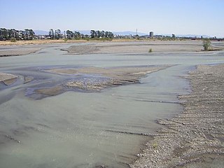
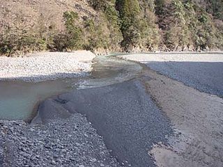
The Fuefuki River is a river located in the Yamanashi Prefecture of Japan. It is a tributary of the Fuji River.