Graphs are unavailable due to technical issues. There is more info on Phabricator and on MediaWiki.org. |
Map of dams in Miyagi Prefecture.(See Wikidata query)
The following is a list of dams in Miyagi Prefecture, Japan.
Graphs are unavailable due to technical issues. There is more info on Phabricator and on MediaWiki.org. |
The following is a list of dams in Miyagi Prefecture, Japan.
Shichikashuku is a town located in Katta District, Miyagi Prefecture, Japan. As of 1 June 2020, the town had an estimated population of 1,323, and a population density of 5.0 persons per km² in 626 households. The total area of the town is 263.09 square kilometres (101.58 sq mi).

Kawasaki is a town located in Miyagi Prefecture, Japan. As of 31 May 2020, the town had an estimated population of 8,637 and a population density of 32 persons per km2 in 3,391 households. The total area of the town is 270.77 square kilometres (104.54 sq mi).

Taiwa is a town located in Miyagi Prefecture, Japan. As of 31 May 2020, the town had an estimated population of 28,436, and a population density of 130 persons per km2 in 12,016 households. The total area of the town is 225.49 square kilometres (87.06 sq mi).
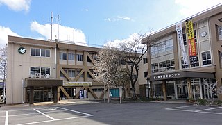
Kami is a town located in Miyagi Prefecture, Japan. As of 31 May 2020, the town had an estimated population of 22,804 and a population density of 50 persons per km2 in 8119 households. The total area of the town is 460.67 square kilometres (177.87 sq mi)..

The Omono River is located in Akita Prefecture, Japan. The river flows from Mount Daisen on the border of Akita Prefecture with Miyagi and Yamagata Prefectures in the city of Yuzawa and drains into the Sea of Japan at the city of Akita. The river's drainage basin is essentially the entire southern half of Akita Prefecture. The river is free of dams for its entire length. It is regarded as a "first class river" in the Japanese river classification system.

Aratozawa Dam is a dam in Kurihara, Miyagi Prefecture, Japan, completed in 1998.

Kamafusa Dam is a multi-purpose concrete gravity dam in Kawasaki, Miyagi Prefecture, Japan, completed in 1970.

Koda Dam is a dam on the Nagasaki River in Kurihara, Miyagi Prefecture, Japan, completed in 2005.

Minamikawa Dam) is a concrete gravity arch dam on the Naruse River in the town of Taiwa, Kurokawa District Miyagi Prefecture, Japan, completed in 1987 by Kumagai. The dam supports a 220 KW hydroelectric power station.

Miyatoko Dam' is a multi-purpose dam on the Miyatoko River, a branch of the Naruse River in the town of Taiwa, Kurokawa District Miyagi Prefecture, Japan. The dam was completed in 1998.

Naganuma Dam is a dam in the city of Tome, Miyagi, Japan, completed in May 2014. The dam is located on the Hasama River, a branch of the Kitakami River system.

Nanakita Dam is a rock-filled dam in Izumi-ku, Sendai, Miyagi Prefecture, Japan, completed in 1984.

Naruko Dam is a concrete gravity-arch dam in the city of Ōsaki, Miyagi Prefecture, Japan, completed in 1958 by Kajima Corporation. The dam is located on the Eaigawa, the former main course of the Kitakami River.

Urushizawa Dam is multi-purpose dam on the Naruse River in the town of Kami, in Miyagi Prefecture, in the Tōhoku region of northern Japan. The dam was completed in 1980. The dam is used for flood control, irrigation, tap water, industrial water, and hydroelectric power generation.

The Natori River is a river located in central Miyagi prefecture, in the Tōhoku region of northern Japan. It starts at Mount Kamuro in the Ōu Mountains and flows in an easterly direction through the cities of Natori and Sendai. The river's headwaters start in the Zao Mountain range, it flows through the Sendai Plain and ends by draining into Sendai Bay. The river's estuary is located on Japan's east coast, and faces the Pacific Ocean. The river's flow is the greatest during the snow melt season from March to April, the rainy season from June to July and during the typhoon season from September to October. The river's length is 55 km, and its tributaries are the Hirose, Masuda and Goishi Rivers. The Natori provides water for 1 million people in the city of Sendai.

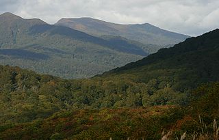
Miyagi Prefecture is a prefecture of Japan located in the Tōhoku region of Honshu. Miyagi Prefecture has a population of 2,265,724 and has a geographic area of 7,282 km2 (2,812 sq mi). Miyagi Prefecture borders Iwate Prefecture to the north, Akita Prefecture to the northwest, Yamagata Prefecture to the west, and Fukushima Prefecture to the south.

The Sendai-Tōbu Road is a toll road in Miyagi Prefecture, Japan. It is owned and operated by the East Nippon Expressway Company. Along with the Sanriku Expressway, Sendai-Hokubu Road, Sendai-Nanbu Road, and Tōhoku Expressway the northern portion of the road forms a ring road around the city, Sendai, known as the "Gurutto Sendai". The route is signed E6 under Ministry of Land, Infrastructure, Transport and Tourism's "2016 Proposal for Realization of Expressway Numbering."

The Sendai-Nanbu Road is a toll road in Sendai, Miyagi Prefecture, Japan. It is owned and operated by the East Nippon Expressway Company. Along with the Sanriku Expressway, Sendai-Hokubu Road, Sendai-Tōbu Road, and Tōhoku Expressway it forms a ring road around the city, Sendai, known as the "Gurutto Sendai". The route is signed E48 under Ministry of Land, Infrastructure, Transport and Tourism's "2016 Proposal for Realization of Expressway Numbering."


