List of dams in Ishikawa Prefecture

Last updated

Map of dams in Ishikawa Prefecture(See Wikidata query)

The following is a list of dams in Ishikawa Prefecture, Japan.

Contents

List

NameLocationOpenedHeight (metres)Image
Akase Dam   OOjs UI icon edit-ltr-progressive.svg 36°17′46″N 136°29′4″E [1] 197838
Dainichigawa Dam   OOjs UI icon edit-ltr-progressive.svg 36°17′23″N 136°34′43″E 197659.9 Dainichigawa Dam wet left view (Ishikawa prefecture).jpg
Fukumitsu Dam   OOjs UI icon edit-ltr-progressive.svg 37°21′23″N 137°11′12″E [1] 198636.5
Hakkagawa Dam‎  OOjs UI icon edit-ltr-progressive.svg 37°15′45″N 136°49′55″E [1] 52 [2] Haltukagawadam.jpg
Io Dam   OOjs UI icon edit-ltr-progressive.svg 36°33′40″N 136°46′42″E 200158.8 Iou-923-r1.JPG
Iwasaka Dam   OOjs UI icon edit-ltr-progressive.svg 37°28′16″N 137°15′47″E [1] 198431.7
Jike Dam   OOjs UI icon edit-ltr-progressive.svg 37°29′53″N 137°19′26″E [1] 199135.4
Kamiterazu Dam   OOjs UI icon edit-ltr-progressive.svg 36°27′45″N 136°43′10″E 196519.5
Kitakawachi Dam   OOjs UI icon edit-ltr-progressive.svg 37°22′39″N 137°2′33″E 47 [2] Kitakawachi Dam.jpg
Kutani Dam   OOjs UI icon edit-ltr-progressive.svg 36°12′23″N 136°22′40″E 200575.8 [2] Kutani dam.jpg
Mikohara Dam   OOjs UI icon edit-ltr-progressive.svg 36°52′58″N 136°51′8″E [1] 194223.7 Shen Zi Yuan damu - panoramio.jpg
Miyata Dam   OOjs UI icon edit-ltr-progressive.svg 37°13′27″N 137°2′40″E [1] 197922.1
Morohashi Dam   OOjs UI icon edit-ltr-progressive.svg 37°14′2″N 137°2′56″E [1] 198635.2
Oguchi Dam   OOjs UI icon edit-ltr-progressive.svg 36°15′21″N 136°44′27″E Oguchi I Dam survey.jpg
Ohtsubogawa Dam   OOjs UI icon edit-ltr-progressive.svg 37°3′30″N 136°44′18″E [3] 199220.3 Otsubogawa Dam.jpg
Ohzsemachi Dam   OOjs UI icon edit-ltr-progressive.svg 37°4′43″N 136°48′13″E [4] 195418
Oya Dam   OOjs UI icon edit-ltr-progressive.svg 37°23′30″N 137°10′40″E [1] 199256.5
Saigawa Dam   OOjs UI icon edit-ltr-progressive.svg 36°25′51″N 136°44′48″E [1] 72 [2] Saigawa-910-r1.JPG
Shingu Dam   OOjs UI icon edit-ltr-progressive.svg 36°50′12″N 136°49′11″E [1] 195525.4
Shinuchikawa Dam   OOjs UI icon edit-ltr-progressive.svg 36°29′21″N 136°40′52″E 198418.9
Shiogawa Bosai Dam   OOjs UI icon edit-ltr-progressive.svg 36°50′47″N 136°50′5″E [1] 195624
Tane Dam   OOjs UI icon edit-ltr-progressive.svg 36°59′4″N 136°57′53″E [1] 197330 Tanedam.JPG
Tatsumi Dam   OOjs UI icon edit-ltr-progressive.svg 36°29′56″N 136°42′50″E [2] 47 [2] Tatsumi Dam.jpg
Tedorigawa Dam   OOjs UI icon edit-ltr-progressive.svg 36°15′55″N 136°38′38″E [1] 1979153 [2] Tedorigawa Dam and lake.jpg
Tetorigawa No.2 Dam   OOjs UI icon edit-ltr-progressive.svg 36°17′34″N 136°38′27″E [1] 197937.5 Tedorigawa II Dam left view.jpg
Tetorigawa No.3 Dam   OOjs UI icon edit-ltr-progressive.svg 36°24′1″N 136°38′4″E [1] 197850 Tedorigawa III Dam.jpg
Teradagawa Dam   OOjs UI icon edit-ltr-progressive.svg 37°18′0″N 137°3′4″E 200726.7
Uchikawa Dam   OOjs UI icon edit-ltr-progressive.svg 36°28′23″N 136°40′15″E [1] 81 [2] Uchikawa-915-r1.JPG
Wagatani Dam   OOjs UI icon edit-ltr-progressive.svg 36°12′39″N 136°20′58″E [1] 196456.5 Wagatani dam.jpg
Wakayama Dam   OOjs UI icon edit-ltr-progressive.svg 37°26′43″N 137°8′49″E [1] 196325.4
Yamaguchi Bosai Dam   OOjs UI icon edit-ltr-progressive.svg 37°20′19″N 137°10′58″E [1] 197027
Yoshinodani Dam   OOjs UI icon edit-ltr-progressive.svg 36°16′25″N 136°41′13″E 20.5 [2] Yoshinodani Dam.jpg

See also

Related Research Articles

<span class="mw-page-title-main">Ishikawa Prefecture</span> Prefecture of Japan

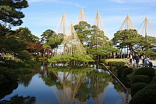
Ishikawa Prefecture is a prefecture of Japan located in the Chūbu region of Honshu island. Ishikawa Prefecture has a population of 1,140,573 and has a geographic area of 4,186 km2. Ishikawa Prefecture borders Toyama Prefecture to the east, Gifu Prefecture to the southeast, and Fukui Prefecture to the south.

<span class="mw-page-title-main">Toyama Prefecture</span> Prefecture of Japan

Toyama Prefecture is a prefecture of Japan located in the Chūbu region of Honshu. Toyama Prefecture has a population of 1,044,588 and has a geographic area of 4,247.61 km2. Toyama Prefecture borders Ishikawa Prefecture to the west, Gifu Prefecture to the south, Nagano Prefecture to the east, and Niigata Prefecture to the northeast.

<span class="mw-page-title-main">Saigawa Dam (Ishikawa Prefecture)</span> Dam in Ishikawa Prefecture, Japan

Saigawa Dam is a dam in the Ishikawa Prefecture of Japan, completed in 1965.

<span class="mw-page-title-main">Yoshinodani Dam</span> Dam in Ishikawa Prefecture, Japan

Yoshinodani Dam is a dam in the Ishikawa Prefecture of Japan, completed in 1926.

<span class="mw-page-title-main">Ishikawa Prefectural Museum of Traditional Arts and Crafts</span> Museum in Kanazawa, Ishikawa, Japan

The Ishikawa Prefectural Museum of Traditional Arts and Crafts is a museum about traditional arts and crafts located in Kenroku-en, Kanazawa, Ishikawa Prefecture, Japan.

References

  1. 1 2 3 4 5 6 7 8 9 10 11 12 13 14 15 16 17 18 19 20 Geographic Names Server, Wikidata   Q1194038
  2. 1 2 3 4 5 6 7 8 9 Dams in Japan, Japan Dam Foundation, Wikidata   Q113763464
  3. https://maps.ontarget.cc/dams/en.html#!id=3068
  4. https://structurae.net/en/structures/ohzsemachi-dam