List of dams in Oita Prefecture

Last updated

Map of dams in Oita Prefecture.(See Wikidata query)

The following is a list of dams in Oita Prefecture, Japan.

Contents

List

NameLocationOpenedHeight (meters)Image
Aki Dam  OOjs UI icon edit-ltr-progressive.svg 33°29′8″N 131°36′33″E [1] 35 [2]
Aoe Dam  OOjs UI icon edit-ltr-progressive.svg 33°4′13″N 131°48′21″E [1] 43 [2]
Chikura Dam  OOjs UI icon edit-ltr-progressive.svg 33°22′6″N 130°55′41″E [1] 22 [2]
Fukami Dam  OOjs UI icon edit-ltr-progressive.svg 33°19′10″N 131°19′56″E [1] 38.5 [2]
Gyonyu Dam  OOjs UI icon edit-ltr-progressive.svg 33°34′11″N 131°38′58″E [1] 43.5 [2]
Hakusui Dam   OOjs UI icon edit-ltr-progressive.svg 32°54′19″N 131°19′38″E 14 Hakusui-Dam full-view.jpg
Hiju Dam   OOjs UI icon edit-ltr-progressive.svg 33°21′17″N 131°14′56″E 196948 Hiju Dam survey 1974.jpg
Hisashi Dam   OOjs UI icon edit-ltr-progressive.svg 33°26′14″N 131°25′59″E 197940 [2] Qiu noNong Ye Wen Hua Gong Yuan noFeng Jing (hurawagadenkaraJian taHu ).jpg
Ichigi Dam  OOjs UI icon edit-ltr-progressive.svg 33°11′29″N 131°28′20″E [1]
Inaba Dam   OOjs UI icon edit-ltr-progressive.svg 32°59′38″N 131°17′48″E 201056 Inaba Dam.JPG
Ishiba Dam  OOjs UI icon edit-ltr-progressive.svg 32°58′38″N 131°39′29″E [1] 47 [2]
Ishiyama Dam  OOjs UI icon edit-ltr-progressive.svg 33°26′39″N 131°34′57″E [1] 41 [2]
Kawabe Dam  OOjs UI icon edit-ltr-progressive.svg 32°59′33″N 131°33′44″E [1]
Kitagawa Dam   OOjs UI icon edit-ltr-progressive.svg 32°47′26″N 131°36′28″E 196282 Kitagawa-2757-r1.JPG
Konakao Dam  OOjs UI icon edit-ltr-progressive.svg 32°54′8″N 131°56′52″E [1] 22.3 [2]
Koshita Dam  OOjs UI icon edit-ltr-progressive.svg 33°28′26″N 131°19′25″E [1] 40.6 [2]
Kurosawa Dam  OOjs UI icon edit-ltr-progressive.svg 32°51′3″N 131°50′19″E [1] 47.5 [2]
Matsubara Dam   OOjs UI icon edit-ltr-progressive.svg 33°11′39″N 130°59′38″E Matsubara-2798-r1.JPG
Matsugi Dam  OOjs UI icon edit-ltr-progressive.svg 33°17′13″N 131°13′7″E [1] 48.5 [2]
Nabekura Dam  OOjs UI icon edit-ltr-progressive.svg 33°25′48″N 131°40′18″E [1] 43.5 [2]
Nagayu Dam  OOjs UI icon edit-ltr-progressive.svg 33°4′32″N 131°22′53″E [1] 15 [2]
Nakanokawa Dam  OOjs UI icon edit-ltr-progressive.svg 33°9′54″N 131°46′7″E [1] 37.3 [2]
Nakao Dam  OOjs UI icon edit-ltr-progressive.svg 33°12′48″N 131°48′57″E [1]
Namiishi Dam  OOjs UI icon edit-ltr-progressive.svg 33°33′56″N 131°34′2″E [1] 38.5 [2]
Naokawa Dam  OOjs UI icon edit-ltr-progressive.svg 32°51′46″N 131°46′54″E [1] 24.9 [2]
Notsu Dam  OOjs UI icon edit-ltr-progressive.svg 32°58′51″N 131°45′42″E [1] 34.9 [2]
Nanase Dam   OOjs UI icon edit-ltr-progressive.svg 33°47′26″N 131°36′28″E 202085.5 Oitagawa-2793-r1.JPG
Onagohata Dam   OOjs UI icon edit-ltr-progressive.svg 33°17′19″N 130°58′12″E 34.3 [2] Onagohata power station reservoir 1976.jpg
Onakao Dam  OOjs UI icon edit-ltr-progressive.svg 32°53′34″N 131°56′21″E [1] 25.4 [2]
Onobaru Dam  OOjs UI icon edit-ltr-progressive.svg 33°19′28″N 131°16′57″E [1] 196215.7
Oyama Dam  OOjs UI icon edit-ltr-progressive.svg 33°14′36″N 130°57′24″E 94 [2] Oyama Dam.jpg
Saganoseki Dam  OOjs UI icon edit-ltr-progressive.svg 33°14′8″N 131°51′15″E [1] 42 [2]
Serikawa Dam   OOjs UI icon edit-ltr-progressive.svg 33°8′23″N 131°26′28″E 195652.2 Serikawa-2752-r1.JPG
Shidahara Dam  OOjs UI icon edit-ltr-progressive.svg 33°4′22″N 131°31′33″E [1]
Shimouke Dam   OOjs UI icon edit-ltr-progressive.svg 33°9′36″N 130°59′4″E [1] Shimouke-2797-r1.JPG
Shuki Dam  OOjs UI icon edit-ltr-progressive.svg 33°13′19″N 131°50′8″E [1]
Suehiro Dam  OOjs UI icon edit-ltr-progressive.svg 33°8′41″N 131°43′28″E [1] 45.5 [2]
Todoroki Dam  OOjs UI icon edit-ltr-progressive.svg 33°12′33″N 131°47′32″E [1]
Uozumi Dam  OOjs UI icon edit-ltr-progressive.svg 32°57′29″N 131°23′26″E [1] Taketa Power station weir.JPG
Wakasugi Dam  OOjs UI icon edit-ltr-progressive.svg 33°17′15″N 131°20′51″E [1] 33.5 [2]
Yabakei Dam   OOjs UI icon edit-ltr-progressive.svg 33°26′49″N 131°7′26″E 62 [2] Yabakei-2783-r1.JPG
Yoake Dam   OOjs UI icon edit-ltr-progressive.svg 33°20′19″N 130°50′44″E [1] 195415 Ye Ming damu - panoramio.jpg
Yukagi Dam  OOjs UI icon edit-ltr-progressive.svg 33°0′58″N 131°51′40″E [1] 58.5 [2]

See also

Related Research Articles

<span class="mw-page-title-main">Ōita Prefecture</span> Prefecture of Japan

Ōita Prefecture is a prefecture of Japan located on the island of Kyūshū. Ōita Prefecture has a population of 1,136,245 and has a geographic area of 6,340 km2. Ōita Prefecture borders Fukuoka Prefecture to the northwest, Kumamoto Prefecture to the southwest, and Miyazaki Prefecture to the south.

<span class="mw-page-title-main">Ōno River</span> River in Ōita, Japan

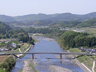
The Ōno River is a river that originates in Ōita Prefecture, Japan. After running through the southern and central portions of Ōita Prefecture, it runs through the eastern part of Kumamoto Prefecture and the northern part of Miyazaki Prefecture.

<span class="mw-page-title-main">Kunisaki</span> City in Kyushu, Japan

Kunisaki is a small coastal city located in Ōita Prefecture, Kyushu, Japan. As of 30 November 2023, the city had an estimated population of 25,721 in 13082 households, and a population density of 81 persons per km². The total area of the city is 318.10 km2 (122.82 sq mi).

<span class="mw-page-title-main">Ōita (city)</span> Core city in Kyushu, Japan

Ōita is the capital city of Ōita Prefecture, located on the island of Kyushu, Japan. As of 30 November 2023, the city had an estimated population of 474,804 in 230867 households, and a population density of 950 persons per km². The total area of the city is 502.38 km2 (193.97 sq mi).

<span class="mw-page-title-main">Japan National Route 326</span> Road in Japan

National Route 326 is a national highway of Japan connecting Nobeoka, Miyazaki and Bungo-ōno, Ōita in Japan, with a total length of 68.3 km (42.44 mi).

<span class="mw-page-title-main">Hiju Dam</span> Dam in Ōita, Japan

Hiju Dam is a dam in Kusu, Ōita Prefecture, Japan, and it was completed in 1969. The rock-fill dam is characterized by radial gates of the gate 3, which supplies water for agriculture and farmland.

<span class="mw-page-title-main">Hisashi Dam</span> Dam in Ōita Prefecture, Japan

Hisashi Dam is a dam in the Ōita Prefecture, Japan, completed in 1979. It is an embankment dam with the water used for irrigation and industry. The dam is 40 metres high and retains 4,800,000 m3 of water over a 263-metre crest length. The volume of the dam is 431,000 m3 and the surface area of Lake Hisashi is 370,000 m2.

<span class="mw-page-title-main">Inaba Dam</span> Dam in Ōita, Japan

Inaba Dam is a dam in Taketa, Ōita Prefecture, Japan, completed in 2010.

<span class="mw-page-title-main">Kitagawa Dam</span> Dam in Ōita Prefecture, Japan

Kitagawa Dam is a dam in the Saiki, Ōita, Japan, completed in 1962. It spans the Kita River, a class A river, in the Gokase River drainage system. It is managed by Ōita Prefecture, and it is an 82.0 meter tall concrete arch dam. It is the largest dam in the Gokase River drainage system, and it was built with government subsidies with the goal of flood control and hydroelectric power generation for the Kita River basin. The man-made lake formed by the dam is the largest such reservoir of any dam administered by the prefecture, but it is simply called the Kitagawa Dam Lake and has no nickname. Despite that in 2005 it was selected by the Dam Waters Environment Development Center Foundation as one of the top one hundred reservoirs.

<span class="mw-page-title-main">Nanase Dam</span> Dam in Ōita Prefecture

Nanase Dam is a dam in the Ōita Prefecture, Japan, which was completed in 2020. It is mainly dedicated to flood control, with a retention capacity of 25.9 million cubic meters of water. It was previously known as Oitagawa Dam but was renamed on completion.

<span class="mw-page-title-main">Onagohata Dam</span> Dam in Ōita Prefecture, Japan

Onagohata Dam is a dam in the Ōita Prefecture, Japan, completed in 1931.

<span class="mw-page-title-main">Serikawa Dam</span> Dam in Ōita Prefecture, Japan

Serikawa Dam is a dam in the Ōita Prefecture, Japan, completed in 1956. In 2009, the Provincial Business Office decided to temporarily stop the dam's production of electricity, due to low water and production levels.

<span class="mw-page-title-main">Shimouke Dam</span> Dam in Ōita Prefecture, Japan

Shimouke Dam is a dam in the Ōita Prefecture, Japan, completed in 1972.

References

  1. 1 2 3 4 5 6 7 8 9 10 11 12 13 14 15 16 17 18 19 20 21 22 23 24 25 26 27 28 29 30 31 32 Geographic Names Server, Wikidata   Q1194038
  2. 1 2 3 4 5 6 7 8 9 10 11 12 13 14 15 16 17 18 19 20 21 22 23 24 25 26 Dams in Japan, Japan Dam Foundation, Wikidata   Q113763464